Tuesday 1st Oct 2019 Machynlleth
– Llanbrynmair
Buses and Trains
I had been
waiting for weeks for a let up in the weather. Eventually the forecast
indicated a 48 hour window in between the rain-bearing weather fronts. The
problem was that I required four days to complete the national trail that I had
started last year. So I was going to get wet at the beginning or the end, take
your pick. The United match on a Monday evening defined the latter option but
the continuous rain was to take longer to clear than was first thought. Early
on Tuesday, Jill took me in damp conditions over to Wilmslow station for the train
to Shrewsbury. Here the problems began. The line onwards into mid-Wales was
flooded. My train was cancelled and the next train only went as far as Newtown.
From thence it was a bus replacement. So from expecting a late but achievable
16-mile schedule, I was desperately chasing the remains of the day and walking
and jogging far faster than I had wanted.
 My bus
replacement arrived into Machynlleth at 1.10pm, 1½ hours late. I leapt off the coach
and pounded passed the clock tower and down the main street. I had five minutes
in a café gulping down a cappuccino and vanilla slice before setting off at a
march up the long road out of town and across the golf course. The ground was
saturated and the road was running with water. As I crossed the first hill it
started to rain and it was to continue on and off for most of the day. As the
grass got wetter, keeping my feet became an issue and steep descents on muddy
paths were a nightmare. I fell several times and was soon covered in mud up my
back and over my rucksack from slipping onto my back side. The first difficulty
with route finding was in Abercegir where I was several minutes trying to find
the exit from the village. The next set
of hills was very remote and featureless but I was able to jog on the flat
sections of grassland. I briefly wandered off-line at one point but quickly
corrected to find the contour route around the head of a valley and onto the
start of the descent to Cemmaes Road. The very steep grass fields were
thankfully not quite so slippery and I soon got down to the main road with 10
miles behind me and two hours daylight remaining.
My bus
replacement arrived into Machynlleth at 1.10pm, 1½ hours late. I leapt off the coach
and pounded passed the clock tower and down the main street. I had five minutes
in a café gulping down a cappuccino and vanilla slice before setting off at a
march up the long road out of town and across the golf course. The ground was
saturated and the road was running with water. As I crossed the first hill it
started to rain and it was to continue on and off for most of the day. As the
grass got wetter, keeping my feet became an issue and steep descents on muddy
paths were a nightmare. I fell several times and was soon covered in mud up my
back and over my rucksack from slipping onto my back side. The first difficulty
with route finding was in Abercegir where I was several minutes trying to find
the exit from the village. The next set
of hills was very remote and featureless but I was able to jog on the flat
sections of grassland. I briefly wandered off-line at one point but quickly
corrected to find the contour route around the head of a valley and onto the
start of the descent to Cemmaes Road. The very steep grass fields were
thankfully not quite so slippery and I soon got down to the main road with 10
miles behind me and two hours daylight remaining.
I was glad
to get off the road again. No pavements and very fast moving traffic alarmed me.
After a mile beside the river, the route turned steeply uphill and I was
beginning to feel shattered. I had not planned to go so quickly and with such
effort. Emergency rations and water were called for and I got going again along
a flattish two-mile path that contoured across the hillside. The forest shown
on my map had been cleared and the landscape looked dismal. At last, in the
fast approaching gloaming, I reached the final ridge where the route turned
towards my final destination, running along the last remnants of the plantation
and then down steep wet grass where I was once again flying on the seat of my
pants. It was dark when I reached the farm at the foot of the hill and pitch
black by the time I got to Llanbrynmair. I stopped at the pub to ensure that a
meal would be forthcoming, then went over the road to my b&b and had a very
quick shower and change of clothes. I was certainly ready for a meal.
Machynlleth dep.
13.09, Llanbrynmair arr. 19.40
GPS 18.33
miles in 6hrs 24mins 10secs walking time.
I stayed at Wynnstay
House B&B and ate across the road at the Wynnstay Arms. The lovely lady who
owns the pub made me a plateful of lamb shank, chips and vegetables. I managed
two bottles of Badger Fursty Ferret (4.4%) whilst watching Bayern put seven
goals passed to Spurs.
Wednesday 2nd Oct 2019 Llanbrynmair – Lake Vyrnwy
Too Late for the Rally
What a
difference a day makes. The morning was clear and dry and the sun was breaking
through as I finished breakfast, packed my rucksack and retraced my steps out
of the village. After turning back onto the signed trail, the route crossed
several fields climbing steadily. Then suddenly there was a post pointing
directly up a very steep grassy ridge. At the top, the view was spectacular in
the morning sunshine. The high level traverse of Cerrig y Tan was the highlight
of the week. Views to the north and west opened up and the going was good
underfoot. It was almost a disappointment to finally come to the end of this
magnificent bit of country. The route passed into an extensive plantation and
onto wide forest tracks. The last mile was back to wet and slippery grass before
I emerged out of the trees and onto a bare and featureless moor, with route
posts indicating the presence of a way. A gradual shedding of height brought me
to a well-defined farm track and then to a road.
It was
almost two miles of tarmac before, at Dolwen Farm, I had to wade along a
flooded walled  farm-track which climbed gradually uphill onto another desolate
moor. A long descent, desperately trying to spot the next post, seemed endless
and complicated, weaving as it did across the grain of the hillside. At last I
spotted a trod across a field to a farm that featured on my map. I am not at
all sure I came in from the correct angle but, at the end of a private drive, I
picked up the acorn signs again. Then it was down a few lanes and over a
footbridge to emerge onto the main road at Llangadfan. And, glory be, there on
the other side of the road was a café, the Cwpan Pinc. I had a lovely slice of
coffee & walnut cake with my cappuccino. A gentleman presented me with a
set of DVDs from a local man who had motor-cycled round the world. Then it was
off into the afternoon section.
farm-track which climbed gradually uphill onto another desolate
moor. A long descent, desperately trying to spot the next post, seemed endless
and complicated, weaving as it did across the grain of the hillside. At last I
spotted a trod across a field to a farm that featured on my map. I am not at
all sure I came in from the correct angle but, at the end of a private drive, I
picked up the acorn signs again. Then it was down a few lanes and over a
footbridge to emerge onto the main road at Llangadfan. And, glory be, there on
the other side of the road was a café, the Cwpan Pinc. I had a lovely slice of
coffee & walnut cake with my cappuccino. A gentleman presented me with a
set of DVDs from a local man who had motor-cycled round the world. Then it was
off into the afternoon section.
 farm-track which climbed gradually uphill onto another desolate
moor. A long descent, desperately trying to spot the next post, seemed endless
and complicated, weaving as it did across the grain of the hillside. At last I
spotted a trod across a field to a farm that featured on my map. I am not at
all sure I came in from the correct angle but, at the end of a private drive, I
picked up the acorn signs again. Then it was down a few lanes and over a
footbridge to emerge onto the main road at Llangadfan. And, glory be, there on
the other side of the road was a café, the Cwpan Pinc. I had a lovely slice of
coffee & walnut cake with my cappuccino. A gentleman presented me with a
set of DVDs from a local man who had motor-cycled round the world. Then it was
off into the afternoon section.
farm-track which climbed gradually uphill onto another desolate
moor. A long descent, desperately trying to spot the next post, seemed endless
and complicated, weaving as it did across the grain of the hillside. At last I
spotted a trod across a field to a farm that featured on my map. I am not at
all sure I came in from the correct angle but, at the end of a private drive, I
picked up the acorn signs again. Then it was down a few lanes and over a
footbridge to emerge onto the main road at Llangadfan. And, glory be, there on
the other side of the road was a café, the Cwpan Pinc. I had a lovely slice of
coffee & walnut cake with my cappuccino. A gentleman presented me with a
set of DVDs from a local man who had motor-cycled round the world. Then it was
off into the afternoon section.
Initially
the route crossed farmland and the signage disappeared. So I took to the
parallel lanes which provided better conditions underfoot. A long uphill series
of field brought me to another lane at Penyfford. The footpath opposite, the
entrance to Dyfnant Forest, was blocked by a ‘Footpath Closed’ sign. No
alternatives or diversions were given so I pressed on into the forest and onto
the forest tracks that had obviously just been used as part of the Welsh Rally.
At the stage point, workmen were clearing the equipment from the previous day.
If I had been a day earlier, I would not have got through; the route of Glyndwr’s
Way had been a high speed race track. Thank goodness for the United match that
had delayed my passage by a day. I really must follow up on the legality of
running an event like this along a national trail without providing an
alternative way for walkers.  Anyway, I was through and down a stony track that
was a raging stream. This led onto the lane that took me to Ddol Cownwy and its
large site of mobile homes. Then, just in case I had forgotten my climbing
muscles, up went the track over the next hill. I could hear the roar of the
water before I saw it. Then there was the Lake Vynrwy Dam beneath me, spilling
vast quantities of water in a spectacular waterfall. And beyond, high on the
hillside, was the majestic hotel that was my destination. I quickly dropped
down to the silent and empty village and crossed the dam to reach the memorial
to those who had been involved with its construction. It was a pleasant walk
along the side of the lake and up the steep entrance road to the hotel. It had
been a superb day’s walking.
Anyway, I was through and down a stony track that
was a raging stream. This led onto the lane that took me to Ddol Cownwy and its
large site of mobile homes. Then, just in case I had forgotten my climbing
muscles, up went the track over the next hill. I could hear the roar of the
water before I saw it. Then there was the Lake Vynrwy Dam beneath me, spilling
vast quantities of water in a spectacular waterfall. And beyond, high on the
hillside, was the majestic hotel that was my destination. I quickly dropped
down to the silent and empty village and crossed the dam to reach the memorial
to those who had been involved with its construction. It was a pleasant walk
along the side of the lake and up the steep entrance road to the hotel. It had
been a superb day’s walking.
 Anyway, I was through and down a stony track that
was a raging stream. This led onto the lane that took me to Ddol Cownwy and its
large site of mobile homes. Then, just in case I had forgotten my climbing
muscles, up went the track over the next hill. I could hear the roar of the
water before I saw it. Then there was the Lake Vynrwy Dam beneath me, spilling
vast quantities of water in a spectacular waterfall. And beyond, high on the
hillside, was the majestic hotel that was my destination. I quickly dropped
down to the silent and empty village and crossed the dam to reach the memorial
to those who had been involved with its construction. It was a pleasant walk
along the side of the lake and up the steep entrance road to the hotel. It had
been a superb day’s walking.
Anyway, I was through and down a stony track that
was a raging stream. This led onto the lane that took me to Ddol Cownwy and its
large site of mobile homes. Then, just in case I had forgotten my climbing
muscles, up went the track over the next hill. I could hear the roar of the
water before I saw it. Then there was the Lake Vynrwy Dam beneath me, spilling
vast quantities of water in a spectacular waterfall. And beyond, high on the
hillside, was the majestic hotel that was my destination. I quickly dropped
down to the silent and empty village and crossed the dam to reach the memorial
to those who had been involved with its construction. It was a pleasant walk
along the side of the lake and up the steep entrance road to the hotel. It had
been a superb day’s walking.
Llanbrynmair
dep. 09.22, Vyrnwy arr. 17.30
GPS 20.07 miles
in 7hrs 36mins 24secs walking with 30 mins in the café at Llangadfan (14.00-14.30).
I stayed in
Lake Vyrnwy Hotel & Spa. I ate in the Brasserie, chicken tikka masala,
followed by sticky toffee pudding & ice cream. Some lovely real ales and I
enjoyed an awful lot of Old Jailhouse (3.9%) from Monty’s Brewery near
Montgomery.
Thursday 3rd Oct 2019 Lake Vyrnwy – Meifod
Racing the Rain
Leaving the
hotel, I slipped and slithered down a woodland path that was a short cut back
to the dam  of Lake Vrynwy. A cloud of mist and spray hung over the spillway
reminiscent of some of the great waterfalls of the world. The day was dry but
yesterday’s sunshine had disappeared. I picked up the route again and followed
it on tracks and paths downriver to Llanwyddyn. The road south went gradually
uphill until a forest road forked to the left. More signs of the rally littered
the way. Then a figure-post pointed up a narrow trod between the trees and up a
set of, maybe, 100 or more steps. Emerging at last onto a bare hilltop, the
view around was stunning. But the way dived immediately back into the forest
and down a narrow, steep and slippery
of Lake Vrynwy. A cloud of mist and spray hung over the spillway
reminiscent of some of the great waterfalls of the world. The day was dry but
yesterday’s sunshine had disappeared. I picked up the route again and followed
it on tracks and paths downriver to Llanwyddyn. The road south went gradually
uphill until a forest road forked to the left. More signs of the rally littered
the way. Then a figure-post pointed up a narrow trod between the trees and up a
set of, maybe, 100 or more steps. Emerging at last onto a bare hilltop, the
view around was stunning. But the way dived immediately back into the forest
and down a narrow, steep and slippery  path which dropped straight into Pont
Llogel. Just before the bridge, a signpost led me through a carpark onto the
banks of the River Vrynwy and along the Ann Griffith’s Walk. After a mile of
easy walking, the Glyndwr’s Way turned off up a field at the top of which a
farm track is followed. A diversion, not particularly well signed, took me
round the farm at Pentre. Then it was lanes, fields and open moorland before
the gentle drop back into the Vrynwy valley at the village of Dolanog.
path which dropped straight into Pont
Llogel. Just before the bridge, a signpost led me through a carpark onto the
banks of the River Vrynwy and along the Ann Griffith’s Walk. After a mile of
easy walking, the Glyndwr’s Way turned off up a field at the top of which a
farm track is followed. A diversion, not particularly well signed, took me
round the farm at Pentre. Then it was lanes, fields and open moorland before
the gentle drop back into the Vrynwy valley at the village of Dolanog.
 of Lake Vrynwy. A cloud of mist and spray hung over the spillway
reminiscent of some of the great waterfalls of the world. The day was dry but
yesterday’s sunshine had disappeared. I picked up the route again and followed
it on tracks and paths downriver to Llanwyddyn. The road south went gradually
uphill until a forest road forked to the left. More signs of the rally littered
the way. Then a figure-post pointed up a narrow trod between the trees and up a
set of, maybe, 100 or more steps. Emerging at last onto a bare hilltop, the
view around was stunning. But the way dived immediately back into the forest
and down a narrow, steep and slippery
of Lake Vrynwy. A cloud of mist and spray hung over the spillway
reminiscent of some of the great waterfalls of the world. The day was dry but
yesterday’s sunshine had disappeared. I picked up the route again and followed
it on tracks and paths downriver to Llanwyddyn. The road south went gradually
uphill until a forest road forked to the left. More signs of the rally littered
the way. Then a figure-post pointed up a narrow trod between the trees and up a
set of, maybe, 100 or more steps. Emerging at last onto a bare hilltop, the
view around was stunning. But the way dived immediately back into the forest
and down a narrow, steep and slippery  path which dropped straight into Pont
Llogel. Just before the bridge, a signpost led me through a carpark onto the
banks of the River Vrynwy and along the Ann Griffith’s Walk. After a mile of
easy walking, the Glyndwr’s Way turned off up a field at the top of which a
farm track is followed. A diversion, not particularly well signed, took me
round the farm at Pentre. Then it was lanes, fields and open moorland before
the gentle drop back into the Vrynwy valley at the village of Dolanog.
path which dropped straight into Pont
Llogel. Just before the bridge, a signpost led me through a carpark onto the
banks of the River Vrynwy and along the Ann Griffith’s Walk. After a mile of
easy walking, the Glyndwr’s Way turned off up a field at the top of which a
farm track is followed. A diversion, not particularly well signed, took me
round the farm at Pentre. Then it was lanes, fields and open moorland before
the gentle drop back into the Vrynwy valley at the village of Dolanog.
Crossing the
river, I walked first along the road and then a wooded path on the south bank
of the river. Some parts of this section were interesting, particularly as we
passed under a hill into a wooded gorge. Then it was out into fields and flat
grassland before I came to a large farm where the route took to its access
road. Pontrobert was larger than I expected. It had a school and a bus shelter
and a river bridge that was closed for road works. It even had a pub but this
was closed as well so I was not to get a refreshment break today. The storm
clouds that had been forecast were amassing behind me and I pushed on at an
increasingly greater tempo. A short section of farmland led to another farm
access lane, this one tarmacked all the way. Just before the main road, the
route turned into yet another forest, this one being heavily felled. I was given
a lecture on health & safety by a forester at the entrance and then ignored
the diversion signs and clambered through the mud and over the logs and
brashings and out into the lane into Meifod. Now a few drops of rain began to
fall and I increased my pace yet again. I passed the school thinking I might
have to run to keep dry but I turned the corner into the village and there was
the pub 50 yards up the road. I was home and dry and it was not yet 3.30pm.
So for the
first time this week, I had time for a long shower, a much need shave and a
good read/rest. Then I slipped down into the bar to taste the local waters and
watch my football team in the early kick-off European match. I should do this
more often.
Lake Vyrnwy dep.
09.13, Meifod arr. 15.25
GPS 16.26 in
6hrs 11mins 10secs.
I stayed in the Kings Head in Meifod and had fish
& chips in the bar whilst watching United on TV and drinking HPA (4.0%) from
Wye Valley Brewery. I finished with apple crumble and then retired early to my
bedroom to watch KJT win her gold medal.
Friday 4th Oct 2019 Meifod – Welshpool
A Golfing High
A storm
had passed through during the night and it was dry and overcast as I left the
hotel. I had got an early start, breakfasting in my damp walking gear so that I
was walking soon after 8.30am. This turned out to be an excellent move as I was
able to enjoy an excellent morning’s walk free from any time pressures. And I
needed that extra time as the ground was saturated once more and fast progress
on the slippery ground was impossible. The long ascent out of the valley took a
zig-zag through the woods and along quiet lanes. The convoluted excursion ended,
after three miles of walking, at a viewpoint immediately above my starting
point. Then more rapid progress was made to the south with a complex sequence
of farms, fields, woods and lanes. Any sloping land was treacherous to walk
over and I skated on sheets of water, grass and mud for the next hour or so.
The only let up in concentration was through a caravan site and along a narrow
lane around Stonehouse, a large and prosperous looking farm.
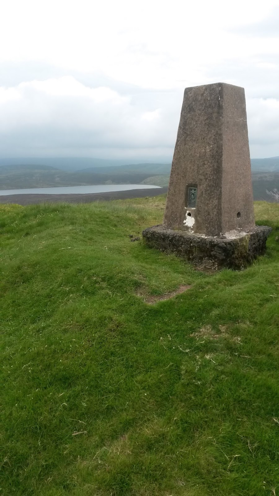
 There was a
sting in the tail. It started in a wood when a set of steps and steep ground
had to be climbed to get over a tree-lined hill. This height was lost again as
the path slanted down a woodland track and into open fields to a stream. Facing
me was then the longest steepest barest field on the entire route. An endless
slog up a cut grass slope eventually led through a kissing gate and across a
lane. The top was now in sight above a golf course built on the crest of the
ridge. A convoluted route around the edge of the course, the golfers obviously
not welcoming long-distance walkers, took me up bracken slopes, across
bracken-lined footpaths, and then finally up a steep climb to the trig point at
Y Golfa.
There was a
sting in the tail. It started in a wood when a set of steps and steep ground
had to be climbed to get over a tree-lined hill. This height was lost again as
the path slanted down a woodland track and into open fields to a stream. Facing
me was then the longest steepest barest field on the entire route. An endless
slog up a cut grass slope eventually led through a kissing gate and across a
lane. The top was now in sight above a golf course built on the crest of the
ridge. A convoluted route around the edge of the course, the golfers obviously
not welcoming long-distance walkers, took me up bracken slopes, across
bracken-lined footpaths, and then finally up a steep climb to the trig point at
Y Golfa. Then it was
downhill all the way, first across hillside, then through woodland and farmland
and finally across beautifully kept parkland. This came out at the roundabout
at the entrance to Welshpool. I had made good time and could afford a break for
lunch. I sought out the Monkey Tree Café, which we had discovered during our
summer trip with the grandchildren. A Panini and coffee were quickly consumed
and I continued on my way through town, pausing to have photographs taken at
the official end to Glyndwr’s Way. The station was a short way beyond and I was
soon on a train heading for Shrewsbury and a connection to Wilmslow. Jill was
waiting in the sunshine and I was home by late afternoon enjoying a nice cup of
tea. I had clocked 66 miles in four days of walking and had completed another
national trail.
Then it was
downhill all the way, first across hillside, then through woodland and farmland
and finally across beautifully kept parkland. This came out at the roundabout
at the entrance to Welshpool. I had made good time and could afford a break for
lunch. I sought out the Monkey Tree Café, which we had discovered during our
summer trip with the grandchildren. A Panini and coffee were quickly consumed
and I continued on my way through town, pausing to have photographs taken at
the official end to Glyndwr’s Way. The station was a short way beyond and I was
soon on a train heading for Shrewsbury and a connection to Wilmslow. Jill was
waiting in the sunshine and I was home by late afternoon enjoying a nice cup of
tea. I had clocked 66 miles in four days of walking and had completed another
national trail.
Meifod dep. 08.40,
Welshpool Station arr. 13.35
GPS 11.80 miles
in 4hrs 23mins 54secs walking time plus a 30 min (12.55-13.25) break in a café
in Welshpool.