Monday, 12 May 2014

Central Highlands


Corrour Station - Strathpeffer, 1st–5th May 2014


Introduction

Our end-to-end project is now entering the latter stages. Last year we terminated our walk in awful weather on Rannoch Moor, not being able to resist the temptation of jumping on a train home when we got to Corrour Station. To resume our northerly journey, we had to retrace our train journey back onto the moor. A train from Manchester dropped us into the streets of Glasgow in weather that was reminiscent of last year. We had to don all our wet weather gear for the walk to Queens Street. Here the Fort William section of the train was struggling to start its engines so we all had to crowd into two carriages and arrived late in Crianlarich where the Oban bound passengers left us. We were further delayed at Bridge of Orchy where we were held until the sleeper went passed. I was worried about the venison burger I had ordered at Corrour but the guard rang ahead and warned them we would be late. It was 10pm when we pulled into the dark wet station at the top of the world. My meal was ready and I washed it down with lovely beer from the Cairngorm brewery.
 

Thursday 1st May 2014     Corrour – Kinloch Laggan
Mayday on Rannoch Moor

It was not very tempting to venture out onto the moor. The clag was down on the hills, it was very cold and windy and the air was full of wetness without it actually raining. Donning all our winter gear, we set out soon after 9am along the path upon which we finished a year before. This time however we kept along the southern shoreline of Loch Ossian and made fast progress to the lodge, an amazing building, at the eastern end of the lake. Here we met a construction team who were building a new hydro-electric scheme. The access road had completely obliterated the footpath up the glen. A supervisor gave us advice on how to wait for the diggers to see us and lower their buckets before proceeding through. One of the drivers got down from his cabin and directed us to the best route back to the path.  We then had a pleasant hour weaving our way along the burn before, on reaching the upper reaches, crossing and shinning up the steep southern slopes. The path that we were aiming for was an extraordinary construction, a beautifully drained trod on a raised dyke. We now made fast progress up to Bealach Dubh, our high point of the day. The views backward and forward were breath-taking.
 
Soon we were plunging down, checked briefly by a snowfield that lay across the path at an exposed point. After edging gingerly across we soon resumed our descent and stopped for a bite to eat lunch below the dramatic ridges of Ben Alder, now beginning to appear from the clouds. We then flew down to the valley floor and Culna Bothy. A notice stopped Mike from entering, ‘beware asbestos’. On we walked passed Loch Pattack and along a very wet track beside the river. Then the route became drier and grassier, the temperature rose and we were able to take off some of our winter gear. At last we came to a fork to the left to reach Kinloch Laggan some two miles ahead. We dropped through a wood to the lochside and onto a tarmac road from the Ardverikie Estate. It came as a relief to find that there was a mobile signal and I was able to ring our B&B and beg a pick-up. We emerged over a narrow bridge near the gate and lodge of the estate and onto the main road. In a few minutes our lift arrived and we were wheeling along towards our night’s accommodation. The Rumblie is a lovely bungalow in the village of Laggan. It has a small bar and a bistro. The food is served in a glass conservatory where one can eat whilst watching the birds outside on the bird feeders.

Corrour Station dep. 09.09, Kinloch Laggan arr. 17.05 with a lunch stop 12.57-13.12 just beyond the Bealach Dubh.  GPS 23.86 miles in 7hr 40m 26s + 15 min lunch stop.
 
We stayed at the Rumblie, Gregask Avenue, Laggan which is at least 5 miles off route. I had beef lasagne from the bistro menu and stick toffee pudding. The bottled beers were again from the wonderful Cairngorm Brewery, trying Sheepshaggers Gold (4.5%) and Caillie (3.8%).

  
Friday 2nd May 2014       Kinloch Laggan – Fort Augustus
Corrieyairack and Pylons

The weather forecast was marvellous, sunshine and negligible wind even on the summits. Simon took us back in the Prius to where he had met us the previous evening and we set off round the lochside looking at the most perfect setting of snow-covered hills reflected in the still waters. Turning right up a track, we found ourselves on a construction road for the new electricity line. This eventually turned off and we proceeded to Sherramore on the original grassy surface. Here we turned onto General Wade’s Military Road which we followed passed Garva Bridge, Melgrave and up over the Corrieyairack Pass. We paused for a bite to eat before attempting the final zig-zags. Views were good but spoilt by the new line of pylons, the construction vehicles and access track. From the top, the military road kept to itself and provided a long and pleasant descent passed a house called Blackburn and down to a stream at the foot of the pass.

Here I took a questionable route choice, following the steam to the Culachy Falls. The path became increasingly overgrown and the falls were hidden behind the thick vegetation so we ended up on a narrow but signposted trod that brought us through a wood near Culachy House. The falls were obviously not a popular visitor attraction. We entered Fort Augustus via the burial ground, old and new, and then a mile along the main road. Guessing where the old railway may have come out, it was not difficult to identify Station Road. A house at the top of the hill bore the RBS Bank logo. Surely this could not be our B&B, but it was. Bank House used to be the bank manager’s house but has been sold off separately and now shares the building with the bank. Our host recommended a pub facing the canal and backed up her recommendation by appearing there herself for a meal.

Kinloch Laggan dep. 09.15, Fort Augustus arr. 17.30, GPS 24.18 miles in 7hrs 51m 19s plus a 20 minute lunch stop.

We stayed at Bank House, Station Road, Fort Augustus. We ate at the Lock Inn: chicken curry followed by Loch Ness muddies (chocolate torte). The beer was Batemans Yellabelly Gold (3.9%).
 

Saturday 3rd May 2014    Fort Augustus – Tomich
The Balfour Beatty Way

As we emerged on another sunny morning, cool and perfect for walking, mountain bikes were arriving along the canal towpath and turning into the town. We asked marshals what was happening and were told of an event where competitors ride from Fort William, leave their bikes at Fort Augustus and then run/walk through the night along the Great Glen Way to Inverness. I was not tempted to join in. Instead I popped in a butchers to buy a pie for lunch and then we walked through the village and turned left towards Jenkins Park. Here we found a signpost pointing up the hill and indicating the start of the old military route.

We zig-zagged up on a delightful woodland path which, in the morning sun, could have been an Alpine route. If only the quality of the walking had lasted. Once we had levelled out we joined a forestry track which ran into a construction road for the new power lines. Now we were surrounded by health & safety notices which included demarcated mobile phone zones. So now we had a choice, we could try to follow the remnants of the old path or cut straight down the hillside into Glen Moriston using the Balfour Beatty Way. Not being luddites, we took the easy option and were soon on the road to Torgoyle Bridge and beyond.

Crossing the river, it was only a few yards before we found the construction road blazing its way up the opposite hillside. Just follow the pylons. In fast warming conditions we sweated and toiled up the stony and gritty track, ticking off the pylons one by one on our way to a 2000ft highpoint. There was the odd sign of the old route but it had mostly disappeared under the works access road. One mountain biker seemed pleased with the easy access to this remote area and we made steady progress towards our next destination.

On our way down we took a diversion to see the Plodda Falls and it was well worth the effort and the extra mile. The falls were spectacular, viewed either from above from a high viewing platform or from below in the deep wooded gorge. After an exciting half hour or so we then headed down the river, passing the ruins on Guisachan, the old home of Lord Tweedmouth, the man who moved Tomich to its present site and built the modern cottages which are now a conservation village with a huge monument to Lord Tweedmouth at its entrance.  

Fort Augustus dep. 09.15, Tomich arr. 16.45, GPS 20.35 in 7hr 09m 24s plus a 21 min halt to eat my pie. 

We stayed in Tomich Hotel, ate steak & ale pie & chips, followed by bread & putter pudding & custard (Mike had apoplexy). The real ale was An Teallach Ale (4.2%) from An Teallach Brewery, Dundonell.


Sunday 4th May 2014     Tomich – Struy
Rest Day

There was no hurry this morning. The logistics of our walk were such that today we only had to shift 11 miles down the glen so as to be in the optimum position for the final day’s schedule. A leisurely breakfast and a chat with the owner had the cleaners waiting for our room. The sunny weather had departed and there was rain in the air as we headed north out of the village and up the road towards Cannich. We did not go through Cannich though, staying on the quieter lane on the east of the river. This continued all the way up to Struy and in that time we saw the very occasional vehicle and a group of horse riders. The only person we spoke to was a lady with a camera waiting for some photographs of birds round her feeders.

It threatened to rain several times and there was evidence of some puddles on the roads but it did not rain on us. Our luck with the weather was still holding. After a pleasant 3 hours or so through woodland of downy birch, we came to the bridge over the River Glass and into Struy. This seemed to consist of a pub and church and little else. Our accommodation for the night lay another half mile up the road at the Cnoc Hotel, which was situated above and back from the road in a rather bare garden
 
But they were most welcoming. Our rooms were not ready, not surprisingly as it was only lunchtime but we were led into the residents lounge, the fire was lit and we sat in luxury, still in our shorts, whilst we were served with coffee and scones. Mike had invited an old friend, a climbing partner from university days who now lives nearby with his wife, to join us for a drink. Jeff and Margaret arrived quite soon and we had a drink and a brief chat before they set off for a cycle. We meantime had showers and changed into more suitable clothes so that by the time Jeff and Margaret returned we were more appropriately attired for the residents lounge. The beers were served and the reminiscences began and Mike and Jeff were transported back to epic climbs in Glencoe. The drinks kept coming and the hours slipped away and then it was too late for our guests to go home to eat so food was ordered and we all ate together at the hotel and of course drank more beer and had more chat. So it was a lovely relaxing time with great company, a very nice rest day.

Tomich dep. 09.44, Struy arr. 13.25, GPS 11.25 miles in 3hrs 41m 09s.

We stayed in the Cnoc Hotel. I had fish and chips washed down by bottled Trade Winds (4.3%) from Cairngorm and Red Kite Ale (4.2%) from Black Isle.
 

Monday 5th May 2014     Struy - Strathpeffer
River Crossing at Hangman’s Cottage

The one uncertainty of this year’s walk was whether we could wade the Allt Goibhre. If this proved impassable, a five mile detour would be necessary and our arrangements for getting home put in jeopardy. So we had an early start and got a steady pace going on our climb up the Erchless Burn. The weather was as yesterday, grey and threatening, and a cold wind had arisen. So it was back to the winter gear as we topped out the climb and began the long contour to Tighachrochadair. The path was waterlogged and we were slowed by the continual need to by-pass the wettest sections.

Eventually we could see the two buildings of Tighachrochadair below us. We failed to locate the start of the path that descended to the river so we set out hopefully into the grass & heather and came across the path halfway down. Tighachrochadair is in a remote situation, a deserted farm and barn on a grassy level beside a small river. The first building we came to was an open barn containing a huge notice board displaying photographs and newspaper cuttings from visiting walking groups. Some told the story of a woman who was revisiting this abandoned farm, her former home, in her dotage.

The moment had come. Down at the riverbank, it looked quite straightforward to wade the shallow waters. I had to stop halfway whilst Mike recorded the crossing. Then Mike pulled out the walking stick that he had carried for 5 days. At its first touch of the river bottom, it broke into two pieces. The swamp that faced us on the far side caused us more problems than the river crossing but we eventually pulled onto drier steeper ground and started a wet tramp towards where the map showed there to be a path. Suddenly two figures appeared ahead of us on a slight rise. So we turned towards them and found, as we expected, that these two were on the path. The woman was from Yorkshire and was planning a walk that she was due to lead in the near future. The older gentleman was introduced as a highlander. He told us how to pronounce Tighachrochadair and that it means Hangman’s Cottage. Then we asked him how one pronounces Cnoc. It sounded like Croc. When we were told that he was 85 years old we looked around in astonishment at the miles of wet featureless hills he must have crossed to get here. The air or water or whiskey must keep you young and healthy up here.

Happy that we had a few more years walking ahead of us, we set out into the wilderness which eventually ended on some high ground with staggering views of Beauly and Cromarty Firths and the Black Isle in between. We sat for a short lunch break looking out over the coastal plain and its green field below. We had not seen such fertility for days. Then we plunged down a steepening path to a 10ft high wooden kissing gate in which I got stuck. I eventually reversed out and tried again to get through without a rucksack on my back.

At the bottom we entered onto some quiet country lanes which eventually led us onto busier ‘A’ roads at Marybank. Our original plan had been to stay off road by going up the River Orrin, viewing the Falls of Orrin and then crossing into Contin over the Achonachie Dam. But we had heard, later confirm by our friends Jeff and Margaret, that access to this dam had been blocked by the power company. So the first bridge across the River Connon was Moy Bridge towards which we now walked. This valley must flood regularly as gates are in place to close the road. But we were fine and were soon crossing the Ullapool road and heading for a footpath marked on the map to Jamestown. This was obvious at first but the final section had been blocked by a farmer and we diverted up a field and climbed a low fence onto a lane. In Jamestown we saw the sign for a pathway through a wood into Strathpeffer and the finish of this year’s section of our end-to-end journey. There was a lovely little cafe serving coffee and Guinness cake. So we let one bus pass and had a relaxing hour in the tea shop. The next bus took us back to Inverness where we had a few hours to kill before our train home. So we had a quick look round the town and then went into a pub to a meal and some celebratory ale.

Struy dep. 08.45, Strathpeffer arr. 15.15, GPS 17.61 in 6hrs 13m 42s plus 21 mins lunch stop.

I ate steak pie and chips in a riverside pub in Inverness and some delightful Pollinated Heather Honey Beer (4.5%) from Black Isle on cask.
 
We caught the sleeper from Inverness to Crewe and then took the first bus home. A great walk in a little window of dry weather. Someone is looking down on us.

Friday, 21 March 2014

Howgills and Limestone Trail


Kirkby Stephen – Horton in Ribblesdale, 11th – 14th March 2014
 
Introduction

As the weather began to pick up, I grabbed a few walking guide books out of the library. The very next weekend, the weather man started his forecast with the words ‘on the weather map appears a word you will not have seen for 3 months “HIGH” ‘. I dropped everything, rang around a few b&b’s and packed a rucksack. The new book by David & Heather Pitt began to fascinate me. The route from Kirkby Stephen to Settle followed the railway line and provided easy access. It was also linked with Wainwright’s Pennine Journey, a book that deeply influenced me so many years ago. 

Tuesday 11th March 2014       Kirkby Stephen Station – Ravenstonedale
A Multiplicity of Viaducts

I just had time for a mouthful of muesli before I picked up my rucksack and began the walk to the station. The fast train into Manchester was spot on time on what was a cool but magnificent morning, the like of which we had not experienced for months. There was a moment of panic when the Leeds train hit signalling problems, but it eventually got up to speed and left me less than 10 minutes to locate and board the Settle & Carlisle service. On a poor day this is a great trip but on a morning such as this, beneath a cloudless sky and between sunlit hills, it was truly memorable. The crossing of the Ribbleshead Viaduct was the highlight, before the dramatic crossing of Ais Gill Summit and the descent below Mallerstang.

 The station at Kirkby Stephen is so far out of the town that it is as though one has been dropped in the middle of the countryside. It was almost 2 miles to the church, with its paving stone dedicated to Alfred Wainwright and his Pennine Journey. I went first down to Frank’s Bridge and then back into town for some lunch. As I had already walked a couple of miles, I decided to leave out the guidebook’s loop round the Poetry Path and head straight off along the coast to coast route. This took me out through Greenriggs Farm and onto some vast open fields. Here I had great difficulty finding the correct line. I did not realise I would need my compass so early in the walk. I had packed it deep in my sack. Eventually I found the stiles and made my way round to Waitby and Smardale. Another navigational mistake here reminded me of the need to concentrate. I walked alongside another viaduct on the mainline, which I thought was Smardale Viaduct. Then it was a long drag down the old railway line now designated as Smardalegill Nature Reserve. Butterflies were flying already. This brought me to yet another viaduct, known as Smardalegill Viaduct, a lovely curved structure in a dramatically steep-sided valley. Here I met a couple who filled me in with local knowledge such as how the older locals pronounce Ravenstonedale. The man indicated a permissive route along the beck as an alternative to the dreary old railway. This was a delightful narrow path above the stream and through some disused quarries. This led to a path descending from the fell and heading down to Smardale Bridge. If I was to repeat this route I would next time take the high level route over Smardale Fell directly from Greenriggs.

From here it was a pleasant but muddy riverside path that eventually turned away from the river and headed over the fields and across the main road into Ravenstonedale. I arrived at my b&b at exactly the time I had estimated, finding my host unloading her car after a shopping trip. Just time for a hot shower and it was back though the village to the pub.

Kirkby Stephen Station dep. 12.30, Frank’s Bridge 13.05, lunch (13.10-13.50), Ravenstonedale 17.00
GPS 10.47 miles in 3hr 55m 07s.

I stayed at Westview, Ravenstonedale, Cumbria, CA17 4NG, Tel: 015396 23415. I ate in the Black Swan; chicken, haggis and bacon pie followed by bread& butter pudding and custard. The beer was Black Sheep Ale (4.4%).

Wednesday 12th March 2014     Ravenstonedale  – Sedburgh
Crossing the Howgills

It was very cold at 9am when I left the my b&b and walked back through the quiet village under a cloudless sky. I regretted packing my gloves deep in the rucksack as I started on a 4 mile westerly journey to get to the foot of Bowderdale. Some of this first section was on roads, very quiet moorland lanes. Then there was a a nursery and garden centre to pass through in a most remote spot. My mobile phone began to pick up a signal and I was able to phone home and report in. At last Bowderdale Foot was reached and I turned south once more onto a bridleway into the Howgills.

The trek up Bowderdale was another 4 mile stretch, this time however in increasing dramatic scenery. The peaks of Randygill Top and Yarlside began to dominate the left-hand side of the valley. I passed two mountain bikers resting beside the waterlogged path. The trod had become a runoff for water draining down the hillside. Just before Bowderdale Head the main path forked right and started to climb up to the main crest. The guidebook suggested that the route should continue down passed Cautley Spout and on to the Cross Keys but I was intending to run two days into one and found no temptation to descend to a temperance pub. I therefore turned uphill and slowly gained the tops near the Calf. 

There followed a glorious traverse of the main ridge round to Bush Howe and Fell Head. I met a couple who had been in the Black Swan the previous night and we spent a few minutes chatting in the sunshine. A cool wind was blowing that made this ridge not the place to stop for a break. So I descended steeply down into a more sheltered spot on Whins End before getting out my bag of nuts and energy drink. I was soon on my way downwards  through Beck House and down to the River Lune. I dropped onto the Dales Way through the farm at Crook of Lune. Another disused railway viaduct dominated the westerly side of the valley. I followed the Dales Way until Bramaskew, then I set out over the fields to Height of Winder and thence onto Howgill Lane. At I descended the lane into the outskirts of Sedburgh, I saw a footpath not marked on the map which was signed to the cattle market. As this looked a short cut onto Station Road, I set off down and soon found myself at a new supermarket. I asked a lady if she knew where my b&b was and she guessed correctly as I was soon ringing the doorbell of Holmecroft, Station Road, Sedbergh, Cumbria LA10 5DW. Tel: 015396 20754, my accommodation for the night.

Ravenstonedale dep. 09.05, lunch on Whins End (14.00 - 14.11), Sedburgh arr. 16.46
GPS 18.58 miles in 7hrs 28m 26s plus the 11 min lunch stop.

John, my host, made me a nice cup of tea and advised me on the eating houses in town. So I soon put on my sandals and walked the half mile into Sedbergh. Here I looked at each of the recommended pubs and settled on the Dalesman where I had fish and chips followed by Bakewell tart and ice cream. The beers were Lancaster Amber, Lancaster Brewery (3.7%) and Main Line, Settle Brewery (3.8%).

Thursday 13th March 2014    Sedbergh – Ingleton
Pot Holes on the Route

It was a very foggy morning. This seemed to add to the low morning temperature. My landlady told me that the forecast was for the mist to burn off by 11am, so I did not get my gloves out but wore my fleece as I went round passed an old church and the school playing fields. At Birks I crossed the river and then followed it through a wood and over a golf course. This led onto a narrow lane that climbed onto a moor where a bridle way led left across the grass. I needed a compass to find the correct line across the open moorside. In the next lane a large truck came menacingly towards me and I had no alternative but to climb a bank and hang from the hedge whilst it edged passed. Just as this lane came out onto the main road, the track to Fellside Farm set off upwards and eastwards. The climb onto the next range of hills went on for miles. But, as I climbed, I slowly came out of the wet clammy fog into a sunlit landscape of green hills and blue sky, with all the surrounding valleys filled with white cotton wool.

For six miles, I was above the weather in glorious sunshine and high level walking; one of the best sections of hill walking I  had done for a very long time. Eventually the ridge began to descend and by the time I was on Eskholme Pike, I was back in the mist and searching for my compass. Down at valley level, the mist had not as promised burnt off but had left a grey murky day. Rather than drop into Barbon village, I cut across Barbon Park and set off on the next section of the trail through the woods to Blindbeck Bridge. Here I crossed the beck and cut back down the road to find the start of an awful stony bridleway up to Bullpot Farm. Off road vehicles, maybe rescue teams from pot hole accidents, had left the track rutted and waterlogged. I stopped briefly by the farm to have a few nuts and some water and then set off down an equally muddy path into pothole country. Years ago I had descended Lancaster Hole, now out there somewhere on the nearside moorside. My own present day excitement was still to come. The path continued up and down until I was suddenly faced with a steep grassy descent. A path zig-zagged down to a stile which led into Ease Gill Kirk, a dark and spooky cleft of rock in a predominantly dry valley. The Ease Gill cave system was below. I tried to go through at valley level but found the rocky and slippery gorge increasing threatening. I was eventually confronted by a smooth rocky chute into a deep pool. The only alternative, without retreating, was to shin up a steep grassy scramble with led up to a narrow trod high up on the wall of the gorge. A delicate traverse brought me out into sunlight once more and a gate led onto the open fell.

The next two miles was a very enjoyable tramp over wet grassland above the beck. I noticed bubbles coming for a large puddle on the path in front. Closer investigation revealed a group of large light-green frogs swimming around and tending to their precious frog-spawn. A boggy traverse above a forest brought me to a grassy descent over well drained fields into the valley bottom near the village of Leck. The day was still not over however and a mile or so of road led to Ireby and a long section of field paths which, farm by farm, brought me eventually to Thornton Hall and the turn into Ingleton. The path came straight out into the bottom end of village for where it was a steep climb up to the centre and my b&b. This was entered through a front garden full of plants and I found my host for the night tending his bedding plants. The old farm was very basic downstairs but the bedrooms were lovely. Adrian had kept the old baths and toilets which added to the character of the place. I was soon lying in a piping hot bath foaming with muscle relaxant.

Sedbergh dep. 09.00, the Calf 11.45, Barbon 13.05, lunch at Bullpot Farm (13.57 - 14.10),
Ingleton 17.45
GPS 22.47 miles in 8hrs 31m 01s plus the 13 min lunch stop.

I stayed at Seed Hill Guest House, High Street, Ingleton, LA6 3AB, Tel: 015242 41799
I ate at the Wheatsheaf, Honey Cider Belly Pork and sticky toffee pudding. The beer was Threakston’s Best Bitter and Marston EPA.

Friday 14th March 2014     Ingleton – Horton in Ribblesdale
Another Battle with Ingleborough

At dawn it had promised to be another sunny day but by the time (08.41) I left Seed Hill, the mist was collecting above the village. I had got an early start in the expectation of having a long and challenging last day. I had decided to go straight up the main track for Ingleborough summit rather than the extended loop suggested in the guidebook: this included three miles of road walking. As I gained height, I expected to walk out of the mist as I had done the previous day but the visibility seem to deteriorate and it got colder and windier. I was almost blown off the steep steps up to the summit plateaux and I had to pause to put on fleece and winter gear before venturing any further.

Ingleborough and I have history. The last time I ventured over the summit, at the end of a three peaks round, I had been hit by a blizzard and had messed up the navigation from the summit cairn to the start of the Horton path. I had come across on a bearing of 80 degrees but had hit the eastern cliffs and in the whiteout had not known which way to turn. This time I failed to find the summit cairn: it was a very thick mist. So I crossed the plateau on a compass bearing of 75 and still hit the east face. This time I knew I had to turn left and soon shot down a good path. Pausing once again to check the compass, I realised I was heading south and had descended onto the Clapham path. So it was back to the top once more for another push northwards. At last I was descending eastwards and after dropping through some rocks, traversed across grass to the main Horton path.

The long descent to Horton does not get any easier. In a cold gale blowing wet cloud across the fell side, the path was as stony, rutted, slippery and waterlogged as I remembered it from previous passages. It took an age to reach the final grassy fields and the last ridge over to the railway station. A peek at the timetable revealed that the next train was over an hour away. I was wet, cold and mentally tired from another battle with Ingleborough. I decided to abandon the day, go for a coffee in the café and forget about the continuation to Settle. There was no point. Visibility was poor, the weather was deteriorating even more and I suddenly wanted to go home. I changed clothes in the public toilets and walked on to the café. I was stunned to find it closed, even though the winter opening times were clearing indicating the opposite. So I walked back to the Crown, had soup and a coffee there, and then retreated back to the station waiting room. The 13.24 was running late and left little time to make a connection at Leeds. It was standing room only across the Pennines to Manchester. And this is the train company that will lose some of its rolling stock next year to a London train company. Virgin trains were experiencing delays at Piccadilly due to a fatality on the line so I was in time to catch a service that should have left half an hour beforehand. So I was back in Macclesfield by 4.30pm. What had started as a glorious sunny walk had ended in cold and gloom. The little glimpse of spring was over.

Ingleton dep. 08.41, Ingleborough summit 10.05, Horton Station (12.14)
GPS 8.78 miles in 3hrs 33mins.

End piece

 
I had based this walk on the new publication ‘Howgills and Limestone Trail’ but I did not stick faithfully to the suggested route. I found that the suggested stages had in some cases been extended to make 11/12 mile days by adding unnecessary loops (admittedly to places of interest). But by straightening out the route, I was able to do two stages a day without much problem and to produce a Pennine Journey of my own. Remind me though never to do that Horton path off Ingleborough again.


Thursday, 17 October 2013

The Ridgeway


Avebury – Cheddington Station
8th – 11th October 2013

Introduction  

It had been a lovely summer, a bit too warm for long-distance walking. I still felt however that there was one walk left in me before the onset of winter. So I booked accommodation for the Ridgeway and hoped that I had not left it too late in the season. I vacillated between a 4 and a 5 day schedule but the difficulties in getting well-spaced accommodation on the first part of the walk were such that I ended up with a reservation for a pub on the first night which was not open until 5.30pm. I therefore decided on a 4-day trip with early morning travel and a long afternoon of walking on day one.
 

Tuesday 8th October 2013       Avebury – Ashbury
An Avenue of Stones

Jill was up before the lark this morning and had a cooked breakfast ready for me before I had finalised the packing of the rucksack. Then she took me down to the station for the first train to Birmingham. The connections were on time and I was soon winging my way down to Cheltenham Spa where I had a very tight connection on to the Swindon line (via Stroud). Thinking that any transport problems were behind me, it was quite a shock when the multiple unit broke down at Gloucester and a replacement train was called for. It was fortunate that my connection in Swindon was not quite so tight and the new train gained some of the lost time. I had a very quick cappuccino at the bus station and then leapt onto a bus to Avebury. We arrived a few minutes behind schedule and, as on-coming darkness could be a problem later on, I set off straight away. 

I started my walk in bright sunshine by cutting across a corner of the stone circle and then out onto the road that ran parallel to the avenue of stones. I kept to the road to make better time and passed an odd young couple cuddling up together whilst lying on the roof of their old van. Soon after a police car, sirens blaring, shot passed in a great hurray. Were these events connected? Obviously not because a helicopter flew slowly over as I came out onto the A4 and the search was not aimed at the side road. It was 1.75 miles to Overton Hill and the official start of the Ridgeway. Although the sun had disappeared behind a thick layer of low cloud, it was warm enough for me to strip down to my walking shirt and shorts before I began the serious business of the day. More police sirens at the next road crossing. Then it was a long steady climb which eventually flattened out. The potential for views was obvious but the distant landscape was hidden by the water-laden air. 

Then suddenly the path dropped away and the first major feature of the walk came into view across a shallow col. Barbury Castle is a huge hill fort with double ramparts. The path climbed straight up through the middle, the atmosphere spoilt by a party of rowdy teenagers who seemed intent on chasing sheep. But I had no time to stop so I pressed on along a lovely grassy ridge which led eventually to Ogbourne St George. Not that the village is seen from the path. Before the first house has come into view, the route turns right and does a long loop to the south. After what seems like an age, and a busy road crossing, the path started to climb steeply and, for the first time, I was sweating. There was then a dreary section that emerged onto a vast high ridge with distant views of Liddington Castle. The track dipped and then climbed over the shoulder of the hill. I did not deviate to see the hill fort but dived down to the road which I followed for two miles or so to take me over the M4 and up to the foot of Fox Hill. The climb was rather taxing but I was soon over and on a flat track that ran above a series of villages dotted along the foot of the downs. At one of the connecting footpaths down off the top, I turned left and descended into Ashbury. It was not hard to find the pub, my accommodation for the night. The owner looked a little perplexed when I asked about a meal. He suggested that I should wait till after 8pm because he was busy with a party before then. From the look on my face, he could see my dismay. He relented and suggested I came down before the party arrived so it was in and out of the shower and straight down to the dining room. It had been a very long day and a long time since I had eaten. 

Avebury dep. 11.44, Overton Hill 12.15, Ashbury 18.15
GPS 22.17 miles in 6hr 32m 18s, about 20.4 miles on-route. 

I stayed at the Rose & Crown in Ashbury. Started with Wiltshire Gold (4.0%) from Arkell’s and then went on to UK Cascade (4.2%), Arkell’s beer of the month. I ate steak & kidney pudding and followed that up with chocolate sponge and ice cream.
 

Wednesday 9th October 2013     Ashbury – Goring
Waylaid at Waylands 

It was a great shock to find out that the pub I was staying in did not do a cooked breakfast. I had a long, long day ahead of me and no prospect of finding food. Added to this, I was charged £5 for a bowl of Alpen and two slices of toast. Not a b&b that I could recommend. However such was my delight with the climb back to the Ridgeway and the first few miles of the route that I soon forgot my dismay. I had only just got into my stride when I came across the sign to Wayland’s Smithy. Not wanting to miss one of the highlights of the walk, I spend a magical few minutes entirely alone in the silent wooded setting of the ancient long barrow.  

However I had a long day in front of me and I was soon back up to speed, only to come across another opportunity for stopping. A side path to Uffington Castle on Whitehorse Hill provided views that were worth the small diversion. Then it was down to serious walking. Didcot Power Station came into view and was in sight all day and for some of tomorrow. The section over Bull Down was wonderful walking on grassy downland which continued almost until the A34 underpass. Then the route became rather dreary on a wide, rutted and flinty track passing over lower ground between hedges and offering little in the way of views.  

As the track began its long descent into the Thames Valley, I was confronted by the first of four tractor-pulled trailers full of freshly cut grass. Behind each trailer was a huge cloud of dust and out of one of these emerged a walker coming towards me, a local man who walks at least 8 miles a day for fitness and training. After a brief chat, I set off down the hill only to be passed by the returning four vehicles and more dust. I was glad to reach the tarmac because the tractors were now heading back towards me on a second run. It seemed a long drag along this lane and then the main road into Streatley. The town looked totally devoid of tea shops so I turned left towards Goring and, lo and behold, just before the bridge was a welcoming deli/coffee shop, (and it was still open!). It had been a long time since breakfast so I indulged myself with a cappuccino and a huge slice on Victoria sponge cake.  I finally staggered over the Thames and turned up Thames Road, would you believe, and walked a further half-mile on-route before turning into Mill Road to search for my b&b. I was quite tired and the hard ground had made my feet rather sore so I was glad to find my delightful overnight accommodation and have a long hot shower. 

Ashbury dep. 08.50, Goring arr. 17.10, GPS 25.35 miles in 7hrs 52m 11s plus a 30 minute coffee stop at the deli at the Swan on the Streatley Bridge. About 24.25 miles on-route. 

I stayed with Mrs Howarth, Melrose Cottage, Milldown Road, Goring. I walked to the John Barleycorn in Goring and had fish and chips, bread & butter pudding and several pints of Ringwood Boondoggle (4.2%) in very fine condition. 
 

Thursday 10th October 2013    Goring – Cadsden (Princes Risborough)
A Grim Ditch
 
How nice it was to get a full English breakfast, and a really good one at that. The cooler weather that had been forecast had arrived overnight and I donned a long-sleeved shirt and fleece before venturing out of doors. Just before 9 am I began to retrace my steps along Mill Road and back to the riverside path. The first five miles along the Thames was a delight in the morning sunshine, on grassy paths through meadows and small villages. It was with a sense of regret that I arrived at a major road and turned right on a woodland path that ran alongside it. Another road crossing led to a long section on a narrow path raised above a desert of ploughed fields. Eventually the line of Grim’s Ditch was reached, hardly noticeable at first but getting deeper and more wooded as the higher ground was attained. Sometimes the path crossed the ditch and sometimes it ran along the bottom. But the ditch finally came to an end at Nuffield where the route turned left passed the church and over a golf course.  

The was a steep descent through more woods before the path came out onto bare agricultural land, huge fields with the path running in a straight line across the middle. I picked up and answered some text messages before descending again through more woodland and emerged at the bottom onto a straight wide track which was to take me across the countryside for many miles. This ran on the lower ground along the foot of the escarpment, passing Watlington and Lewknor and then under the M40. Crossing the A40 soon afterwards, the track resumed its straight line on a long section passed the chalk pits of Chinnor and onwards into a wooded area. At last the route turned off round a hill and then left the Icknield Way to climb uphill. There was a magnificent section along a grassy ridge with views over to Princes Risborough and beyond. There was a step climb to the top of Lodge Hill then an equally steep descent down to farmland and a golf course. A rather hairy railway crossing, high speed trains hurling round a steep curve, took me onto a climb up to the top of a railway tunnel and out onto a road. There was a section of road walking, the last section of which, an A-road into Princes Risborough was extremely busy. Just before the town, the route turned right into Upper Icknield Way and peace was restored.  

Just when a nice easy finish was the order of the day, the route then veered steeply uphill and contoured rounded a wooded hillside on narrow paths. This emerged onto a fantastic viewpoint, a grassy edge looking out over the town below. The route then took a right turn and descended steeply via a tricky forest path into the car park of the pub that I was staying in. It had been a long and varied day, some of the best walking so far. As I leapt into the shower to cleanse off the dust of the day, little did I imagine I would be triggering the smoke alarms all over the pub? As staff were running round and knocking on my bedroom door, I was prompted to dress more quickly than usual. 

Goring dep. 08.59, Cadsden arr. 17.50, GPS 27.59 in 8hr 54m 03s.
About 27.2 miles on-route. 

I stayed at the Plough at Cadsden. I had a half a duck with mash and veg followed by spotted dick & custard. The beer was all from Greene King, Gangly Ghoul (4.2%) a dark seasonal brew and the ubiquitous IPA (3.6%)
 

Friday 11th October 2013     Cadsden  – Cheddington Station
A Game of Chequers 

The breakfast at the Plough was enormous, more than enough to keep me going for the day. I let myself out of the side door just before 8.45am. It was ever so quiet in the woodland as I set off across the road into a cold morning under a cloudless sky. Here my phone picked up a signal for the first time and I was presented with text messages from home. I was ringing home on the first climb of the day and it may have been this distraction that led me to my first error in route-finding. I was ten minutes or so wandering round Pulpit Wood trying to get back on route and I was quite relieved to once again pick up the line of sign-posts. 

I was rather annoyed at my carelessness. This had cost me time that I might not have to spare. I had a reservation booked for an afternoon train home. But this got me up to speed and I was soon walking passed notices telling me not to enter a serious crime scene. It took me a few seconds to realise I was now passing Chequers, the Prime Minister’s country house. This could be seen in the distance, lit up in the morning sunshine. I then missed another left turn which was not so costly on time and distance but jolted me back into navigation mode. I could not afford any more mistakes if I was going to make the train.  

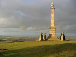
A pleasant walk through the woods led out onto a spectacular edge of grassy down-land which terminated in Coombe Hill and its monument. Here was a magnificent view, with Aylesbury at its focal point. I chatted briefly with a girl runner, originally from Oswaldtwistle, who pointed out some of the sights to be seen. My earlier loss of time did not allow me to linger and, as the girl started her jog downwards, I followed as quickly as I could down to Wendover. The route goes right into the town before turning up a narrow path between the houses and out passed the church. 

The good weather had now deserted me. The clouds had rolled in and, by the time I had climbed out of town and through the woods, it has started to rain. So for the first time in the entire walk, it was out with the waterproofs. The drizzle got more and more persistent as I entered Tring Park, an attractive high country estate above the town. The rain was dripping off the avenues of trees and the path down to the A41 became slippery. Tring Station is a long way out of Tring and at the foot of the next (and last) big climb. Half way up the slippery scramble, I was passed by a serious fell runner who was motoring over the difficult terrain. The climb brought me out of the woodland onto a bare and grassy summit where the wind was so strong that I was struggling to make progress. It was stormy and wild as I descended to a road crossing.  

Thence onto the very last section up to Ivinghoe Beacon. It was a relief to pull up the final mound onto the trig point and viewing place. But the weather was so unpleasant that I again did not linger but set off straight down the steep face of the hill. And straight into trouble. In seconds I was in skin-ripping brambles and long scrub. So bad was it that I had to reverse my route and go back over the summit and back to the access road at its rear. This lost me more time so I ran down the busy main road into Ivinghoe village where I came to a road sign that said 'Cheddington 3 miles'. My heart sank as I now had less than an hour to the train. A quick look at the bus times showed me that I only had one method of transport available, so I set off at a slow jog down the very busy and wet road. It really was miserable conditions now and only movement kept me warm. After half an hour I saw a farmer getting out of his tractor so I went over and asked how far it was to the station. What an incredible reply! Just 50 yards down the road to the left. I was there! The station was a mile before the village so had only been two miles out of Ivinghoe.  

So I had half an hour to spare which gave me time to cross over to the deserted platform and strip off my wet clothes in the shelter on Platform 3. When the train arrived, I was back in civilian clothes and was warm dry and ready for the trip home. The 30 minute change at Milton Keynes allowed me to grab a cappuccino and pastry before the fast train took me to Stoke in exactly the hour. I was back in Macclesfield by 6.20pm and had time for a pint or two before walking home to prepare for the arrival of my daughter and her family, coming to stay for the half term holidays. No time to worry about tiredness and sore feet. The grandchildren burst into the house within minutes of my arrival and I was back in the real world. 

Cadsden dep. 08.45, Ivinghoe Beacon 14.25, Cheddington Station arr. 15.30
GPS 22.28 in 6hrs 50


Sunday, 12 May 2013

Southern Highlands


Milngavie – Corrour Station
29th April – 3rd May 2013

Introduction

This was the 2013 edition of our annual 100 miles along our end-to-end route from Lands’ End to the North Coast of Scotland. Last year I had finished a traverse of Southern Scotland when I dropped off the Campsie Fells onto the Glengoyle Distillery. Now we were picking up that end point and continuing for another five days into the Highlands. As my daughter and family live in Scotland, I went north early to spend time with the grandchildren, waiting for Mike to arrive for our walk
 

Monday 29th April       Milngavie – Drymen
A Day on the West Highland Way

I took my grand-daughter to school and then walked on to the station and caught a train to Glasgow Central. Mike soon joined me, having travelled up from Crewe on the Virgin Pendolino. Then it was a descent into the depths of Platform 17 for the suburban train out of town. It was a cold but beautiful spring morning as we left the Milngavie station and walked into the pedestrianised town centre, completely missing the post and sign that indicated the start of the West Highland Way (WHW). However we were soon walking north into quiet woodland beside a small stream (or do I call it a burn from now on). Within an hour we were watching an Osprey fishing in a small lochan and we seemed a million miles from civilisation. We walked for a short while with a group of Americans  
who were just setting out to walk the complete WHW. We then pushed on to the distillery where I had finished last year. Dropping my sack, I jogged the 500 yards to the point on the main road where I had actually reached last year. I then returned the same way to pick up my sack and continue up the WHW. Mike was rather critical of this, arguing that I should for completeness carry the sack everywhere, but I argued that it was me that was doing the end-to-end walk, not my sack (which is falling apart and may not last the course).

In the afternoon we were hit by a series of cold sharp showers, necessitating the donning of waterproofs. The route followed an old railway for some miles before it turned off across a river bridge where a fridge, outside a house, promised ice cream at an ‘honesty shop’. As we sat on a wall eating our choc ices, honestly paid for, a Brisbane couple walked by and we accompanied them for the final two miles along the lane into Drymen. We were later to meet Julie and Jim Woodyatt again in the pub and join them for a meal. There was a long crocodile of folk trailing into town. We had in all the years we had been doing long distance footpaths never seen such a sight. The b&b's were busy, the pubs were full and there seems an industry in driving bags up and down the route. We were the only ones carrying our kit. We were not convinced this sort of regimentation was for us. 

Milgavie dep. 11.25, Drymen arr. 15.45, GPS 13 miles in 4hr 17m 12s

We stayed in the Braeside Guest House on Main Street and ate at the Clachan Inn, the oldest inn in Scotland, lamb burgers and chips, no real puddings and little real ale. The local brew was off and after a pint of Greene King IPA, I turned to red wine. 


Tuesday 30th April 2013       Drymen – Callander
Mort Safes and Cappuccino

It was a beautiful morning. There was not a cloud in the sky and the air was like cold wine. The start of the Rob Roy Way (RRW) was along four miles of road but it was a very quiet road and a relief to be on our own away from the hundreds of walkers on the WHW. We found our first RRW symbols which we followed to the point at which we turned left into the water catchment system. The initial forest road was tarmacked as it followed the line of the aqueduct which carries water from Loch Katrine to Glasgow. The aqueduct was exposed as it crossed side valleys and re-entrants and was at its most spectacular as the Corrie Aqueduct, spoilt rather by the scaffolding of the maintenance team. After this the track became stony and grassy for a while and then became wide a forestry track for the decent into Aberfoyle.  

The lane into Aberfoyle passed an old church, Kirkton Church which had had its roof removed many years ago to encourage villages to use the parish church in the centre. An interesting feature of this ruin was the two steel coffins, ‘mort-safes’, that sat either side of the entrance, designed to discourage bodysnatching. A lovely coffee shop on the main road provided cappuccinos and Victoria sponge. This refuelled us for the climb into the Montheith Hills and a lovely balcony route that gave us splendid views over the golf course and the now distant Campsie Fells. The wide forest track eventually came to an end and the route continued on a narrow and muddy path that ran through forest and meadows and a lovely section of tree-lined lochan. We pulled out onto another wide forestry track for the long descent to Callander. As we hit tarmac, we came across a council vehicle stuck in a ditch. Then we went passed a delightful old river bridge, Gartchonzie Bridge, where another council vehicle passed us obviously on its way to pull out his colleagues. 

The route took a loop around a plantation before it finally dropped into town at the local secondary school just as the students were pouring out. We followed the pupils through the sports fields and over the footbridge which took us into the main street. Calling into the visitors centre we noticed that a video show was available about Rob Roy so we quickly showered and changed at the b&b and returned to watch an interesting, but not particularly informative, reconstruction of his life. Not much is known about the man besides the fact that he kept cattle and was not averse to stealing more. 

Drymen dep. 08.45, Callander arr. 15.55, GPS 21.06 miles in 6hrs 39m 43s plus a 35 minute coffee stop. 

We stayed in the Southfork Villa Guest House in Cross Street, Callender and ate in the Waverley: steak and kidney pie and chips with apple pie and custard and two beers from the Inveralmond Brewery, Ossian (4.1%) and Lia Fail (a darker ale at 4.7%).
 

Wednesday 1st May 2013    Callander – Killin
A Day on Old Railway Lines 

It had been raining during the night and it was still damp as we left the guest house. So with waterproofs on, we set out westwards out of town and onto an old railway line, now a cycle route. Soon it dried up and we were able to take off some layers and make good time along the side of Loch Lubhnaig. It was not flat all the way. Two sections were waterlogged so the route diverted 100ft or so up the hill to a forest track. It was lovely gentle countryside to walk though, reminiscence of the English Lake District. After nine miles, the way came down to cross the river and crossed another footbridge to reach Strathyre. There is not much there so we were glad to sit outside the village shop and have coffee from a machine.  

Then there was a rather gratuitous loop up the east side of the valley, a loop into the forest to avoid walking up the main road. It made it even more gratuitous to find that the loop was officially closed for forestry activities and we walked through stacks of wood from freshly cut trees. The descent back to the road was down an enormous zigzag that seemed to take forever. Eventually though we were down at the Kingshouse, which is not called the Kingshouse and more. It is now a trendy cafe and b&b. Passing under the new road, the RRW turned along an undulating cycle path, tarmacked in its entirety, that followed the busy road. Here we met three ladies over from Amsterdam, a mother, daughter and friend who were walking the RRW because the accommodation on the WHW was fully booked. We left them as they took the diversion into Lochearnhead. We climbed to a stunning picnic and viewpoint overlooking the loch and sat in the sun and ate our sandwiches. 

It was time for sun-cream as we set off up Glen Ogle on an old railway line giving fabulous views of the valley below. At the bealach, the road had climbed up to railway level. We then crossed the road and went off passed the memorial to the two pilots of a crashed Tornedo. The way through the woods was again closed and a diversion took us on a high level loop round into Killin. We came out into the village right opposite the Falls of Dochart, a marvellous and dramatic end to the day. 

Callander dep. 08.55, Killin arr. 16.45, GPS 23.09 in 6hr 48m 39s plus a 30 min coffee stop and a 20 min picnic. 

We stayed in Breadalbane House an ate at the Falls of Dochart. The food, black pudding for starters and fish and chips, was very good and the real ale was superb. Strathbraan Head East (4.2%) rated in a very high score (8 out or 10) and Fyne Maverick (4.2%). 


Thursday 2nd May 2013     Killin – Rannoch Station
Trouble with Trees 

We were down before 8am but the breakfast room was locked. We really needed an early start today as we had a very long and desolate section awaiting us. The breakfast took what seemed an age to arrive and even though we had our bags packed and waiting in the hall, it was after 8.30am when we finally got underway. A quick stop at the Co-op secured some butties for a picnic lunch and then it was off up the road, first north and then west to the hydro-power station. Here we turned up a steep tarmacked track that zigzagged up to a power station compound. We failed to find the path marked on the map and spend an uncomfortable half hour contouring into the upper part of the Allt Dhuin Criosg. Eventually we came to flatter ground and a long tramp across boggy ground passed the shielings and over the Lairig Bhreislich. Our decision to descent the left bank was the correct one but it was a long and steep decent onto the easier slopes and it came as a relief to see a footbridge over the river below. We quickly dropped onto this bridge and crossed it to the road. We were soon down in Glen Lyon and, lo and behold, there in Innerwick was a tea shop. It was rather busy with walkers and cyclist but we found a table and had our tea and cake whilst talking to a couple who liked climbing and short wave radio, a strange but interesting combination. 

Then we set off on our second big climb of the day, this time with the weather closing in. The lower track up the Lairig a Mhuic was wide and well-made but came to a sudden halt and then became a sparse and slippery trod. My route guide for this section was the Scottish Hill Tracks publication. This suggested that we should scale a beallach to the west and drop onto the Rannoch Forest track at its earliest point.  Mike pointed out the advantage of continuing to the east of Meall nan Sac and contouring round to pick up the track lower down. What I did not realise was that Mike was using a 30 year old map which did not have the forest extension that was shown on mine. So we ended up with a mixture of our two ideas, not ideal, but it did avoid 500ft of climbing but entailed a long and tiresome detour along the new forest fence to get back to the forest entrance.  

It was a great relief to reach the forest track and commence the decent into Loch Rannoch. But soon some problems arose. Tree damage from a recent storm had not been cleared and we came to a huge pine, lying across the track, which could only be passed by crawling commando-style under the branches. Mike went first, and then I handed over the sacks and followed as he scrambled for his camera to record the scene. The continuation into the lower forest was surreal. The entire landscape had been clear felled, and it looked for all the world like the scenes from Hiroshima. The logs were piled up beside the track in huge (20ft high) stacks that ran for half a mile.  

As we exited the forest and crossed the river, another choice faced us. We could either turn north for the road and have a 10 mile road walk or go round to the south of Leagag and reduce the amount of tarmac. As the second option was shorter, we turned west into worsening weather and it started to rain and blow. The path round to the Allt a Mheanbh-chruidh became wet and slippery and we were glad to reach the track and get some easier walking down to Bridge of Gaur. As we turned west on to the long lonely road, the weather deteriorated further. We were 90 minutes walking the five miles to Rannoch Station, into a cold and wet gale, with only one car passing us on route. When we finally arrived, the hotel door was locked but it was soon opened to give us a warm welcome, a lovely bath and a marvellous meal. 

Killin dep. 08.37, Rannoch Station arr. 19.30, GPS 31.55 miles in 10hrs 20m 06s plus 35 minutes in the Innerwick tea shop. 

We stayed in the Moor of Rannoch Hotel, on Scott’s first day. He had bought the hotel and had moved in the previous day. He likes to stock bottles of Scottish brewed real ales and, out of his large collection, we drank Bitter and Twisted (4.2%) from Harviestoun and Sheepshaggers Gold (4.5%) from Cairngorm. We easily managed a 3 course meal as our clothes dried by an open fire. 


Friday 3rd May 2013     Rannoch Station – Corrour Station
A Dreich Day on Rannoch Moor 

Listening to the rain driving against the window through the night had convinced us that it might be a good idea to abandon the last day’s walk and jump on the first train home in the morning. However the wind had dropped when we awoke so we stayed with plan A and breakfasted early, paid our bill and ventured out into the rain once again. Back down the road we went, to the track that led northwards across Rannoch Moor. The clag was hiding the high mountains and all we could see was colourless wet grassland stretching away into the mist. The path was wet, made worst in places by attempts to upgrade the route with heavy machines. The small streams of yesterday were now raging torrents and even small side streams provided interesting crossings.  

At breakfast, two ladies from our hotel had been telling us of their plans to take the early train to Corrour and walk back along the route we were taking. So it was no surprise to us when a pair of figures appeared on the track in front of us, moving slowly towards us. A quick exchange of information prepared us for the fact that the track ahead did not get any drier. We at least were now heading down out of the mist, turning left at Peter’s Stone and down towards the loch. Soon the youth hostel came into view, tucked serenely on a peninsula out into the loch. And there in the distance were the white buildings of Corrour Station. 

At the youth hostel, we joined the wide track out to the station and the rain seemed to get heavier now we were totally exposed to the huge expanses of the Moor. A Czech car was parked up at the station. Did this belong to the new owners of the restaurant? The cafe was busy with walkers all waiting for the lunchtime train and we had to slip over the line onto the platform to find a quiet shelter to change out of our wet gear. I only just managed to attain a modicum of decency before the restaurant emptied and they all came over to join us. But I was in dry clothes and feeling a bit warmer when the train pulled in and we were on our way south. It took at least an hour and several hot drinks before I felt fully comfortable by which time the train was running down passed Bridge of Orchy to Crianlarich, surely one of the most spectacular sections of railway line in the country. What a pity the mist and the water running down the windows made it hard to appreciate the scenery. 

It was 3 hours back to Glasgow then a short walk to Central Station and the train to Ayr. Rachel picked us up from the station, took us home, fed us royally (bread and butter pudding) and we slept long and well ready for the drive home.   

Rannoch Station dep. 08.35, Corrour Station arr. 12.05, GPS 11.34 in 3hrs 29m 42s