Tuesday, 2 May 2023

Stanza Stones Trail

19th October 2022, 26th-27thApril 2023


Introduction


In the planning discussions for next year’s walks for the South Manchester Group of the LDWA, Bridget came up with the concept of walking the Stanza Stones Trail. This is a 47-mile route from Marsden, the birthplace of Simon Armitage, the Poet Laureate, to his present home town of Ilkley. Six of his poems have been carved onto gritstone outcrops along the trail, each reflecting on a different aspect of water. As part of the reconnaissance 
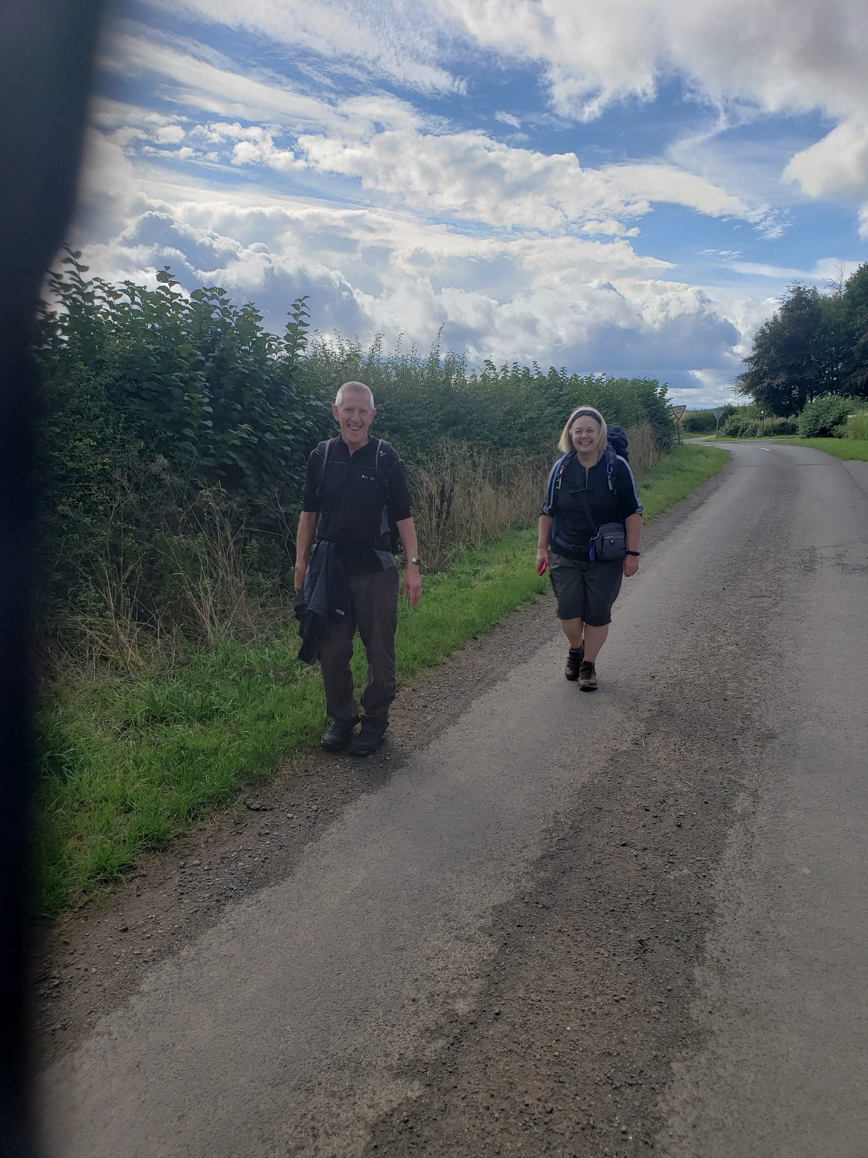
programme, David and I offered to accompany Bridget across the moors on the first of her journeys. The logistics were an interesting exercise with the favoured option being to let the train take the strain. So, in between strikes and crew shortages, we booked our e-tickets and met on Piccadilly Station early one Wednesday morning for the first stage of the walk.


Wednesday 19th October 2022                     Marsden – Hebden Bridge

Snow and Rain


An early train to Piccadilly enabled David and me to enjoy a cup of coffee before rendezvousing with Bridget for the 08.30 TransPennine train to Marsden. The weather was fine with a minimal risk of rain. Only the wind would become an issue. Just after 9am the three of us were climbing the steps from the platform at Marsden station, gravitating downhill to find the Huddersfield Narrow canal. A pleasant amble along the towpath brought us to the visitors’ centre at the basin comprising the end of the Standedge Tunnel which, at 3 miles in length, is the longest deepest and highest tunnel in Britain. Crossing the canal and zig-zagging up to the main road, we found the route up a farm track and then onto the open moor. A steep grass trod ascended straight up Pule Hill where the views from the memorial cross were spectacular. A narrow path took us across the moor to the western edge overlooking Redbrook Clough. A wide grassy track descended into an old quarry where a careful search revealed our first Stanza Stone, consisting of four lines of the poem ‘Snow’ carved into a gritstone boulder.


The quarry workings were exited down a long straight incline, the original track of a winch railway. Following the Standedge Trail to the Carriage House, no longer a pub or hotel, we crossed the A62 and set out across more disused quarry workings to join the Pennine Way. Much of the path over White Hill is paved with old industrial flagstones. It came as a pleasant surprise to find a café in a shipping container sited beside the A672 near Windy Gap transmission station. A quick bacon butty enabled us to keep our sandwiches for later on this long day’s walk. Outside the wind was really letting this place live up to its name, blowing us across the M62 footbridge and along Blackstone Edge. Picking our own route through the overgrown quarries below the Edge, we emerged onto the waterworks path near the White House. Resisting the urge for a second refreshment break, we staggered onto into the gale towards the Rain Stone, the second Stanza Stone, comprising the entire poem ‘Rain’ carved into a long low gritstone edge on the far bank of a steep-sided leat crossed via an old stone clapper bridge.


The wind was really strong alongside the reservoirs, making progress in a straight line rather difficult. Round the end of the reservoir, the wind blew us out onto open moors at the end of which stood the tower on Stoodley Pike. It seemed to take an age to reach it but when we final did, we crouched against the leeward wall to eat our butties. The descent into Hebden Bridge was fast and furious, interrupted only by a panic over a misplaced pair of gloves and a careful check on the correct path. The long straight road into the valley brought us out at the canal bridge and we finished how we had started, on a towpath. We enquired of some locals the best way through the park and we were soon on the station approach. A train was due and I had very little time to buy a ticket before we were whisked away towards Manchester and the end of a long and invigorating day. One last mile across the city centre and we went our separate ways at Piccadilly Station. When shall we three meet again!


Marsden dep. 09.05, Hebden Bridge arr. 16.50

GPS 18.68 miles in 7hr 01mins 39secs walking time with a 25-minute break in the café at Windy Gap and a 15-min halt sheltering behind Stoodley Pike for a final refuelling.


Wednesday 26th April 2023        Hebden Bridge - Bingley

Mist


Well, it took six months before the three musketeers could reconvene to finish what began last autumn. Poor weather, train strikes and other commitments delayed our return but now we regathered at Piccadilly Station again for the march across the city. Catching a train from Victoria Station just before 10am, we were in Hebden Bridge by 10.25am. Our start involved a mile of road walking up Keighley Road before we left behind the traffic and noise of a busy town and climbed through woods and fields into another world, the Pennine Moors. By carefully following the text in the guidebook, it was a lot easier finding the intended route than we had anticipated.  Soon Chiserley was behind us in the bright morning sunshine as we climbed the farm-track to the equestrian centre and Midgley Moor. We hesitated on the descent to Catherine House as text and map did not quite match. But we finally were sure we were on the right lines when we entered the walled track and turned through the arch and up the valley road.


On the steep climb up to the crenellated house, we passed a lone woman backpacker who had not found the optimum route into the valley and had had a difficult descent. We passed strongly onwards via another arched farm entrance and over Warley Moor heading towards the wind farms. Cold Edge Road was memorable for its fly tipping and a very depressed guy pacing slowly up and down. In the middle of all this, we grabbed a bite to eat, spoilt somewhat by Bridget’s jaw clicking out of joint. It was not the place to hang around so we continued passed reservoir and quarry to find a gate leading towards our first Stanza Stone. The Mist Stone proved difficult to find, set as it is on an inclined slab below a large cairn, facing away from the path. The crossing of the moor was less taxing and we eventually turned onto Hambledon Lane and descended towards a paddock and large tent. Here a Yorkshire Shepherdess was watching her sheep, Derbyshire Gritstones, through a pair of binoculars. She was overseeing the lambing of her flock and was using the tent as a daytime shelter. Then followed two miles of tarmac.


Carefully picking our way through the traffic on the A629, it was a relief to be off-road and heading for our overnight destination. An enclosed path brought us to Hellas Lane, a semi-suburban road leading past a farm and down to a bridge over Harden Beck. The guidebook warned of rocky scrambles down the beck-side path but the fingerpost announced this to be the ‘Senior Way’ so it couldn’t be that bad. Passing a waterfall, the hazards came as much from tree roots as from slippery rocks and we were soon down and on easier ground only to find ourselves facing a steep climb up the wooded side of the valley. The continuation along the edge of the gorge was generally flat or downhill but, after crossing a road and footbridge, another uphill slog was the sting in the tail. A short way down Lee Lane, a field path led into a woodland. Here a forest track descended back to beck-level and across Shipley Golf Course to a substantial footbridge over the River Aire. Myrtle Park is the gateway to Bingley but we had a further mile to walk. Passing the station, we trudged up Park Road taking the ginnel shortcut to Lady Lane. This was officially closed and we had to scramble over a trench make further progress. It had been a long hard day right to its conclusion.


Hebden Bridge dep. 10.28, Bingley Hotel arr. 18.20

GPS  16.14 miles in 7hr 28mins 49secs walking plus 20 lunch stop on the ‘Waste Road’.

Stayed at the Oakwood Hall Hotel, Lady Lane, Bingley. Shared a brie & cranberry sauce starter then had a chicken Rogan Josh and finished with chocolate sponge and custard (with extra custard). The beer was Saltaire Blonde (4.0%) from the brewery down the valley.


Thursday 27th April 2023                 Bingley - Ilkley

Dew, Puddle and Beck


Wandering down to breakfast, I found Bridget already tucking into her eggs and toast. I soon caught up with my full English and jug of sludge-like cona coffee. Rucksacks were soon packed and the party gathered at the hotel entrance for a 9am departure. In spite of a poor forecast, the good weather stayed with us as we descended through suburban roads to Five Rise Locks. A three-mile stroll down the canal towpath gave us a good start to a day when we had a specific train to catch. Leaving the Leeds & Liverpool canal at Leche’s Bridge, the route took us upwards through a wood-covered hillside on paths and lanes leading to the open moors. Passing a friendly tup near a communications tower, the guidebook talked us over a grassy field path, through a gate into a newly planted woodland and along a made-up walkway/cycle track to the Dew Stone, our first Stanza Stone of the day.


After our mandatory poetry recital, the track took us through a damp and dark pine forest which was part of the original plantation. Emerging into sheep grazing moorland, a level farm track led us passed Black Potts Farm round to Doubler Stone Farm. Here a faint trod ascended close by the Doubler Stones and up onto the highest level of the moor, Black Hill, a spectacular viewpoint over the Aire Valley and the village of Addingham. A mother-daughter pairing of fell runners passed us on their morning training round, the 12-year-old taking full advantage of her teacher’s strike to pursue her ‘physical training’ part of the curriculum. A glorious path ran along the northern edge of Ilkley Moor. All we needed was some shelter from the cold breeze and the Noon Stone provided the perfect siting for a lunch stop. Just after and just behind noon, we sat for a short break.


The afternoon session was dominated by stones. And we had the task of finding, them. Firstly, we turned away from the plateau edge, climbing through rough moorland on an indistinct trod that led over a ridge and across to a now mostly felled and logged plantation. Keeping to the outside of the forest wall, we scrambled up to yet another level, pausing to make sure we had the right line for the traverse of the boggy high-level plateau. A marshy wall-side plod brought us to the wireless station and the Thimble Stones which acted as an attack point for the next Stanza Stone, the Puddle Stone. A flagged path lead over the moor to the Twelve Apostles stone circle and then descended  towards Ilkley and the finish of our expedition. But the designated route turned aside from the direct path to follow the Backstone Beck down passed the Poets Seat to a junction of footpaths emerging from both sides of the stream crossing. Desperate not to fail with our last Stanza Stone search, we hesitantly crossed the beck and heading downhill studying text, route sketches and ordnance survey maps. We had two clues: it was near the next footbridge and almost in the stream. To our great relief, a Stanza Stone direction post stood next to the main path and we scrambled up through some gorse and along to a delightful clearing beside the beck. Here it was, the Beck Stone. No time to sit and enjoy the moment of triumph, it was back to the footbridge and onwards via tarn, lane and road to Ilkley station. Just time for a tray of coffees as we sat awaiting our train home.


Bingley dep. 08.54, Ilkley arr. 15.20

GPS  14.41 miles in 6hrs 04min 00 secs plus a 20 min stop (12.15-12.35) at the Noon Stone


Conclusion


A series of trains and city walks took us home. The Ilkley train dropped us at Bradford Forster Square, then probably the trickiest navigation of the day got us across the city to Interchange Station where a very crowded commuter train crossed the Pennines via our starting point of Hebden Bridge and on to Manchester Victoria. Another foot slog across Manchester with Piccadilly station as our destination. Here the three tired combatants sat on a seat awaiting their various trains and saying our thanks and farewells . Such had been our enjoyment of the Stanza Stones Trail that we were already discussing options for next year’s walking project.


Friday, 14 April 2023

Peak District Boundary Walk (Part 2)

26th- 30th March 2023


Introduction


Last year, as part of the 50th anniversary celebrations of the Long-Distance Walkers Association (LDWA), the South Manchester Group walked a 50-mile section of the Peak District Boundary Walk (PDBW). Starting in Bollington, several of the group followed the route for three days around the boundary of the national park finishing in Old Glossop. Ever since, I have been pining to continue what we had started with a view to completing the entire 190 miles of the trail. Through the dark winter months, I kept fit with weekly day walks so that I was ready for the spring walking season. At last, the clocks were put forward and a window of dry weather appeared. On the very first day of summer time, I begged a lift to the station for an early train the Manchester and onwards to Glossop. By 11.30am, I was emerging from the station and heading up Norfolk Street towards the old town and the Bulls Head pub where last year’s trek had terminated.


Sunday 26th March 2023                  Old Glossop - Diggle

Pots and Pans


The promised dry weather manifested itself as I set out from the Bulls Head into the Derbyshire countryside. A rising field path, grassy but muddy in parts, led over a ridge, crossed a busy road and descended passed a tree-lined graveyard into Padfield. A young couple ran passed, following a guidebook of a different round. I proceeded more slowly over the Longdendale Trail and down to the reservoirs. On the wall of the dam, I asked a young woman to take my photograph with Bottoms Reservoir and Bleaklow in the background. The steep climb up the north bank and into Tintwistle led to another Bulls Head. Leaving the village via Arnfield Lane, the sunlit ridge of Lees Hill opened up ahead.


From Arnfield farm it was quite a pull up and over moorland paths. A track led between the Swineshaw Reservoirs and then climbed yet again to a magnificent viewpoint overlooking Mossley. An awkward stony descent led out onto a narrow lane that descended to a new housing estate. This was circumnavigated round to a path contouring below Buckton Castle, an ancient fortification from the 12th century. Pausing for a brief conversation with a local couple who were able to identify the football ground and other features of Mossley, I then walked on to find a quiet spot for a late lunch. On the single-track lane to Fern Lee Farm, four girls in a car, hopelessly lost, asked me for directions. The last I saw of them was turning  in a farmyard and heading back the way they had come. As I approached Dove Stone Reservoir, a heavy shower of rain passed through, giving cause for waterproofs; not what I really wanted at the start of the last climb of the day.


The path from Hollins Lane, as indicated in the guidebook, appeared to have been closed. An obvious detour, not marked as a right of way, had a PDBW green marker disc so I assume this is now the official route. What came next was cruel. A steep grassy track led up Alderman’s Hill, the end of which is an outcrop of rocks known by locals as Pots and Pans. A stone obelisk war memorial overlooked Greenfield and its valley. The correct line beyond the obelisk was not immediately obvious and I was briefly heading down towards the Isle of Skye road before I corrected back to the northwest edge. Slipping and sliding down the steep path to Pobgreen, the route followed lanes below Running Hill Head. A featureless set of fields proved difficult to navigate and I was glad of my digital maps to find the best line across to Diggle. My accommodation for the night was 0.3 miles off route and it was nearly 7pm before I arrived. My landlady suggested that I should get to the pub as soon as possible because they finished cooking early on a Sunday so I dropped my rucksack and continued the short distance down to the Diggle Hotel.    


Old Glossop dep. 11.35, Diggle arr. 18.50

GPS 16.22 miles in 7hr 03mins 10 secs walking time with a 15-minute break near the obelisk.

Stayed at the Sunfield Accommodation in Diggle, a lovely b&b in the oldest part of the village. I ate just down the lane in the Diggle Hotel, an old-fashioned ale house. The kitchen was about to close so I quickly ordered suet rag pudding and chips followed by sticky toffee pudding. The beers were Butterley (3.8%) for Ossett Brewery and Landlord (4.1%) from Timothy Taylor. I was joined for the meal by Robert and Lucy-Jean from Oxford, a couple walking the Pennine Way and staying at the hotel.


Monday 27th March 2023             Diggle – Holme - Holmbridge

No Food on Mondays


It was duck eggs for breakfast, thanks to of the Indian runner ducks that trotted around the garden. Taking a leisurely start to the day, it was 9.45am before I got my boots on and was strolling back up to the PDBW. Rising tracks and field paths led up to Standedge and the main road over the Pennines. Through the car park, the Pennine Way was flagged almost the entire way over Black Moss. The final drop into Wessenden was steep and slippery and I had to pick my way carefully down to the footbridge and then scramble the other side. The section round the back of Wessenden Lodge and up to the top track was not obvious and I ended in a boggy gully before shinning straight up the hillside. There was a wonderful mile long section along the edge of the moor with views of Marsden opening up below. On Brin Hill the route plunged left down steep lanes and paths, emerging on a road that led into Marsden town centre. Here was a lovely little cafe that provided a light lunch and the energy for a long afternoon.


Back the way I had come and all the way up to the top of Binn Moor, I felt it was a very strange addition to the boundary walk; almost 2.5miles out and back in order to visit  Marsden. The flat section alongside the Deer Hill Conduit was a welcome relief and I got a goodly pace going around the shooting lodge and reservoirs. In glorious sunshine, I contoured above Meltham on a crisscross of tracks and lanes. A long climb onto Royd Edge ended at a viewpoint over the clough below and the hills beyond. The drop into the Royd Edge Clough was followed by a path through a shady wood and a rocky ascent up the far bank and onto a road. This rose forever upwards to a busy trans-Pennine road, which was crossed near the Huntsman Inn. On the devious descent into the next valley, I came across two teenagers pushing bikes, seeking advice on the best route up to the Huntsman. I hope my suggestion was of some help.


I pause briefly at Digley Reservoir to take a selfie before tackling the final section of the day, a gentle path along the waterside and then a series of small fields and squeeze stiles. The village of Holme eventually came into view, the end of the PDBW section for the day. There was apparently no accommodation so I had booked a b&b in the nearest village, 1.5 miles down the road in Holmbridge. At least it was downhill and dry and I came at last to the Pickled Pheasant, which promised the only food in the village. I popped in to reserve a table only to be told that there was no food on Mondays so I continued my wearisome way to the  b&b. This appeared empty but my room number was on a slate near the front door so I let myself in, showered and changed and came down to meet my landlady. She advised me to catch a bus and seek food in Holmfirth, some two miles down the road. She even showed me where the bus stopped. It had been a long warm day and I was glad to get off my feet.


Diggle dep. 09.46,  Holmbridge arr. 17.50 

GPS 17.41 miles in 7hrs 25mins 40secs walking with 40 mins in Mario’s Diner in Marsden (13.00- 13.40).

I stayed in Corn Loft House, a lovely b&b run by Trevor, a local councillor. Catching the 18.38 bus from outside the front door, I was in Holmfirth in 10 minutes, stepping out into the magnificent stage set from the Last of the Summer Wine. Asking a local couple for advice, I crossed the river to the Old Bridge Inn where the food was superb. Persian lamb tagine, with apple crumble as a dessert. The Port Nelson (4.0%), a New Zealand Pale Ale from Small World Brewery was so nice that I sneaked in a second. A late bus took me back to Holmbridge and the b&b where I collapsed into a four-poster bed.


Tuesday 28th March 2023     Holmbridge – Holme - Midhopestones

Helicopter Over Winscar


The window of dry weather had closed and dark, threatening clouds hung over the moors. I plodded my way back up the valley to Holme and the start of the day’s section on the PDBW. I was late leaving because my landlord, Trevor, was more interested in chatting than cooking the breakfast. It was nearly 10.30am before I was back enroute. The poor forecast had induced me to don full wet weather gear so I was well prepared for the rain that arrived. After an initial drop from Holme village, the route crossed the spectacular dam of Ramsden Reservoir, climbed a steep track beside a wood and ventured out over a wet hillside. The next couple of miles were on wide straight tracks across dreary flat land before a right turn into a forestry road broke the monotony It also broke the silence as I walked towards a group of trainee foresters practising their chain saw techniques.


It was now hammering down and I was becoming increasingly bedraggled as I emerged onto a muddy lane searching for the path over to Harden. The guidebook had warned that signage was minimal over this featureless ex-mining and quarrying land. The problem was that there were too many paths rather than too few. So, with a modicum of a sense of direction, there was no problem in finding my way through the merk onto the busy road that ran beside Winscar Reservoir. The flight path of a helicopter came nearer as I passed through the car park and across the wall of the dam. The route as indicated in the PDBW guidebook, descending from the top of the dam, was blocked by a locked gate and a notice saying ‘no public access’. So, I continued along the access road, passing the point where the helicopter was picking up stones for a moorland drainage project. My entry into Dunford Bridge was down the steep road from the west. This led straight onto the Trans-Pennine Trail where a bench was perfectly placed for a lunch-stop.


Improvement work to the Trans-Pennine Trail was in evidence. At first the surface was a new rubbery substance that made for fast going. This led onto a hard dry surface for the two -mile stretch to the first bridge. At this point a field path led south for a further mile up to the very busy Woodhead Road. Crossing with care, forest tracks led down to Langsett Reservoir. A delightful woodland path ran beside the water and came out on the road crossing the wall of the dam. On the other side, a field path dropped down to the river emerging from the overflow. This led to a lane and the final section of the day’s walk up a steep path edged with a line of freshly planted trees. The path climbed up and along the edge of a cliff overlooking Midhope Reservoir. On a dry day the views would be superb but not today. I ventured down towards a track reduced to uncrossable mud by the passage of forestry vehicles. Taking to  the trees to find a dry route down, I still ended on my back side sliding down the hillside, At the junction with Mortimer Road, I turned off route to find my accommodation, a pub in the nearby village of Midhopestones. I was so wet that I stripped off all my wet gear and hung it to drip dry over the stone floor of the bar. Only then did I make my way to my room and a warm shower.


Holmbridge dep. 09.49, Midhopestones arr.16.00

GPS 15.08 miles in 5hrs 58mins 25secs walking time plus 10 mins on a bench on the Trans-Pennine Trail near Dunford Bridge.

I stayed in the Old Mustard Pot in Midhopestones. The meal was fish, chips and mushy peas followed by sticky toffee apple crumble and a cappuccino. The beer was Farmers Blonde (4.0%) from Bradfield Brewery and Landlord (4.1%) from Timothy Taylor.


Wednesday 29th March 2023           Midhopestones -  Ringinglow                    

Wyming Brook        


The rains had abated, the skies had cleared and it was with a spring in my step that I let myself out of a deserted pub and set off up Mortimer Road. No breakfast was on offer so I was keen to get going towards an early lunch stop. Today was potentially my longest day. I was able to make good  progress on the road and out onto a delightful field path overlooking a steep-sided valley. The edge walk continued along a farm track and lane with joggers and dog walkers enjoyed the morning sunshine. The entry into Bolsterstone village was passed a   large graveyard rather tastefully set out. The impressive church had a commanding position over villages, both present and past. A steep road descended into Ewden village but the official route took a short cut through a wood emerging onto the road again near the river. Careful navigation was required to stay enroute around the head of the reservoir and up the steep fields beyond. After a rather curious loop up more fields, high ground was attained via a quarried hill top, the exit line from which was not obvious. I eventually found the section of road that would that lead in a convoluted manner towards my next destination, Bradfield. The mist was down and the line across the fields was not easy to pick out. A works hooter sounded like a foghorn, 12 noon, time for lunch, and that increased my pace as I headed rapidly downwards out of the mist.


The path entered Higher Bradfield opposite the parish church, standing as it does in a spectacular setting overlooking the lower village. I took the path through the church and graveyard and down a steep wooded path to Agden Reservoir. A quiet lane led towards Lower Bradfield but the signed path took a short cut bypassing the café that I was seeking for my first food of the day. Finding myself on a riverside path leading out of the village, I collapsed onto a bench and eat my entire emergency rations. Suitably reenergised, I then turned uphill onto the old coach road (not a marked right of way). This joined the road system at an impressive residence built like a mediaeval castle perched high above the valley floor. A seemingly endless climb took me through Ughill and then down a steep road losing all that hard-gained height. Repeating the climbing process must have clouded my navigation judgement because, after slogging up a pathless wet field, I missed a stile in the wall and followed my digital map into a cul de sac. I waste ten minutes scrambling over fallen trees before seeing my folly. Then it was for ever upwards up Royds Clough, and Crawshaw Lodge. Here the view into the Rivelin Valley opened out. All I had to do was lose all that height again.


Crossing the busy main road, the path ran along the steam that fed the reservoirs, emerging onto a wide forestry track the wound round the hillside above the dams. Then the route turned into Wyming Brook and another world. The next mile or so was my highlight of the week, a magical climb up a steep fast flowing stream. It was hard to believe that Sheffield was so close by: I could have been in the Canadian mountains. For twenty minutes I scrambled up a wet and rocky path over wooden bridges and over rocky outcrops. Eventually all good things come to an end and I gentle ascended to Redmires Road and the running routes of my university days. From there it was much more straight forward, up lanes and paths to Brown Edge Farm, a moment’s hesitation to find the correct line through old quarry workings and then over the fields to Ringinglow Road. A mile along the busy road, clinging to an inadequate grass verge, brought me to my overnight accommodation.


Midhopestones dep. 08.53, Ringinglow arr.17.15

GPS 19.01 miles in 8hrs 05mins 18secs walking time with 20 mins on a bench just outside Lower Bradfield.

Stayed at the Norfolk Arms in Ringinglow, eating chicken jalfrezi and drinking Moonshine (4.3%) from Abbeydale.


Thursday 30th March 2023              Ringinglow – The Robin Hood Inn            

I’ve Got Three Buses to Catch


A wet mist obscured the view from my room when I opened the curtains in the morning but a watery sun was breaking through the gloom as I checked out of the hotel. I went without breakfast as this was expensive and time consuming on a day when I had got a bus to catch (or three). Forsaking the opportunity of donning full rain gear, I headed straight from the hotel door along Sheephill Lane and into the rough and rutted Houndkirk Lane. After 1½ miles, a narrow trod led left across the open moor which in this wet weather had become water logged and my path was a drainage channel. With boots now sodden, I emerged onto Hathersage Road, walked along it for a few yards and then descended into Blacka Dike. The stepping stones were under water but so was everything else. After a long pull up to a gate onto the moors, the route turned left and left again to contour beneath Wimble Holme Hill. Out onto the wild and windy tops of Flask Edge, the rain drove into my face and the ground became increasing saturated. The road walk that followed was a positive relief before a grass track traversed the next section of moorland and the end of my high-level morning plod.


The rain had stopped but the long descent to Car Road was horrendously slippery, first on wet clay and lower down on the ubiquitous mud. Car Road was more solid but with a torrent of run-off streaming down its gorged-out channels. The woodland section in the valley was a swamp with windblown trees across the muddy path acting as extra obstacles. A section on tarmac up Horsleygate Lane brought me to a bridleway leading steeply down into the village of Millthorpe: The Royal Oak pub had just opened. After an initial problem with an end of barrel beer, I settled for a Farmers Blonde, a pork pie and pickled onions and a bowl of mushroom soup. Much to my horror, when I came to be on my way, the rain had started again. This time it was not going to let up and I regretted not wearing my over-trousers. But I was wet now and needing to keep an eye on the time. Back though the quagmire, I got frustrated at the slow rate of progress, and to top it all, I tripped over a fallen branch and ended up with both hands and knees caked in mud. It was a pleasure to reach dry ground even though this was a mile-long path back up to the moors. A stretch of downhill road enabled me to increase my speed of travel.


From the very busy main road, my final moorland crossing started from a gate on a crossroads. I was disappointed that the wet and treacherous path did not provide easy walking. Thankfully I had time in hand before my rendezvous with the bus and I was able to pootle under the crags of Nelsons Monument and down to the Chesterfield Road and the Robin Hood Inn. I had 20 minutes to wait for the bus, not enough time for a coffee in the pub but the sun was now shining and I could sit out in warmer conditions. Stopping the bus was another problem. It descended down the main road towards me at quite some speed and I was jumping and waving at the bus stop to ensure that it could stop in time. But I was soon warm and dry and on my way to Bakewell where I had another 20-minute wait for the TransPeak service to Buxton. A 30-minute connection provided the opportunity of a coffee and cake so I was not too hungry as the Macclesfield bus crossed over the Cat & Fiddle towards home. One last commitment though. Thursday evenings are my regular ‘early-doors’ session with two mates. And this bus was heading right passed the pub. So, I was able to celebrate my successful trip round 80 miles on the Peak District Boundary with pints of Reverie (4.2%) from Abbeydale, Rattus Norvegicus (4.5%) from Rat Brewery and Isobar IPA (4.3%) from my home town brewery, Storm. What a fabulous conclusion to an adventurous week’s walking.


Ringinglow dep. 08.22, The Robin Hood Inn arr. 14.55

GPS 14.81 miles in 5hrs 58mins 10secs walking time with 30 mins in the Royal Oak in Millthorpe.            


Conclusion


During these five-days, I walked 82 miles in total, almost 80 miles of which was on the official route of the PDBW as per the guidebook published by the Friends of the Peak District. I found the trail not totally satisfying and would not place it in my favourite land-distance footpaths. The route is rather contrived, based as it is to following the nearest rights of way to the national park boundary. The excursions, out and back, whilst beneficial for stage and accommodation planning, were rather frustration to the through walker. However I had chosen to follow the guidebook so I followed every extrinsicity. The PDBW does however introduce the trail walker to new and fascinating corners of the Peak District and for that I am grateful to those who planned and promoted the idea. I intend to complete the round and should be able to manage that with a further four days of walking. And that will have the advantage of walking home.

Wednesday, 21 September 2022

Borders Abbeys Way

11th – 14th September 2022


Introduction


My wife was off to Canada to visit her cousins. My granddaughter in Scotland was celebrating her 15th birthday. Was there a way of fitting a long-distance trail in as well? I could just about manage a 68-mile circuit in the Scottish Borders if I got round in 4 days. We had the birthday meal on the Saturday night and on her birthday itself, I wished Charlotte love and best wishes and slipped out of the house into the early Sunday sunshine. The drive on empty roads across southern Scotland was a delight. By 10.15am I was parking up in Selkirk. After a quick cappuccino and scone in the Peony Rose Coffee House, it was back to Sir Walter Scott’s statue for photographs at the start of the Borders Abbeys Way (BAW).


Sunday 11th September 2022                       Selkirk - Dryburgh

Temple on the Tweed


An uphill start passed the museum and climbed up to the A7. Straight across, the gradient  eased and by the time the route turned off the road and onto the Selkirk Hills, I was on a contouring path with great views back over the town and onwards to a distant Galashiels. A beautiful section on an old drove road led to a track which dropped through some woodlands to Cauldshiels Loch. A network of narrow country lanes led down to Abbotsford House, Scott’s home on the banks of the Tweed. The visitor’s centre was right on route and here the word ‘cake’ stopped me in my tracks. The morning walk was halted by a cappuccino and lemon sponge.


The afternoon section was very different in character. Now the trail became a riverside path through woods and meadows and continued in this vein until the old chain bridge. I had crossed this earlier in the year on the Southern Upland Way. But this time my route was ahead along a quiet lane passing the rugby fields to Melrose Abbey, the first of four ruined abbeys enroute.  Having already had my café stop, I continued on a path signed ‘Newstead’  walking parallel to the river on a bank above the flood meadows. At Newstead, I turned under the main road and up a steep hill away from the river. At the top was a viewing platform and the Rhymer’s Stone, the mythical site of the Eildon Tree where Thomas the Rhymer met the Faerie Queen. An undulating, traffic-free lane took me over the ridge and down into the hamlet of Eildon and the town of Newtown St. Boswell.


A sign directed me down a side street, round the back of a garage and into Newtown Glen on a wooded path that eventually brought me back to the river. Dryburgh Bridge is another chain footbridge across the Tweed. On the north bank is a conical hill upon which stands the Temple of the Muses. I accessed this up a set of steps and a great view was to be had over the river and bridge. The rather haunting metal figures gave me time to reflect on the splendid situation. I then descended back to normality and the Dryburgh Abbey Hotel, my accommodation for the night.


Selkirk dep. 10.45, Dryburgh Abbey arr. 16.24

GPS 14.84 miles in 5hr 16mins 01secs walking time with a 20-minute break in the café at Abbotsford House.

Stayed at the Dryburgh Abbey Hotel, a magnificent old house by the river. I ate a very ordinary meal of chicken and haggis and mashed potatoes followed by apple crumble and custard. I had halves of Green King IPA and Belhaven lager served from kegs. And during the meal I could not find anyone to get me a glass of wine, a most forgettable meal.


Monday 12th September 2022                  Dryburgh – Kelso

Two Closed Abbeys and One Closed Castle


Accommodation distribution on the next two sections required days of unequal length. There was hurry this morning. This was to be a short day. I had time for a leisurely breakfast and a walk round the grounds of this wonderfully situated hotel. The abbey ruins were closed at this early hour so I peered over the wall to get a view of the old buildings, surrounded as they were by the usual security barriers. Although it had rained in the night there was hardly a cloud in the sky as I set off along the riverside path on a peaceful stretch of the Tweed, with swans gliding majestically against the flow. The route then climbed a grassy ramp through some trees and along higher ground to Mertoun Bridge.


 A short track away from the river took me onto a quiet lane to Clintmains and down to a section of main road. Soon I turned off passed Magdalene Hall and back down to the river. A second idyllic grassy section on the riverbank ended yet again with a ramp up to higher ground. Up this steep ascent, I passed a couple obviously walking the BAW. They called me back when I missed a right turn and we then fell into step for half an hour whilst we swapped walking stories. Helen and Derek were up from Chester to walk both the BAW and St Cuthberts Way in one trip. They paused for a coffee break and I, tempted by the fleshpots of Kelso, pushed on along a straight road to Harrietfield where I turned right and had my own short break.


It was getting really warm in the sunshine as I descended to the racecourse, two days early for the next race meeting. Passing the school and threading though housing estates, I eventually emerged onto a grassy park near Floors Castle. This was closed following the Queen’s death last week so I strode back to the river across the manicured meadows of the Cobby. I stopped to ask for directions from a guy working in his back garden, then followed his instructions along the river and up to the Market Place. My hotel was just off the square. As I was so early, I had time for a quick shower and change of clothes before finding the ’Off the Square’ café. Here I enquired about real ale and was sent scurrying back to the Market Place and into Rutherfords, a micropub selling three real ales on hand-pumps. I tried two of these, Magus Pale Ale (3.8%) from Durham Brewery and Dhu Brew IPA (3.8%) from Stow Brewery. Sitting at a table outside, Ian McKirdy introduced himself and pulled up a chair. We spent a couple of hours sitting in the sun and exchanging life experiences. Then a woman from the next table recognised me from the Gordon Arms last year, She had been heading in the opposite direction on the Southern Upland Way and valued our advice on the section we had just completed. Bev was here shopping in Kelso with her daughter, an amazing and delightful coincidence. Then Helen and Derek rolled into town having had a much easier-paced walk once they had rid themselves of me. I was wonderfully happy and a little bit tiddly as I tottered back to my hotel for my meal.


Dryburgh Abbey dep. 09.09, Kelso arr. 14.25 

GPS 14.13 miles in 5hrs 16mins 30secs walking with a 10 min break near Harrietfield.

I stayed in Ednam House, a superb hotel in contrast to last night. I ate a top-class meal of belly pork with a dessert of Eccles cake and yarg cheese. A glass of Portuguese red wind complemented it perfectly.


Tuesday 13th September 2022          Kelso – Denholm

Go to Jail, Do Not Pass Go


This was to be my long day so I was first down for breakfast and out into the morning sunshine before 8.30am. The ruined abbey was difficult to see or get near to. So I marched onto the bridge above the confluence of the Tweed and the Teviot and paused to take in the distant view of Floors Castle. A long drag along a busy A-road wound round to the River Teviot where a stile led to a riverside path that I followed for at least three miles, all the way to Roxburgh, the ancient county town. The view ahead was dominated by the beautiful old railway viaduct. The route continued for a short way along the riverbank before ascending up a grass track and steep field to join the old railway line.


Another three-mile stretch took me at a good pace along the curving old railway track round to the hamlet at Nesbit. Emerging onto a road next to a narrow metal bridge, I crossed the Teviot and turned into the flood meadows on the east bank, following for much of the way a raised flood bank. Where the Jed Water enters the Teviot, the trail turns up the side stream and across a main road. For a short while and a big climb, Deer Street and St Cuthberts Way is joined. After a mile or so, I turned off onto a wooded path which gentle descended into the outskirts of Jedburgh. An urban pathway followed the stream as it weaved below the town eventually coming out onto a road below the abbey ruins. These sit like a parish church on a hilltop above town centre. The Abbey View Café caught my eye and brought my long morning to a conclusion. A cappuccino and apple cake were vital to further progress.


It took some getting going again after my lunch break. The trail exits Jedburgh via a steep street passing the police station and heading for the Castle Gaol. I fleetingly passed through the cell block but had no time for the museum. The route beyond the castle descended to a stream and then reared up to gain the highpoint beneath the summit of Black Law. Here I paused for a bite to eat. This was a magnificent section of hill walking culminating in a dramatic decent through bracken and woodland to the small village of Bedrule. The last section began easily enough with a steady climb to a ridge, but I lost all signage and directions in the top field and took the wrong line down to Spital Tower. Here I picked up the official route and found the wet and overgrown path down to Denholm. It was a lovely moment to emerge opposite the huge village green and to see my hotel in one corner.


Kelso dep. 08.30, Denholm arr.17.00

GPS 21.50 miles in 7hrs 47mins 38secs walking time plus 30mins in the Abbey View Café in Jedburgh and a 10min brake on Black Law.

I stayed in the Auld Cross Keys, a friendly pub with nice accommodation. After a couple of pints of Kirkstall Pale Ale (4.0%), I settled down to a large plate of fish and chips with a dessert of treacle tart & ice cream.


Wednesday 14th September 2022                Denholm – Selkirk               

Through the Flood Defences


Another sunny morning, if a bit chilly in the shade. I crossed the village green and set off from the far corner down the road to the bridge across the Teviot. The riverside path on the far bank was closed due to a landslip and I had to follow the diversion along the lanes round to Knowetownhead. Here I picked up to a lovely stretch of riverside path with the river on one side and open pasture on the other. This brought me to the old bridge at Hornshole where the path continued through woodland into the outskirts of Hawick. The way was then barred because of the flood defence workings but some very understanding contractors showed me the way through the barriers and onto the road passing the rugby grounds. This brought me out on the A7 at the foot of the town, not close to any cafes. But as I started my ascent up the other side, there was a small post office cum shop which had a coffee machine and a stock of carrot cake. I adjourned to a bench across the street and sat for a while taking my morning sugar-fix.


Setting out again up the very steep Stirches Road, I was overtaken, yes overtaken, by a couple of walkers, Nigel and Lesley Clayton from Heptonstall. Having recovered from the shock of this disgrace, I managed to keep with them to discover that they were very fit and experiences walkers with a CV of serious trail-walking. And they were a lot younger than me. They left me near Drinkstone Hill and I continued at a more sedate pace over splendid moors and into a remote plantation of pines. Paths and tracks brought me down to the Ale Water and then onto a golf where the route was well signed. Just near Wollrig, I stopped for a short break before taking to the road and the steep climb through Hartwoodmyres Forest. Good tracks led into and through the forest to emerge above pasture land on a long straight path to Middlestead. Here I fell into step with two ladies from Carlisle who were also walking the entire BAW but at a more civilised poace. A mile of road brought me to my last major turn, a path on the left that headed off toward Selkirk. Still lots of fields and stiles to negotiate but I eventually reached the tracks of the Haining Estate which twisted passed fine buildings before coming out onto the busy roads of the town centre. One last climb and I was back in the Market Place and at Scott’s Memorial. The car had survived its four-day stay in the car park and, after a quick change of clothes, I was ready for the long drive home.


Denholm dep. 08.31, Selkirk  arr.15.18

18.40 miles in 6hrs 21mins 29secs walking time with 20 mins on a bench outside a post office in Hawick and a 10 min stop at Wollrig.


Conclusion


I had completed another of Scotland’s Great Trails, my ninth I believe. At 68 miles in length (I walked 69 miles due to my wanderings above Denholm) it should have been comfortably walkable in four days but the way the towns and hotels are distributed, it might have been wiser to take 5 days. The route divides itself into two days of easy riverside walking and two or three days of pleasant hills and moors. The towns are lovely but the abbey ruins are progressively being shut off behind construction site barriers. Health & Safety gone mad. It is one of the best signed routes I have walked although there are one or two places where I felt abandoned. I was incredibly lucky with the weather and I shall always remember it for being in the national period of mourning for the late Queen.

Wednesday, 10 August 2022

England Coast Path & Thames Path Extension


Thames Barrier - Grain,   2nd – 4th Aug 2022


Introduction


Earlier this year, a new section of the England Coast Path was officially opened. My walking mate David was born and bred in southeast London so offered to accompany me and act as interpreter. We had planned for a trip in mid-July but were caught out by a heatwave, train cancellations and a declared state of national emergency. We deferred our hotel bookings for two weeks and rebooked our train journey for the first day of August. The railways were still in chaos, some of it strike-induced, so our express to London was declassified and we travelled first-class. The DLR from Bank took us rapidly to Greenwich where we checked into our hotel and then found a friendly coffee shop on the High Street. To stretch our legs we went for a walk through the foot tunnel onto the Isle of Dogs. The city farm at Mudshute was suffering from lack of rain. All grassland was parched straw and the heat would take some getting used to. Back on the south side to the river, we slipped past the Naval College and along to the Cutty Sark, an olde worlde pub on the riverfront. On our way back through Greenwich, we called in at Cafe Rouge to see whether we needed a table reservation. Then we went back to our pub for another pint and a change of clothes.


Stayed at the Mitre on Greenwich High Road. Ate at Café Rouge, black truffle & camembert burger, lemon tart, a bottle of red wine and an early night. 


Tuesday 2nd Aug 2022                      Thames Barrier – Dartford Bridge

A Barrier to Progress


Descending to breakfast, we were informed that this was not included in our booking. I had not brought with me the details of the original reservation which stated breakfast was part of the deal. The girls gave us some bacon and eggs and suggested a lack of communications with the central booking office. Grabbing a butty from M&S, we leapt onto a bus heading for Woolwich, getting off at the pathway down to the Thames Barrier. I had wanted to start here as this is where my trip began along the Thames Path some 5 years ago. This time we were heading in the opposite direction, along the Thames Path Extension to the mouth of the river. A few photos were taken to commemorate the occasion and then, under a cloudy sky, we were off through the back streets of Charlton towards Woolwich. The ferry stopped working as we approached the South Circular so we went on to the subway which was the point at which the England Coast Path crosses the Thames. Our trek along the Kent section of this path was about to begin.


We passed some unusual metal sculptures at Woolwich Arsenal, a cluster of alien-like figures in dark steel. Under clearing skies and warming temperatures we walked passed mile after mile of riverside apartments. Then industrial sites became our companion as we rounded a bend in the river and saw Erith ahead. Digital technology was used to navigate into the town to find the Tropical Café where our first break of the day was taken. Returning to the coast path, we continued for another mile or so until a bench in the riverside gardens proved an ideal lunch stop to eat our M&S sandwiches. The route took to the streets to exit Erith before a track cut back towards the river at Crayford Ness and we came out into our first bit of countryside. As we rounded the Ness, the Dartford Crossing came into view. It looked so close. Little did we know what awaited us. The River Darrent blocked our way.


We had been aware that an excursion inland would be necessary to get round this impasse. What we had not realised was just how long it was going to take us to reach the point on the other side of the barrage gates. In total it took nearly two hours to get round the two prongs of this river system, a loop that brought us to the A206 dual carriageway at two separate points. By the time we regained the riverside not 100 metres further along, we had clocked up five miles of walking. The last mile and a half along the river was straightforward and we soon reached the site of the old Littlebrook Power Station, now being rebuilt as an Amazon warehouse To reach our hotel, we had to weave through an industrial estate, along a bus-only lane and across some busy roads. Luckily, we found a subway which took us under the worst of the traffic and into the car park of the hotel. It had been a long hot day.


Thames Barrier dep. 09.52, Holiday Inn, Dartford Bridge arr. 17.50

GPS 19.45 miles in 7hrs 12mins 10secs walking time, plus a 30-minute stop in Erith (Tropical Café) for coffee and cake and a 20-minute sandwich stop in Erith Riverside Gardens  

Stayed in the Holiday Inn on University Way. The beer was IPA from Goose Island (5.9%). Ate Chicken Masala followed by apple tart and custard.


Wednesday 3rd Aug 2022             Dartford Bridge - Cliffe

Out into the Marshes


An early breakfast avoided the queues at the buffet. This enabled us to be walking well before 9am. The return journey to the coast path seemed much shorter than last night. In fact it was 1½ miles back to the Thames but a good night’s rest had filled us with renewed energy and we were soon standing under Dartford Bridge, a huge concrete structure. Then it was onwards into Greenhithe and the Asda supermarket for our daily sandwiches. A complex section around the streets took us round the town centre and out once more onto the bare and parched marshes. I paused under the immense pylons carrying the 400kV national grid over the Thames. This was a project my father had worked on over half a century ago. The route cut inland to get across Broadness and the bend in the river and then continued on an inland route through the industrial complexes of Ebbsfleet. Emerging onto the main road at the football stadium, there in front of us, like a mirage shimmering in the sunshine, was a Costa’s coffee shop and the end of our early morning endeavours.


The entire riverbank now seemed to be under reconstruction and development. Firstly we by-passed the workings at Northfleet Harbour, then passed factory after factory, including one which had its own war memorial to workers killed in the last war. A coast path walker coming towards us gave us a tip about traversing the next housing estate. ‘Just walk straight through and ignore the diversion signs’, he said. And we did. This brought us into Gravesend and the pierhead at Tilbury Ferry. The attraction of a beer garden proved too much and we marched automatically into the Three Daws. A pint of Landlords later, we emerged into the intense midday heat and moved slowly on through the urban landscape. We encountered all sorts of problems getting out of Gravesend. First, we came without warning to a barrier across the path, ‘Footpath closed due to Dangerous Tyres’. With no diversion signs to be seen, we backtracked around a small harbour and back to the river using our digital mapping system. This took us into a long treelined ginnel the outlet of which was blocked by another  unclimbable barriers, the other end of the closure. So we backtracked once more and left town along a busy road.


We eventually found our way back onto the riverbank having walked at least a mile longer than planned. The only way we could get out of the sun on this shade-less path was by crawling under an industrial pier. Here we ate our Azda sandwiches. The last stage of the day was not without its mishap. It seemed so straightforward to walk along this dry cracked seawall over the featureless salt marshes but we ended up missing the turn off along an overgrown path to Cliffe Fort. An extra half mile was added to our days total. Round the vast old fort, now an active sand quarry, the route cut inland to a point where a good track headed east across freshwater pools left as bird habitats from previous extraction activities. Two tired and over-heated individuals struggled up the last hill and along the straight narrow lane into Cliffe Village. The Six Bells pub seemed an oasis.


Holiday Inn dep. 08.43,  Cliffe arr. 17.00

GPS 19.23 miles in 7hrs 11mins 34secs walking plus 30-min stop in Costas in Ebbsfleet, 15 mins in the Three Daws in Gravesend and 15-min lunch stop under a pier.

We stayed at the Six Bells in Cliffe, drank Whitstable Bay Pale Ale (4.0%) from Shepherd Neame and ate sea bass & chips. A bottle of Rioja was given a rigorous once over.


Thursday 4th Aug 2022                     Cliffe – Grain

The Hoo Peninsular


Breakfast at the Six Bells was not until 8.30am. So we had a leisurely start to the day tucking into our bacon and eggs whilst scanning the morning paper. The doors of the pub were wide open and the heat of the day was infiltrating. In fact it was cooler outside where the breeze from the west cooled us as we left the village and descended to the water pools at marsh  level. Initially we could not gain the top of the sea wall and were constrained to walk along the grassy track on the landward side. This sheltered us from the cooling effect of the breeze and we got hot very quickly. A river drainage system ran through the grazed grassland, this being connected to the sea via sluices under the sea defences. Obviously, the flatlands could be inundated with brackish water should the situation demand.

The sea wall and our walking route was not always dead straight. Inlets and bays in the estuary led to detours and U-shaped loops that were the main features in this flat and featureless peninsular. When the path regained the crest of the sea wall, we passed the time by watching large container ships approaching on the incoming tide. Towns and settlements on the north shore were clearly seen and what we thought must be Southend came into view. Ahead of us, the village of Allhallows never seemed to get any nearer. The white tents of the holiday park dominated the coastal prospect for at least two hours. It got hotter and hotter and our water rations were long consumed. So it was a great relief to emerge eventually onto the waterfront of the holiday park. We turned into the entertainment areas where we emptied a huge jar of iced water into our water-bottles and then sat in the shade of one of the holiday homes to eat our sandwiches.


The last section of the day was thankfully a lot shorter. Leaving Allhallows and its noisy holiday village behind us, our view was now dominated by oil storage tanks, part of the legacy of the power stations which once provided much of the electricity for London and the south east. Passing a monument to the raising of the sea defences, the route finally turned away from the embankment that we had been following for the best part of six hours. The village of Grain was the end of this section of the Coast Path and my completion of the entire length of the Thames Path from its source in the Cotswolds to its estuary into the North Sea, some 230 miles of walking over three trips. Half a mile short of the terminal point, our journey was brought to an abrupt end by a supermarket, the Hogarth Inn and a bus stop. Clutching more sandwiches, we toasted the successful completion of our expedition with John Smiths Gold (not my drink of choice). It had been very hot walking under a blazing sun. Now it was time to go home. The bus was only a few minutes late.


Cliffe dep. 09.24, Grain arr.15.55

GPS 17.26 miles in 6hrs 4mins 32secs walking time plus a 30 mins water and butty at Allhallows.


Conclusion


The bus into Rochester hit traffic in the outskirts of Strood. I could see the prospects of catching an early train home disappearing in the rush-hour jams. A guy on the bus suggested that it would be far quicker if we abandoned our plans to go through to Rochester, get off the bus and walk to Strood Station. He came with us, showing us the underpass that took us under the line. Wonderfully, the train to St Pancras was running late and we had time to buy tickets and leap on. It was an amazing quick journey. The suburban unit joined the high-speed line at Ebbsfleet and shot under the Thames and under most of east London to get to St Pancras International. We summoned up the sinews to stride along Euston Road and into Euston Station. Here a very early evening train had been delayed and, not wanting to chance cancellations later on, we raced down the platform to claim seats for the trip north. My wife met the train and took David home first. Arriving so late and tired, I was ready to go straight to bed but was told in no uncertain terms to have a shower first, the sheets on the bed had been changed in my absence.