Tuesday, 25 August 2015

Wales Coast Path (Part 1)

Chepstow – Ogmore-by-Sea, 10th – 14th August 2015
 
Introduction

As I am only one year away from the completion of my end-to-end project of walking 100 miles a year from Lands’ End to John O’Groats, I was delighted when Phil suggested that he wanted to start married life with another long-term walking project. He loves walking in Wales so what better idea could we come up with than the Wales Coast Path. It was close to home with good rail connections around the Province and, with 870 miles of glorious coastal scenery, a 100 mile a year schedule would see out my walking days. So the only decision to be made was which end to start. I love the idea of walking home, so we went for a south-to- north plan and a start on the Welsh/English border at Chepstow. For the first year the obvious place to finish was at Ogmore where a diversion inland up the estuary brings the route close to a railway station with a direct train home.
 

Monday 10th August 2015     Chepstow – Caldicot
Bridges and Tunnels

Phil and I met in Nero’s and then wandered down to the station for the Birmingham train. There was time for a coffee before the Cardiff train pulled in and we took this down to Chepstow. We did not have to look far for a café. The First Class Café is part of the station and here a friendly young lady provided us with bacon baps. The early morning rain had cleared away and it was tee-shirts and shorts from the very start. The walk to the old bridge took a good ten minutes and when we arrived at the river, the bridge was under wraps and scaffolding. But there was pedestrian access so we were able to walk over to the English bank and then turn, shake hands and begin our Welsh odyssey.

The route was marked by a symbol, a Welsh dragon in an egg. This appeared on signs and was even embedded into the pavement. We retraced our steps to the station and then up a steep hill into the suburbs of Chepstow. A wooded path eventually came out into some fields and we caught the occasional view of the River Wye below us. The first of the Severn crossings came into view, a towering structure carrying a motorway from England. The path went under this motorway and then turned alongside it through some industrial estates. There was a lovely old church in Mathern, St Tewdric’s, and we stopped for a peaceful peep inside. Then we crossed the very edge of St Pierre’s famous golf course before reaching the sea wall. Here the vista started to open up and we got views over the Severn Estuary towards Avonmouth.

We then came to a charming little hamlet of terraced houses and a large warehouse. This was Sudbrook and an information board gave us the history of the place. These were the cottages for the construction workers who had dug the Severn Railway Tunnel for Brunel. The industrial buildings include a pumping house that removes large ingresses of water from the tunnel. Out again on the sea-wall, we smelt the sea for the first time and the view was dominated by another huge bridge, the second Severn crossing, a beautiful construction of curved white concrete. Once more we passed underneath and then alongside it for half-a-mile before turning away from the coast and across a motorway footbridge. This led to the town of Caldicot and our accommodation for the night. We left the official route at the railway line and crossed into the town. Our b&b was five minute’s walk up the road.

Chepstow dep. 13.22, Caldicot arr. 16.55.   GPS 10.42 miles in 3hr 28m 51s including a 10 min stop at the church in Mathern.

We stayed at Brooklands Motel, Pill Row, Caldicot. We ate at the Haywain in Sandy Lane. The Castle Inn was closed on Monday’s. I had fish and chips and treacle pudding & custard. The beer was Brains SA (4.2%).
 

Tuesday 11th August 2015       Caldicot – Newport
From Power to Nature

We breakfasted at 8am, a habit we maintained all week. So we were on our way before 9am, back down the road to the railway and the coast path. The weather looked fair and I had donned sun-block and a hat. The path followed the railway for some way, along tracks and lanes, before turning back towards the seawall. As we regained the coast we met with barriers across the route. Construction work was taking place ahead and we were being barred from continuing. However we had little choice. A glance at the map showed no feasible alternative but to climb round the barriers and continue through the workings. A contractor stopped us and explained that there was an official diversion. We had passed no diversion signs so we could only assume they were catering for walkers coming from the other direction only. We pressed on and were lucky to hit a tea break as no machines were manned and we scampered through without meeting anyone else. Getting out the other end was more of a problem and involved scrambling down to the foreshore and back up a concrete wall.

Then there was a long section of sea-wall, grassy and overgrown in places. Porton House, a pink-coloured property, could be seen ahead for an hour or so before we reached it. Soon after, the route left the sea wall and turned inland up a lane passed a café appropriately called Seawall Café. Here an enterprising couple had set up a coffee shop and information centre where we picked up pamphlets about Newport and its coastal features. We sat outside in the sunshine to have our refreshments. Then it was up the lane and over the fields to the village of Goldcliff.   
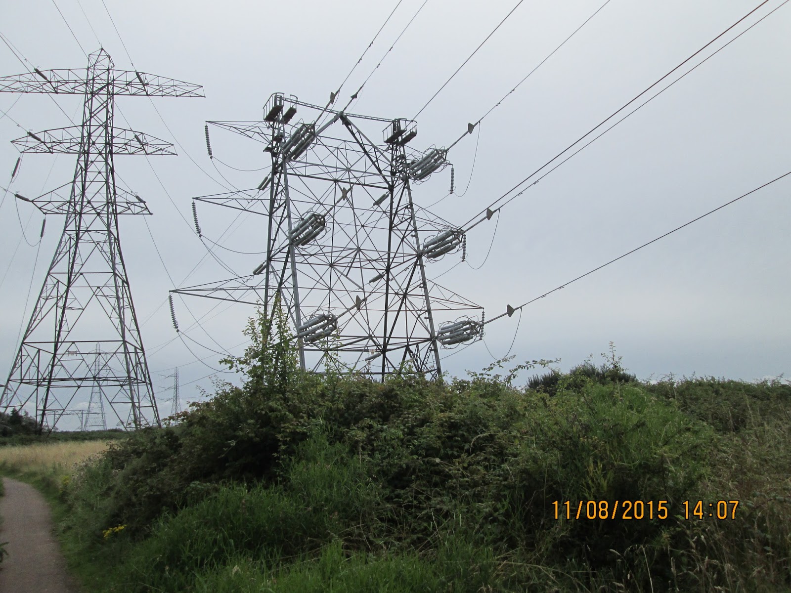

The route back to the coast was rough and complex, turning and twisting over fields and nature reserves. It was a relief to get back onto the seawall but this did not last for long because we then entered a wetland site that had been created from the old ash disposal beds of Uskmouth power station. I found the power lines were more interesting than the bird life, as the wetlands were hidden from the perimeter path by high reed beds. It was such a long way round that we kept passing the same people, some staggering along on walking sticks, before arriving back close to where we had started. So it was a blessing when we left all this behind and set off at last towards Newport. After the village of Nash, there was a most contrived section across pathless fields. This brought us into heavy industry and eventually out onto a site road busy with heavy vehicles. A friendly driver got out of his cab and directed us to the overgrown path towards the Transporter Bridge. We had done nearly 20 miles and Newport was only 200 yards away. Imagine our chagrin when we found the bridged was closed and we were faced with a most unwanted two extra miles of industrial estate and busy roads to get to the new bridge. Then it was a further mile of steep uphill passed the hospital to our digs on the top of Stow Hill.

Caldicot dep.09.03, Newport arr. 16.50, GPS 22.50 miles in 7hrs 17m 53s walking time plus a 30 minute lunch stop at the Seawall Café near Goldcliff.

We stayed at the Knoll Guesthouse, Stow Hill, Newport. We ate at the Pen and Wig at the lower end of Stow Hill. I had a pulled pork burger and chips. The beer was magnificent, the Otley 01 Original (4.0%), brewed in Pontypridd, getting my highest ever rating of more than 9 out of 10. Perhaps I was just thirsty. The bells were ringing from a practise session as we staggered slowly home past the cathedral, a lovely end to a long warm day.

Wednesday 12th August 2015    Newport – Penarth
Crossing the Barrage

There was hardly a cloud in the sky as we left Stow Hill and headed back into Newport and onto the coast path. In all it was four miles of road and track before we finally came back to the sea wall at West Usk lighthouse. Then there was (or should have been) a delightfully long section of sea wall path for miles down the coast. But just after we passed a pub called the Lighthouse, we came to another ‘Path Closed’ sign and more uncrossable barriers. This time however, a diversion route had been well signed and maintained and we were quickly round all the diggers and machines and on our way again.

We could see the city of Cardiff in front of us, and the landscape began to be dominated by heavy industry. As we approached a huge landfill site we were turned inland on a good path through a beautifully maintained wetland. Eventually this deposited us onto a very busy road which we followed as best we could on contrived pathways to either side. Just before we left the roads, the route dived left through an area of travellers’ homes. This was a frightening and depressing section where the track was covered in black ash and metal from the burning of waste that seemed a local occupation. But we climbed round a little headland, passed a modern sewerage works and then out onto a busy modern road through light industry, passing office blocks and tennis centres.

A main road led over a bridge, from the top of which the skyline of central Cardiff opened up. Our route took us down Atlantic Wharf to County Hall, outside which cormorants decorated the line of posts in the water. The highlight of the day was turning the final corner to the Millennium Centre and its plaza which was full of sculptures, water features and kids play areas. We popped into Maria’s coffee shop for a well-earned snack. It was very hot now and the whiteness of the stone seemed to trap all the heat. It was the only time during the trip that we found crowds of people enjoying the coast and its facilities. Passed the Welsh Assembly Building, we walked along a promenade round Cardiff Bay, passing the Dr Who Experience, a boat exhibition and finally came out onto the Cardiff Barrage. This was a beautifully constructed dam, with sloping grass giving a sense of parkland leading down to the bay. The bay was freshwater kept tide-free by the closing of sluice gates. At the far side of the sluices, we arrived at Penarth, the centre of which is reached up a steep hill and over the crest of a high headland. We descended along the marked route until we were at the pier. Here we left the coast path and climbed back up to the station to find our guesthouse.

Newport dep. 08.48, Penarth arr. 16.00, GPS 20.60 miles in 6hr 59m 07s walking time plus a 10 minute halt to eat a flap-jack.

We stayed at Allandale Guesthouse, Plymouth Road, Penarth. Our host welcomed us, took our money, told us there was no breakfast, and disappeared. We never saw him again or anyone else in the guesthouse during our short stay. On our way into town we called at the Railway. We were put off from staying by a poor pint of Hereford Pale Ale (4.0%) from Wye Valley Brewery. So we moved onto the Bears Head, now a Weatherspoon’s pub and found a beer much more to our liking, Central Session Room IPA (4.0%), brewed at Banks Brewery by Ernesto Mora Romero. I ate dragon sausage and mash with a piece of garlic bread.
 

Thursday 13th August 2015     Penarth – Limpert Bay
Power to the People

A b&b without breakfast was a novel experience but it gave us the freedom to get up early and slip out of the silent guesthouse as and when it suited us. So we were back up in town before 8am, waiting for Wetherspoon’s to open. A large fry-up put us right for the day and, just before 8.40am we were on our way. We descended back to the pier and along the deserted promenade. It was a lot cooler today and the forecast had threatened rain, possibly heavy rain.
 
After days of walking on flat shorelines, it was quite a shock to be faced with a big hill, a steep climb up steps and open grassland. Then it was into a section of narrow paths heading south between low coastal woodland with very few views of the sea far below. The islands of Steep Holm and Flat Holm dominated the seascape and would do so for most of the day. A corner was turned at Lavernock and we were heading west once more. We skirted a caravan site as the route passes between houses and the sea. This lovely section was soon to come to a most unpleasant end. A sudden turn inland led to a series of busy roads that led into Barry, not the most pleasing of the towns that we had walked through. Eventually we came out on the now deserted docks and passed a totally inactive steam railway. This was August and no one was here. A brief encounter with the café-less town centre ended at the railway station which had a café that closed at lunchtime! So on we went, desperate for a break, across the access road onto Barry Island. A steep hill took us through dreary streets and the island looked terribly disappointing until we pulled round a headland on the south side and there below us was spread the most fabulous looking beach, almost deserted. Whitmore Bay seafront was lined with cafes and we chose one with the best looking cakes and sat outside for a short rest.

The afternoon began with a lovely walk out to Friars Point before we left the island across the same access road and headed westward once more. Another climb took us over more clifftops and then dropped us steeply into Porthkerry and a magnificent train viaduct. Here we came across the only other people walking the coast path, a couple from Merseyside who had done the entire coast in
sections coming north to south. We climbed up through a wood and came out in a grassy field at the end of the runway of Cardiff Airport. As a jet screamed over our heads we passed into a caravan site where we had to ask, at the main office, for directions. We dropped into Rhoose which looked a large town away to our right. The coastal path went out over some old quarry workings. We were on limestone. Rhoose Head, we learnt from an information board, was the southernmost point of the Welsh mainland. One last caravan site was negotiated. Yet again it was so quiet. Was no one on holiday in Wales this year? One huge monstrosity stood in front of us. We dropped onto the foreshore and across an inlet with the chimney of Aberthaw Power Station rising hundreds of feet into the air. As we got closer, the other buildings came into view and we rounded the station on a perimeter walkway of concrete between the security fence and the seawall. As soon as we had completed this walkway, lo and behold, here was our guesthouse for the night.

Penarth (Wetherspoon’s) dep. 08.41, Limpert Bay arr. 16.00, GPS 21.16 miles in 6hrs 44m 13s walking time plus a 30 minute lunch halt in the K9 Plus 1 Café in Whitmore Bay.

We stayed at Limpert Bay Guesthouse, right on route but remote from any pubs. We got a taxi up to Llantwit Major to eat in the Old Swan Inn. I had duck breast and mash washed down with a large range of real ales: Oxfordshire Bitter (3.7%) from White Horse Brewery, Maid Marian (4.5%) from Springhead in Nottingham, Falling Star (4.2%) from Wickwar, and Celt Experience (4.7%) from Castell Coch in Caerphilly.


Friday 14th August 2015     Limpert Bay – Ogmore-by-Sea
Into the Rain

The rain that had been promised all week finally arrived in the early hours and it was still pouring down as we had our early breakfast. It was quite warm so I was unsure what to wear as we set out. As it was, I chose nothing more than a short-sleeved top and an umbrella. There were only a few occasions when I regretted not wearing more, these being on the steep and slippery descends into the steep valleys that were a feature of this section of coast. Here I really could have done with a free arm for balance.

Out into the pouring rain, we started up a road inland towards Gileston Farm, slowly at first to allow our sore feet to bed in. The route back to the coast was not well marked and certainly did not look well walked. After crossing grass and stubble fields, a stile eventually led out onto a storm beach of huge smooth stones. It was not obvious where one was to leave the beach but after a difficult few minutes of ankle-breaking progress, a path up a wooded hill became apparent. Then we broke out of the trees and onto a glorious section of cliff top where the only danger was the cliff falling into the sea.

After a few more miles, the path dropped into a small bay and a car park, a lifeguard point and a beach café. Just time for a coffee and cake, then it was out again into the rain. This was easing now but the sky was still dark and threatening. A series of steep sided valleys were crossed, each with very slippery paths leading down and up the other side. In the wet conditions our trail shoes were not gripping and we each had falls as we slithered gingerly along. In between these clines there was easy walking in grassy fields along the clifftop. On a sunny day, this would have provided the best views of the trip. But it was not until we were in sight of our day’s objective that it finally stopped raining and allowed us to stow away umbrellas and waterproofs. In fact it was pleasant and warm as we rounded the coast under the village of Ogmore-by-Sea and continued to the cark park at the river estuary. Here we finished our first section of the coast path and shinned steeply up to the road to find a bus stop. The bus arrived spot on time and took us into Bridgend where we had time for a meal in the Wyndham Arms before shuffling up to the railway station for the train to Manchester. Getting off at Wilmslow, Jill was waiting in the car to take us home for a well-earned rest.

Limpert Bay dep. 08.34, Ogmore-by-Sea arr. 14.00, GPS 14.70 miles in 5hrs 12m 37s walking time plus a 15 minute coffee & cake stop at the Llantwit Beach Café.
 
Overview

We walked 90 miles during the five days. 87 miles of this were on-route. So we have another 783 miles to reach Chester perhaps 8 years into the future. We shall be back next year, we hope, to continue along the coast to Swansea, the Gower and beyond.


Monday, 8 June 2015

Northern Highlands


Strathpeffer - Kinbrace, 30th May – 3rd June 2015

 
Introduction

We returned to the north of Scotland, to Strathpeffer where we have finished last year, to resume our annual pilgrimage towards John O’Groats. We had started so long ago that it was difficult to recall the number of years and all the start/finish points. In fact my daughter was still at university when we began our journey and she is now expecting her fourth child. On the way north, I had called in to spend a few days with the grandchildren and had then met Mike in Glasgow on Friday 29th May. Together we caught the 13.41 train from Queen Street Station and, after changing at Perth and Inverness, eventually disembarked at Dingwall at 17.45 and caught the last bus towards Contin. On reaching Strathpeffer, I took Mike to the wrong hotel. Having booked at several highland hotels, I was convinced that it was the Highland Hotel here in Strathpeffer. But it wasn’t. It was the Strathpeffer Hotel next to the bus stop. This did not augur well for the more demanding navigation still to come. The dining room was filled with a coach-load of elderly Germans. But we had a pleasant meal in the bar, fish and chips, bread & butter pudding and Maclachlan’s Real Ale (served cold from a cask). Afterwards we went for a postprandial and visited the Eagle Stone at the bottom edge of the village.
 

Saturday 30th May 2015     Stathpeffer – Aultguish
The Wet Fish Road

The day dawned bright and fresh and not too cold so I donned my shorts. Little did I think at the time that it would be the only day I would wear them. After weaving through the Germans to get our breakfast, we set out soon after 9.00am and had a pleasant stroll up the hill and along the side of Loch Kinellan. Here we met a lone woman out walking without a dog. How rare is that now-a-days? She turned back to accompany us to the awkward fork in the forest and made sure we were on the right path. It was a wonderful help as there were tracks all over the forest but we unerringly found our way through and out onto the track to Rogie Falls. This was well worth visiting; an impressive sight when viewed from the middle of the footbridge. A fish ladder carved out of the rocks looked almost natural as it looped its way around the main falls. Back on the track we had an easy walk in the morning sunshine to Little Garve where we were very taken by the beautiful old bridge which the main road now bypasses. Here we met a woman finishing her run accompanied by her young son on his bike. She was training for the cross-Scotland race that passes through Tomich, one of our overnight stops last year. 

The map here was confusing. The original route onwards had been severed by the new road and looked impassable so we went the long way round, along the old road to the north-east and then across the main road and back along a forestry track. As we did so the weather turned, never to recover properly for the rest of our trip. By the time we reached the track junction, where a signpost indicated that the old drove road directly uphill from Little Garve might still exist, it was raining hard and we donned all our waterproofs. We had a quick bite to eat and set off uphill following the sign ‘Drove Road to Aultguish’.Unfortunately the underfoot conditions went downhill. The track was
swamped and our progress was slowed by continually having to scramble to either side to avoid deep puddles of slimy morass. After what seemed an age, we came out of the forest and onto an open moor. Now there was no protection from the squalls coming in from the west, but we could see the Aultguish Inn on the road below. But still the wet ground would not let go and in fact it got worse. In the end we abandoned the main path and slid down the wet hillside to the road some 500 yards short the inn. My legs were caked in brown peat so I stripped off shoes and socks and left them in the car park.

We had a lovely room. We were early enough to watch the Scottish Cup Final and to enjoy the exciting victory of the local Highland team. Then it was down for a pint before Jeff and Margaret arrived to join us for a meal. I had last met Mike’s old university mate and his wife at Struy on last year’s trip. And it was lovely to meet them again and exchange much news and opinion. Margaret, who seems an authority on this part of the world, told us that our wet afternoon tramp across the moors had followed the Fish Road, an old route for transporting fish from the west coast at Ullapool to the east side at Dingwall. We suggested it was more suitable for fish than for walkers. She also filled me with anticipation for a coffee shop at Shin Falls that we would pass in two days time. Then it was a last pint and an early night. We were in for a big day tomorrow.
 
Strathpeffer dep. 09.08, Aultguish Inn arr. 15.14.   GPS 16.69 miles in 5hr 52m 33s including a 10 min lunch stop.

We stayed at Aultguish Inn on the Garve to Ullapool road. I had exquisite venison & pheasant pie and Drambuie sponge pudding. The beer was Kildonan (4.4%) from Dundonnell Brewery at Little Loch Broom, by far the outstanding ale on this holiday.

 
Sunday 31st May 2015       Aultguish – Bonar Bridge
Walking with Wolves

Throughout the planning stage of this walk, I had realised that the next stage north from Aultguish would be long, whether we chose the western route to Oykel Bridge or the eastern alternative to Ardgay. Discouraging reports were coming in on the mountain path over to Oykel Bridge. Then I could not find accommodation in Ardgay so we had no alternative but to go all the way through to Bonar Bridge. At least there will be food there awaiting us. Oh for the old bothy or a new guest house at Alladale Lodge or Croik!

With such a big day ahead of us, we breakfasted early and were on the road by 8.45am heading eastwards and downhill. What a dreary day! Drizzle coming from a grey sky. At least there was no wind and the umbrellas went up. This kept us dry until we turned off the road and into Strath Vaich. The first two miles were tarmacked but this led onto a muddy track under some woodland and then up over a low hill and down beside the three-mile long Loch Vaich. There was some activity below us at Lubachlaggan but otherwise we saw no-one in the glen. As we climbed up towards the bealach, the wind got stronger and I had to fight to get my umbrella down before it was destroyed. This only resulted in me cutting my finger which bled profusely for much of the day.

A delightful path dropped down into Shangri La, or Deanich Lodge as it was called on the map. The next six or seven miles were the highlight of the trip, a steady descent down the beautiful Gleann Mor alongside the river as it meandered through meadows or roared down rapids. In the middle of this we stopped to eat our two-day-old butties and then dropped down steeply into Alladale. We learnt later that this is where the wolf might get reintroduced to the Scottish mountains. I recalled meeting two young conservation workers in Namibia last year, who had told me about this scheme and their keenness to come and work on it,

Listening for every howl, we hurried on as we still had a long way to go. The weather was improving and we removed our heavy gear for the length of Strath Carron. It was to be ten miles of road walking at the end of a strenuous day. We crossed to the south side of the river, onto a quiet narrow lane. The map showed a riverside path for the last two miles, but this failed to materialise and we were tarmac-bound all the way. It seemed an age to get to Ardgay and then we marched straight through, over the railway and around the head of the Dornoch Firth into Bonar Bridge. The new bridge is quite elegant and, on the other side, the hotel was advertising its meals. It was only a few more yards to our overnight accommodation and the end of a very long day. I am getting too old for days like this.

Aultguish dep.08.45, Bonar Bridge arr. 18.15, GPS 30.56 miles in 9hrs 11m 17s walking time plus a 20 minute lunch stop (12.55-13.15).

We stayed at Kyle House, Dornoch Road, Bonar Bridge. We ate at the Old Bridge Hotel: haggis parcels for starters and fish & chips yet again. The beer was Belhaven Bitter but I was so thirsty, who cares.
 

Monday 1st June 2015    Bonar Bridge – Lairg
No Coffee at Shin Falls

I had recovered better than I expected from yesterday’s exertions but I was still looking forward to a rest day. After a leisurely breakfast and without the usual hurried packing of sacks, we wandered down to the local shop and restocked our lunch-snacks. It was bright and breezy but with a cold wind that kept us under full body cover. I don’t think the shorts are going to appear again on this trip. In fact I sought out a pair of gloves.

I had considered backtracking to Ardgay and following the forest roads to the west of the river round to Carbisdale Castle. But the thought of retracing yesterday’s tarmac, and the worry about not being able to re-cross the river, put us off the idea and instead we marched for about 1½ miles north out of Bonar Bridge along the main road to Lairg. At the entrance to the Balblair forestry walks, we took to the forestry track that runs parallel to the road to the east of the river and which then drops you back onto it near Invershin Hotel. Here we were able to see the castle and read its short history from an interpretive board place beside the road. We also found that we could cross the river at this point. In 2000 a new footbridge was hung from the side of the railway bridge thus negating the need to have stations on each side of the river.

On Saturday night last, Margaret has heighten my interest in the Shin Falls by telling me of the coffee shop owned by Al Fayed. So for two days I had anticipated my first cappuccino of the trip. These thoughts speeded my footsteps over the next two miles or so of road, even though I was determined to stay off full pace for this my rest day. The sound of roaring water took us down some steps to the falls which were slightly disappointing after the Rogie Falls of two days ago. But we paused for a few minutes and took photographs and delighted in the situation. Then it was back up to the road and the visitor centre. Disaster! The silence and bareness was a huge shock. Everything had been burned down in a fire that had destroyed the centre, restaurant and coffee shop. There was nothing but a large slap of concrete and a nearly deserted car park. I was going to have to forego my coffee and cake.

A lady dog-walked was sitting in the car park and she told us that, as the storm damage forestry clearances were not taking place today, it would be possible to climb up into the plantations and pick up a forest track towards Lairg. This kept us off tarmac for two miles but then we had no alternative, without a big diversion, but to strike out again towards our target. From the map we could see a footbridge marked over the River Shin leading towards the railway station. We were hopeful for a way across the river as it would shorten our route into our overnight accommodation. We found the lovely suspension bridge and crossed one at a time as it appeared a little frail and swayed slightly. On the other side we met a male dog-walker who asked us where we were heading and when I told him we had crossed the river to find our bed & breakfast for the night, he introduced himself as Clive, the owner of the Highland House. We were almost there. Passing Lairg Station, it was only a few yards down the road to the lonely roadside house with its Saltire flying in the front garden. Clive had phoned ahead and we were expected.

As it was still only lunchtime, I had a quick shower and change of clothes and we walked up the road into town. Using the wall of the dam just north of the b&b, we crossed the river yet again and walked up the quiet lane to the Ferrycross Visitor Centre. Mike fancied a walk up to the local view point but I was more interested in my cake and cappuccino. So I spent a quiet half hour restocking mentally and physically in preparation for the big push that was to follow over the next few days. Mike re-joined me for a quick drink and we walked over the bridge into Lairg village centre. Blink and you miss this. The visitor centre quoted Paul Theroux, the travel writer, on arriving by train.

. ‘..the train pulled out and left me in a sort of pine-scented silence. Lairg Station was two miles from Lairg, but even Lairg was nowhere…’  

It was time for a pint so we nipped into the Nip Inn which was the bar of the Lairg Highland Hotel. So it was not a long stagger into next door’s restaurant for a meal of tandoori chicken & rice followed by sticky toffee pudding and ice cream. The beer was bottled Dark Island (4.6%) from Orkney brewery. By the time we finished, it was raining hard so we asked the hotel to get us a taxi and we rode out of town in style but at least we kept our only change of clothes warm and dry.

We stayed at Highland House, 88 Lower Toroboll, Lairg.

Bonar Bridge dep. 09.46, Highland House (a mile south of Lairg) arr. 14.00, GPS 11.43 miles in 3hr 59m 18s walking time plus a 13 min halt to eat a flap-jack and some nuts.
 

Tuesday 2nd June 2015     Lairg – Crask
Road from Nowhere
The rained had ceased by the time we left Highland House and once more traipsed up the road into Lairg. We called at the local store to stock up with sandwiches for the next few days. We were heading out into a very remote part of the world now and would not be encountering any more shops. We had thought long and hard about an off-road alternative for today’s walk. The forests to the east of the road were criss-crossed with paths and it looked a distinct possibility to take a narrow lane northwards out of town to Seval and then over some open land to the edge of a forest. Global Earth had shown a forestry ride from the end of the path which would link up with the major forest track running north. But was there an unclimbable deer fence? And Mike had noticed that this track crosses a large burn without any indication of a bridge. Previous experiences of wading Scottish rivers had alerted us to the difficulties and dangers of river crossings especially after heavy rain.

So we took the safer option and walked eleven miles up the main road, which was single track for most of the way and would have been very quiet except for the fleets of German motorbikes. The weather had deteriorated again with heavy showers of rain blowing in on a very cold wind. So we were back to wearing full waterproofs, hats and gloves. Near North Dalchork we took a three mile loop through the forest to give our feet a break but, as most of the plantations had been clear-felled, we got preciously little shelter from the wind. The last mile was back on the road. It was a wonderful moment when we came round a bend and saw the Crask Inn ahead, two lonely buildings set in a huge landscape of bleak moorland with distant snow-covered mountains beyond.

As we approached the inn, it appeared to be closed. All was quiet and in darkness. There was a great sense of relief when, on trying the door handle, the door open and we entered a small dark room which had a bar at one end. A bell on the counter brought the lady owner who was out in the back trying to start the generator. But she paused in her task and made us a cup of tea and then eventually started the machine and gave us light. Her husband came in and lit the peat/wood-burning stove and
we got some warmth at last. Other people started to arrive. A couple of Dutch motorcyclists pulled in for a cup of tea before moving on, a Swiss cyclist who was staying in the bunkhouse across the road (the second building) and then a group of English cyclists in the early stages of a north-to-south end-to-end attempt. The inn and its bunkhouse were full by evening and we had a delightful night of good food, beer and chat in the company of a great set of people. Outside the rain was driven against the windows. Surely this bad weather must pass eventually.

Lairg (Highland House) dep. 09.39, Crask arr. 14.30, GPS 15.22 miles in 4hrs 31m 47s walking time plus a 14 minute (13.03-13.17) lunch halt.

We stayed in the Crask Inn, one of the most remote places one can imagine. I had a prawn cocktail for starters, then venison casserole and finished with Bakewell tart and ice cream. The beers were served draught from pins from the Black Isle Brewery Co., Blonde (4.6%) and Red Kite (4.2%).
 

Wednesday 3rd June 2015     Crask Inn – Kinbrace Station
Burnt Out Bothy

What a dreadful morning. All the weather forecasts we had heard during the trip had promised us summer starting today. Not in the north of Scotland, it wasn’t! The windows of the inn were awash with rain driving across the bleak landscape. We had had our earliest breakfast, 7.30am, as we had a train to catch and we had no idea of the state of the ground we must cross. Soon after 8.30am, we stepped out into the wind and rain. At least it was on our backs.

The first three miles or so were on a very wet path that crossed endless streams and marshes. But all things come to an end and we eventually pulled up to the bealach and on to firmer ground. Round a
corner the view opened up and what a view it turned out to be. Below us was a sunlit glen descending to Loch a' Bhealaich and Loch Choire. Our path was beautifully engineered across the face of the mountain, dropping at a welcome and steady gradient. This led us out into the glen and a long tramp on good tracks, some quite sandy, along the lochsides. As we approached Loch Choire House we saw smoke rising out of the trees and I recalled that a bothy had recently burnt down. When we arrived, we found the smoke to be coming from the demolition team that was tidying up the ruins. No more overnight bivvying here for a while!

Rather than follow the wide vehicle track for its full length, we took instead an alternative ‘short cut’, a path marked on the map crossing some higher ground. It was hardly shorter in time as there were some awkward wet sections and a couple of climbs over gates in the very high deer fences. So it was a relief to get back onto the wide estate road. The surface was smooth and pleasant to walk on. At Gearnsary we sheltered behind a wall and had a quick bite to eat, finishing off butties we had bought two days previously in Lairg.

The final push was in improving weather. The sun shone during the afternoon and if it had not been for the biting wind, we might have mistaken it for the promised arrival of better weather. Eventually Badanloch Lodge came into view at the end of the eponymous loch. As we crossed the wall of the dam, the bitingly cold wind threatened my sun hat which I had to remove or risk losing it. Lapwings started to mob us: we must have been traversing their nesting ground. A large herd of red deer crossed our path and then some geese (they must have been greylags but I was most surprised to see these here in June) and oyster catchers. There was more wildlife here than we had seen on the entire trip so far. It seemed a long four miles to Kinbrace but we had time to spare and slowed to a more comfortable pace. And the sun was shining on us now as we dropped down to a river bridge and up into the delightfully situated village of Kinbrace. This looked an absolute picture in the sunshine. I was very glad to have made it. The cold weather and the wind had made this a challenging few days.

Crask dep. 08.35, Kinbrace arr. 16.45, GPS 25.30 miles in 7hrs 52m 25s walking time plus a 20 minute lunch stop.

 
Aftermath

We arrived at Kinbrace Station with enough time to strip off our walking gear and change into our travelling clothes. The train was 10 minutes late and remained so all the way to Inverness. This left us without much time to make the connection and to settle onto the Caledonian Sleeper before it pulled out and headed south into the night. The bottles of Fyne went down well although they were rather expensive. Sampled the Highland at 4.8% and the Avalanche at 4.2%. These went well with a macaroni cheese which got us through the night. We arrived in Crewe before the buffet bars were open but we did get a bacon bap before leaving the station to catch the first bus. The sun was shining as I walked home from the bus stop. It all looked so verdant and felt so warm and fertile. It was hard to believe that 24 hours earlier we had been struggling across the Flow Country in such awful conditions. Another world. The total mileage for the trip was another 98 miles towards John O’Groats. Next year we shall be there (DV).

Tuesday, 28 April 2015

Angles Way

Great Yarmouth – Thetford, 16th – 20th April 2015

Introduction

Three years ago I had walked in Norfolk for the first time and been surprised and delighted by the quality of the countryside and its paths. I had finished the Peddars Way and Norfolk Coast Path at Cromer, where I was met and entertained by Jill’s cousin and his wife. Ever since then, we have been longing to renew the experience. An art exhibition at Norwich Castle was the catalyst. Jill and I travelled down by train and spent three happy days with Robert and Mary. Besides the castle and its Boudicca exhibition, we visited the Saxon burial site at Sutton Hoo. I was steeped in the history of East Anglia. All I now needed to do was walk the walk. So early one morning, Robert and Mary kindly dropped us outside Norwich Station. Jill caught a train home whilst I took a local diesel to Great Yarmouth.


Thursday 16th April 2015       Great Yarmouth – Oulton
Saxon Churches

The 9.30am train from Norwich arrived in Yarmouth at just after 10.00am. I collected some money from an ATM before I turned over Haven Bridge and out onto the sea defences to the south of Breydon Water. The weather had been lovely all week and it looked set to continue as I covered myself in sun block and donned my new Tilley hat. It was a good four miles along the sea wall before the coast line turned left and into Burgh. The signage indicated that the route ran below the hill so I almost missed the Roman Fort and had to cut back up some steps to view the ruins.

There was a dreary suburban section through Belton but eventually I reached Sandy Lane which I followed until it became sandy. The skies were clearing and it was warm now as I passed a golf club and turned onto an overgrown path to reach the A143 at Fritton. A wide avenue led to an old church with a round tower, supposedly one of the best preserved of Saxon churches in East Anglia. I stopped for a look inside and then sat on the bench outside to eat a quick snack.

It was now very warm as I strode out along a long section of road to Herringfleet Hall and beyond. I passed another Saxon church at Ashby, this time with an octagonal tower. This was locked so I hurried on into Somerleyton. I was tempted to cut out the loop through the village and in retrospect I should have done so. As it was, I entered the village and got hopelessly lost in the marina. As I was about to climb onto the railway line, a couple sent me back to try again to find the correct exit out of the boatyard. This was an unmarked gap between some trees behind an old vessel. I was now back on-route to the station and thence to where I could have taken a short cut. Then came a stretch of very pleasant woodland, spoilt by a half mile section where the path had been ploughed. I soon reached Camps Heath and turned up Holly Hill to find my digs for the night. Laurel Farm was only 0.75 miles off route and was very easy to find.

Great Yarmouth dep. 10.10, 10 minute break at Fritton Church, Oulton  arr. 16.10
GPS 17.85 miles in 5hr 54m 22s walking time with 17.1 miles on-route.

I stayed at Laurel Farm, Hall Lane, Oulton, (Kevin and Janet) in a beautiful barn conversion in a courtyard behind the magnificent farm house. I ate at the Blue Boar just over half a mile away. Haddock, chips and mushy peas followed by orange cake and ice cream. The beer was Adnam’s bitter and it was well kept.

 
Friday 17th April 2015    Oulton – Bungay
A Harrier over the Marshes

After a leisurely breakfast, I packed and set off back down Hall Lane and Holly Hill. There was a bitterly cold wind and I had my jacket on for the entire morning. From Camps Heath it was no distance into suburban Oulton Broad and a complex section of street walking. But I found my way through to the quayside. In trying to stay close to the lake I got off the signed route. However I spotted a Chinese Water Deer foraging in the marshland shrub. All routes seemed to converge on the wildlife centre so I was soon back on signed paths.

The next two miles were through major construction sites with much movement of heavy equipment. Footpath diversions were in place and the official Angles Way signage disappeared into the ether. This led to a very confusing moment when the diverted path re-joined the river bank. At the top of the steps up to the levee, the onward route was fenced off as part of the diversion system. It took me several minutes to convince myself that the way to Beccles lay beyond the temporary fencing.

Thus began the five mile slog along the river, not attractive at first so to while away the time I rang my daughter. As we prattled, the miles flew by and I almost forgot where I was. Suddenly, out of the reeds ahead of me, rose a Marsh Harrier, the first one I had ever seen. This was a great moment of excitement in a rather dull part of the walk. Eventually, after what seemed like an age, the river curved under a road bridge and into Beccles. This was a lovely grassy haven after a long spell on the bare river bank. The sun came out to celebrate and even more amazingly, I found myself passing a café on my way into the Old Market Square. It would have been rude to have walked any further.

Reinforced by panini and cappuccino, I set out again. The afternoon session was short and simple, following paths and lanes on either side of the main road. The last mile into Ditchingham was along a narrow busy lane with no pavements. The traffic roared passed at an alarming speed as I searched for the path over the fields. This I failed to spot and had to continue all the way up this scary lane to the Ditchingham outskirts. Here I abandoned the route and walked back through Bungay town centre seeking my accommodation for the night. I knew roughly where Treetops was situated and was much relieved to find a steep wooded path right up to the house. This saved a half mile detour. I was soon showered and changed and descending the steep path back into town in search of a meal.

Oulton dep. 09.18, Lunch in Beccles 13.16-13.50 and Bungay arr. 16.45, GPS 21.36 miles in 6hrs 49m 42s walking time plus a 35 minute coffee stop In Beccles, 19.13 ml on-route.

I stayed with Nigel and Valerie at Treetops in Woodland Drive, Bungay. I first tried a real ale pub but this was not serving food so I went to the Castle Inn and had a splendid leg of duck finishing with chocolate torte and coffee. The Earl Soham beer was a revelation. I stayed on Victoria Bitter, at 3.6% an idea session beer.

 
Saturday 18th April 2015    Bungay - Brockdish
Electrifying Pace

I had an even more leisurely breakfast today. It was 9.25am before I was out in the morning sun, outside Treetops and ready for the day. I slipped down the steep path to the main road into town and walked back through the town centre and out once again to Ditchingham. It was a cool clear morning with blue skies and no wind. The circumnavigation of Bungay was a delight, on woodland paths around the common on the other side of the river. Jill rang me and we caught up with affairs in the real world like kids and grandkids.

The loop finishes at Earsham where the official route traverses a cattle farm criss-crossed by electric fences. The way through was not clear in the morning sunshine. I ended up on hands and knees crawling across the field and under all the electric wires. Oh for a bit of route signage! There was a sharp climb up to a plateau of farm land and then over to Homersfield where the path went past the old church and into a wood and a bench suitable for a lunch-stop. Then it was down onto a road and along the river into Mendham with its magnificent church. 

Here I crossed the river bridge back into Norfolk and up over higher ground into the outskirts of Harleston. I did not see much of the town as the route skirts around to the south and off on the road to Weybread and its magnificent houses. The last few miles along the river were splendid. Grassy paths ran through riverine meadows and woods. Time evaporated as I tramped onwards into field after wood after field. Suddenly it was all over. A bridge was reached then a farm yard and drive and there at the exit from the drive was the b&b and a very welcome cup of tea. I had been warned when I booked the room of the lack of gas at the pub for cooking. Would the pub have now got gas and a full menu or would I be on the forewarned pizzas?

Bungay dep. 09.25, Lunch at Homersfield (13.04-13.120, Brockdish arr. 15.48
GPS 19.23 mls in 6hrs 13m 45s walking time.

I stayed at the Greyhound House b&b, Brockdish. I found that the old Kings Head was still without a gas cooker in the kitchen so I settled for dough balls & garlic butter followed by mushroom and garlic pizza. Coffee and carrot cake made the perfect dessert. I fell in love with Moon Gazer Gold IPA (5%) from Norfolk Brewery at Fakenham.

 
Sunday 19th April 2015     Brockdish  – Hopton
A Place of Diss-repute

Breakfast was at 8.30pm on this cold Sunday morning so I packed and was ready to depart as soon as possible after my full English. Today I was to cross the watershed of the route from the Waveney to the Little Ouse river systems at the dizzy altitude of 100 ft above sea level. First however I had to negotiate some farmland on my way to Diss. The agricultural sections were the only parts of the route requiring careful navigation. The Way was well marked generally but all signage often disappeared on the long farm sections. Today was a prime example as I followed a fingerpost along a clear track but then found myself off route and hopelessly of course climbing metal gates and crossing riverside meadows. However I had the river as my marker so I was able to get back onto route without much loss of time. Again I missed the correct line across fields near Scole and ended up too far south. My line back onto the route involved a right-of way severed by a dual carriageway the crossing of which involved sprawling over the central barriers. My only concern now was whether the coffee shops would be open in Diss on a Sunday morning.
 

I turned into the main street and, lo and behold, there was a café with tables outside. So I enjoyed a coffee and scones before have a quick look round the town centre. I moved on via the lovely mere and over well-kept parkland. A lovely setting made more-so by the late appearance of the sun and a warming of the day. As I walked towards Roydon, I could hear the whistle of an engine at a nearby steam museum. I encountered a herd of frisky young heifers and was quick to get through their field as I could see some dog walkers coming towards us. Cattle and dogs do not mix and I was not going to hang round to watch.

I then entered what I considered to be the highlight of the entire five days. The next three miles traversed wooded fenland around the watershed, on winding paths through the willow and reeds of Redgrave Fen. A short interlude on roads and around pig farms took me over to the wonderful Hinderclay Fen: walking at its very best. However nothing lasts forever and I was at last out into the afternoon sunshine and the last miles into Hopton. I could see the pub as I entered the village and popped in to warn them that I would be late for my Sunday roast. As I entered the pub, the landlord looked at me and my walking gear and just said ‘Roast Pork’. My landlady had called in to pre-arrange the keeping of some food for me after the lunchtime cooking had ended. I agreed to have a quick shower and get back as soon as possible. I stopped to ask some locals where the b&b was as there were no signs. I decided to try ringing on the door of the only unmarked house and was spot on with my guess. So I was soon showered and changed and back in the Vine.

Brockdish dep. 09.25, Lunch in Diss 13.10-13.40, Hopton arr. 14.15
GPS 20.08 ml  in 6hrs 25m 15s walking

I stayed at Mill House B&B, High Street, Hopton and ate at the Vine: Roast Pork (late Sunday lunch). The pub was CAMRA listed so I sampled Growler Lemon Head from Nethergate (4.0%) and Sirius Dog Star from Wolf (4.2%)

 
Monday 20th April 2015    Hopton - Thetford
The Euston Express

I needed an earlier start this morning as I was not sure of the distance now the Angles Way has been extended to Thetford and I had a train to catch. So for the first time on the trip I was away for 9.00am. It was a cool misty morning with an obviously clear sky above. The mist soon burnt off and I was in for a stunning April day, so hot that I was glad of some of the shadier sections. The left-rights out of Hopton eventually led me back onto line and a direct march towards Riddlesworth Hall which is now a school. Then it was out onto open heath towards the start of the Peddars Way. I took a diagonal route across Knettishall Heath, coming out onto the Icknield Way south of its junction with the Peddars Way.

I had expected the long straight sections of the Icknield Way to be bare, stony and boring, but they were anything but. Much of it was tree-lined and sandy, making for pleasant walking underfoot. The highlight was a traverse of the Euston Estate. Here, as I trudged along a wide avenue with vegetation to either side, I was thrilled to see a barn owl flying slowly towards me, only banking away when quite near. It was a wonderful moment of stillness and beauty. The owl turned away and I carried on into Euston where a short length of busy main road awaited me. I was soon up and away, climbing this time onto higher heathland and a very straight section of the route. Again a main road was crossed before I turned onto a track much like my fears had led me to expect: massively wide and straight, no shade and a baking hot midday sun. I sat briefly in the shade of a tall hedge before stirring myself for one last effort. There was more farm activity here than anywhere else on the whole route so I was glad to make the turn off the Icknield Way and on to the finally run-in northwards towards Thetford.

After so much flat walking, the steepness of the last hill up to St Edmund Way took me by surprise. But it was not far now across Barnham Cross Common and into the outskirts of town. I followed the recommended route down Nuns Bridges Road and found the delightful riverside path that starts between the two bridges and leads by a series of footbridges along the river and into the town centre. I had time for a coffee and a snack which was fortuitous as no refreshments would appear on my four hour train journey home. There was one moment of panic when I could not find anyone who spoke English and that knew where the station was. But eventually a lady recollected a road called Station Road and we decided that would make a good target. I gained the platform at 4.00pm looking for a toilet or waiting room where I could change from my walking gear into something more suited for train travel. But nothing was open and I had to leave my change for a miniscule toilet on the two-coach diesel unit that arrived to carry me to Stockport. The country-side looked stunning in the evening sun and passing through towns like Ely reminded me that there was much more to see in this magnificent country of ours.

Hopton dep. 09.04, lunch near New Zealand Cottages (12.50- 12.58), Thetford Coffee Shop (15.20-15.45), Thetford Station arr. 16.00. GPS: 20.48 ml in 6hrs 24m 30s walking.

I caught the 16.23 train to Stockport and was met at Macclesfield Station by Jill who gave me a welcome lift home. I had had a marvellous five days of walking in near perfect walking weather.

Friday, 19 September 2014

Dales Way


Ilkley - Bowness, 1st–5th September 2014

 
Introduction
 
Phil and I had been discussing a possible joint venture for some time without any particular focus. When Phil tabled his enthusiasm to revisit the Yorkshire Dales, following our trek down the Lady Anne’s Way, the Dales Way became our late summer objective. A quick ring round some of the b&bs proved it could be a possibility to set it up at the last minute, the poor August weather seemed to be relenting so we went for the first week in September and hoped for the best.


Monday 1st Sept 2014     Ilkley – Burnsall
Into the Sunshine

It hardly seemed the best as I was driven down to the station to meet Phil and begin our train journey. The weather was awful: the hills were covered by a cold blanket of cloud and drizzle. I was close to using the umbrella as I walked into the station. However from that moment the conditions got better and better and were to furnish some of the best walking weather I have ever had. The train connections went like clockwork and we hardly had time to grab coffees at Manchester and at Leeds before our departures were due. So we arrived at Ilkley Station ahead of schedule (12 noon) and were soon out in the sunshine looking for the river. We were disappointed to find no mention of the Dales Way at the road bridge so we set off upstream through a small park to reach a beautiful old stone bridge hardly wide enough for modern traffic. Here at last we found an interpretive board dedicated to the Dales Way and we realised that here at last was the official start. The early sections were very straight-forward, through a sports club, a few fields and then out onto a lane at Addingham. We paused briefly to look round the church, St. Peters, situated on raised ground above well-kept grassland.

Then it was out into open country with our first riverside walking. A short interlude on the road led to an underpass at Bolton Old Bridge into the Bolton Priory Estate. Fabulous views of the ruins opened out as we approached over luscious grassland. An even better view was that of an ice-cream van. We continued on our way licking cones of vanilla ice. We crossed the river at a foot-bridge and went through a wood filled with kids’ activity equipment. Then it was back over the river at Cavendish Bridge and then along a wide track through Strid Wood. We completely overshot the Strid, hidden as it was by a curtain of trees. By the time we realised this we were out of the wood and at a narrow footbridge across the river. For here it was an easy walk to Bardon Bridge and another ice-cream van. Foregoing the pleasure this time, we pushed on along the river to the Howgill loop and then back along grassy paths until the wide grassy fields of Burnsall opened up in front. I booked a table at the Red Lion and then trekked up to our b&b. It was not long however before we returned for drinks and a meal.

Ilkley dep. 12.03, Burnsall arr. 17.05. GPS 14.17 miles in 5hr 2m 58s.

We stayed at Wharf View Farm, Main Street, Burnsall, N. Yorks, BD23 6BP   Tel: 01756 720643. We ate at the Red Lion, fish, chips and mushy peas, and chocolate sponge with more ice-cream. The beers were Wharfedale King of the Mountains (3.9%) and Hatton Dark Horse Pale Ale (4.5%).


Tuesday 2nd September 2014       Bunsall – Buckden
A Short Walk

We woke up to the perfect morning. Cool clear and cloudless sky, the early morning sun exaggerating the contrast between the water, the banks and the surrounding hills. We were in no hurry today. Our schedule was for a short easy walk up the valley so as to be in position for the big push tomorrow. So it was almost 9.30am when we left our b&b and headed back into the village and down to the bridge. The scene of the quietly flowing water under the sunlit old bridge was a picture worth having and Phil did not disappoint. We met a woman, walking a dog, who had seen kingfishers and a strange light in the sky following the ridge line of the opposite hills. We crossed the river at a narrow and bouncy suspension bridge which was under repair. Every time a walked wanted to cross, the guys replacing the wooden slats had to come ashore, so progress was very slow. Linton church was across the river as we came round towards the falls. Here we re-crossed the river on a more substantial footbridge to get the optimum view of the waterfall and weirs. Then it was back across the bridge and up into Grassington for a cup of coffee.

The climb out of Grassington was quite steep and rather confusing. It was only after a careful combination of guidebook and maps that we found the correct route across the fields and onto the high plateau. We made some glib comment of how difficult it might be for foreigners to navigate across such featureless and poorly marked routes. But we found a good line and headed across the limestone moors. We came across a couple of retired postmen who were heading beyond our target of Buckden. I explained that I would also have been trying for Hubberholme but was put off by the Tuesday closing of the George pub. They look at me with alarm and disbelief. It was Tuesday! On we walked until we came to a plantation where the path descended steeply to a quiet lane. This was followed passed a conference centre and then we turned onto a footpath system of fields and stiles into Kettlewell. It was time for another coffee, this time with some Bakewell tart.
 
We now only had four miles of riverside path before we came to Buckden. A woman walked quickly down the road toward the village and we walked more slowly after her. We eventually located our b&b for the night, a tea shop behind the pub (closed Tuesdays!). However the woman was in, the one who had been racing ahead of us down the road, and she showed us to our rooms. The bath was rather small but with a bit of a struggle we were soon washed and changed and having our first pint in the pub next door. A lady, American from her accent, was also staying at our teashop and we invited her to joint us for a meal. She had spent much of the day trying to find her way across the high ground out of Grassington. Our prediction of the difficulties that strangers would have to British navigation had turned out to be correct. Jane from Massachusetts was walking the Lady Anne’s Way, the route that Phil and I had completed some three years ago.

Burnsall dep. 09.25, coffee in Grassington, coffee/cake in Kettlewell, Buckden  arr. 16.20, GPS 15.25 miles in 5hrs 46m 24s walking time..

We stayed at the West Winds Yorkshire Tearooms, Buckden, North Yorkshire BD23 5JA
Telephone 01756 760883. We ate at the Buck Inn. I had steak & ale pie and drank Spitting Feathers, Theaksons Best Bitter (3.8%) & Copper Dragon Black Gold (3.7%).
 

Wednesday 3rd September 2014    Buckden – Dent
Crossing the Watershed

It was very misty this morning and a haze hung over the hills. But there was no wind and it was warm and humid as we left our teashop b&b and set off into the upper regions of Wharfedale denoted Langstrothdale on the maps. We soon came to Hubberholme, confirmed the Tuesday closure of the pub, and wondered how our postman friends had got on last night in an alcohol free zone. There was some superb walking up to Beckermonds and the head of the river. Then it was over a footbridge and thence on steep tarmac into Oughtershaw and a rather unusual wayside stone. Here we left the lane and continued up the beck to Nethergill and Swarthgill and then onto narrow muddy trods up the fell side with the watershed of England in the marshy ground down to our left. We missed the direct route up to Cam Houses and found ourselves in the valley below the farm buildings. We were then faced by a steep grassy track to get ourselves back on route. Then a narrow path slanted up to the crest of the ridge where we met the Pennine Way. At the junction of these two major routes there was a small gathering of walkers eating lunch. We caught up with Ian and Nadine, our Middlesbrough friends, and swapped photo opportunities. Then it was off to Cam End and down to Gayle Beck along a wide track that had recently been constructed to give access to logging operations. Half way down we were passed by two monster log trucks throwing up dust across the dry countryside. At the bridge at the bottom sat our two postmen, full of stories about closed pubs and tins of lager.

Then came an unexpectedly rough section across Gayle Moor to Dentdale Head. The narrow undulating trod reminded me of how the Pennine Way had been many years ago. With some relief we stepped out onto the Dentdale road which we followed for many miles through Upper Dentdale, passed the Sportsman’s Inn at Cowgill (closed!!!) into the lower and wider parts of the valley. Here we regained the countryside on some field paths on a rather artificial route which crossed and re-crossed the beck in its attempt to minimise the use of tarmac. Eventually we came to tranquil riverside paths that led to the village of Dent. We left the path at Church Bridge and entered the village as the church clock struck five. We walked right passed the b&b and did a short tour of the village before asking a local who sent us back the way we had come.

A quick shower and we were ready for a pint and where better than in Dent. We started in the George and Dragon which is the tap for Dent Brewery. There sat Ian and Nadine having a drink before dinner. We crossed the road to the Sun and had an ample meal and more beer. It had been a great and tiring day crossing the watershed.

Buckden dep. 09.08, Dent arr. 17.05, GPS 22.41 in 7hr 40m 43s.

We stayed at Garda View Guest House, Main Street, Dent, Cumbria, LA10 5QL Tel: 01539 625209. We had Dent Aviator (4%) and Golden Fleece (3.7%) in the George and Dragon and Kirkby Lonsdale Tiffin Gold (3.6%) and Monumental (4.5 %) in the Sun to accompany a meal of camembert for starters and fish and chips.
 

Thursday 4th September 2014     Dent – Skelsmergh
Up the Lune

It was a magnificent morning, unbelievable for Cumbria. We left the b&b just before 9.20am and retraced our steps to Church Bridge under a cloudless sky and with the sun bringing out the colours on the surrounding hillsides. There was no wind; the air was like wine, cool and invigorating as we set out along the riverside path. This led out onto a lane and then turned north to cross the river and climb up to a high ridge. Here the views of Dentdale were superb and a great introduction for what was round the corner. As we traversed round the end of the ridge, the panorama of Sedbergh opened up before us with the Howgills as a pale green backdrop against a blue sky. This was surely the greatest landscape moment of the entire walk.

The route dropped down steep grassy paths and into the hamlet of Millthrop on the River Rothay. Here we abandoned the route temporarily to seek coffee and cakes in Sedbergh town centre. But it was only a brief rest as we were soon on our way back to the Rothay via the beautifully manicured grounds of Sedbergh School. We followed the river as it wound its way through fields and woods and over the old Tebay-Ingleton railway. Eventually we emerged onto a main road which we had to trek for almost half a mile. Then it was over some farmland to the key turn of the day: a right turn into the Lune Valley. At first the way kept close to the river until we reached a magnificent railway viaduct cross high above the river. This was yet again the disused Tebay-Ingleton Railway. What a shame that this fantastic structure was now derelict.

The route then climbed steeply uphill and passed through a series of farms high above the valley floor. Eventually we dropped back down to the river and walked on its bank up to the beautiful bridge at Crook of Lune. Here the character of the walk changed dramatically. We crossed the bridge and said our goodbyes to the Lune. The lane went steeply uphill and under another magnificent disused railway viaduct. The traffic noise from the M6 now became apparent. But we walked beside it for an age, up through some poorly marked field systems. We lost the official line at Lakethwaite Farm but we were able to pull out onto a high lane and correct our error. The next field path led to a footbridge across the motorway and then across some quiet fields parallel to the West Coast mainline. A new diversion, not on the map or in the guide book took us directly down to a bridge across the railway. Just on the other side we met David who had been walking towards us. He turned back with us and we all walked on together to where David had parked his car near Skelsmergh Tarn. Phil and I continued to the A6 and then jumped into David’s car and were driven off to a lovely night of eating, drinking and chatting.

Dent dep. 09.19, coffee in Sedbergh, Skelsmergh arr. 18.00
GPS 20.38 ml in 8hrs 3mins 19s walking time.

We stayed with David, Phil’s cousin, who fed us and entertained us like royalty and the only thanks he asked was for us to re-tune his television.


Friday 5th September 2014     Skelsmergh (A6) – Bowness-on-Windermere
Along the Kent to the Lakes

David cooked us a lovely breakfast before taking us back to Skelsmergh. He dropped us off at the entrance to the lane to the fishing tarn soon after 9am and we set off for the last leg of the trip. It appeared to be so easy that we fast lost concentration and ended up in a huge sloping field with not a clue how to get out. After two laps of the perimeter fence I retraced my steps to the top gate, found a half-hidden direction indicator and then followed this to the farthest corner of this mega-field and, lo and behold, there was the stile. I was a bit more attentive to the signs (or lack of them) from then onwards and it was not long before we were by-passing Burneside and were on the banks of the River Kent. Then followed a lovely section of riverside walking through Bowston and on to Staveley. It was tempting to search out a cup of coffee by taking a diversion into the centre of the village, similar to yesterday’s loop into Sedbergh. But we were close to finishing now so we kept to the official route around the south side of the village and over the by-pass. Then there were some steep climbs, some on lanes, rather unexpected for what was to be an easy day.

The section from the last road climb to the end was a sheer delight over rolling farmland and wooded hills. The first view of Windermere came as a wonderful surprise, opening up as we came out of a small wood. Then it was a plunge down a steep drop, only stopping to have photographs at a slate and stone seat which signified the end of the Dales Way. Some girls, waiting at the bottom for a party which we had earlier overtaken, recognised us from the coffee shop in Sedbergh. The road down into Bowness was just as steep. It took us into a different world. Suddenly we were surrounded by tourist, cars and commotion.  We found David waiting for us near the ferry pier. The tea shops were so busy we would never have got served so we jumped into David’s car and he drove us to The Station Hotel in Oxenholme where we partook of some refreshments whilst we waited for our train home.

Skelsmergh (09.12) – Bowness-on-Windermere (13.27)  GPS 11.60 ml in 4-15-16

Luckily I looked up the progress of our prospective train only to discover delays along the line coming south out of Scotland. So David took us down to Carnforth Station where a train from Barrow took us to Manchester. All went well until we reached Oxford Road Station where it was announced that a relief driver could not be located and there was no one able to take the train any further. Rather than wait (we had a connection to catch) we decided to walk to Piccadilly and got an extra mile and a half on the day’s total for our sins. But at least we got back home on time and I caught my lift home. We had left in rain and had arrived in a heat wave and not a drop of rain had fallen in between. We were blessed for this wonderful trip.