Thursday, 13 September 2018

Offa's Dyke (Part 2)

Welshpool - Chepstow    29th August – 3rd September 2018

Introduction

Back in 2006, Mike and I had squeezed in a few extra days walking by taking the train to Prestatyn and following Offa’s Dyke Path down to Buttington Bridge and Welshpool. Since then we have been tied up with our epic End-to-End walk which we completed last year. So, with more time on our hands, we could revisit the national trail which we had started 11 years ago. We booked train tickets to Welshpool and went back to the marches in more ways than one.
 

Wednesday 29th August 2018           Welshpool - Mellington
Digging Beacon Ring

The unreliability of our local train company persuaded us to use the Wilmslow line to get to Crewe and Shrewsbury. Jill took us to Wilmslow Station to start our journey. A long connection at Shrewsbury gave us an opportunity for a late breakfast. We were in Welshpool by 10.50am and we set off straight away along the canal to Buttington Bridge. A light drizzle caused us to briefly raise our umbrellas, a strange event in this driest of dry summers. Crossing the parched farmland on the east bank of the Severn, the weather improved and it was hot work plodding up to the top of Beacon Ring and its iron-age monument.

The path contoured around the earth works to where an archaeological dig was underway. An  archaeologist suggested that we continue our circumnavigation to view a trench has been dug through the outer ramparts. We spent time that we could ill afford, considering our late start, talking to two more of the archaeologists and finding out how the dating of the site is being investigated. Then we set off again downhill on woodland tracks to the village of Kingswood. The route bypassed the village centre and halfway along we sat in a field and ate our lunches.

The last section of the day was almost a straight line though farmland and field systems, continually crossing and re-crossing the Welsh-English border. The town of Montgomery looked enticingly close by, tucked into the hillside to our right. But we had further to go, onwards passed Brompton Hall and Mellington Hall. After the holiday park, a gate led left across a rough pasture and onto a lane into the hamlet of Mellington. The last house, as always, was our b&b for the night.

Welshpool dep. 10.50, Mellington arr. 17.30  

GPS 16.20 miles in 6hrs 33mins 24secs walking time plus 15 mins at Kingswood for our lunch.
 
We stayed at Shirley Heights in Mellington. Sheila made us a wonderful meal of beef bourguignon, cheese & biscuits and some cans on Old Speckled Hen.

 
Thursday 30th August 2018          Mellington – Dolley Green
Offa’s Roller Coaster

It was going to be a long day so we asked for an early breakfast. By 7.30am we were tucking into a ‘full Welsh’, and we were on our way soon after 8.30am. We first had to retrace our steps along the lane and across the field to get back on-route. Then the climbing started. As we slogged to the top of the first hill we picked up the line of the dyke and walked in the fields to one side. The sky was clear, there was no wind and we began to sweat, alarmingly for so early in the day. On reaching the top we caught our first glimpse of the rolling hills ahead.

Steep descents followed steep climbs for the rest of the morning. Under cloudless skies and with magnificent views we traversed this roller coaster of hills. We ticked off the valleys one by one, the Unk, Churchtown, Hergan, Clun and then the massive grind up to Springhill Farm where we had a short break for some food and water. Then thankfully there was an easier section involving a gentle decent, passed sheep and sheepdogs, to Garbett Hall before the last blast up Cwm-sanaham Hill and the glorious descent into Knighton. The first building we came to was the Offa’s Dyke Centre complete with café. We were thankful for a coffee and cake after a very strenuous day. But it was not over yet!

I rang ahead to warn our overnight accommodation that we were running late. It was after 4pm before we embarked on the last leg of the day. This began with a climb up through some woods onto a plateau of farmland and open moors. It was so much easier walking that we got into a good rhythm and in no time at all, it seemed, we were strolling down the lane into Dolley Green. What a magnificent day’s walking.

Mellington dep. 08.37, Dolley Green arr. 18.30 

GPS 20.68 miles in 9hrs 11mins 17secs walking with 10 mins rest near Springhill Farm and 25 mins (15.40-16.05) in the Offa’s Dyke Centre in Knighton.

We stayed with Thea and Barry at Rose Villa in Dolley Green. Our accommodation was a cabin in their beautiful garden. House and garden were surrounded by logs just like a Swiss villa, thus belying Thea’s origins. We ate in the kitchen ‘en famille’, with Thea producing wonderful food from her wood-burning range. The conversation flowed but we finally stumbled back to our cabin and a well-earned sleep.

 
Friday 31st August 2018        Dolley Green – Hay-on-Wye
Another early start. 7.30am saw us reconvening around the kitchen table. Mike was not allowed to refuse the sausages, sourced as they were from a local farm shop. The main problem was getting away, such was the level and intensity of the conversation. With full stomachs and ringing ears, we set off down the road on a gloriously sunny morning. The initial section followed closely the line of the dyke, up and down hills to Evenjobb and beyond. There was a huge climb up Rushock Hill where the dyke wound its way around the steep contours. The long descent to Kington zig-zagged its way across sheep-grazed grassland which eventually brought us to a golf course and down into the lovely town centre. The cafes were full of the lunching golden oldies so we bought sandwiches in a supermarket and sat on a bench for our lunch break.

The route out of Kington was a gradual climb up a straight lane which became a straight track which became a straight grassy path along a high ridge of hills. On the highest point was a plantation of monkey-puzzle trees, a rather incongruous sight. The views into mid-Wales were spectacular in this sunny weather. The easy walking ended in a steep stony path down to Gladestry where the pub was firmly closed. Another series of hills were crossed before we found ourselves on another grassy path descending to Newchurch. As we sat eating our snacks, a young woman stomped up the steep slope towards us. She introduced herself as Laura Bentley; she was coming to the end of a circumnavigation of Wales, having completed the coast path in 10 weeks and was returning to Chester up Offa's Dyke. She was collecting for the Alzheimer’s Society. I promised to send a donation.

After the climb beyond the village, things became much easier. Lanes and stony tracks led us down into the Wye Valley and the final descent was on a lovely woodland path through Bettws Dingle. The very busy main road was an unpleasant interlude before we turned down to the river through massive fields busy with combine harvesters. The last mile was on a quiet section of river bank which took us to the road bridge into Hay-on-Wye. The accommodation, we had been told was just passed the town clock and so we soon were ensconced in the outhouse bedroom.

Dolley Green dep. 09.00, Hay-on-Wye arr.19.15
 
GPS 24.41 in 9hrs 47mins 58secs walking time with a 20min break in Kington (13.00-13.20) and 25 mins near Newchurch (16.00-16.25).

We stayed in Belmont House, Belmont Road, Hay on Wye. We ate at the Blue Boy, steak and kidney pie and apple and rhubarb crumble & custard. The beer was Landlord (4.3%) from Timothy Taylor’s.

 
Saturday 1st September 2018           Hay on Wye – Pandy
Traversing the Black Mountains

This promised to be our easiest day so we had a leisurely breakfast and a wander round town before heading for the Black Mountains. A local shop cut us some sandwiches and we stocked up on jam doughnuts. The ascent to Hay Bluff began gently enough across low-lying farmland, parched in the morning sunshine. The path got gradually steeper, crossing tracks and lanes as it climbed. Suddenly we broke out onto high moorland with the ridge of Hay Bluff dominating the foreground. The route of the national train turned left just before the Bluff and ascended on a slanting path which gained the main plateau about half a mile beyond the top of the Bluff. Here we stood for a while talking to a lone walker from Co Down who had come up from Llanthony Priory. Then we started our long traverse of the mountain.

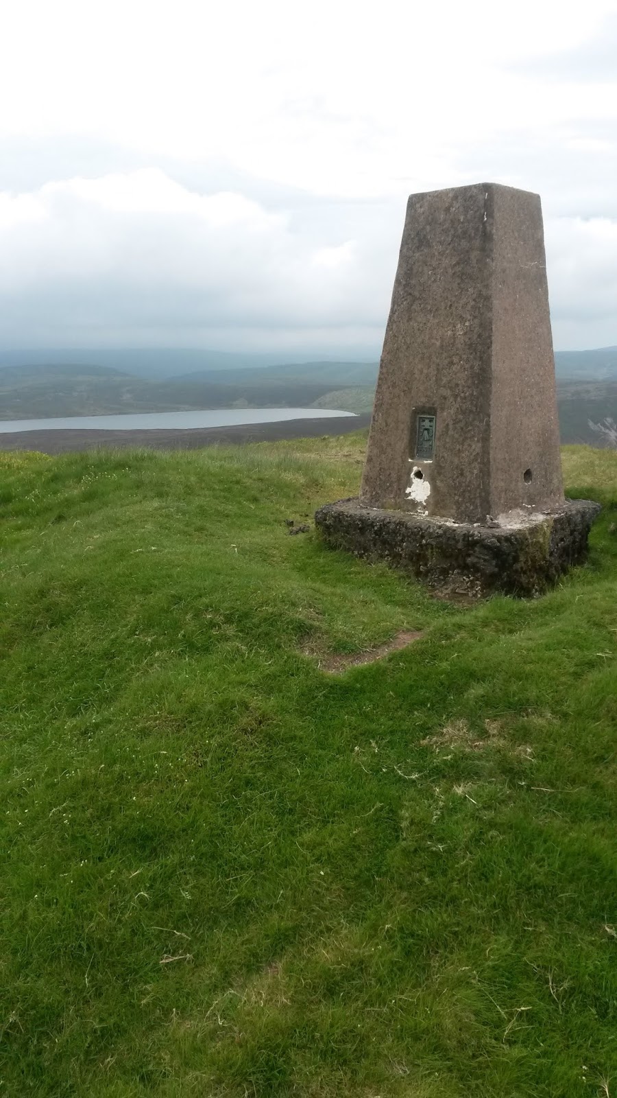
In these benign conditions, the crossing was a walk in the park. In fact all the boggy areas had been over-laid with stone flags similar to parts of the Pennine Way. And it was almost pan flat with imperceptible rises to the occasional cairn or trig point. At the first of these (pt. 610) we sat on the base of the trip to eat our sandwiches and doughnuts. At the second of these, Mike made the mistake of putting his walking stick down whilst he took a photograph. It was another 15 minutes before he remembered that he had left it there. I lay in the sun with the rucksacks whilst he ran back to retrieve it. We were encountering increasing numbers of groups walking towards us, doing the trail south to north. Several of these were Americans. One quartet warned us off jokes about their president, declaring that they were ‘Trumpers’.

The descent was gradual at first and then steeply down to a lane from which we could see the back of the house where we were due to stay. But access from the rear had not been negotiated so we had to trapes for over a mile round the lanes to gain the front entrance and then back up the very impressive tree-lined driveway. It was a great shame that the present state of the house does to reflect the magnificence to the approach.

Hay on Wye dep. 09.10, Pandy arr. 17.15

GPS 17.24 miles in 7hrs 16mins 10secs walking time plus a 20 min break at first trig point (13.00-13.20) and 30 mins for recovering a lost walking stick.

We stayed at Brynhonddu B&B near Pandy and walked the mile or so to the Old Pandy Inn for a meal of fish and chips and sticky toffee pudding. The beers were HPA (4.0%) and Butty Bach (4.5%) both from Wye Valley Brewery.


Sunday 2nd September 2018             Pandy – Redbrook
The Whiter of Three Castles

Harp music welcomed us down to breakfast and accompanied us through our bacon and eggs. Suitable soothed we slipped out of the b&b just after 9am and set off once more down the long drive. It did not seem quite so long in the light of day and we were soon back on route over the train-line and across the main road at the Lancaster Arms which is now no longer a pub. An early up and over took us to the lovely village Llangattock where an American walker, from Boston,  told us that he did not know any ‘Trumpers’ and could not imaging Trumpers over here walking a national trail. A lone girl walker stopped to warn us of cornfields ahead. Little did we know what waited us.

Just after leaving Caggle Street, we started the long slog up to the White Castle. Here we had our first break and asked an Israeli couple to take a photograph of the two of us. Leaving the castle we soon met our first indication of trouble ahead, a footpath closure sign but with no alternatives indicated. We decided to press on through the closure notices and found ourselves in a massive field of corn, at least 10ft high, planted right across the footpath. Careful navigation took us under some electricity lines being worked upon, probably the reason for the closure in the first place. But the farmer had quickly taken the opportunity to plough up the path and plant his precious corn. We battled on through the jungle, eventually coming out onto a quite country lane. A diversion was marked at this end. Obviously north-to-south walkers were not catered
 
We needed another rest so we sat in a cider orchard and ate our snacks before setting off on an easier section of the day passed the holiday homes at Hendre and through the quiet woodland tracks of Kings Wood. This led us directly into the outskirts of Monmouth, and very posh outskirts they were. The River Monnow was crossed on a magnificent old bridge which acted as one of the town gates. The town of Monmouth looked lovely in the evening sunshine and it was tempting to stop for the night. We succumbed to a quick pint at the Punch House, sitting outside in Agincourt Square. Then we pressed on. A few extra miles tonight would make the last day so much less stress

We had not realised what climb awaited us. We toiled up this ‘sting in the tail’ but the view from the top, Kymin, was worth it. All of Monmouth and our day’s walk was laid out before us. Kymin is where Lord Nelson used to entertain Lady Hamilton and there is a naval monument nearby to 16 British admirals. The descent was long and gentle and all was well until Mike remembered he had left his stick on the bench at Kymin. So back he went and did the descent a second time. Meanwhile I pushed on to tell our landlady what was happening and I had time for a shower and change of clothes before Mike arrived, having persuaded a local lady to show him where our b&b was situated.

Pandy dep. 09.10,  Redbrook arr.18.50

GPS 21.83 miles in 8hrs 49mins 53secs walking time plus 10min stop at the White Castle and 30 mins (17.00-17.30) for a pint of Silver King (4.3%, Ossett Brewery) in the Punch House in Monmouth.

We stayed at Tresco b&b in Redbrook and ate at the Bell Inn. We were rather late getting in but they were most welcoming and cooked us a lovely meal of steak burgers and chips washed down by Golden Rule (4.0%) from Bespoke Brewing Co in Mitcheldean.


Monday 3rd September 2018            Redbrook – Chepstow
Steep and Lofty Cliffs

Our last day. A train to catch so an early start was a necessity. Mike had strolled ahead to get his sandwich from the Post Office and, by the time I came along, we were ready for the first big climb of the day. But first of all we had to find it. Then a lady dog walker called us over and indicated a hidden set of steps that led onto the steep hillside.  Once we were up, the walking was splendid, through wooded paths and stepping over tree roots on top of the dyke. The descent to Bigsweir was long and gradual and we made good time through the woods and down the road to the old bridge. We did not cross it but instead turned left and south and repeated the climb and descent cycle.

We had not budgeted for the viciousness of the climb out of Bigsweir. It got steeper and steeper until we reached a set of wooden steps that took us into a complex of lanes and sunken paths before dropping into a very prosperous looking valley. We crossed this valley well above Brockweir and flogged up what turned out to be our last major climb. We were then in dense woodland all the way, rarely gaining any glimpse of the Wye Valley below. This added to the impact of arriving at the Devil’s Pulpit where the magnificent view over Tintern Abbey and the river opened up below. We sat eating our lunch and admiring the view. Two American ladies shared our picnic spot and we chatted away for far too long. Eventually, after receiving an invitation from Julie to visit her and do some walking in Virginia, we moved on and into the coda of our trip.

After another two miles of forest trails we were suddenly aware of a change in the character of the land in front of us. Suddenly, there in the distance was the sea, or at least the Severn Estuary with its road bridges and Oldbury Power Station.  The ridge dropped gradually away. A busy road had to be negotiated before we entered much tamer farmland and footpaths. A short section along the cliffs at Wintour’s Leap took us into estates and parkland on the edge of Chepstow. We detoured round the housing estates of Sedbury and then crossed the peninsular along the last section of Offa’s wondrous dyke. We did not expect an uphill finish but that was the only way of reaching the finish stone, perched on the cliffs above the Severn. A German couple had finished ten minutes before us and did the honours for our final photoshoot, Mike and me sitting together at the end of our long adventure.

Redbrook dep. 08.50,  Sedbury Cliff 15.50

GPS 14.97 miles in 6hrs 30mins walking time plus 30 mins at the Devil’s Pulpit


Exit Strategy 

We climbed over the fence to stand a few seconds on the very edge of Sedbury Cliff and admire the views over the Severn Estuary. Then we climbed back again and return down the path to the road and then turned along the pavement through Sedbury village and down the steps to the A48. The road bridge led us into Chepstow town centre where we had a coffee and a bite to eat. We still had time for a quick pint (Proper Job 4.5% from Sharp’s) in the Beaufort Hotel before we walked round to the station and caught our train to Birmingham. We missed the connection at New Street and arrived home some 45 minutes late but Jill was there as ever and we were whisked back to our house and a very well-earned sleep. In total we had walked 117 miles and I had another national trail under my belt.


Sunday, 17 June 2018

Glyndwr's Way (Part 1)

Knighton – Machynlleth   4 – 8th June 2018

Monday 4th June 2018          Knighton – Felindre
Late in Clocking On

I was due to travel with Northern Rail but, such have been the concerns about cancellations and the devastating effect that would have on my walking schedule, I asked Jill to take me over to Wilmslow Station and the more reliable Virgin service to Crewe. Here I had time for a coffee and bacon bap before climbing into the single coach that was the Heart of Wales service to Swansea. This was a lovely journey through rural Cheshire and Shropshire before turning onto a single track line through the border hills to Knighton. I walked up to the clock tower and took some photos, then popped into the Clock Tower Café for a cappuccino and carrot cake.

So it was 11.30am before I set off up the ‘Narrows’ and out onto Glyndwr’s Way. Some narrow and steep ginnels took me through the outskirts of the town and up onto a high corniche. This contoured through some woods around Garth Hill before reaching a series of lanes and farm tracks that led over the hills and down to Llangunllo. The sun had broken through and it was getting rather hot. Little did I think that I had five days of sunshine ahead of me. It was a long trek up lanes to the station where the route passed under this morning’s railway line and started a long gradually climb up onto Beacon Hill Common.

The walking from here across the Short Ditch and the moor was magnificent. I overtook a party of Canadians and was into a fast rhythm, perhaps rather too fast as I missed a route marker and ended up too far to the east, descending into a farm whose track took me to Beguildy, about two miles up the road from my target. A small shop made me a ‘coffee to go’ and I completed this two mile section of busy road whilst supping my hot drink. So I probably clocked an extra mile or more in reaching Felindre and my accommodation for the night. I learnt my lesson in the need to concentrate and I corrected all future navigational mistakes much more quickly.

Knighton dep. 10.58, Felindre arr. 17.40  
GPS 18.34 miles in 6hrs 24mins 32secs walking time. I stopped for 25 minutes in Knighton (11.05-11.30).

I stayed at Brandy House Farm in a camping pod.  I dined with two women on a horse riding holiday and one lady walker with a lame dog. The meal started with various pates and was followed by chicken casserole. A crumble completed a splendid meal. A couple of bottles of Old Speckled Hen dealt with my dehydration issues.


Tuesday 5th June 2018          Felindre - Abbeycwmhir
Tilting at Windmills

I has not found it easy to get to sleep in my camping pod but then slept so well that it was five minutes to breakfast when I came round. I had to leap off my mattress, throw on some clothes and dash down to the breakfast room. It was not to be a long day so I had lots of time to pack my rucksack afterwards before setting off. By 9.30am, I was descending the farm drive into the village and along the main road. I saw the Canadian party being dropped off in front of me and I followed them down the road and walked with them up the first climb of the day. At the top we said our farewells and I pressed on along a grassy ridge which eventually brought me to a tarmac lane. Here I lost all the hard earned height as the lane dropped down to a cross road of tracks.

A left turn took me to the foot of a second big climb. At half height three women on horseback sat waiting for me to open and close a gate for them. Then the route continued upwards round a wind farm and traversed undulating hillsides of gorse scrubland which must have been very boggy in wet weather. The section ended in gaining the high point and a fingerpost which pointed down a lane that descended gently at first and then steeply down to Llanbadarn. The shop was off route and the pub was closed so I walked onwards alongside a very busy road beside a river and then crossed the river on a side lane and started to climb yet again. It was really getting hot now so I sat at the top stile to have a bite to eat and to drain my water bottle.

The next section was glorious walking, along a grassy ridge and then down by some pine trees and ancient looking dykes and earthworks. A steep descent led to Tynypant where the climbing started all over again, this time up a narrow wooded ridge, tree-lined at first but opening out onto a ridge with magnificent views all around. My destination lay below in a narrow valley down to the right. To reach this valley, the route dropped down to a col between two peaks and turned sharply downhill through thick woodland and dappled sunlight. It was a walk into Paradise as I worked my way along lanes and woodland paths along this remote valley into Abbeycwmhir. Here I quickly found my b&b and was glad of a cup of tea and a cool shower before joining my hosts, Angela and Michael in their beautiful back garden. A magnificent day’s walking.

Felindre dep. 09.40, Abbeycwmhir arr. 16.05 
GPS 16.32 miles in 6hrs 13mins 06secs walking with 15 mins rest (13.15-13.00) above Llanbadarn.


I stayed with Angela and Michael Winterton at the Oaks in Abbeycwmhir, a lovely b&b where I was treated like one of the family. I pigged myself on two sorts of flan and drank some of their Boddingtons beer.


Wednesday 6th June 2018     Abbeycwmhir – Llanidloes
Cafes and Pubs at Last

As I sat in the conservatory having my breakfast, the hills were shrouded in a light mist which lent a mysterious atmosphere to the valley. But this cloud soon burnt off in the warming morning sun and it was to be another swelteringly hot day. I got the line wrong in the very first field in leaving the village but soon recovered to find a lovely woodland path that led over a small footbridge and steeply up to a lane. Here the map and the signs differed. A finger post pointed up the lane and the map showed the route in fields to the left. I cut up a farm track to try to get back on line, only to find barriers across the line of stiles. So I retreated back to the foot of the Esgair Farm entrance and here found the diversion signs that had been missing from the other end. All this uncertainty did not cost much time and I was soon climbing strongly into the emerging sunshine. A lovely traverse of Upper Esgair Hill ended in a steep drop into the hamlet of Bwlch-y-sarnau.

Angela, my host of last night, had recommended that I should avoid a bit of very boggy ground if I now diverted, on purpose this time, along a road to the west for 500m and then up a forest trail to Waun Marteg. A long section of tarmac led to a lovely contouring track along the edge of a forest passing several deserted farms on its passage. I stopped briefly for a bite and a drink at a stile with a view, then continued on this roller coaster of a contour until a left-hand turn led very steeply down a stony and slippery track into a limestone gorge. Here there was a sharp left turn along a very boggy path that led over a stream to a field gate where all route signage disappeared. I was left at the foot of a huge sloping pasture with no idea which way to head. The map indicated a slanting line so I started up steep grass looking for breaks in the top hedge and fence line. I was not far off with my guess and a few yards along the fence there was a stile into a leafy track. This ascended to a lane and more tarmac and then a steep descent down a rough grassy field where I lost all that precious height again.

A rather arbitrary finger post indicated a left turn which was hard to spot but then the line became clear as I contoured round several properties. There was a rather complex loop round a large farm that obviously did not welcome a national trail but, more by good luck than judgment, I found the bypass and came out opposite a gorgeous little cottage, with shutters, climbing plants and a beautiful garden. Yet more roads led me to Newchapel where the route took a definite turn towards home. Just when the concentration on navigation started to wane, I completely lost the route in the next wood, ended up having to climb belatedly and steeply back to the road that would take me gradually downhill to Llanidloes. I soon found myself in a lovely old town with cafes and pubs and ancient buildings. I was back in civilisation after three days in the wilderness. I celebrated with cappuccino and spicy apple cake in the Great Oak Café.

Abbeycwmhir dep. 09.20, Llanidloes arr. 15.40
GPS 16.25 in 6hrs 04mins 12secs walking time with a 20min break near Cyndfa.


I stayed in the Unicorn Hotel in Llanidloes and I ate at the Angel. I was starving so I started with duck pate, had a main course of lamb curry and finished with lemon sponge and custard. All this was washed down by copious amounts of Butty Bach from Wye Valley Brewery (4.5%).

Thursday 7th June 2018        Llanidloes – Y Star Inn, Dylife
The Welsh Lake District

This was supposed to be an easy day, not exactly a rest day but the next best thing. So after breakfast I sauntered round Llanidloes in the morning sunshine and, before I set out for the day’s walk, managed another coffee and cake in the Great Oak Café. Rather late for me, I strode across the river bridge and up the road on the other side. There was a delightful path climbing into the woods, Allt Goch. I am not sure I got the standard route up to the golf course but I picked up the waymarks at the club house. I nearly missed the left turn off the entrance road but soon corrected any navigation discrepancies and dropped down some very steep grassy fields to the hamlet of Van. I continued along the tarmac farm track towards Garth then turned right and uphill until I met another diversion around an unwelcoming property. Halfway round I started with a nose bleed which persisted whilst I walked up a very busy main road. At last I came to a gate which led into a field and I lay down until the bleeding had subsided.


A field path ran parallel to the road for half a mile until a tarmac farm lane took me a further half mile to a diversion round the farm itself. Here I got my first view of the great dam at Llyn Clywedog. A steep track descended to its base and the atmospheric ruins of an old lead mine. The climb up the other side was on hot and shade-less tarmac, on traffic-free roads that led to a car park with few cars and a café that appeared permanently closed. A murderously steep grassy bank took the route back onto roads. The next section had a diversion due to a landslip. So at least half a mile was added to the day’s total. At the top of the next field I sat at the stile and had a very brief break for water and a flapjack. Then the way markers pointed away from the lake and towards a distant forest. The top of the forest was also the top of the ridge and the route descended on open pasture down towards a deserted farm.

Crossing a stream on a road bridge, I was then turned right into another forest through which I climbed steadily up to the same road. The road continued down passed some bunkhouses and an acid balancing mechanism on the next stream. Then there was a pleasant section across farmland to Llwynygog where I had to scramble up a steep bank to get on-route for the final hill of the day. A track led across the dry plateau until the view of Dylife and the pub opened up below. A short but steep track wound down the hillside to the road almost opposite the entrance to Y Star Inn, my home for the night.

Llanidroes dep. 10.20,  Y Star Inn arr. 16.20
GPS 15.17 miles in 5hrs 45mins 35secs walking time plus a 10 min () break in


I stayed at Y Star Inn at Dylife. There was no real ale on tap so I resorted to bottles of  Felinfoel double dragon and Cwrw. I ate fish and chips followed by a sponge pudding and custard.

Friday 8th June 2018             Y Star Inn – Machynlleth
Another Clock Tower

The earliest time for breakfast was 8am so the dining room was full of walkers and fishermen all straining at the leash. I came through the chaotic service quite well and was through the front door and away by 9am. It was cloudy for the first time in over a week and this made it cool for the climb back up to the top of the ridge to pick up the national trail. I made good time along the top on relatively flat and stony tracks and pathways. After two miles or so, the path led down into a gully to cross the headwaters of Afon Clywedog. A steep and slatey scramble up the other side took me past some newish looking buildings and then over a moor to Glaslyn, a high remote and rather featureless mountain lake.

As I crossed the plateau, the trig point of Foel Fadian beckoned. And it was so near the path that I was up and down in just over 10 minutes, with my first and only peak of the week in the bag. Then came a long and steep descent on slippery slate and loose stones. Stopping briefly to check the navigation, I eventually stepped onto easier and grassier ground and thence into the valley. A gratuitously steep loop kept me off road for a short while but eventually the tarmac was inevitable. I toiled up a steep lane and then a steeper farm track as the day got warmer and stickier. The cloud covered had increase the humidity level and I was sweating more than I had done all week. On the top of Cefn Modfedd, I made a classical error of missing a way-marker and it was several minutes before I realised my mistake, got the compass out and corrected my error. Soon I was on top of the ridge and stopped briefly for a bite to eat and to finish my water bottle.

At Talbontdrain two little boys asked whether I wanted any water and I was delighted to hand over my empty water bottle for filling. Then there was a gruelling climb in the heat of midday up a curving path to Rhiw Goch. It was well worth it because the next 2 miles were on wonderful high ground which finished in a right-hand turn, a steep descent and a poorly marked path up to a recently cleared forest. Another fast section then led down and left out onto the final moor overlooking Machynlleth. But rather than dropping straight down into town, the official route went out on a long loop to the west and it seemed an age before I eventually hit the road and then the steep and narrow path down to the outskirts of Machynlleth. The signs led me through a car park and kiddies play area before passing the Heritage Centre and its café. I could not resist a quick carrot cake and cappuccino before continuing passed the second clock tower of my trip and on to the station. I just had time to change out of my sweaty walking gear and then it was time for the train home.

Y Star Inn dep. 09.00, Machynlleth Station arr.15.45
GPS 17.70 miles in 6hrs 23mins 55secs walking time and had a 10min stop near Talbontdrain and 15 mins (15.20-15.35) in the café at the Heritage Centre in Machynlleth.


Half a train was waiting for me at Machynlleth Station and this set off on time when a rear section arrived and had been attached. I had time for another coffee on Shrewsbury Station before the Manchester train came in and took me to Wilmslow where Jill was waiting to pick me up. It is nearly always the case that the closeness of the experience leads to the last walk being perceived as the best, so I hesitate before claiming that the last five days walking have been some of the most sustainably enjoyable and beautiful, on wonderful grassy hills with everlastingly lovely views. But I am sure that the spectacular weather had a part to play on my thinking that this is the some of the best quality walking of all the national trails.


Wednesday, 11 April 2018

Speyside Way


Buckie – Newtonmore   4 – 8th April 2018

Wednesday 4th April 2018    Buckie – Fochabers
The Mouth of a Great River

It was surely too early to be going this far north. A blizzard was raging on the hills between Stirling and Perth and the world was a total whiteout. I should have cancelled, I thought. But I needed the miles in my legs and, as we were spending Easter with my daughter’s family in Scotland, one of the Scottish National Trails seemed appropriate.  I had left Ayr before 7am on a train to Glasgow. The rain had set in as I trailed over to Queen Street and the Aberdeen train. But lo and behold, it was better in Dundee and dry in Aberdeen and Elgin. As I waited in the icy cold for the bus to Buckie, it was clear. The bus dropped me in East Church Street and, as it was now nearly 3pm, I set off straight away. I found the new start to the Speyside Way, two stones each side of a path. There was no way-marking in the streets so I dropped down to Buckpool by the shortest route and got to the original terminus and the start of the waymarked route.

After travelling for so long, it was good to be striding out into the cold wind with the sea lashing the shore on my right. I walked between the road and the sea on grass and pebbly tracks that ran behind the houses. At Portgordon, the waves were spilling over onto the promenade and I had to cross the road and then turn sharply inland to gain the old railway that had run along the Moray Coast. It was lovely and grassy underfoot until I reached woodland where a narrow trod led through to Spey Bay. Here is situated the Scottish Dolphin Centre on a point overlooking the mouth of the river. Just passed the ice houses, at the shoreline, I picked up a track beside the river that took me five miles up to Fochabers. Underfoot conditions were mixed, generally good walking but with some wet and waterlogged sections. And it was not raining or snowing. Just after the old bridge, the route swung inland to bypass the far side of the town and here I cut back in the main square and my hotel.

Buckie dep. 14.51, Fochabers arr. 18.10  
GPS 11.08 miles in 3hrs 20mins 52secs.

I stayed in the Gordon Arms Hotel, High Street, Fochabers. I had turkey and ham pie and chips followed by treacle sponge and custard. I was introduced to Windswept Blonde (4%) from the Lossiemouth brewery.
 

Thursday 5th April 2018       Fochabers - Aberlour
Boats or Bridges

An 8am breakfast got me out and walking by just after 9am. It was a bright but bitter morning. High cloud and the promise of patchy sunshine. I reversed my last night’s route into town and continue on the footpath around the southern extremities of the town. This led out onto a very quiet lane that I was to follow for almost 5 miles. I broke the monotony of tarmac by taking a loop into woodland at the Earth Pillars to take in the spectacular view of a bend in the river from high on a cliff. Then it was a long plod along the road to Boat o’Brig. From there I initially turned onto the riverside track before looking more carefully at the map. The official Way climbed up the hillside and then joined a wide farm track to a shooting range. Red flags were flying, red lights were flashing and the sound of gun shots echoed all around. A sign assured me that if I stuck to the waymarked route, I was not in danger but it was hard not to crouch and run through the site.

As I gained height on the forest tracks, I was in several centimetres of snow and I was confined to walking in a deep rut made by a vehicle. I was above the snowline for several miles but gradually the track descended back to a lane at Arndilly and a magnificent house set in a wooded estate. Soon I entered Craigellachie where the original ferry boat had been replaced by a Thomas Telford bridge, one of the first across to Spey. A new bridge now takes the busy main road across the river. The old railway started from here and its track is now the next section of the Speyside Way which goes through cuttings and a tunnel along to Aberlour where a museum to the path is situated in the old station buildings. I first located my b&b, had a quick shower, and went along to the museum where the staff stayed late to allow me a viewing of some historic film of the operational railway. Then it was time for more serious issues, beer and food. 

Fochabers dep. 09.04, Aberlour arr. 15.00 
GPS 16.80 miles in 5hrs 57mins 36secs.

I stayed at Norlaggin B&B, High Street, Aberlour. Rose, my host, made a reservation for me at the Mash Tun where I tried the venison stroganoff with wild rice. A lovely dessert followed, pear crumble and custard. I found another beer from Lossiemouth, APA (5%).
 

Friday 6th April 2018            Aberlour – Cromdale
Whisky Galore

This was a day of two halves, a morning along the old railway track and an afternoon scrambling over agricultural land. The grassy track ran alongside the river up to Carron Bridge where it crosses the river. I followed the road into Carron village and turned left to the large and new distillery. At Tamdhu Station there was much activity at a kayaking centre and more distilleries. Passing stacks of whisky barrels at Knockando, the railway continued round some long bends before the river swung south on a long reach to Blacksboat and Ballindalloch. I had made good progress completing the first 10 miles of the day in little over 3 hours. Little did I know that this rate of progress was not going to continue.

The afternoon section began calmly enough with another mile and a half down the railway line. But then the character of the walking changed significantly. The way-markers took me left straight up the river bank and through light woodland to come out on a wet and rough grassy plateau. The route crosses the field between wire fences which restrict the path to a marshy passage along which a line of huge stones have been laid like giant stepping stones across the mire. The crossing ends with a squeeze stile where two metal and chain wicket gates are pulled apart. I was to see many of these before the day was done. The farmland was a mess, ankle deep mud around the gates and a slippery rutted drive. This led out onto the A95, a road with fast-moving lorries and lunatic car drivers overtaking at high speeds. After ten minutes beside this racetrack, I had not seen any way-markers for the expected left-hand turn. I was at the bottom of the drive up to Airdbeg and a woman was walking down towards me. So I approach her for some help and she indicated that I should have been in the next field but kindly showed me how to get back on route.

A steep climb through the woods brought me onto a wide forest track, completed covered with snow and ice. I followed this to its highest point before coming to a figure post pointing down to the right and then plunging down the hillside through a forest fire-break. More mud awaited me in the valley bottom where a waterlogged track led to a narrow footbridge across a raging stream. Steps, field paths and endless squeeze stiles led up to the Woods of Knockfrink where a beautiful track contoured round the hill and descended towards more farmland. I met two ladies who were walking this section of the Speyside Way as an out-and-back from the layby near Airdbeg.

The next part of the route departed significantly from the line on the map.  The way-markers took the route left and high into the forest then down from the highest point alongside the forest boundary. The rough pasture at the bottom was another wet section crossed by another set of giant stepping stones. The squeeze stiles were countless and led between narrow spaced fences across farmland to a muddy farm track, and then left beside this farm track in a long and tiresome circumnavigation of the farm. After what seemed an age of scrambling on a narrow and rocky trod between fences and walls, we descended beside a stream to the line marked on map and in guidebook. It was a relief to cross the tarmac lane and climb into the woods. I still had time for a navigation error. A post at the top of a steep climb indicated a right turn and it took a few minutes to realise that this could not be correct so I returned to the misleading post and went straight on, back onto route.  A long and undulating tramp on a track coated in pine needles led me thought a large wood and down to the main road. Rather dispiritingly, I was turned away from Cromdale but this was necessary to gain access to the old railway which I had not seen for some hours, and had sorely missed. The grassy track was very welcome for the last two miles into the village. The hotel was to my left and the only problem I now had to solve was how to get through the football field and up to it. It had been a real battle since leaving Ballindalloch, the last 12 miles taking almost 5 hours. Thank goodness the hotel had real ale.

Aberlour dep. 09.02, Cromdale arr. 16.57
GPS 22.32 in 7hrs 55mins 08secs.

I stayed in the Haugh Hotel in Cromdale where I ate steak and kidney pie and chips, and then syrup sponge and custard. Windswept Blonde (4%) was the house real ale.


Saturday 7th April 2018        Cromdale – Aviemore
Serendipity or Fate
 
The first 3½ miles, through a forest of Caledonian Pines, was the highlight of the whole trip. After finding my way back across the football pitch and onto the old railway, the route crossed the river and entered this delightful forest. Dog walkers abounded and the place was full of life and light. The day had a good promise to it. At the entrance to Grantown-on-Spey, the Way turned left and bypassed the town. Speybridge is a lovely old bridge at the far end of town and led me once again to the A95 near a smokehouse. Here the line of the old railway is picked up and it was the most attractive of sections, grassy and tree-lined. I was making excellent progress again with this easy walking and I was soon bouncing into Nethy Bridge when I was brought to a standstill by a vision, that of a lovely coffee shop. After 60 miles of walking, this was the first midday café on-route.

The carrot cake was magnificent and I was beginning to find the strength to continue when my text messenger sounded. My great friends Gillian and Walter were skiing nearby in the Cairngorms and wanted to join them for a meal that very evening. As I resumed my walk, my phone rang and arrangements were made for a pick up from my motel in Aviemore. All I had to do is finish my day’s walk and be showered and changed. I tramped on with renewed enthusiasm and good flat tracks through woods and beside roads into Boat of Garten. Then on easy cycle routes for the final 6 miles into Aviemore, so easy in fact that I missed a right-hand turn and did an extra mile.
 
The official route entered Aviemore on the orbital path which dropped me on the road about a mile north of the town centre. All the coffee shops had closed by this time so I went straight to my motel at the far end of town, showered and changed and went for a pint.

Cromdale dep. 09.10,  Aviemore arr. 17.00
GPS 22.84 miles in 7hrs 21mins 23secs walking time plus a 35 min (11.15 – 11.50) break in the Nethy Café at Nethy Bridge.

I stayed at High Range Motel, Grampian Road, Aviemore. I had a quick pint of Fyne Jarl (3.8%) in the Old Bridge Inn. Gillian picked me up and drove me to their hotel, the Muckrach at Dulnain Bridge, where we have a wonderful meal, starting with haggis bon-bons and steak & ale pie. The beer was Cairngorm Gold (4.5%) and the wine was Malbec.

Post-script:  When I was picked up, United were 2-0 down in the evening kick-off and City had started their championship celebrations. A text from home during the meal alerted me to happenings back in Manchester and the evening ended on very high note.


Sunday 8th April 2018           Aviemore – Newtownmore
The Wolf of Badenoch

No breakfast was included in my night’s stay at the motel so I was able to pack my bags carefully and get away without any pressure. I was right on-route and was out of Aviemore as soon as I turned onto the road south. A wide pavement kept me away from the traffic and a left-hand turn at the water works was clearly signed. A track led under the mainline railway and onto a beautifully smooth walkway of cycle standard. This I followed for two hours of so to Kincraig, passing the gates that had caused concern to some walkers/cyclists. These were open and the direct route is not affected so I could not understand what all the fuss has been about.

At Kincraig, I was in need of some breakfast but a village centre looked non-existent so I turned left on a lane and joined the Badenoch Way. After a mile or so, I came to a water sport centre and there, wonder of wonders, was a café/restaurant which made me a bacon bap. So rather later than usual I was fortified by food and got into a good stride along the road passed Insh House and up into the forest. The Badenoch Way signs were not as easy to follow as the Speyside Way posts that bore the Scottish National Trail logo. The route initially followed some power lines then climbed steeply on a track before a wet and slippery trod descended through the trees on a curving line down again to the lane. And at the exact moment tarmac was reached there was a right of way sign taking me left on a gently undulating path through various settlements before emerging onto open moorland.

Back into the trees, I came quickly into Drumguish and Tromsie Bridge where I was directed down the fields alongside the river until the path took to a ridge line to the left. This eventually came out at the lookout platform above the Insh Marshes, a great birdwatching area. From then on, it was tarmac all the way passing the Ruthven Barracks, an imposing ruin on top of a roadside hill. A shinty match was being played as I passed the Dell, the home of Kingussie, the local team. I turned onto the main road at Kingussie and followed the pavement and cycle paths into Newtonmore where the Speyside Way will eventually terminate. Even thought it was deep into a Sunday afternoon, the Tuckshop Café was still open so I made up for a lack of food with lots of coffee and scones. I then continued to the station where I terminated my own 5-day walk. Then I returned to the town for a meal before boarding the train south.

Aviemore dep. 09.00, Newtonmore Station arr.17.30
GPS 19.79 miles in 7hrs 15mins 32secs walking time and had a 20min stop at the Loch Insh water sport centre (11.40-12.00) and a further hour (16.15-17.15) in the Tuckshop in Newtonmore.

I ate in the Glen Hotel, fish, chips and peas then cherry Bakewell sponge. The beers were Orkney Corncrake (4.1%) and Backlash (4.2%) from Stewart Brewery in Perth. My journey home went the plan, a train to Perth, a bus replacement to Glasgow, a Megabus through the night to Manchester and first train to Macclesfield where Jill picked me up from the station on Monday morning. My decision not to cancel was a good one.

Tuesday, 3 October 2017

Wales Coast Path (Part 3)


Llanelli - Bosherston, 18th – 23rd September 2017

Monday 18th September 2017          Llanelli – Burry Port
Burrying Last Year’s Memories

Our drive to Wilmslow Station has become an annual pilgrimage. Jill drove us over yet again for the start of stage three of our walk along the Wales Coast Path. Last year we had finished at Llanelli so it was to there that we were returning on the 09.46 train. It was a splendid journey through the Welsh Marches and along the south coast. We arrived a few minutes early and were walking out of the station before 2pm. We had our photographs taken in front of last year’s finishing point. Unfortunately the lady who we asked to take the photograph, a photographer by hobby, failed to find the shutter button.

So, with our start unrecorded, we went into the Flanagan’s Café in the Discovery Centre on the waterfront and had coffee and carrot cake. It was easy walking along the millennium cycle route, tarmac all the way, into Burry Port with its lifeboat station and lovely harbour. The guesthouse was adjacent to the station, squeezed in between two pubs. Our landlady could not recommend either of these but sent us round the corner to what was deemed the best pub food in town.

Llanelli Station dep. 13.57, Burry Port arr. 16.20   5 miles in 1hr 53m walking time plus 30 minutes in Flanagan’s café (14.15.- 14.45).

We stayed in the Globe Guesthouse, Stepney Road, Burry Port. We ate in the Cornish Arms, steak & ale pie followed by spotted dick and custard. The beers were both from Swansea breweries, Boss Beatle Juice (4.8%) and Gower Gold (4.5%).

Tuesday 19th September 2017          Burry Port - Carmarthen
Up the Estuary

It was a lovely bright morning with lots of blue sky and a gentle breeze. An early breakfast led to an early start and we were heading down to the harbour by 8.50am. An easy start on firm trails through the dunes took us into a country park that had obviously had an industrial heritage. Paths led through woodland passed a narrow-gauge railway and onto the beach. There was a two mile stretch along the firm wet sand closer to the sea. The route off the beach was indicated to us by a guy from the Llanelli Ramblers. We scrambled into the dunes and out onto a forest track and into a quiet part on Pembrey Forest. After emerging from the trees, the route crossed farmland that adjoined an old airfield. We could hear racing cars being test-driven around the motor track beyond.
 

The route took to the main road towards Kidwelly but, instead of heading for the town centre, went west on a huge loop that took in the now disused Kymer Canal to Kidwelly Quay. Then it was back across the railway line in search of a café for some lunch. This we fell across on the main street up to the bridge and I had scones and coffee to revive the flagging spirits.  Emerging from our rest stop, we were soon over the bridge and walking on the north bank of the river through a town park. This led us out onto a quiet lane and up a steep wet and rough track to the hill-top village of Llansaint. Then it was a roller-coaster of a section over hills, through woods and across steams before coming down a very steep set of steps into Ferryside. This is a very long village stretched out along the train track and giving maybe two miles of suburban walking. I began to notice that the mileages given in this section of the guidebook were very inaccurate. The planned 22-mile day was turning out to be significantly longer.

The next section did not follow the river estuary but turned inland to take to rarely walked field paths that wound through high ground to the east. The pace dropped, the miles ticked slowly by and we made slow progress across the wet and slippery farm land. By the time we expected to be arriving in Carmarthen, we were still two miles south of the town dropping down straight and featureless roads to the main school. Here we joined major roads at rush-hour and we had great problems in crossing the town by-pass and its various junctions and roundabouts. Eventually we emerged from a pedestrian tunnel to find ourselves outside our b&b. A most welcome sight.  We felt slightly betrayed by the guide book which, on what was to be our longest day, underestimated the distance by more than 2 miles. The mistake seems to have occurred in the Burry Port to Kidwelly section where 2 miles suddenly goes missing.

Burry Port dep. 08.47, Carmarthen arr. 17.20   GPS 23.86 miles in 8hr 07m 36s moving plus a 25 minute (12.25 – 12.50) stop in ‘Time for Tea’ café in Kidwelly.

We stayed at Tir Celyn, Emlyn Terrace, Carmarthen. We walked into town to Yr Hen Dderwen,  a Weatherspoon’s pub in King Street. I had a fish & chips and pancakes & ice cream. I started with Towy Gold (4.4%) from Castle Gate Brewery, Carmarthen and then went on to Ein Stein (5.0%) from Lymestone Brewery in Stone. We were so tired after this hard day that we took a taxi back to our b&b.

Wednesday 20th September 2017     Carmarthen – St Clears
An Estuary Too Far

The forecast was not good so we got an early start in the hope of getting as far down the other side of the estuary before the rain arrived. On a cool cloudy morning we returned to the town centre and the river, this time crossing over a footbridge near the railway station. A riverside path took us under the rather unusual railway bridge. It looked as if it was designed to be able to lift to allow boats through. The encroaching vegetation showed that the lifting mechanism had not been used for many years. A long section on the rather busy road was broken up by being signed to run parallel to the road behind the hedges. These fields were wet and slippery and had steps and board walks in places so it was tempting to carry on down the road. Eventually though, a vital path down to the river was the one to follow as the road swung away. Our route emerged from the wood to cross farmland and estates, climbing as it went towards Llangain. Here was a lovely old church with a short stumpy spire. We bypassed the village and headed down a lane, losing all the height we had just gained. The next hill was climbed by a series of paths that were hard to navigate. Issues had obviously been had with landowners over this rather unsatisfactory section. After another descent and climb, the way forward was much more direct if a lot wetter. The final descent into Llansteffan was along a boggy, sunken greenway between two overgrown hedges. If this was not wet enough, it now began to rain and I was fighting to get the umbrella between all the brambles and thorns. We emerged into the upper part of the village and marched down to the seafront to get our overdue café stop. But we were to be disappointed.

The cafes in Llansteffan are subject to half-day closure on Wednesdays and, as sod’s law would have it, today was a Wednesday. All that was open was a kiosk and a wooden shelter in which to drink my take-away coffee. So it was not long before we were searching for the way out of town, which began with a straight climb between two fences and continued with a lovely contour beneath the castle in a wood dripping with rain water. A climb on grassy paths over the next headland led us back to a lane and a section on tarmac. The next few miles were a complex mix of road and field paths as the route wound its way up yet another estuary as the rain came down in increasingly heavier pulses. The last road section was two miles long and took us to the foot of a steady climb up fields passed a trig point and then down to a farm and a steep descent through a wood into increasing wetter fields. The very last stile at the bottom of these fields was in a bottomless mire. We were up to our knees in gluttonous sludge as we tried to scramble through. All that remained was a short walk down a concrete farm-track, over a bridge and passed some new house and, as we emerged onto the main road in the village of St Clears, there was our b&b in front of us. Soaked to the skin, we rang the doorbell expecting a warm welcome. Instead we got a dazed look and ‘I was expecting you tomorrow’. ‘But I booked for Wednesday’, I explained. ‘I thought it was Tuesday’ replied Bev, our landlady. ‘If you had been looking for a coffee shop in Llansteffan, you would have known it was a Wednesday’, were my thoughts. But she took us in, dried our clothes and looked after us very well. What a great shame the smoke alarms started ringing during the night.

Carmarthen dep. 08.51, St Clears arr. 16.20, GPS 19.86 miles in 7hrs 07m 42s walking time plus a short stop at Llanstaffan for a takeaway coffee drunk in a shelter.

We stayed in Manordaf b&b and ate at the Santa Clara Inn. I had a wonderful meal of pork belly pork and mash. The beer was Wadsworths 6X (4.1%) so I went onto red wine later on. The landlord, who originally told us that we could not watch the United match on Sky Sports, then found that we were ‘reds’, showed us his shrine to United upstairs (a lifetimes collection of memorabilia) and then turned the television on in the bar and watched the match with us.
Thursday 21st September 2017        St Clears – Saundersfoot
Brown as Owls

It had rained all night and it was still overcast as we set off south along a busy road back towards the sea along the west side of the estuary. In an attempt to get walkers off the road, the official route kept diving into fields on either side, fields that were sodden with overnight rain and were featureless and inadequately signed. After trying a few of these pointless diversions, we headed back to the road and sanity. Just after the hamlet of Cross Inn (no inn), we took a turn to the left and re-joined the coast path near a caravan site. The route returned to the riverside, now a wide estuary, and took us along a lovely if rather wet wooded riverbank emerging at Dylan Thomas’s Boathouse, his family home in the post war years. The little work-shed next door was the highlight of my trip so far. The setting was a delight and you could hear the bird cries and see the heron priested shore, just as he described in his poetry.  The track dropped quickly into the streets of the beautiful town of Laugharne. We passed along the main street and round to the magnificent castle. Here a coach was disgorging its load of golden oldies and we felt back on the tourist route after a long spell in the wilderness of estuary country.

Another fabulous section of footpaths led over a shoulder of St John’s Hill following the route of Dylan Thomas’s birthday walk described in ‘Poem in October’. The seats and information boards contained quotations from the poem including the description of the castle beneath us, ‘brown as owls’. Eventually the route round the base of the hill ended in some quarry workings and we were forced back onto the main road. Here we were once again faced with the prospect of walking behind hedges in fields that were full of water, mud and cattle. We had learnt by now that life was too short to jump in puddles when a perfectly good alternative was available. So we spend half an hour marching along the road making good time in fast improving weather towards Pendine and its promised cafes. From Llanmiloe and its long line of military housing there was a footpath/cycleway for the last two miles into town and we were free of traffic worries. On the sea-front there were several cafes but we soon honed into a delightful little tea shop which boasted excellent chocolate cake. Sitting outside in the sunshine we were able to view the coast line that awaited us. The land of the estuaries and field paths was behind us. In front was what we had come for, raw coastal scenery.

But that coastal scenery came at a price. The next two hours involved three huge climbs over Gilman Point and Marros Beacon. In the afternoon sunshine it provided us with magnificent walking. Eventually we descended to a narrow footbridge over a small stream that demarcated the border with Pembrokeshire.  One last climb and we were on our way down to Amroth and the start of the Pembrokeshire Way. It had taken us three hard years of walking to finally get here. Before leaving Amroth, we fell into conversation with Martyn Baguley, an Edinburgh man who had just produced a book ‘Wildwood Legacy’ about his work in the Pentland Hills. The last couple of miles were over pleasant undulating coastal hills into Wiseman’s Bridge. Although Saundersfoot was laid out in front of us, there seemed no way of reaching it at high tide. But people were walking up the promenade towards a cliff wall so we followed. The lo and behold, there were a series of tunnels that took us under the headlands into the main street. A helpful shopkeeper pointed out our guesthouse and we were soon enjoyed our splendid accommodation.

St Clears dep. 08.53,  Saundersfoot arr. 17.00, GPS 19.37 miles in 7hr 31m 06s walking time plus a 25 min (12.35-13.00) break in Pendine at the ‘Tea by the Sea’ cafe.

We stayed at the superb Harbourlight Guesthouse and ate at the Salvage Bar just down the road. Here, steak and ale pie was washed down with some magnificent beers from Tenby Harbour Brewery, pale ale M.V. Enterprise (4.0%) and an IPA Caldey Lollipop at 4.5%. 

Friday 22nd September 2017                        Saundersfoot – East Trewent
Blown Off-Course

It was another bad forecast, our second in three days. This corner of Wales was being battered by a series of storms coming in from the Atlantic.  So we had another early start to try to beat the weather. But by the time we had climbed over the wooded hills into Tenby, it was beginning to rain. And by the time we had toured round the town centre and broken out onto the south beach, the wind had picked up and the predicted gale had arrived. In this driving wind, a crossing of the beach was not appealing so we took the alternative route behind the dunes and alongside the railway line. The signed path crossed the railway and took to the roadside through the hamlet of Penally. It then returned to the coast over a shooting range that was not being used in these dreadful conditions. We then really got savaged by the wind, having our rain-covers ripped off our rucksacks. Phil had to rescue his Eurohike cover from a fence in a distant field. I lost a water bottle in the fight to stay upright. We had hoped desperately for a coffee shop in Lydstep Haven but, in all the holiday homes and hotels by the shore, there was only a takeaway machine in a small shop.

So we battled up onto the next headland and back into the raging storm. The official path circumnavigated a military installation before returning to the cliff edge. Again we hoped beyond hope for a shelter at Manorbier. We were soaked though and getting cold at the slower pace that we were struggling to maintain. The path was so wet and slippery that I was finding it a nightmare to keep my feet. As we rounded the last headland before Manorbier, the wind blew us towards the edge and I slipped and fell spectacularly down the path. Phil picked me up and ushered me across the deserted beach with no signs of any respite from the downpour. ‘This is getting dangerous’ he said, trying to talk some sense into me as I climbed out the other side. ‘Let’s find an inland alternative’. And we did. We followed the nearest lane to the sea for the remaining three miles into Freshwater East. It was better to arrive safely and live to fight another day. Our accommodation was a more than a mile further on, a farm complex in East Trewent.

Saundersfoot dep. 08.53, East Trewent arr.16.20, GPS 16.16 miles in 6hrs 14m 34s walking time. The owner took us back to the Freshwater Inn for a meal. I had braised duck and red cabbage pie and some Gwaun Valley beer from near Fishguard, King of the Road (4.5%) and Felinfoel from near Llanelli, Double Dragon (4.2%). A taxi came out from Pembroke to answer our needs for the return trip to the farm.

Saturday 23rd September 2017         East Trewent - Bosherston
Bosherston or Bust

It was most disappointing to see that the promised better weather had not arrived. On opening the curtains in the morning, the drizzle was still blowing on the breeze and the clouds were down to sea level forming a mist driving in from the coast. We needed an early start and a good pace today to make the bus connection for our lunchtime train home. So we were breakfasted and packed before 9am and in our wet gear for retracing our steps from the farm back to Freshwater East. A short cut put us onto the coast path and up a wet and slippery climb to the first hilltop of the day. This however proved the only significant climb. We were soon on more level but undulating clifftop and making good progress at last.

As we began the descent into Stackpole Quay, the weather began to improve. The rain had stopped and bright skies were seen approaching. The Quay had a National Trust carpark and a café but this was no time for such frivolities. We had a bus to catch and time was moving on so we pushed the pace up a steep set of steps and out onto the cliffs leading to Barafundle Bay. As we approached the bay, it became obvious that the only viable route was down the steps onto the sand and then over the beach. The exit from this strand was up another steep path that led out onto the relatively flat grassland of Stackpole Point. We then began a route march across the grassy terrain that led us through a dune system and onto a sharp descent to Broad Haven. Time was now of the essence and we had little opportunity for optimal route finding as we scrabble down the beach over rugged layers of abrasive rock, wading a stream and striding across the soft sand not knowing where we could get out on the other side. We followed a couple of walkers through the sand dunes and almost fell into some concrete steps. In no time we were in the car park at Tefelin and on the road to Bosherston. We got to the bus stop just minutes before the bus. But as this had to make a 15 minute round of coastal pick-ups before returning to the village, we had a quick cup of coffee in the village café and caught the bus on its return. On what was now a sunny morning, our third year on the path was at an end and we were on our way home.
 
East Trewent dep. 08.51, Bosherston arr.11.15, GPS 6.90 miles in 2hrs 26m 35s walking time.

The bus driver was a treasure, giving us a history lesson of Pembroke and Pembroke Dock as he drove us to the station. We were in good time for the Swansea Train and had opportunities to change out of our damp walking gear. The two hour ride back to Swansea was a replay in reverse of this year’s walk, a delightful trip spoilt only by a set of young and rowdy football supporters off to watch a match. A 45-minute wait at Swansea gave us the opportunity of a sandwich in the station café before we joined the Manchester train for the long ride north. Inebriated groups was the order of the day: first a group of young people warming up for a night out in Cardiff, then just when it seemed quiet again, a set of very drunk football supporters boarding at Shrewsbury. But eventually the train rolled into Wilmslow Station and there was Jill, waiting to take us home to a meal, shower and a good long rest.