Sunday 17 June 2012

Peddars Way and Norfolk Coast Path


6th – 10th June 2012


Introduction 

Robert, Jill’s cousin, had travelled up to see us earlier this year on a train that crosses the country and almost links our two homes. On departure he invited us to stay with him and Mary at their Norfolk cottage. A book on the Peddars Way has stood on my bookshelf for years. Here was a chance to tick off another national trail and get a weekend away. So I booked my one-way train ticket to Norfolk and set up the accommodation. Jill would drive down later and pick me up for our weekend break.   


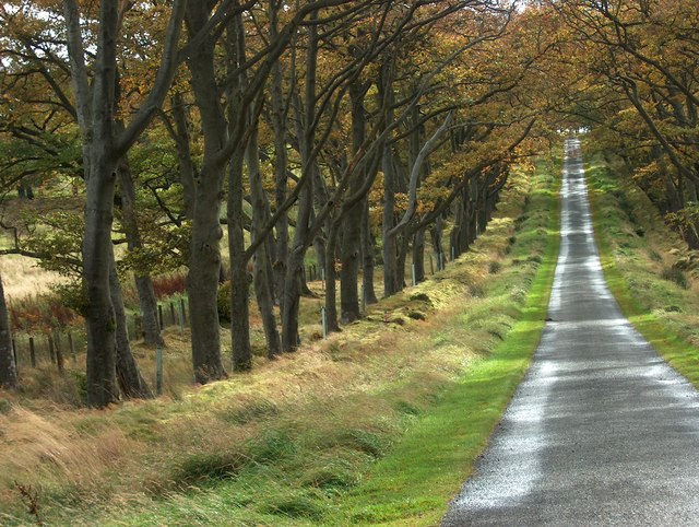
Wednesday 6th June 2012       Knettishall – Stonebridge

 As I only had six miles scheduled for today, I could have a civilised start time. Jill took me down to the station for 10am and I was in good time for the 10.54 Stockport departure to Thetford. The train journey was through some stunningly beautiful countryside, Edale in particular looking a picture in the morning sunshine. We lost time near Nottingham and arrived in Thetford ten minutes late. I had booked a ‘dial a bus’ from a local charity and the lady driver was still waiting but getting increasingly anxious about my lateness. So we were immediately on our way to the start at Knettishall. I was dropped in the middle of nowhere, on a narrow lane through a dark wood. I changed into my walking shorts behind a tree and was quickly underway.

At first the route was along lovely grassy woodland trails, rather wet from the recent rains. It was sunny when I started but within an hour a huge black cloud dominated the sky and the thunder and lightning was followed by torrential rain. I scampered under a tree to don my waterproofs and then realised this was the worst of places to shelter from a thunder storm. So out came the umbrella and I continued along the middle of the track through the downpour, recalling the day when my mate Phil refused to walk with me when holding up a metal object in the midst of bolts of lightning strikes.  The storm soon passed through and it had almost stopped raining by the time I reached the roadside pub and its beautiful accommodation.

Knettishall   dep. 15.14  -  Stonebridge  arr. 17.30,    GPS: 6.31miles in 2hrs 03min 27sec.

Stayed at the Dog & Partridge at Stonebridge near East Wretham. I sampled their Thai Curry and could not resist the Spotted Dick and Custard. Two Woodforde beers were on, Wherry (3.8%) and Norfolk Gem (4.3%).


Thursday 7th June 2012          Stonebridge – Castle Acre

 The weather forecast was awful. A storm was to run up the west side of the country bringing rain and high winds. So it was with some trepidation that I stepped out of the back door of the pub and turned northwards. But it was calm and warm outside so I stowed my waterproofs and started through Thetford Forest and the Battle Area. The first six miles or so were on delightful grassy tracks but the route then took to a long section of tarmac, a main road westwards at first and then a quiet lane on the northerly line. After five miles of this, my left foot felt rather bruised and sore.

I had expected the trail to take me passed the pub in North Pickenham but it turned away from the village centre and headed off to the north west. So I forsook the pub stop and had a snack and drink near the old railway bridge. Then it was thankfully back to grass track up to the A47 crossing before more tarmac led passed Palgrave Hall and left at Great Palgrave where there was a chance to walk behind a hedge on one side of the lane. This descended to another road crossing and a quite lane to South Acre. A lovely view opened up over the priory and village behind. I entered Castle Acre along a narrow lane than ran through a deep ford (with a footbridge for walkers) and then climbed up to my overnight accommodation, a grade 2* listed Tudor house. I arrived at the moment it started to rain so, instead of exploring the lovely village, I lay on the bed reading and dozing whilst it bucketed it down outside. Who says this is a dry part of the world?

Stonebridge  dep.  08.52 -   Castle Acre  arr.  15.15:  GPS 19.58 miles in 6hrs 11 mins 41 sec walking time plus ten minute stop for lunch.

Stayed at the Tudor Lodgings, Castle Acre.  I ate at the Ostrich Inn, battered cod and chips and three pints of St Edmunds Golden Ale from Greene King. 

Friday 8th June 2012       Castle Acre – Hunstanton

 At 7.30am I was sitting in a magnificent Tudor dining hall complete with open wooden beams high above me, a huge fire place at one end and a copy of the Telegraph beside my breakfast place. The storm raging outside did not tempt me to leaving such splendour. But needs must; I had a schedule to keep to. So everything was packed away in double layers of plastic and I eventually wandered out into the European monsoon. Today’s route was in a straight line for 20 miles, the first four of which was on road. The rain had abated but the wind was rising as the road peeled off to the right and the Peddars Way continued on it linear course. The next ten miles were the best section of this Roman road on a smooth grassy that crossed huge fields of crops and not a house or farm in sight. It went on and on and was a joy to walk, even with storm force winds battering me from behind.

A lad came towards me pushing a bike. He had had a puncture and was having to walk home, some ten or so miles away. I lent him my phone to ring for assistance but no one was in at home so he dejectedly walked on into the gale, resigned for a long walk pushing his stricken bike. I turned north again and was soon descending into Ringstead and the Gin Trap. But I was so near home that, even though I had had little to eat or drink all day, I pushed on to Holme and the beach where the Peddars Way just fades into the dunes. I turned westward along these dunes and found myself walking into the teeth of a gale, driving sand into my face as I took to the beach to avoid the soft going.

Scrambling up a low cliff to reach the Hunstanton lighthouse, I got onto the grassy promenade but progress was seriously impeded by the wind. It was like standing in a wind tunnel as I had to cut inland into the shelter of the houses to make any progress towards the town centre. Eventually I struggled to the cross on the Green and then into a coffee shop for a well-earned cake and cappuccino. It was the end of a hard and exhilarating day. I had just walked through the worst storm in ten years. And it was still June.

 Castle Acre  dep.  08.27  -   Hunstanton   arr.  16.05,  22.5 miles in 7hrs 25mins.

I stayed at the Forget Me Not Guest House in Glebe Avenue, Hunstanton and went to the Waterside pub for steak & kidney pudding and Adnams bitter.


Saturday 9th June 2012            Hunstanton – Wells

Another early breakfast and I was away, this time with the wind behind me, back along the promenade and dunes to Holme. It was much easier going on the grass behind the dunes and adjacent to the golf course and I made good time round to Thornham. The wind was still blowing but it was not raining so I took off some clothing as I diverted inland where the route goes off on a long detour. The top path was pleasant walking and I was soon descending back down again to Brancaster where I paused for a few moments to compliment a lady on her beautiful garden. She was from Lincolnshire and had this bungalow as a second home (and another garden to tend). Dashing back over the coast road, it was onto a fascinating section of old railway sleepers, miles of them stretching along the strip between the houses and the sea.  It took me passed a small anchorage and a nice looking pub before I was out on the sea wall and away again from civilisation.

 I eventually arrived in the Burhams and the home of the local hero, Lord Nelson. There were many more tourists and day trippers out now and it was quite a long trail of people that were setting out along the sea wall to the beach. These disappeared into the dunes and their beach activities and I continued for more than two miles along the sands, trying to find the firmest ground to walk on. It always appears to take longer to cover distance when in a featureless environment but ever so gradually the gap in the coastal plantations got nearer and I was able to take once more to the grassy foreshore and pick up speed. I initially failed to find the coast path out of Lady Ann’s Road, floundering for a few moments in the trees. But by going inland a few more yards, I located the wide track and, just as the sun came out and it got quite warm, I set off on the last section of the day.

 Jill had been driving from home and I was wondering how she was going on with the long journey across country. She was planning to call in at the B&B and then locate her cousin Robert at his beach hut. Just as I arrived at the Wells lifeboat station and was turning towards the town, Jill texted me to say she was sitting in the beach hut having a cup of tea. Within minutes I had located the correct hut and was joining them in one of Mary’s lovely cakes. Then we both walked back into town together to finish the day’s walk in the most wonderful fashion.  


 Hunstanton      dep. 08.20       Wells   arr  15.30
22 miles in 7hrs 5 mins

We stayed at the Merchants House on Freeman Street in Wells-next-the-Sea. We had a meal with Robert and Mary in the Crab House Cafe opposite. Drinks were in the Albatross, a ship tied to the quay, where a range of Woodforde beers (tried the Nelson’s Revenge) were on gravity feed.


Sunday 10th June 2012             Wells - Cromer

We got up early, far earlier than Jill had ever got up before on holiday. But I wanted another prompt start as I had my longest day in the entire trail ahead of me. I had the great advantage of taking out all but the day’s needs from my rucksack and it seemed unbelievably light as I said my goodbyes and set off along the harbour. It only took me a few miles to remember why my rucksack was so light. I had left my water bottle with its isotonic contents in the bedroom. So I texted Jill and asked her to follow me down the coast in the car and bring it to a rendezvous point. This we made at Blakeney and I put on the pace through the Stiffkey marshes, pausing only to watch a barn owl fly slowly by on its search for food in the long grass.

I was a few minutes later that my estimated arrival time and Jill was sitting on the side of the harbour enjoying our first sun and warmth. I bought her a cup of tea and demolished a cake myself and then pouched the water-bottle and set off on a long and semi-circular sea wall. An hour later this brought me round to Cley. Here I stopped in a general store and had a sandwich made for my lunch. This I packed away in my sack for later and got back onto the sea wall for the walk out to the beach. At this point the coast path and all signage disappeared. I asked the car park attendant for directions and he just pointed through the car-park. At its end, the only way forward was across loose shingle and the occasional patch of firmer grassland. Even this gave out eventually and I was forced up onto a shingle ridge which provided very slow and arduous going. The crux was a vast shingle beach with rollers crashing to my left. Then half way across this unforgiving terrain I stopped in amazement. There in front of me and totally unperturbed by my presence were three avocets walking slowing up the beach. My journey was complete. Or almost!

 But salvation lay ahead where rising ground took me onto firmer ground and then grass land and finally low cliffs. Passing a row of cottages on the edge of the cliffs, I came to a most splendid section of coastal walking, a sumptuous grass track along the cliff-tops. A steam train puffed by on the local railway and I lay for a few minutes in the sun eating my sandwiches and drinking my isotonic. Then it was all systems go to Cromer and I upped the pace for the section through Sheringham and then up Beacon Hill. I was fair flying now as I came down hill passed a superbly located caravan park/camp site and then through the woods in to Cromer. I headed straight for the pier and then rang Jill to see where she was waiting. Within minutes I was drinking cappuccino and eating Bakewell tart in the Rocket café and it was all over. Another national trail in the bag and now it was time to explore Norfolk with Jill and her relations and to sample some of its real ales.

Wells   dep. 08.14       Cromer arr. 16.00
24 miles in 7 hrs 20mins plus 25 mins for breaks.

We stayed once more at the Merchants House in Wells but this time went up to the Crown Hotel for a classily presented fish dish and the most supreme beer, Norfolk Kiwi (3.8%), from JoC, the brewer and wife of the hotel owner.

Wednesday 9 May 2012

South of Scotland Way


27th April – 1st May 2012


Introduction

This had been intended to be the continuation of the annual walking trip that is taking Mike and me from Minehead to Cape Wrath via Land’s End over an epic 15 year period. At the very last minute, however, Mike pulled out with a virus that had totally debilitated him. I had the choice of rearranging everything for a later date or going it alone. I had put in so much work into planning a new route across the Scottish lowlands that I decided not to let it go to waste.


Friday 27th April 2012                       Galashiels – Innerleithen

Jill took me down for the 6.22am train and the transport system worked perfectly. I even had time for a breakfast in Carlisle whilst I waited for the bus. This time I could not persuade the driver to take an English bus pass for to trip into Scotland. So I paid my money like every other Sassenach. Almost to the second of the scheduled time I was dropped in Galashiels bus station and I set off immediately, heading south out of the town to find the Southern Uplands Way. After weeks of rain in England, I was amazed at the Scottish sunshine. On the first set of hills I met Frank Loy from Sheffield brewing tea whilst keeping out of the biting wind behind a wall. He was doing the entire Southern Upland Way in one 12 day walk. Then a long grassy descent to Yair Bridge brought me to a short road section beside the Tweed. On the long climb up to the Three Brethren, I met my second walker of the day (the last of the entire trip), Dave Stokes who was on a north-south ‘end-to-end’ epic expecting to take three months or so. I agreed to try to meet up with him as he crossed Cheshire next month. There followed a fantastic high level traverse in beautiful sunshine over Minch Moor. The only pause was at a sculpture in heather called the Point of Resolution, where a hole in a wooden staff looked out over oval-shaped cuts in the heather covered plateau below.

A winding track led down to the road at Traquair. I looked for the brewery but failed to recognise it so I set off along the mile and a half of tarmac into Innerleithen calling in at the hotel as I passed to reserve my dining table. Then it was up to my b&b and a welcome cup of tea. After a shower, I returned to the hotel for a magnificent meal and then it was early to bed.

Galashiels   dep. 12.18  -  Innerleithen  arr. 17.25,    GPS: 14.89 miles in 5hrs-7.22min

Stayed at Glede Knowe Guest House, 16 Ronans Terrace, Innerleithen, EH44 6RB
Ate at the Traquair Arms Hotel, Fried Brie for starter and Duck for main course, with 2 pints of Traquair Bear (5%) a strong dark beer, the strongest they brew.


Saturday 28th April 2012                   Innerleithen – Penicuik

In all my reading on the various routes that walkers had used to cross the central lowlands, nobody had ever suggested the traverse of the Moorfoot Hills. Yet it looked so enticing from the maps; and it would save a time consuming diversion via Peebles and would gain a day on the normal ‘end-to-end’ schedule. An early breakfast enabled me to get away before 9am and set off on the steep climb to Lee Pen of a cold crisp sunny morning, still with a biting east wind that got colder and stronger with height. The views back over Tweeddale were spectacular, made the more so by the amazingly dry weather (flood warnings were being issued for southern England). Although from below Lee Pen appears a separate mountain, once reached it turns out to be the termination of a huge featureless moor. Featureless is not the correct word because there is now the obligatory wind-farm to behold.

A long tramp beside a wall was on a good path and my confidence increased as to an easy passage over these hills. Suddenly however the path disappeared into a strip of mowed heather and dropped steeply into a deep ravine, Leithen Door, which I assume is the source of Leithen Burn. On the other side, the mowed strip disappeared and the heather became deep and untrampled so I crossed the wall onto the forestry side and scrambled up a narrow trod. Once I had crested Leithen Door Hill, the path opened up again and doubled as a mountain bike track for some of its progress towards Dunslair Heights. The final few yards are along a wide track and bikers were everywhere. This was one of the few points in the week where I experienced other folk using the hills.

After leaving the buildings and tower behind, the bikers track continued in the right direction downhill into a wide windbreak in the forest. It was at this point that my planned route started to cause concerns. I had noticed on the map that a track went off right into the forest but I never noticed  it nor was that worried about it. The wall that had been my faithful guide was still beside me even though the going was getting considerably rougher.

I got level with the top of Shieldgreen Kipps but was so determined to follow my trusty wall (now a fence) that I did not take the easier route over its summit. At the highest point I momentarily took the wrong wall and was on the point of dropping a needless 1000 ft into the wrong valley when I remembered Mike’s last instructions. So I sat still for a few moments, got out my compass and studied the map. Then I sheepishly got back to my feet and retraced my steps to the fence/wall junction. Mike would be proud of me! However my struggle was only just beginning. The correct wall led over some narrow outcrops with just a trace of a trod in the deep grass. It was a rollercoaster section which got harder and harder. And at just the point when I expected it to ease, as the forest was left behind on Cardon Law, it got considerably worse. Even beside my trusty fence I was floundering around in long tussocks and making very slow progress. I kept getting glimpses of the forest road in the trees to my right and was bitterly regretting no taking this all the way from Dunslair Heights.

Eventually I reached the open moor on Dundreich and again made a poor decision. Rather than heading for the summit to pick up any path, I compassed across the moor on a direct heading for Jeffries Corse. Not one of my better decisions on a day of some very poor ones. But all bad things come to an end and I finally hit the top fence and the traces of a trod. Then suddenly the view opened up and I was looking down into a wide valley and over to the Pentland Hills beyond. What a relief to be striding out again down the wet grassy slopes. I took the right-hand wall down to Gladhouse Cottage and Moorfoot, stopping briefly to take on some food and water. At the road I turned right and then left up a farm road through Toxside.  The track beyond the farm was straightforward enough but I was tempted by a short cut indicated on the map across a new plantation. This cost me half a mile and 15 minutes of going round in circles. But I eventually found my way back on the lane to Mount Lothian where a left turn was the prelude to a three mile walk along quite busy roads. But I could now make up for the slow crossing of the Moorfoots and was not far behind my three mile per hour target as I dropped down the last steep hill into Penicuik. The last piece of navigation for the day was to find the hotel which was up a suburban road on the far side of town, ideal for tomorrow but not that welcome extra distance after an extremely tough day.

Innerleithen  dep.  08.48 -   Penicuik  arr.  16.40:  21 miles in 7hrs 52 mins

Stayed at Craigiebield House Hotel, 50 Bog Road, Penicuik, Midlothian, EH26 9BZ  I ate at the hotel, battered haddock and chips followed by apple cake and ice cream. The only drinkable beer was John Smiths Golden, but I was desperate!


Sunday 29th April 2012          Penicuik – Linlithgow

I had been looking to yesterday’s crossing of the Moorfoot Hills as being the new and exciting breakthrough in the missing links in the ‘end-to-end’ but it had disappointed. Now was the section that had I was not looking forward to and on which I had put in so much planning effort.  But whereas all plans and decisions yesterday could have been improved on, today's choices worked out just the opposite. It all went swimmingly well and the route proved a classic.

It did not start well. It was beginning to rain as I left the hotel. Were we to get the horrific weather that was hitting SW England? You might think so as put the rain-proofs over my rucksack as I turned onto a stream-side path straight out of the hotel and then got lost in a housing estate. I was rescued by a charming young lady out for her long run, training for next month’s Edinburgh marathon. She directed me up a cul-de-sac and then through a woodland towards Coates and the open fell. There were more runners on the A702 and then came a very wet crossing onto the Pentland Hills. I had originally planned a high crossing of these fells but by the time I reached the pass below Scald Law, it was snowing hard. A few runners were risking the slog up to the top but it was not the day for this and 24 miles as well. So I dropped steeply into the Hare and then on through a delightful glacial valley winding beside a river through the remainder of the hills. This finally brought me out onto a flat grass plateau at Bavelaw Castle. A stile took me into a tree-lined avenue that passed by the house and led round to the left and over an indistinct field track to Bavelaw Mill Farm. My route then took me up the farm drive and onto a quiet lane used by a string of runners for their Sunday runs.

I had thought hard and long about the next section. In an attempt to avoid a long road walk, I decided to cut through a farm and hamlet at Cockburn. Then left onto a road that took me up to the A70. I could have gone straight across towards Kaimes Hill but a better route seemed to be to walk south west down the A70 for 250 yards and then turn right at Boll-o-Bere and along a well-defined track which led out into a field system. Across the other side, a track was picked up again and this took me almost to Easter Newton before I saw a stile adjacent to a gate on the left leading into the parkland of Kirknewton House. Grassy paths then traversed the park and came out in front of the hall where I emerged onto the B7031. I crossed the road and tried a farm track that led Overton Farm. Here I had an opportunity to take a field path that was marked on the map but I could see no sign of this path on the ground nor any stiles in the walls so I continued to the main road and walked along the pavement passed the station and onwards to a very busy junction.

Immediately after this junction, my chosen route turned onto an old dismantled railway. This proved to be an absolute gem of a section, almost 5 miles of good quality track going northwards towards my target, through pleasant semi-industrial countryside. It finally dropped me in the centre of Uphall where my next experiment began. An article in the New Scotsman (11/04/08) described as the walk of the week a route from Uphall to Linlithgow over Binny Craig. I followed this easily with the aid of the map and soon found the farm track out of Uphall that took me to new footbridge and then over a road onto the steep-side grassy lump. A wonderful set of steps cut into a granite cliff gave me access to the final steep grassy slope. The views from the summit were stupendous, with the Forth Bridge and the whole river layout out below. Then a reverse of the grass and a traverse of a horse-filled field took me onto a footpath linking the agricultural college with Longmuir Plantation.

A long ride passed a paintball enclosure and on through the plantation and then brought me out into the fields of the Riccarton Hills, hardly any more than a few grassy bumps. Crossing the road at the end, I tried to find a path through Beescraig Wood but the storms of the previous January had brought down so many trees that I had to break out again onto the road than ran north to the visitor centre. There was latterly a path parallel to the road which kept me off tarmac. The drop to Hiltly was blocked by a huge tree that had fallen across a stile at the top of the steep drop. But this was by-passed with care and I eventually reached the lane that led into Linthigow. This lane took me to the top of Strawberry Bank and my digs for the evening.

Penicuik   dep.  08.45  -   Linlithgow   arr.  16.45,  24 miles in 7hrs 50mins.

I stayed at Strawberry Bank House, 13 Avon Place, Linlithgow, EH49 6BL 
Rachel, Charlotte and Peter arrived just after I had finished showering. It was great to see them all after three days on my own. We went down to the Four Marys where I had steak & ale pie followed by apple lattice and ice cream (real puddings were not the feature of this trip!). The beer was remarkably good, Edinburgh Gold from Stewart. Then Rachel gave the kids a shower before they left me to drive back to Ayrshire. I was so entranced with Linlithgow that I went back into town as the sun set and walked round the palace and its loch. I celebrated with a pint of Freoach Heather Ale in the Four Marys and got a much later night that I had intended.


Monday 30th April 2012         Linlithgow – Kilsyth

This was what the Scots call a ‘dreich day’. Grey and overcast with clag on the hills, rain in the air, and very very cold. There was no hurry today, it promised to be an easy trek along the towpath all the way. So I got a leisurely start and wore my Teva sandals not, it turned out to be, a good idea. I kept up my record of starting every day before 9am but only just. The early part of the canal was a delight with narrow winding sections along tree lined cuttings with birds singing and herons sitting on every bank. I was soon round to Falkirk and was about to come off and divert through the town centre just for a break in the monotony. However I local man told me to carry on to a supermarket beside the towpath. I was well passed the turnoff when I realised the supermarket was Tesco’s and the café look dreary. As part of a family who have signed up to 'say no to Tesco’ I was reluctant to stop so I carried on and on down the canal which was now far less rural. I did manage a short diversion through the town to miss the long tunnel. Then I had difficulty locating the canal on the far side but I eventually tramped down to the locks and turned sharp right through another canal tunnel. This time the exit was spectacular. I came out of the tunnel onto a long concrete viaduct which suddenly came to an end at the Falkirk Wheel. I dropped down the slope beside the wheel and was delighted to find a visitors centre and café. So I was able to drink a cappuccino and eat a slice of cake as I watched the Wheel in action with a canal boat coming down to the lower level on an amazing piece of engineering. It was by far the highlight of the day.

Refreshed I set out along the Forth and Clyde Canal which was wide open and lacking any interest. At one point I thought I saw a pub ahead but this turned out to be a mirage, or rather a restaurant. The last 3 miles were in a dead straight line, a disheartening end to the walk. I left the canal at the earliest opportunity and entered Kilsyth via a series of narrow but busy lanes. Navigation through the town centre proved a problem but I found that the b&b was sign posted with a brown sign. The last half mile up to the farm was seriously uphill the more so since I had been on a towpath all day. It turned out to be a longer day than I had expected and my feet had blistered in the sandal. But after a cup of tea, a shower and needles in the feet, I was able to stagger back into town for a meal and a drink.

Linlithgow   dep. 08.58  -  Falkirk Wheel (lunch)  12.55 – 13.30  -  Kilsyth  arr. 16.50, 22 miles in 7hrs 20 mins + 30 mins for lunch.

I stayed at Allanfauld Farm, Allanfauld Road, Kilsyth, G65 9DF. The meal was at the Coachman Hotel where I had haggis and black pudding fritters to start and fish and chips as an encore. The beer however was once again John Smith’s.

Back at the farm, Libby showed me the names and mailings from other ‘end-to-enders’who had stayed there and introduced me to the book by Carole Loader who ran the whole route and also stayed with them. I bought this book when I got home.


Tuesday 1st May 2012                        Kilsyth  -  Dumgoyne

I was down before breakfast before 8am encouraged by the sunshine and the clear hill tops. The previous day I had abandoned the idea of crossing the Campsie Fells and had been preparing for another day of boredom on the canal towpath. But, lo and behold, the great God of walking was smiling on me. So in the morning brightness I said my goodbye to Libby and set off up the hillside towards the Kilsyth Hills. Archie was in the bottom fields and came over to help my route choice. He advised me to head straight up for Laird’s Hill and then go west to pick up the reservoir road. This crossing was pathless but quite walkable except for a boggy section just before the road. I was able to make good time along the track which eventually dropped down to Birkenburn Reservoir. I chose to by-pass this on its south side and the going suddenly got a lot slower. A tussocky section led up from water’s end and headed onto a featureless plateau of colourless grass. It was difficult to distinguish a high point to Lecket Hill but I headed left to pick up a track that came over from Cort-ma Law. A great track then descended gradually to the road.

The hillside opposite, on the Campsie Fells, looked heather-free so I ascended the road only very briefly before climbing the new barbed-wire fence and headed straight up through the new plantations. I thought it a good idea to miss out the first summit and head straight for Hart Hill using Alvain Burn as my route finder. However it was almost impassable at the top of the valley and across the plateau. So I headed for a fence that I could just see on the top of the ridge and found just the traces of a trod. But very faint. Nobody seems to walk the Campsie Fells. I staggered along the fence picking up any slight vestige of a path where I could and, after what seemed an age dropped down steeply into Fin Glen. Again I took a straight line rather than head for the tops. So I tramped over more rough ground heading for the col between Earl’s Seat and Little Earl.  Once across the top fence the navigation became very complex even in the bright sunshine. This is not the place to be in mist. A long slow slog across a boggy wilderness brought me to the final edge of the Campsies near Garlock Hill. A track at last, the first for several hours then took me down and round to the impressive pinnacle of Dumgoyne. Suddenly the view opened up and I could see Loch Lomond and the mountains of the Highland behind. That one moment made all the effort in the traverse of the Campsie Fells worthwhile. Then a final steep grassy slope dropped me down directly into the Dumgoyne Distillery. My bus timetable told me a bus may just have gone but, after a ten minute wait, it came in late and I was able to jump on and get a ride to the station at Milngavie. A train was waiting to leave and I was soon on the way home, another tough section of the end-to-end route behind me.

Kilsyth  dep.  08.40  -  Dumgoyne   arr. 14.50,   GPS 14.34 miles in 5hrs 57.55 mins (+ 10 min break).

I caught the bus almost straight away to Milngavie Station and was in Glasgow so early that I had time to wash and change, have a coffee and cake and then eat a plate of fish and chips (and Deuchars IPA) before boarding my train home. The connection in Preston was a close shave but there were no more scares and I was home bang on schedule. I was glad that Jill was there to pick me up from the station. A long walk home at this late hour would have been a step too far.

Tuesday 27 March 2012

The Yorkshire Wolds Way


19th - 22nd March 2012

Introduction

I went down to London in mid-March to visit the David Hockney exhibition at the Royal Academy and was most taken by the paintings of the Yorkshire Wolds. I had been considering a training walk to stretch my legs after the long winter. The weather was improving, the forecast was brilliant, so I made the spontaneous decision to go for the Wolds Way and explore a corner of the country I knew little about.  I had only a few hours to prepare. I had no maps, no guide book; only an accommodation list downloaded from the website. Throwing some kit into my KIMM sac, I snatched a few hours fitful sleep.

Monday 19th March 2012                 Hessle – South Cave

I had not slept well so was up before the alarm for an early breakfast. Jill was just stirring as I called out my goodbyes and set off to walk to the station. The 08.02 train was running late so I had little time to change at Piccadilly on to the 08.42 to Hull. But the weather improved as we shot across the Pennines and it was bright sunshine as I left Hull station and sought a bookshop and some coffee and cake. The ever-present Waterstones provided both a guide book and carrot cake. Within half an hour I was back at the station to retrace my rail journey but this time on a train that stopped at Hessle. It was 11.30 as I was left standing alone on Hessle station wondering how to find the start of the Wolds Way.

The newly acquired guidebook earned its purchase price in getting me over the footbridge and up to the Italian restaurant at Hessle Have and the official start. Then, under a bright sky, I set off trying to get my rhythm going under the Humber Bridge and the path along the estuary. I had to take to a shingle beach to get round a hotel but was soon onto a dry track beside the railway. In North Ferriby I followed the guidebook description of the way through the village centre, but in retrospect I should have resorted to the map I had printed off from the internet. It was only when I made a mistake coming off Melton Hill that I put the guidebook away and swore never to take the map out of my hand again. I am sure the diversion cost me an extra half-mile and an irritating road walk.

With map in hand I made no further errors in route finding and I found the signposting was of a generally high standard (outside towns and villages). It clouded over as I marched up Welton Dale and over my first big climb to the long westerly dog-leg to Brantingham. There is a beautiful moment as you drop down a grassy field path to the church, isolated from its village and in fabulous location. It looked a picture in a moment of sunshine. There was a mountain biker at the church, pausing to regain his composure after being brought off his bike by some Jack Russell dogs. Hoping is cuts would soon heal, we parted and I continued up the road and then left up another climb to a great viewpoint over my night’s destination. It was 4pm as I descended towards South Cave and turned into the village to find bed & breakfast. The address of the private house was not easy to find and then it looked as though the residents were away so I returned to the pub in the town centre and got myself fixed up for the evening I was on my way.

13.51 miles in 4hrs 17mins 02sec.

I stayed at the Fox and Coney, South Cave. Black Sheep bitter was on a hand pump and I enjoyed steak & ale pie. The room was over the bar and a bit noisy and, although I was very tired, I took an age to get to sleep.


Tuesday 20th March 2012                 South Cave - Huggate

I set the alarm for a 7.30am breakfast. I needed to start covering greater distances now to compensate for my ‘easy’ first day. Today was the vernal equinox, and it certainly felt as though it was spring as I left the hotel (08.27) and retraced my steps up the road I had come in on the previous afternoon. My fleece was stored in my sack and I took off my pullover on the first climb. I got the wind, and a mobile phone signal, as I pulled out of the plantations and onto the bare tops. My bank rang me to sort out some problems with my credit card. Then I was able to ring various members of the family to catch up with the latest news. The views back over the Humber and westwards to Drax were spectacular.

I really motored early on and clocked 10 miles in the first three hours. By 11.50 I was outside the Goodmanham Arms and to my delight it was open and serving food and real ale. A cheese sandwich and a pint of Yorkshire Gold and then a Wold Top bitter were enough to revive me and at 12.25 I was off again on a fast easy section to Millington. I rang ahead to book some accommodation and then relaxed into the long afternoon journey. The traverse of the Londesborough estate was memorable, with the most magnificent brick retaining wall dominating the valley. A lovely old church was all there was at Nunburnholme and then it was just a plod until I pulled onto the edge overlooking Millington and its dale.

I was going really well until I had to drop onto a Roman Road running through a steep sided dale and climb out again up a very steep set of steps. Whether it was the heat or the beer I had consumed at lunchtime, I do not know. But I totally bonked on this climb and felt tired, dizzy and old by the time I gained the flat ground again. I was quite glad to coast home with no heroics and so eventually I could see Huggate away to my right and was very glad to be turning right off the route and into the village. My fitness had been sorely tested. Even though, when I had rung at lunchtime, I had been told that someone would be in the kitchens if I went round the back of the pub at 5pm, the place looked deserted. I had to ring from outside the front door to rouse a response. And a very nowty landlord unlocked the front door to give me access to my room. However the rest of my stay was brilliant and I was wonderfully well fed and watered.

25miles in 7hrs 58 mins + 35 mins for lunch.

I stayed at the Wolds Inn in Huggate. I had the biggest portion of duck in orange gravy washed down with pints of Landlords and Landlords Gold. I still found room for Treacle Pudding and a cappuccino.


Wednesday 21st March 2012            Huggate - Ganton

The owners of the Wolds Inn got up early to provide me with a cooked breakfast and a packed lunch in readiness for my mega-day. I had everything packed before the meal so, as soon as I was finished, I set off up the road I had come down the previous night (at 8.32am). It was grey and overcast but quite warm for the time of day and year. I was soon dropping into a big flat-bottomed dale which I followed for almost an hour up to Fridaythorpe. Here was the half-way point of the walk, the place where the national trail had been officially opened. The route out of the village took me passed the ABN mill but I had no time to call in to see if old friends were on-site. After a high level section, the path dropped very steeply into another set of grassy dales, full of sheep and little else. This eventually took me out onto the road to Thixendale. In the quiet village was a shop sign taking me round the back of a house into a glass conservatory that acted as the village store. Buying the cakes and drinks was easy; getting away from the chatty owner was more problematic. But I finally made my excuses and dashed for the door, into the main street and up a steep chalky leading on to the tops.

One more dale crossing took me onto a high ridge where a right turn enables to route to stay level along to edge of a deepening dale that leads to Wharram Percy. Eventually the path descends to the deserted medieval village and here I sat momentarily on a seat overlooking the old fishpond to eat my newly purchased cakes. Then it was passed the old church and up to a road and left onto a section that was not nearly as interesting as the early morning had been. But at least it took me over high ground, provided me with a mobile phone signal and enabled me to book accommodation for the night ahead.

I was getting rather hungry by the time I got to Settrington Beacon, so I was really pleased to find a bench overlooking the steep descent to Rowgate. Here I sat for a 15 minute lunch break (1.50-2.05pm) looking out over Wintringham and the wolds behind. It was warming up now as I plodded along the farm track and then turned right over the fields into Wintringham. The route then turns away from the village centre and goes round the back to reach the church without seeing anything of the village itself. A left turn at the church took me up through some woods and plantations on a steep-sided ridge. The final scramble onto the top of Knapton Wold was the steepest part of the whole route. Thank goodness I went up better that yesterday’s crux climb. A lady dog walker warned me to look out for some ‘odd goings on at the top, red and things’. These turned out to be a new work of art called ‘Enclosure Rites’ consisting of line of ten figures (3ft high), processing like a medieval family across a field next to a circular pond surrounded by a red painted stockade fence.

Returning to more important things like getting to the pub, I turned right on the northern edge of the wolds, a significant moment as this turn pointed me towards the sea and my ultimate destination.  This level traverse took me the rest of the afternoon, with features such as woods, daffodils, sheep-filled fields and farms all blending into one long period of concentration to finish off this long day. The climb out of Sherburn was a pain as it seemed a gratuitous diversion to keep the route away from the direct line, but eventually I finally came into Ganton, and continued down to the main road to arrive at the pub just four minutes earlier than expected (5.56pm). That was a very long day!

 28 miles in 9hrs 10 mins + 15 minutes lunch stop.

Stayed in the Ganton Greyhound, took a quiet room at the rear (away from the traffic noise) and had a meal of belly pork and stick toffee pudding. The beer was Headland Red (4/3%) from Wold Top.

Thursday 22nd March 2012              Ganton - Filey

I was down early for the 8am breakfast, was served quickly and had my bags packed and was out into the cold clear morning before 8.30am. There was a gentle start across some fields before a right turn led up to the top of the wolds. Once this was gained, the route kept its height passed the RAF station and then started to roller-coaster across a series of steep sided dales.

Then came the only part of the whole route that was hard to follow. Starting down the side of a ploughed field, a fingerpost was reached that pointed at 90 degrees across the crops.  The farmer had not left any edge to walk on and the next half mile was in soft ploughed soil with crops growing up fast on either side. I abandoned the last leg of this section (across a sloping crop field) and went down a fence boundary and across the crops in the base of Camp Dale. It was quite a relief to get out of this interminable field and into a series of delightful dales full of scrub and old trees.

Coming up for air, I found myself in sunshine once more traversing the last ‘wold’ of the entire walk. The descent to Muston was easy and I paused only briefly to replace my tracksters by walking trousers for the return to civilisation. Soon I was in the outskirts of Filey. I called into the railway station to check the train times and then followed the instructions in the guide book to zigzag through the narrow streets and onto Filey Brigg. In the mid-day sun it was a picture. In fact I stopped a couple and asked them to take my picture with my phone to commemorate the end of a magnificent 80 mile expedition.

13 miles in 4hrs 20min 23sec.

I turned my back on the sea and retraced my steps to the station to catch the 13.42 train to Sheffield and onwards home. I felt strong enough to walk home from the station but had to make a pit stop in the Treacle Tap to see me on my way. A most invigorating few days!