Tuesday 3 October 2017

Wales Coast Path (Part 3)


Llanelli - Bosherston, 18th – 23rd September 2017

Monday 18th September 2017          Llanelli – Burry Port
Burrying Last Year’s Memories

Our drive to Wilmslow Station has become an annual pilgrimage. Jill drove us over yet again for the start of stage three of our walk along the Wales Coast Path. Last year we had finished at Llanelli so it was to there that we were returning on the 09.46 train. It was a splendid journey through the Welsh Marches and along the south coast. We arrived a few minutes early and were walking out of the station before 2pm. We had our photographs taken in front of last year’s finishing point. Unfortunately the lady who we asked to take the photograph, a photographer by hobby, failed to find the shutter button.

So, with our start unrecorded, we went into the Flanagan’s Café in the Discovery Centre on the waterfront and had coffee and carrot cake. It was easy walking along the millennium cycle route, tarmac all the way, into Burry Port with its lifeboat station and lovely harbour. The guesthouse was adjacent to the station, squeezed in between two pubs. Our landlady could not recommend either of these but sent us round the corner to what was deemed the best pub food in town.

Llanelli Station dep. 13.57, Burry Port arr. 16.20   5 miles in 1hr 53m walking time plus 30 minutes in Flanagan’s café (14.15.- 14.45).

We stayed in the Globe Guesthouse, Stepney Road, Burry Port. We ate in the Cornish Arms, steak & ale pie followed by spotted dick and custard. The beers were both from Swansea breweries, Boss Beatle Juice (4.8%) and Gower Gold (4.5%).

Tuesday 19th September 2017          Burry Port - Carmarthen
Up the Estuary

It was a lovely bright morning with lots of blue sky and a gentle breeze. An early breakfast led to an early start and we were heading down to the harbour by 8.50am. An easy start on firm trails through the dunes took us into a country park that had obviously had an industrial heritage. Paths led through woodland passed a narrow-gauge railway and onto the beach. There was a two mile stretch along the firm wet sand closer to the sea. The route off the beach was indicated to us by a guy from the Llanelli Ramblers. We scrambled into the dunes and out onto a forest track and into a quiet part on Pembrey Forest. After emerging from the trees, the route crossed farmland that adjoined an old airfield. We could hear racing cars being test-driven around the motor track beyond.
 

The route took to the main road towards Kidwelly but, instead of heading for the town centre, went west on a huge loop that took in the now disused Kymer Canal to Kidwelly Quay. Then it was back across the railway line in search of a café for some lunch. This we fell across on the main street up to the bridge and I had scones and coffee to revive the flagging spirits.  Emerging from our rest stop, we were soon over the bridge and walking on the north bank of the river through a town park. This led us out onto a quiet lane and up a steep wet and rough track to the hill-top village of Llansaint. Then it was a roller-coaster of a section over hills, through woods and across steams before coming down a very steep set of steps into Ferryside. This is a very long village stretched out along the train track and giving maybe two miles of suburban walking. I began to notice that the mileages given in this section of the guidebook were very inaccurate. The planned 22-mile day was turning out to be significantly longer.

The next section did not follow the river estuary but turned inland to take to rarely walked field paths that wound through high ground to the east. The pace dropped, the miles ticked slowly by and we made slow progress across the wet and slippery farm land. By the time we expected to be arriving in Carmarthen, we were still two miles south of the town dropping down straight and featureless roads to the main school. Here we joined major roads at rush-hour and we had great problems in crossing the town by-pass and its various junctions and roundabouts. Eventually we emerged from a pedestrian tunnel to find ourselves outside our b&b. A most welcome sight.  We felt slightly betrayed by the guide book which, on what was to be our longest day, underestimated the distance by more than 2 miles. The mistake seems to have occurred in the Burry Port to Kidwelly section where 2 miles suddenly goes missing.

Burry Port dep. 08.47, Carmarthen arr. 17.20   GPS 23.86 miles in 8hr 07m 36s moving plus a 25 minute (12.25 – 12.50) stop in ‘Time for Tea’ café in Kidwelly.

We stayed at Tir Celyn, Emlyn Terrace, Carmarthen. We walked into town to Yr Hen Dderwen,  a Weatherspoon’s pub in King Street. I had a fish & chips and pancakes & ice cream. I started with Towy Gold (4.4%) from Castle Gate Brewery, Carmarthen and then went on to Ein Stein (5.0%) from Lymestone Brewery in Stone. We were so tired after this hard day that we took a taxi back to our b&b.

Wednesday 20th September 2017     Carmarthen – St Clears
An Estuary Too Far

The forecast was not good so we got an early start in the hope of getting as far down the other side of the estuary before the rain arrived. On a cool cloudy morning we returned to the town centre and the river, this time crossing over a footbridge near the railway station. A riverside path took us under the rather unusual railway bridge. It looked as if it was designed to be able to lift to allow boats through. The encroaching vegetation showed that the lifting mechanism had not been used for many years. A long section on the rather busy road was broken up by being signed to run parallel to the road behind the hedges. These fields were wet and slippery and had steps and board walks in places so it was tempting to carry on down the road. Eventually though, a vital path down to the river was the one to follow as the road swung away. Our route emerged from the wood to cross farmland and estates, climbing as it went towards Llangain. Here was a lovely old church with a short stumpy spire. We bypassed the village and headed down a lane, losing all the height we had just gained. The next hill was climbed by a series of paths that were hard to navigate. Issues had obviously been had with landowners over this rather unsatisfactory section. After another descent and climb, the way forward was much more direct if a lot wetter. The final descent into Llansteffan was along a boggy, sunken greenway between two overgrown hedges. If this was not wet enough, it now began to rain and I was fighting to get the umbrella between all the brambles and thorns. We emerged into the upper part of the village and marched down to the seafront to get our overdue café stop. But we were to be disappointed.

The cafes in Llansteffan are subject to half-day closure on Wednesdays and, as sod’s law would have it, today was a Wednesday. All that was open was a kiosk and a wooden shelter in which to drink my take-away coffee. So it was not long before we were searching for the way out of town, which began with a straight climb between two fences and continued with a lovely contour beneath the castle in a wood dripping with rain water. A climb on grassy paths over the next headland led us back to a lane and a section on tarmac. The next few miles were a complex mix of road and field paths as the route wound its way up yet another estuary as the rain came down in increasingly heavier pulses. The last road section was two miles long and took us to the foot of a steady climb up fields passed a trig point and then down to a farm and a steep descent through a wood into increasing wetter fields. The very last stile at the bottom of these fields was in a bottomless mire. We were up to our knees in gluttonous sludge as we tried to scramble through. All that remained was a short walk down a concrete farm-track, over a bridge and passed some new house and, as we emerged onto the main road in the village of St Clears, there was our b&b in front of us. Soaked to the skin, we rang the doorbell expecting a warm welcome. Instead we got a dazed look and ‘I was expecting you tomorrow’. ‘But I booked for Wednesday’, I explained. ‘I thought it was Tuesday’ replied Bev, our landlady. ‘If you had been looking for a coffee shop in Llansteffan, you would have known it was a Wednesday’, were my thoughts. But she took us in, dried our clothes and looked after us very well. What a great shame the smoke alarms started ringing during the night.

Carmarthen dep. 08.51, St Clears arr. 16.20, GPS 19.86 miles in 7hrs 07m 42s walking time plus a short stop at Llanstaffan for a takeaway coffee drunk in a shelter.

We stayed in Manordaf b&b and ate at the Santa Clara Inn. I had a wonderful meal of pork belly pork and mash. The beer was Wadsworths 6X (4.1%) so I went onto red wine later on. The landlord, who originally told us that we could not watch the United match on Sky Sports, then found that we were ‘reds’, showed us his shrine to United upstairs (a lifetimes collection of memorabilia) and then turned the television on in the bar and watched the match with us.
Thursday 21st September 2017        St Clears – Saundersfoot
Brown as Owls

It had rained all night and it was still overcast as we set off south along a busy road back towards the sea along the west side of the estuary. In an attempt to get walkers off the road, the official route kept diving into fields on either side, fields that were sodden with overnight rain and were featureless and inadequately signed. After trying a few of these pointless diversions, we headed back to the road and sanity. Just after the hamlet of Cross Inn (no inn), we took a turn to the left and re-joined the coast path near a caravan site. The route returned to the riverside, now a wide estuary, and took us along a lovely if rather wet wooded riverbank emerging at Dylan Thomas’s Boathouse, his family home in the post war years. The little work-shed next door was the highlight of my trip so far. The setting was a delight and you could hear the bird cries and see the heron priested shore, just as he described in his poetry.  The track dropped quickly into the streets of the beautiful town of Laugharne. We passed along the main street and round to the magnificent castle. Here a coach was disgorging its load of golden oldies and we felt back on the tourist route after a long spell in the wilderness of estuary country.

Another fabulous section of footpaths led over a shoulder of St John’s Hill following the route of Dylan Thomas’s birthday walk described in ‘Poem in October’. The seats and information boards contained quotations from the poem including the description of the castle beneath us, ‘brown as owls’. Eventually the route round the base of the hill ended in some quarry workings and we were forced back onto the main road. Here we were once again faced with the prospect of walking behind hedges in fields that were full of water, mud and cattle. We had learnt by now that life was too short to jump in puddles when a perfectly good alternative was available. So we spend half an hour marching along the road making good time in fast improving weather towards Pendine and its promised cafes. From Llanmiloe and its long line of military housing there was a footpath/cycleway for the last two miles into town and we were free of traffic worries. On the sea-front there were several cafes but we soon honed into a delightful little tea shop which boasted excellent chocolate cake. Sitting outside in the sunshine we were able to view the coast line that awaited us. The land of the estuaries and field paths was behind us. In front was what we had come for, raw coastal scenery.

But that coastal scenery came at a price. The next two hours involved three huge climbs over Gilman Point and Marros Beacon. In the afternoon sunshine it provided us with magnificent walking. Eventually we descended to a narrow footbridge over a small stream that demarcated the border with Pembrokeshire.  One last climb and we were on our way down to Amroth and the start of the Pembrokeshire Way. It had taken us three hard years of walking to finally get here. Before leaving Amroth, we fell into conversation with Martyn Baguley, an Edinburgh man who had just produced a book ‘Wildwood Legacy’ about his work in the Pentland Hills. The last couple of miles were over pleasant undulating coastal hills into Wiseman’s Bridge. Although Saundersfoot was laid out in front of us, there seemed no way of reaching it at high tide. But people were walking up the promenade towards a cliff wall so we followed. The lo and behold, there were a series of tunnels that took us under the headlands into the main street. A helpful shopkeeper pointed out our guesthouse and we were soon enjoyed our splendid accommodation.

St Clears dep. 08.53,  Saundersfoot arr. 17.00, GPS 19.37 miles in 7hr 31m 06s walking time plus a 25 min (12.35-13.00) break in Pendine at the ‘Tea by the Sea’ cafe.

We stayed at the superb Harbourlight Guesthouse and ate at the Salvage Bar just down the road. Here, steak and ale pie was washed down with some magnificent beers from Tenby Harbour Brewery, pale ale M.V. Enterprise (4.0%) and an IPA Caldey Lollipop at 4.5%. 

Friday 22nd September 2017                        Saundersfoot – East Trewent
Blown Off-Course

It was another bad forecast, our second in three days. This corner of Wales was being battered by a series of storms coming in from the Atlantic.  So we had another early start to try to beat 
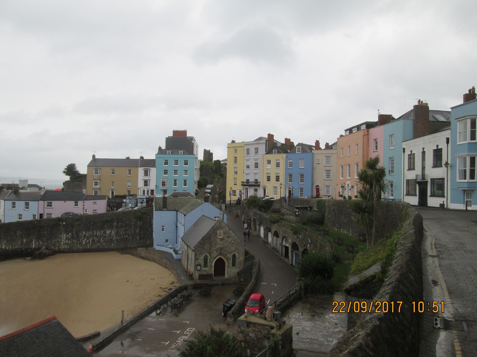
the weather. But by the time we had climbed over the wooded hills into Tenby, it was beginning to rain. And by the time we had toured round the town centre and broken out onto the south beach, the wind had picked up and the predicted gale had arrived. In this driving wind, a crossing of the beach was not appealing so we took the alternative route behind the dunes and alongside the railway line. The signed path crossed the railway and took to the roadside through the hamlet of Penally. It then returned to the coast over a shooting range that was not being used in these dreadful conditions. We then really got savaged by the wind, having our rain-covers ripped off our rucksacks. Phil had to rescue his Eurohike cover from a fence in a distant field. I lost a water bottle in the fight to stay upright. We had hoped desperately for a coffee shop in Lydstep Haven but, in all the holiday homes and hotels by the shore, there was only a takeaway machine in a small shop.

So we battled up onto the next headland and back into the raging storm. The official path circumnavigated a military installation before returning to the cliff edge. Again we hoped beyond hope for a shelter at Manorbier. We were soaked though and getting cold at the slower pace that we were struggling to maintain. The path was so wet and slippery that I was finding it a nightmare to keep my feet. As we rounded the last headland before Manorbier, the wind blew us towards the edge and I slipped and fell spectacularly down the path. Phil picked me up and ushered me across the deserted beach with no signs of any respite from the downpour. ‘This is getting dangerous’ he said, trying to talk some sense into me as I climbed out the other side. ‘Let’s find an inland alternative’. And we did. We followed the nearest lane to the sea for the remaining three miles into Freshwater East. It was better to arrive safely and live to fight another day. Our accommodation was a more than a mile further on, a farm complex in East Trewent.

Saundersfoot dep. 08.53, East Trewent arr.16.20, GPS 16.16 miles in 6hrs 14m 34s walking time. The owner took us back to the Freshwater Inn for a meal. I had braised duck and red cabbage pie and some Gwaun Valley beer from near Fishguard, King of the Road (4.5%) and Felinfoel from near Llanelli, Double Dragon (4.2%). A taxi came out from Pembroke to answer our needs for the return trip to the farm.

Saturday 23rd September 2017         East Trewent - Bosherston
Bosherston or Bust

It was most disappointing to see that the promised better weather had not arrived. On opening the curtains in the morning, the drizzle was still blowing on the breeze and the clouds were down to sea level forming a mist driving in from the coast. We needed an early start and a good pace today to make the bus connection for our lunchtime train home. So we were breakfasted and packed before 9am and in our wet gear for retracing our steps from the farm back to Freshwater East. A short cut put us onto the coast path and up a wet and slippery climb to the first hilltop of the day. This however proved the only significant climb. We were soon on more level but undulating clifftop and making good progress at last.

As we began the descent into Stackpole Quay, the weather began to improve. The rain had stopped and bright skies were seen approaching. The Quay had a National Trust carpark and a café but this was no time for such frivolities. We had a bus to catch and time was moving on so we pushed the pace up a steep set of steps and out onto the cliffs leading to Barafundle Bay. As we approached the bay, it became obvious that the only viable route was down the steps onto the sand and then over the beach. The exit from this strand was up another steep path that led out onto the relatively flat grassland of Stackpole Point. We then began a route march across the grassy terrain that led us through a dune system and onto a sharp descent to Broad Haven. Time was now of the essence and we had little opportunity for optimal route finding as we scrabble down the beach over rugged layers of abrasive rock, wading a stream and striding across the soft sand not knowing where we could get out on the other side. We followed a couple of walkers through the sand dunes and almost fell into some concrete steps. In no time we were in the car park at Tefelin and on the road to Bosherston. We got to the bus stop just minutes before the bus. But as this had to make a 15 minute round of coastal pick-ups before returning to the village, we had a quick cup of coffee in the village café and caught the bus on its return. On what was now a sunny morning, our third year on the path was at an end and we were on our way home.
 
East Trewent dep. 08.51, Bosherston arr.11.15, GPS 6.90 miles in 2hrs 26m 35s walking time.

The bus driver was a treasure, giving us a history lesson of Pembroke and Pembroke Dock as he drove us to the station. We were in good time for the Swansea Train and had opportunities to change out of our damp walking gear. The two hour ride back to Swansea was a replay in reverse of this year’s walk, a delightful trip spoilt only by a set of young and rowdy football supporters off to watch a match. A 45-minute wait at Swansea gave us the opportunity of a sandwich in the station café before we joined the Manchester train for the long ride north. Inebriated groups was the order of the day: first a group of young people warming up for a night out in Cardiff, then just when it seemed quiet again, a set of very drunk football supporters boarding at Shrewsbury. But eventually the train rolled into Wilmslow Station and there was Jill, waiting to take us home to a meal, shower and a good long rest.


Monday 19 June 2017

South of Scotland Way: the Missing Link


Galashiels –Milngavie, 6 – 10th June 2017

Introduction

Almost 20 years ago Mike and I had set out from Minehead with a plan to walk round Land’s End on the South West Coast Path. In 5-day annual jaunts of 100 miles a time, we completed our objective and then continued northwards using long distance footpaths to John O’Groats. Via the Macmillan, Mid-shires, Pennine and St Cuthbert Ways, we got to Galashiels. Mike then missed a year through illness before he re-joined me at Milngavie the following year to use parts of the West Highland and Rob Roy Ways and the old drove and military roads across the Highlands all the way to the north coast. So Mike needed to complete the missing link. I accompanied him on the condition that we chose a different route across the South of Scotland to the one I had walked in 2012.

So Jill took us, her annual pilgrimage, down to the station for our train to Edinburgh where we used the newly reopened Waverley line to Galashiels. Here we stayed at Craigielea B&B on Lawyers Brae and ate at the Salmon Inn, sausage & mash followed by sticky toffee pudding. We found a lovely real ale, Summer Buzz (3.8%) from Box Steam Brewery in Wiltshire.

Tuesday 6th June 2017          Galashiels – Peebles
Southern Upland Way and Cross Borders Drove Road

The forecast was dismal so we were fully togged up as we, just before 9am, left our digs and weaved our way up the hill onto the Southern Upland Way which skirts round the south of the town. Little did I know that I would be carrying an open umbrella for every minute of the day, except where the wind threatened to demolish it. The weather got progressively worse as we crossed over a low ridge to the Tweed Valley and then up the big climb from Yair to the Three Brethren. Here we donned full winter gear. So much for waiting for summer. We walked into a stiff cold wind along the high and exposed ridge over to Trachair by which time I was soaked, battered and rather dispirited.

A mile of sheltered road gave us a brief respite for the weather but we were soon embarking on a rough climb following the line of the Cross Borders Drove Road. I needed a sugar-fix to get me up and over the col which was a long traverse into what was now a raging storm. This led us onto a long narrow ridge that pointed us down to Peebles. On a better day this would be a highlight in anyone’s walking calendar but today it was a survival mission. Slowly, slowly we dropped into town and then onwards through endless suburbs to the bridge over the Tweed. At our b&b our landlady stood ready to collect our soaking clothes and hang them on her kitchen rack. She said later that she had never experienced clothes so wet as mine. We felt warmed and stronger after a shower and cup of tea but the rain was not relenting outside and we walked to the pub in sandals and bare feet so as to prevent our spare clothes from getting wet as well. A month’s rainfall fell that day in the Borders.

Galashiels dep. 08.57, Peebles arr. 17.01
GPS 22.80 miles in 8hrs 4mins 26secs: the conditions were too bad for stopping.

We stayed at Lindores Guest House in Old Town, Peebles. The Crown on High Street provided a good meal of chicken stuffed with haggis and I topped up with sticky toffee pudding again. The beer was Belhaven Bitter.

Wednesday 7th June 2017                 Peebles - Biggar
The John Buchan Way

It was a much better day, sunny and dry with a biting wind that dried the sodden countryside. We got a leisurely start as it promised to be an easier day. We planned to follow the John Buchan Way for its entire length to Broughton. We readily found the correct way out of Peebles and had just come out of a wooded area and were starting to climb through open fields when we had the most amazing of coincidences A lone figure, repairing a wall, was Roger, an old friend and running mate who had left my home town maybe 15 years ago. I had never seen him since nor had any idea where he had resettled. What are the chances, throughout the entire Scottish Borders of me bumping in to him? Although I suppose that if he is to stand all day on a long distance footpath, then it would be inevitable.

The official path contoured below Cademuir Hill but the route over the top looked very tempting. A gale threatened to blow us over the steep edge as we traversed the hill to its westernmost point where we descended steeply back onto the marked trail. A second climb took us over another ridge and down to Stobo, a quiet little hamlet with a lovely church. A delightful wooded valley alongside Easton Burn took us to the foot of the last climb and here we sat on a bench in front of a ruined farmhouse to have a quick sandwich. Then we ascended into a fabulous group of hills and a series of tracks and paths that led us through some magnificent country. The gusting wind made it very exciting as we gained the final col and turned southwards down Hollows Burn to Broughton. A man walking his dog in the lower reaches of the valley was the only person we saw on the entire crossing.

We turned onto the main road through Broughton and, joy of joys, there was a tea shop. Coffee and cakes were quickly demolished and we received the welcome news that we did not have to walk down the road into Biggar. The old railway line was now an established footpath. All we had to do was to find Broughton Brewery and the route was signed. I have an instinct for this sort of thing so we were soon motoring at nearly four miles an hour on a pleasant but flat route across pretty countryside. In no time at all, it seemed, we were turning across the golf course and into town passed the school. This route came out right opposite our hotel and a great day’s walking was complete.

Peebles dep. 09.13, Biggar arr. 16.57  
GPS 19.27 miles in 6hrs 53mins 13secs walking time plus a 20 minute break near Stobo and a 20 minute café stop in Laurel Bank Tea Shop in Broughton.

We stayed at the Elphinstone Hotel in Biggar where I devoured pork & black pudding stack and an apple crumble sundae. The ale was Jaguar (4.5%) from the Kelburn Brewery in Barrhead, one of my all-time favourites.

Thursday 8th June 2017        Biggar – New Lanark
Election Day Special

The weather forecast was not good, but if we were to have a chance of climbing Tinto, we would have to go early to avoid the worst of the rain. We had set our hearts on traversing this lovely mountain as a way of minimising the road walking on this section. But the moment we stepped outside the hotel, at just before 8.30am, the drizzle started and by the time we had walked the length of Lindsaylands Road, the clag was down on the hills and the rain was getting heavier. The prospect of walking down the A72 to Symington, with little likelihood of gaining the top of Tinto, was rather depressing so we change our minds and our route.

We abandoned our plans for the off-road traverse of the mountain and instead we took the Sustrans-signed lanes along the river to Thankerton. Here we crossed the Clyde and the railway line before turning right up Perryflats Road keeping parallel to the main road. After a couple of miles, as we contoured below Chester Hill, we turned sharp left and headed down a track towards Warrenhill. A mirage appeared out of the rain. There, on a wall across the road, were painted the words ‘Farm Shop & Tearoom’. Hardly believing my eyes, we followed the signs round the back of the farm to a small café and bistro. Leaving our umbrellas outside, we entered the tiny café and stripped off our sodden waterproofs. The owner did not seem to mind the puddles on the floor. He gave us an orienteering map of the Carmichael Estate and indicated the off road options ahead.

So we followed tracks and traffic-free lanes for the next two miles passing an old ruin of a castle which evidently fell prey to Oliver Cromwell. We emerged from the estate into the village of Carmichael. Then onwards through quiet lanes to the A70 and thence to the bridge across Douglas Water at Sandilands. We had spotted from the map the opportunity of accessing Bonnington Linn from Kirkfieldbank Road but were not sure whether it would go. Heading down to the river from the road corner, we were at first dismayed at seeing a high metal security gate across the track. We were relieved to see that there was a pedestrian gate to one side and we were soon crossing the weir above the Falls of Clyde. The two miles down the path beside the fall were so spectacular that we could not drag ourselves away from the viewing platforms. But it was still raining as we came round the final bend into the impressive complex of New Lanark and its mills and old houses. One of these mills was a very smart hotel and it was here that we spent the night, election night.

Biggar dep. 08.25, New Lanark arr. 15.00
GPS 16.08 miles in 5hrs 49mins 43secs walking time plus a 20min stop at Carmichael’s Tearoom near Thankerton.

The New Lanark Mill Hotel was a magnificent building in a magnificent setting, a World Heritage Site. I had fish and chips followed by warm carrot and orange cake, all slightly disappointing. The only acceptable beer was Caledonian 80/- adding to my disappointment.
Friday 9th June 2017          New Lanark – Uddingston

Motorway Chaos on the Clyde Walkway

My disappointment with the hotel continued in the morning when we were charged for breakfast even though I had a booking that included breakfast in the advanced rate. Getting a refund took 30 precious minutes that would come home to bite us later. Our departure was further delayed by not finding any signage for the Clyde Walkway within the New Lanark village. Eventually we found a high level exit which took us on our way down the gorge passed more waterfalls and rapids. The best of these falls came after the village of Kirkfieldbank, the Stonebyres Falls. With the high volume of water thundering over through the cataract, it was the most impressive river setting I have experienced in the British Isles. The only problem was that it remained difficult to see. The path was thickly tree-lined and there were no viewing opportunities. This probably explains why it seemed relatively unvisited compared with the more touristy Falls of Clyde up-stream.  

By the time the river reached Crossford, it was out of the narrows and once more flowing gently between water meadows. The route climbed steeply over a last ridge whilst the river went round a long loop. Then we descended into the central belt of Scotland with its towns, roads and industry. The background hum from the M74 was ever present. The high rise blocks of Wishaw and Motherwell dominated the view to the right. But the return to civilisation had one advantage. As we ventured into Strathclyde Country Park we found a tearoom in the Water Centre. So rather late in the day we had our first break, not knowing the chaos and problems ahead.

The last phase of the day started quietly enough with a pleasant walk on roads and grassland beside the loch. But at the far end there was no indication of the Clyde Walkway. We enquired of a local the way ahead but he had no knowledge of a path. He pointed us towards the motorway complex and its adjoining hotel, mentioning a new footbridge. To a walker, the view of the motorway exit (junction 5 on the M74) was a nightmare: roundabouts and new roads with no pavements or walkways. The new footbridges were there. It was just a matter of reaching them. Mike set off to climb a newly landscaped bank of loose earth and scrambled over the metal handrails to gain the first one. This took us over to the main roundabout and into a tunnel under the motorway. Then we gained the second bridge via a long spiral which eventually led us into a network of busy dual-carriage ways and some green-man controlled crossings. We chose a dual-carriage which look to be heading in the right direction and at the end of this, we found Bothwell Bridge, our original target.

Our problems were far from over. We crossed the river, as per the map, but failed to see any exit from the cycle way that ran beside the busy road. So we ended up following the road signs for the David Livingstone Centre which took us a long way round passed Stonefield Station. It was only when we reached the river again that we saw a Clyde Walkway sign, our first for several hours. Re-crossing the Clyde on a metal footbridge, it was a relatively short walk passed Bothwell Castle and through peaceful woodland beside the river. At Uddingston High School we left the path and turned into the town and our hotel. It had been a long and frustrating day.

New Lanark dep. 09.02, Uddingston arr. 18.45
GPS 25.69 miles in 8hrs 57mins 36secs walking time plus a 20 min stop for coffee and cake in Strathclyde Water Centre.

We stayed at Redstones Hotel in Uddingston and ate in their restaurant, Il Capo. I had a marvellous beef burger and chips, washed down by Caledonian beer. The sticky toffee pudding that I had as dessert was my third of the trip. There is a definite lack of diversity in Scottish puddings.

Saturday 10th June 2017                   Uddingston - Milngavie
Clyde and Kelvin Walkways

The hotel did not start breakfasts until 9am at weekends. This was a problem for us. A long day was on the cards and, with a train to catch, we had planned for the earliest departure of the week. The manager, with no other staff available other than the night porter, agreed to make us breakfast himself. So, at 8am, we were sitting in the dining room with our rucksacks packed beside us, eating porridge and bacon rolls. The drizzle that we faced when we stepped outside just after 8.30am was not heavy enough to trigger waterproofs. And it was quite mild and muggy as we retrace last night’s route from the riverbank.

Crossing the metal footbridge, we followed a well-signed section of the route across waste ground and woodland edges. This was not according to the map where the land that it had originally crossed was now a huge development of new houses. Our path lay down by the river on the outside of miles of security fencing. Some red deer appeared to be caught inside the fencing but had got out before we reached the spot. Two runners came towards us on a training run and recce for the 40 mile ‘ultra’ race along the entire Clyde Walkway which was now only a month away. We saw nothing at all of Cambuslang which lay away to our left and only knew it was there from the map and fingerposts. By the time we arrived at the second river crossing of the day, we were well and truly back on tarmacked cycle ways, Sustrans routes into the city.

The next 90 minutes or so took us passed Celtic’s football ground and a greyhound stadium before we burst out into the verdant parkland of Glasgow Green. Another runner stopped and set us the mental task of finding the only US state which did not contain any of the letters in George W Bush. This kept us happily employed until we came to the busy road crossing in the city centre. Before we knew it there was the Clutha, the scene of the tragic helicopter accident. Then we were passing under Central Station and out passed the SECC and science centre. As the tall ship came into view, our route turned away from the Clyde, our companion for the last 40 miles, and over the dual-carriageway and northwards towards the university, We found the River Kelvin and came to a shield on a lamppost marking the start of the Kelvin Walkway, Round the bend was the Kelvin Hall and Kelvingrove Museum and Art Gallery. With 14.5 miles behind us, it was time for a coffee break. An organ recital was just coming to an end as we tucked into some very welcome cakes.

As we restarted, the weather was fast improving. Kelvingrove Park was just preparing for a festival and was full of families and dog walkers. We had a slight problem finding the Kelvin Walkway from the northern end but, by staying as close to the river as the streets would allow, we came back onto the official route which was signed but confusingly and inconsistently. But the further we got out of the city, the easier it was to follow. The Kelvin valley was surprising deep and wooded, a wild strip going right into the city. Near the university science park, the way took a short cut across a large loop in the river, and we only regaining the riverbank after a mile of suburban walking. But there was no more tarmac from now on, just a narrow and slippery footpath through water meadows. The clock was ticking now. We were getting conscious of the pending train departure. There was an opportunity of a short-cut, by walking up a busy and narrow A-road. The path followed the river round a long gratuitous loop. It was not a well walked section and it involved scrambling along an overgrown riverbank, slowing our progress. I was delighted and relieved to get back to the main road and then onto a good straight track that led us straight into the town of Milngavie. As usual the signage failed us and we had to carefully navigate from the map to find the station which, after 5 very hard days, we reached with 25 minutes to spare.

The trains worked perfectly and we were soon back at Glasgow Central grabbing a bite to eat before clambering rather stiffly onto a pendolino heading south. Jill once again met is from the station and took us home for a very welcome sleep in our own beds. Oh, and the American state is Indiana.

Uddingston  dep. 08.35,  Milngavie  arr. 17.15
GPS  24.80 miles in 8hrs 7mins 41 secs walking time plus 25 minutes in Kelvingrove Museum Coffee Shop.

Aftermath

In the week we walked 109 miles in generally poor weather. The rain and low clouds had frustrated our plans to climb Tinto, one of the highest hills in the South of Scotland. So we had a day of road walking in the wet.  But we loved the John Buchan Way, a very fine route through remote hills. And the upper parts of the Clyde were spectacular. The people that we met were all very chatty, welcoming and helpful, not like the more introverted country folk of the south.  So our mission is complete. Mike and I have walked the entire length of Britain together and we are still the best of friends. Is there life after LEJOG?


Friday 12 May 2017

Thames Path (Part 2)

Tilehurst – Thames Head - Kemble, 2nd – 6th May 2017

Tuesday 2nd May 2017          Tilehurst - Benson
Through the Goring Gap

It looked like the start of a glorious week of weather, wall to wall sunshine on the local weather-site. Before I donned shorts and threw out my gloves, I should have looked at the weather for the south of England. One of the oddities of the railway ticketing system is that slit-ticketing can substantially reduce the cost of travel. So I found myself having a quick cappuccino on Wolverhampton Station whilst travelling to Tilehurst, my finishing point back in March when I walked the first half of the Thames Path. All my connections worked perfectly and at 12.27 my Great Western train dropped me on a deserted platform at Tilehurst. With no distractions to deflect me, I set off straight away.

The first mile or so was in the housing estates of Purley but I was quickly back to the river at Marpledurham lock and out into the countryside. Flat meadows took me round to Pangbourne which is hidden from the riverside path until you exit onto Whitchurch Bridge, a toll bridge. The bridge was decorated with woollen tapestries and stuffed animals, part of a local arts festival. The route went through Whitchurch village and uphill before turning left into a lane which ran parallel with the river. A path from its end descended gradually through woodland high about the river. Then it was back down to water level around to Goring in its beautiful hilly setting. Exactly opposite to where the path emerges onto the road was a most wonderful coffee shop and my first of several in the week.

Continuing on the other side of the river, the way was less attractive. At Moulsford, the route is pushed onto a busy road, particular at school finishing time where a rather aggressive breed of Chelsea tractors threatened my life at every school entrance. I was relieved to get under the railway and back onto a quiet riverside path up to Wallingford. I did not see much of the village as the signed route avoided the centre. And I was in no mood for looking around. The clouds looked threatening and a cold wind had blown up. It began to drizzle on the next and last section of the day and I arrived in Benson with waterproofs on and umbrella in hand. I was directed by a local man towards the village centre and my accommodation for the night.

Tilehurst Station, dep. 12.28, Benson, arr. 18.20   GPS 17.01 miles in 5hr 27m 35s

I stayed at the Crown Inn in High Street, Benson. This is tied to the Greene King empire but is allowed one ‘guest’ beer at any time. This was Old Hoppy Hen (4.2%) from the Morland Brewery label. This was originally an Abingdon brewery, but Greene King bought and closed it and Morland beers are now brewed in Suffolk. The eating area in the pub is run as a separate business, the Crown Thai, owned by a Thai lady. I enjoyed a starter of sticky pork spare ribs and a main of duck with coconut rice. And I could pop round to the bar to keep my fluids up.

Wednesday 3rd May 2017     Benson - Oxford
A Footbridge Too Far

It was mighty cold when I stepped out of the back door of the pub. I felt rather exposed in my shorts and I wished that I had my gloves with me. But the best way to keep warm is to keep moving so I retraced my steps through the village and quickly gained the riverside path passed the Waterfront café and marina. In no time at all, I was photographing Shillingford Bridge, photos that did not come out too well in the gloom. The exit from the village was via a long section of very busy road. The two road crossings took time and patience. I was glad when I spotted the gap in the opposite hedge which indicated a route to quieter climes.

On the long loop around Dorchester, I finally felt warm and I kept up a good pace after crossing the weir and striding out over the meadows and rough pastures towards Clifton. A section where the river had been straightened to improve navigation finished with another weir. Then there was a rather boring tramp across flatland and under a railway. At Culham the path ran along another cut or canalised reach. Finally I came to the big bend in the river where it turns north and then eastwards, apparently the wrong way. At the crest of this loop lay the lovely town of Abingdon. I felt a real buzz as I passed signs for free mooring and notices for free parking. Abingdon seems to welcome you. And what better welcome than to cross the bridge and find a Costa coffee shop. So it was out with the loyalty card and in for a panini and cappuccino.

The section after lunch was really delightful, a good path along gently wooded banks. Here I met a guy from Solihull who was an experienced long distance walker. We could have chatted all afternoon but I still had some way to go. So off I tramped and was really please with my pace and the time schedule that this provided. Then it all fell apart. To the north of Sandiford Lock, I came up to a group of workmen who claimed to be moving a footbridge to accommodate some new hydro-generators. They would not allow me to cross even though the bridge was still in place. They referred me to some closure signs back at the lock and I, by now in a foul mood, retraced my steps. The lock-keeper, who had watched me pass by earlier without alerting me to the closure, helped me find a diversion map on a fence behind a parked bicycle. It was not obvious. I then returned even further down the trail to the point of the so called diversion. There was no diversion or closure sign, only a card pinned to a fence not visible to someone coming from the south .The diversion route lay along a narrow cycle track with fast moving bicycles flying passed in both directions. I was not a happy bunny. This had cost me over 1½ mile extra on what was already a long day. And added a half hour to my schedule!
 
It was rather depressing to see a traffic jam on Donnington Bridge, my exit point to Oxford. It was a rapid return to reality after the remoteness of the Thames Path. I cut up a cycle way passed a school to reach Iffley Road and my guest house for the night.

Benson dep. 08.58, Oxford arr. 17.05   GPS 22.70 miles in 7hrs 38m 50s moving plus a 30 minute café stop at Costa Coffee in Abingdon (13.12-13.42)..

I stayed at the Cherwell Guest House in Iffley Road, Oxford near the track where Roger Bannister did the first sub-4 minute mile. I ate at the Cape of Good Hope pub where I was so hungry that, after my fish and chips, I had sticky toffee pudding as well. The beers were Oakham Scarlet Macaw (4.4%) and Horns (Wandsworth) Hop Air Balloon (4.2%). It was raining as I walked back to the guest house.

Thursday 4th May 2017        Oxford – Tadpole Bridge
No Ferryman at the Inn

It was so cold again next morning but although the skies were dark grey, it was not raining. This was made worse by news from the north of cloudless skies and wall to wall sunshine. I joined the school run feeling rather self-conscious in my shorts with all the kids wrapped up in winter gear. There was still lots of traffic on Donnington Bridge but I dropped down onto the quiet riverside path with the city noises despatched into the distance. It was rather interesting walking through the city centre, looking into the backs of properties old and new. The river wound round the centre and passed a set of terrace houses. A short diversion round a construction site was this time well signed.

Eventually and gradually, I came out into open countryside, and there was a long section of grassy water meadows enabling me to get up to speed for the long day ahead. The weather improved and, by the time I came to Kings Lock, the northernmost point of the Thames, I was peeling off the layers of clothing. A wooded hillside dominated the southern aspect and the trail squeezed onto a woodland path around its north ridge. Swinford Bridge was a lovely sight but I needed a coffee shop more than good views. There was a short section on road to bypass a boatyard and then I crossed the river at Pinkhill Lock. Here I fell into step with a man and his dog. Together we headed away from the river across grassy meadows until he realised he could not make a circular walk and had to turn back. He had informed me that there was no foot ferry at Bablock Hythe and he was not sure whether the pub was still open. I was disappointed as I was by now getting desperate for a lunch stop.  So it was with some relief that, after a very long section away from the river, I walked into the car park of the Ferryman Inn to find it busy with lunchtime trade. I collapsed into a corner seat and enjoyed a pint of real ale whilst my lunch was being prepared.

The afternoon session drifted by in a haze of paths and meadows. Newbridge looked a picture with its two pubs, one serving coffee and cake. But it was too soon to stop again so I embarked on a seven-mile stretch of river that was remote and lonely. I saw no-one for two hours and very little sign of any habitation. The only signs of mankind were the pill boxes and tall wooden footbridges, including Ten Foot Bridge. It was hard to believe that I was in the crowded and over-populated south of England. All good things come to an end and eventually I saw Tadpole Bridge ahead and this I had to cross to reach my hotel. It was the end of another long but splendid day.

Oxford dep. 08.40, Tadpole Bridge arr. 17.10, GPS 23.04 miles in 7hrs 47m 56s walking time plus a 40-minute stop in the Ferryman Inn at Bablock Hythe. Here I had a ham & brie baguette and a pint of Wadworth Horizon (4.0%).

My hotel was the Trout at Tadpole Bridge where I was given a lovely bedroom in an out-building. I ate pork belly and black pudding which was very ordinary considering the price and reputation of the pub. I tried the Trout Bitter (3.6%) brewed for them by Ramsbury Brewery near Marlborough. I then homed in on Recoil (4.2%) from Loose Cannon, a genuine Abingdon Brewery. This was a wonderful ale (score of 9/10) which impressed me so much that, when the dessert menu failed to tempt me, I went liquid.
Friday 5th May 2017              Tadpole Bridge – Cricklade
Head of Navigation

For the first time all week I woke to sunshine and, after my only full English breakfast of the trip, I set off under sun-cream and a sun-hat. Radcot Bridge was little over an hour upstream passed more pill boxes and Old Man’s Bridge. The Swan at Radcot no longer provides accommodation. This is a shame because it is in a beautiful spot, just back from the river in a wooded setting. The next feature was Kelscott Manor, another hour up the trail. I could see the old house through the trees but I had another long day planned and I was in no mood for sightseeing. I was momentarily off route near Buscot locks failing to find any signage over a wooden bridge and, even when I corrected this error, I found myself having to crawl commando-style under an electric fence. At the locks there was a notice board tempting me to turn into Buscot village to a tea shop. But I had bigger fish to fry. I was heading to the flesh pots of Lechlade where I knew of a café near the river. Lechlade looked a picture in the sunshine as I approached across the riverside meadows. I turned over the bridge and found my café in the pub car park down to my left.

The afternoon section in no way matched the morning’s. A long loop round to Inglesham church took me passed the confluence with the River Coln and the head of navigation on the Thames. Then it was out onto a very busy main road for a mile and a half. The lack of pavement meant that the walker was expected to crawl along a narrow grass verge, very poor for a national trail. Surely a fenced strip in the adjoining field could be negotiated. At last I was able to turn off this awful highway and head back towards the river. The route followed hard and dusty farm tracks for a couple of miles before picking up a tarmacked lane into Castle Eaton. The pub was closed. In fact the whole village seemed to be on siesta. So it came as a surprise to see a young mum pushing her buggy at high speed towards me. It is not just bicycles that go off road nowadays. I met a couple from Florida walking the opposite way to me. They had just finished the Cotswold Way and wanted a few extra days walking.

I pressed on now with the end in sight. I could see the tower of Cricklade church ahead of me, and I had only to pass under the bypass and across a few fields full of dog walkers and I was in the village searching for my accommodation. The Old Bear was at the top end of the High Street and the door was bolted and barred. I found my way round the back into the carpark and knocked up the owner who booked me in and showed me to a very nice room.

Tadpole Bridge dep. 08.55, Cricklade arr. 16.40, GPS 23.30 miles in 7hrs 30m 36s walking time plus a 30 min (12.20-12.50) stop at the Tea Chest Café in Lechlade. Banana cake covered in chocolate was the order of the day.

After a shower, I wandered back down High Street to the Red Lion and entered pandemonium. The place was heaving and, after I had grabbed a pint of Lode Star (4.5%), (Hop Kettle Brewery was run by the owner of the pub), I begged to join a table with one spare seat. The restaurant at the back of the bar opened at 6.30pm so I reserved a table and was seated in a much quieter room as soon as it opened. Here I had my best meal of the whole trip, lamb rump cooked to perfection. The chef was so good that I tried his dessert of toffee sponge and it did not disappoint. Add to this my discovery of North Wall (4.2%) again from Hop Kettle and I went back up to the Old Bear a very happy man.

Saturday 6th May 2017                     Cricklade – Thames Head - Kemble
The Source of the Problem

With no breakfast booked at the pub, I was able to make an early getaway. By 8am I was letting myself out of the back gate and round into Cricklade High Street, not busy at this ungodly hour on a weekend. Stacey’s Kitchen was open and frying, so I popped in for a bacon butty. And before 8.30am I was passing the old Catholic Church and seeking the route out of town. I was concentrating today on the navigation. There was precious little signage and I could afford no mistakes today with a train to catch.

For this, my last day, I had no great expectations. The Thames was just a small stream and seemed on the map to disappear into vast lakes and reservoirs. However it turned out to be one of the most delightful sections of the whole trail. Open pasture led me into Cotswold Water Park where a series of well-kept tracks weaved round the lakes, leaving the river temporarily but providing lovely views over the water. Eventually I came out into the playing fields on Ashton Keynes and again had to be careful with route-finding through the village. Then there was a lovely section along the river as it burbled through woodland that hid the surrounding lakes. This went right through to the village of Ewen where there was a mile beside a road.

Then the world got positively lumpy. I was conscious for the first time in 180 miles that I was walking uphill. Here at last were the Cotswold Hills, sloping sheep-grazed pastureland. The sun came out to celebrate and I felt warm enough to take off my pullover. The river bed was now a parched channel with a trickle of water at its core. Just before the Fosse Way, this disappeared altogether, the embankment for the road severing any sign of the ditch. This would have been a more natural end to the trail. Instead I had to risk the road crossing with its high speed traffic on this narrow and straight section of highway. Then I pressed on over a rather uninviting field on a vague grassy track that led to a gate. And there I could see the end. At the far side of the field, up against a wooded hillside, was a light-coloured stone monolith gleaming in the sunlight. And next to it stood a finger-post that told me I was 184 miles away from the Thames Barrier and the start of my adventure. The writing on the stone was difficult to read. It stood like a small version of the magic stone in 2001 A Space Odyssey, but instead of it announcing the birth of humanity, it marked the birth of a river. I had a bite to eat and drank my spare water. It was time to go home.
 
I turned and retraced by steps to the Fosse Way and then took a more direct line down the next field to the Kemble Path. I was soon at the station buying my ticket and then standing on a crowded platform filled with Gloucester supporters on their way to the last match of the season. An hour later I was in a coffee shop near Cheltenham Spa Station, The Green Coffee Machine, awaiting my train back to the sunny north.

Cricklade dep. 08.25, Thames Head arr. 12.30, Kemble Station 13.20
GPS 14.45 miles in 4hrs 45m 48s walking time with a 15min stop at the Thames Head.

Aftermath

I walked a total of 98 mile over the five days, 94 of which were on the official route. The Thames Path was my eleventh National Trail, leaving me eight more to complete. It had provided pretty straightforward walking, pan-flat for most of the route and reasonably well signed. Accommodation and transport were easy to arrange, especially out of season. I was a bit aggrieved that the north of England had had such unbroken sunshine whilst I was struggling with grey skies, drizzle and icy cold winds, bitterly regretting my choice of shorts and no gloves. All things considered though, it was ideal walking conditions, a following wind and no chance of dehydration. Talking of which, I had found two more beers to rave about.

Thursday 16 March 2017

Thames Path (Part 1)

Thames Barrier –Tilehurst, 7 – 11th March 2017

 
Tuesday 7th March 2017     Thames Barrier – Tower Bridge
Starting with a Bomb Scare

My wife had booked to spend a week with her cousins in Toronto. March is not my favourite time of the Canadian year so I sought a national trail that I could walk during the latter part of a considerably warmer English winter. What better than a trek through the centre of London. So straight from delivering Jill to the airport, ‘do we have to be so early?’ I grabbed my carefully prepared rucksack and hurried down to the railway station. A lunchtime train to London should enable me to walk the first 10-mile section of the Thames Path in daylight.

All went well to Euston and then on the tube to Bank. It was a short walk to Cannon Street where, as I crossed the concourse to the ticket office, a public announcement was being made. Being short of time to buy my train ticket, I hurried into the ticket office planning to catch up with announcements later. When I emerged, I enquired about what was happening. The station had just been closed. A bomb scare at London Bridge Station had completed halted trains to the south east. I had the choice of sitting it out until the train services recommenced or looking for an alternative way of getting to the Thames Barrier. Hating inaction, I retraced my steps to Bank and negotiated the use of the newly acquired ticket on the DLR. The Lewisham-bound train was perfect for getting to Cutty Sark in Greenwich. Here some friendly bus crews put me on to the right bus and, rather later than planned, I was dropped off at the end of a road signed to the Thames Barrier Industrial Estate.

It was a most inauspicious start. The industrial estate was busy with dusty dirty construction vehicles and it was a relief to emerge onto the banks of the river where a patch of greenery surrounded the Thames Barrier and its visitor centre. This was closed so there was no opportunity for a café stop. But time was now of the essence so I hurried back towards London. The first mile of so was pretty horrific, passing waste management and building sites. Diversions from the signed route were the norm and navigation would have been difficult if I had not been following one of the biggest rivers in the country. As I got back to Greenwich, the sun was low in the sky. After passing Cutty Sark for the second time in the day, the route cut inland once more, this time through residential areas. I had to keep my concentration to stay on the official route. The signs kept pointing back to the water front only to keep cutting back to the road after a few yards. I ended up in the reception area of an hotel trying to force a route down the riverbank. I gave up the riverfront excursions and stayed on the road that ran parallel. As it went dark, this led to a fabulous section through the narrow passages of
Rotherhithe. All this was new to me: I have never been through Rotherhithe and I thoroughly enjoyed the atmospheric narrow streets in the growing darkness. Suddenly I rounded the last bend in the river and the city of London opened up before me. This view of Tower Bridge, lit up in the night sky, with the brightly lit skyscrapers behind, provided one of the great moments of the whole walk.

There were many people on the bridge and it was difficult weaving through the crowds of tourists and commuters. On the far side I descended a flight of the steps and emerged onto the cobbles that used to be carpeted to take the London Marathon runners passed the Tower. Soon I was searching for my hotel which confusingly was not accessed from the street which its address it bears.

Woolwich Road/ Westmoor Street Bus Stop, dep. 15.20, Thames Barrier, dep. 15.30, Tower Bridge, arr. 19.04   GPS 11.67 miles in 3hr 35m 00s

I stayed at the Hub by Premier Inn around the corner from Great Tower Street. There was a Weatherspoon’s, the Liberty Bounds, along the street so, rather later than I would have liked, I ate fish and chips and researched the beers of a new microbrewery, Sambrook’s of Battersea. I tried pints of Junction (4.5%) and Wandle (3.8%).
 

Wednesday 8th March 2017     Tower Bridge - Richmond
The South Bank Show

It had the audacity to rain this morning. I had to try out my new walking umbrella far earlier than I expected. It was a little too breezy for the umbrella as I re-crossed Tower Bridge to pick up the national trail. At least the poor weather kept the tourists away and I strode out along the south bank passed HMS Belfast. Then came the steps up to London Bridge. I thought there was no uphill on this route. The trail left the riverside and continued down Clink Street and round to Southwark Cathedral, another fist for my collection of the cathedrals of England. I was completely taken by surprise to
come out of the cathedral and virtually fall over the Golden Hinde in is secluded dry-dock. I had forgotten all about this piece of medieval England but I was aware of the next, the Globe Theatre, which I still have not been to. Another target for the year? The Tate Modern I knew from my power station days. And then it was the concrete jungle of the South Bank. Some people like this, I know, but I consider the only advantage of being there is that one can turn ones back on it and look across to the wonderful skyline of the city on the other side of the river.

In Lambeth there was one of several diversions around riverside construction projects. The longest of these took me passed the Battersea Dogs Home in a long loop to get round the newly developing power station. It was a relief to squeeze passed the queues of wagons and into Battersea Park. I cut across the centre of the park passing the zoo and heading diagonally for Albert Bridge. The riverside was regained for a short while, but after Wandsworth Bridge, the diversions stared once more. One of these took me over the River Wandle. That explains the name of last night’s beer! At last I came to Putney Bridge and a few yards passed here, London and its paved streets came to an end. In front was a dirt track, green fields and a tree lined embankment.

But first I had lunch to attend to. In a tiny park with a kiddies play area was Loo Loo’s, a wooden hut and homely café. A croque monsieur went down so quickly that I had to reinforce it with a piece of carrot cake. Who was Loo Loo, I asked. ‘My mother’, said the woman attending to my needs. ‘Why Loo Loo’. ‘Because the kids playing on the swings came in here to go to the loo so that’s what they called her’. Reinvigorated for the afternoon, I strode onto the Boat Race course and for the next four miles or so relived all those years of watching the event on television. The banks were line with rowing club houses and the river was filled with their members. The race itself was only a few weeks away. The race route seemed a long way when you are walking. The finish is at a scruffy part of the river, Chiswick Bridge being far from the prettiest of the day. One can see precious little of Kew Gardens from the riverbank and not much of Richmond Deer Park. The noise from the jets on-route for a landing at Heathrow was tiresome and I was quite glad when the great loop of the river was completed and I could see Richmond Bridge ahead. Just before the bridge I cut up Water Lane and after a short search, traced my hotel for the night. It had been a short but fascinating day.

Tower Bridge  dep. 09.00, Richmond arr. 15.45   GPS 19.08 miles in 6hrs 07m 11s moving plus a 30 minute café stop at Loo Loo’s near Putney (12.30-13.00)..

I stayed at the Travelodge in Richmond, had a pint of Young’s London Gold (4.00%) at the White Cross before dining at the Old Ship. Here I ate duck comfit and discovered a very good ale from Twickenham Brewery, Grandstand (3.8%).


Thursday 9th March 2017     Richmond – Staines
Ferry Across the Thames

This was the first time I tried walking, voluntarily that is, without a breakfast. I refused what was on offer at the Travelodge and gave myself the choice of finding somewhere locally or to get a few miles under my belt before stopping for a breakfast. I chose to make a start and to stop at the first suitable café en route. So I returned to the river down Water Lane and turned back to the task in hand.

A gentle start through some parkland led out onto the riverbank with views of the pubs of Twickenham on the far shore. I quickly came round the corner to Teddington lock and the end of the tidal Thames. From now on rainfall and weirs would control the river levels, not time and tide. It was no distance from there to Kingston Bridge where the path crosses over to the other bank. No cafes were apparent close to the river so I pressed on, round an everlasting bend with flat meadows to the
right. Outside Hampton Court, I asked a Dutch couple to take a photo of me in front of the gates then I returned to civilisation at Hampton Court Bridge where I returned once again to the south bank and into café country. I had a choice of coffee houses and immediately tried a likely looking candidate and here ate my very late breakfast, a very welcome bacon butty. This of course turned out to be inadequate. The display of cakes on the counter was too much for my iron discipline. I even had a second coffee.
 
For the next few miles I was conscious of residential areas away to the left. In some places these spilt down to the river. Walton really is on the Thames. After Walton Bridge a long straight track ran along a canal that cut through a loop in the river. Where this re-joined the main river, a few steps led down to a land stage and a bell. Like an Alice in Wonderland scene, it said ‘ring me’. So I did and a ferryman brought a boat across the river and took me over to Shepperton. Road walking dominated the next section but a few field sections provided some variation. Beyond Chertsey the footpath ran beside the road for a mile of so under the M3 and into Laleham. From thence it was an easy few minutes round the next bend and into the outskirts of Staines. The route left the river at the railway bridge but then cut back to the waterside through a small park containing the London Stone. Here ended the day’s walk and I cut into the town to find yet another Travelodge.

Richmond dep. 08.49, Staines arr. 16.20, GPS 20.50 miles in 6hrs 42m 40s walking time plus a bacon butty and coffee at the Five at the Bridge Café at East Molesey (11.38-12.25). Once again I could not resist one of their cakes as well.

My hotel was the Travelodge in Staines. I ate at the George, a Weatherspoon’s, where I had lamb shank and pints of HBB (3.7%) from Hogs Back near Farnham and Incredible Pale Ale (5.0%) from Reunion Brewery in Twickenham. The latter was superb if a little strong.  

Friday 10th March 2017     Staines – Marlow
A Two Stop Day

For the one big day of the walk, the last thing one should do is make a navigation mistake. There are not many mistakes one can make when walking up the Thames. So imagine my chagrin when I found I had stepped out of the hotel and set off up the wrong side of the river. So I had over half a mile on my GPS before I returned to Marlow Bridge and shuffled shamefully across.

Once back onside, I made good progress, firstly passing under the M25, then out onto the water meadows of Runnymede. The Magna Carta memorial was rather disappointing. The presence of a very busy road takes away any atmosphere the area might have. It had suddenly got suburban again and the route takes to the main road at Old Windsor and through Datchet. There was a second Albert Bridge, a lot quieter than the first. Then at Victoria Bridge the landscape opens up into another spectacular view. There, across the playing fields of Eaton, was the first sighting of Windsor Castle and St Georges Chapel. The river goes round a loop before coming back into Windsor alongside a railway line which masks the royal castle. But the most attractive sight as I crossed the bridge into the centre of Windsor was the Costas sign on the riverside café.  My late morning refreshments beckoned.

After a short break, I was much revived and hurried on along the north side of the Thames, the side that had cost me dear at the start of the day. In the meadows opposite the race course there was a lovely old church, St Mary Magdalene, in a tranquil setting lying back from the river. I spent a few moments of contemplation in the totally silent sanctum and then emerged into the sunshine to continue the rest of my life, or at least the bit up to the next teashop. I quickly came up to the rowing centre at Dorney and the locks at Monkey Island. Here I chatted briefly with a man from the Environment Agency who told me where the famous restaurant was to be found in Bray village on the opposite bank of the river. A bit early for a posh meal! Then it was on round the next bend and back into suburbia, Maidenhead was imminent.

And so was another coffee break. I at been advised by several people this morning about Jenner’s. I had been told that it was right en route and that I could not miss it on my way out of town. And sure enough, there across this busy road, sitting within a small park, was a large wooden hut and a coffee sign. After paying London prices for the last few days it was lovely to get coffee & cake for £3.00, so I relaxed briefly and briefly and watched the world by in this busy little café. But not relaxing for long! Soon I was off again up the road to Boulter’s Lock and back onto the riverside path. A lovely couple of miles up the tree-lined river ended with a left turn inland and a road section through Cookham village. The route remains on the right bank until Bourne End railway bridge which carries the trail on a footbridge across the river onto the northern side. Then a bare and barren three miles of muddy fields, led under the by-pass and into the lovely town of Marlow. The official route weaves and winds its way through passages and back entries before exiting the churchyard, almost at the doorway of my hotel. My long day was at an end.

Staines dep. 08.12, Marlow arr. 16.25, GPS 23.30 miles in 7hrs 30m 36s walking time plus a brie & bacon panini at Costas in Windsor (11.05-11.25) and tea and carrot cake at Jenner’s in Maidenhead (13.45-14.05).

The Premier Inn in Marlow was right on-route. I had a couple of pints in the Ship, both from Rebellion Brewery in Marlow, IPA (3.7%) and an excellent Roast Nuts (4.6%). I then went along to the Tiger Garden Indian Restaurant and ordered duck jalfrezi and the pre-requisite pint of Cobra.
 

Saturday 11th March 2017     Marlow - Tilehurst
Breakfast in Henley

I was beginning to enjoy the late rising that breakfast-free hotels could offer. I could lie in, then crawl out of bed, pack my bags and slip out of the hotel in record-speed time. The only problem would be getting to the first café en-route in time for breakfast, Today the next town would be 8.5 miles up-river, a tidy walk on an empty stomach. I stepped out of the hotel right onto the path, crossed the road and was off before 9.00am on a cloudy morning. I slowly wound up the pace on a peaceful section to Hurley lock, arriving before the tea-hut had opened. The caravans and mobile homes to my life were quiet with an out-of-season feel. The route then broke out into open fields and a deer park near Culham Court. Rounding a huge bend in the river, I arrived at Temple Island as the first of the Saturday morning rowers pounded downstream. The riverside path was then busy with coaches and trainers riding along on their bicycles shouting instructions and encouragement to the crews out on the water. A race between two eights hurtled passed, one crew in national colours. Their speed was breath-taking. I got some advice on Henley coffee shops from one such coach and then hurried on towards my breakfast. As I crossed the bridge, I could see a likely looking café on the Henley water-front. Never has a bacon sandwich been so welcome.

It was warmer and brighter when I emerged. The sun was attempting a breakthrough. But this was not sufficient to dry out the path on the next section. There were patches of pace-sapping mud all the way down to Lower Shiplake and Sonning. Stopping briefly to show two Asian girls how to work a kissing gate, I was soon crossing the delightful old bridge near the hotel and theatre at Sonning. There was a good track down the south bank all the way round to Reading. The way got busier and busier as I neared civilisation. Industry and railways lines closed in on me until I was finally in the town centre and up to its two busy bridges. Passed the second of these, a tarmacked path crossed parkland full of weekend strollers, bikers and dog walkers. As the path, river and railway came together at Tilehurst, I stopped to change out of my walking gear and into something more appropriate for the trip home. I could see the station above me but was disappointed to be unable to access it without continuing for half a mile to a footbridge across the railway to the main road. By the time I had reversed my direction of travel to get to the station, I had missed the train I was going for and had to wait for the next service back to Reading which, as sod’s law would have it, was running 14, that is ‘1’ …’4’ minutes late.

Marlow dep. 08.41, Tilehurst Station arr. 16.20. GPS 21.36 miles in 7hrs 01m 48s walking time with a stop at the Chocolate Café in Henley (11.30 – 12.03).
 

Aftermath

Once on the train, I was back in Reading in just a few minutes. I shuffled through the shopping street looking for somewhere for a quick meal and a pint. And I found the perfect place. A town centre hotel, the George, had a bistro bar, the Dickens Bar, which served cheap and cheerful food but no hand-pumped beer. So I took to the default position of fish and chips and bottled beer. Here this was London Pride (4.7%), so welcome that I had two. For entertainment I watched the closing stages of England’s demolition job on the Scotland rugby team. Back at the station, the trains home worked perfectly. I did not even have to change platform at Birmingham. So by soon 9.40pm I was in Macclesfield and prepared for the last mile of the week.

So I had walked half the Thames Path. The weather had been kind: in fact it was remarkably warm at times and I could not really call this a winter walk. Spring had come early. I was wise doing this path out of season. I can imagine that parts of this route would be very busy later in the year and I was told that accommodation becomes hard to find in the summer. So it may be autumn or next spring before I get round to finishing off this national trail. Five more days should get me up to the source of the Thames, and I shall look forward to it. It is a pleasant and varied route.