Friday 30 September 2016

Wales Coast Path (Part 2)

Ogmore by Sea – Llanelli, 19th – 23rd September 2016

Monday 19th September 2016          Ogmore by Sea - Porthcawl
Into the Sand

This was the second year of our twelve year project for walking around the coast of Wales. Last year we walked from Chepstow to Ogmore by Sea before taking a bus to Bridgend station. So, this time slightly later in the year, we were heading back to Bridgend and Ogmore to continue from where we left off. Phil was round early so he could park his car for the week and be ready for the lift to Wilmslow. My wife delivered us in good time for the 09.46 Arriva Wales train to South Wales. On a cloudy and damp morning, we travelled through the beautiful Welsh Marches and round the south coast to Bridgend. Arriving near 20 minutes late, we were tight for our bus connection and only had time to grab a take-away coffee and sausage rolls which we consumed on the short bus ride out to Ogmore by Sea. We got off at the exact bus stop that ended last year’s walk and dropped into the car park to take the mandatory photographs. The 2016 edition of the Wales Coast Path was underway.
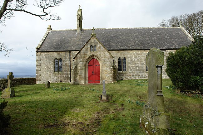
We then retraced the bus route back up the river to Ogmore. Here there was a footbridge across the river that led to a delightful little hamlet of thatched cottages and old church in a sheltered woodland setting. A lane led to a castle. In the car park we crossed onto a sandy path whilst failing to set eyes of the castle itself. This sandy path got sandier and sandier as we cut back towards the river and we ended up skirting round a system of large dunes. Or we though they were large as we had no idea what was to come. So after 90 minutes of walking, and with 4.5 miles on our GPS, we ended up about 200 yards from where we had started, but on the opposite bank of the estuary. Oh for the courage to wade rivers!

Just as a shower of rain came in from the sea, the waymarked route led us onto a large stretch of exposed beach which, as it was low tide, made easy going until we came to a rock shelf that blocked further progress. The official path then continued behind the dunes until we could descend once more onto the beach and the final run in to a holiday park. At a lifeboat station, a lovely but deserted sandy beach opened up, Sandy Bay, and we crossed this to reach Porthcawl harbour and town centre. As the rain eased, we turned away from the sea to find our accommodation for the night and prepare ourselves for our first sally into the drinking dens of South Wales,

Ogmore by Sea dep. 13.55, Porthcawl arr. 16.52   GPS 8.38 miles in 2hr 56m 37s

We stayed in the Butterfly Guest house, Mary Street, Porthcawl. We were recommended the Lorelei Hotel as the best real ale in town, a superb Golden Arrow (4.5%) from Cottage Brewing in Somerset. We then moved on to the Royal Oak for a meal of belly pork followed by strawberry sponge and ice cream. I had to make do with Doom Bar (4.0%) and Ruddles County (4.7%).

 
Tuesday 20th September 2016          Porthcawl - Swansea
TATA for Now

The weather was clear; the sky was blue as we made our way back to the sea front. The promenade looked lovely in the morning sunshine. As we approached the golf course, the view down the coast opened up. The dominant feature was the distant steel works and its periodic plumes of steam. But in the foreground was Sker House, a dark yellow colour, lit up by the low sun, And the smoke and steam seemed to be emanating from its chimneys!

Beyond Sker House, we broke out onto Kenfig Burrows, a huge area of grass-covered dunes, now a nature reserve. We knew that a footbridge had been missing last year and we certainly did not wish to take the inland option for this section of the coast path. So it was some relief to come to a brand new and very sturdy wooden structure that took us out of the burrows and up a sunken sandy path around a complex area of dunes. We started to encounter signs of industrial use as we passed through new growths of woodland on old railway sidings. Eventually the route brought us to actively-used sidings at the entrance to the steel works and then across the main line. The pleasant part of the day was over.

To get round the TATA steel works, we started alongside a busy dual carriageway, and then dived through a ginnel into a long stretch of suburban housing in Margam. After what seemed an age, we broke out of the housing estates and back onto the dual carriageway and continued passed several roundabouts. Eventually we crossed a river bridge and were able to turn back through Port Talbot towards the sea. What a relief it was to hit the promenade at Aberavon and walk by the sea once more. It was also a relief to see a coffee shop. We were in need of something to revive the spirits. A custard slice and cappuccino were just the thing and, after a 30 minute break, we donned our sacks and venture back onto the prom. Here we met a young man, Tom Davies, who was walking in ten weeks what we were proposed to do in twelve years. He was circumnavigating Wales in a single contiguous expedition, camping where he could and encouraging charitable donations for Alzheimer’s Research. I shall follow his progress with a passion.

The waymarked route took us onto the beach at the end of the promenade. It is always easier to see the signs onto the beach than off it again. In the absence of any indication of a route through the dunes, even though the map indicated one, we continued on easy wet sand to the mouth of the river and then inland up the estuary. We thus avoided any dunes but found ourselves in increasingly softer mud and running side streams. We aimed at a pipe line that came out of an industrial plant on a raised gantry. Passing under this pipeline we reached a track that was above high water so were able to make fast progress once again towards the two bridges across the river. The route passes under the motorway and up to the A-road and then across the bridge.

On the other side, we found ourselves alongside a very busy A-road and it seemed a long time before we were able to turn off this and head inland towards Jersey Marine. Here we picked up the tow path of an old canal, the Tennant Canal, This quickly became totally overgrown and impassable but the path swung away onto a cycle route that took us most of the way into Swansea. The main road was re-crossed on a bridge which is now a bus lane and which took us into new developments around the docklands. Here on the edge of a huge dock was our hotel for the night. It had been a long and sometimes depressing day.

Porthcawl dep. 08.50, Swansea arr. 16.20   GPS 22.52 miles in 7hr 01m 46s moving plus a 25 minute café stop on the promenade at Aberavon (13.00-13.25)..

We stayed at the Premier Inn on the Waterfront in Swansea. This was very handy for the city centre and in particular for Wind Street and its eating houses. We found a Weatherspoon’s, the Bank Statement, and I had a huge lamb shank to offset the rigours of the day. I so enjoyed this that I celebrated with pancakes and ice cream, all washed down with beer from a local Swansea brewery, Boss Brewing. I sampled Boss Blaze (4.5%) and Boss Brave (an IPA at 5.5% this helped me sleep).


Wednesday 21st September 2016     Swansea – Port Eynon
Mumble in the Dunes

Being in a hotel, we took the opportunity of a very early breakfast and were standing on the dockside with sacks on backs before 8.30am. The city looked lovely in the bright morning sunshine with a clarity of light that was almost Mediterranean.  Even though some drizzle came in from the sea, this impression of a Riviera coast continued along the promenade and cycle path, passed the University and all the way to the Mumbles. Here, with its quiet harbour and coffee shops, looked the perfect place for a morning stop but it was far too early and, on reaching the pier and lifeboat station, we turned up a flight of steps and out onto a high headland. We entered a different world. The dramatic Gower coastline opened up in front of us, the wind was in our faces and an exhilarating feeling overtook us. The first part of the coast path was tarmac and it was easy going around the headlands and bays. We had set ourselves the challenge of walking ten miles before succumbing to the teas shops and Caswell Bay met these criteria perfectly as we dropped into the Surfside café for Victoria sponge and orange polenta.

We took the high tide route (no choice) out of the Caswell Bay along a road that was closed to cars due to some roadworks. We slipped between the diggers and  along a wild section of cliff path that climbed and fell through the overgrown undercliff. The first drop was into Brandy Cove where we met a couple of journalist taking photographs (‘a busman’s holiday’ one said). We struggle to find the route out of the cove and had to ask a resident of the beachside cottage. Then the journalists returned to show us where we had gone wrong and we were soon, after posing for a photo, scrambling up through the dense woodland. It was slow going to get over a high headland but then we speeded up again on a long grassy descent to the road which we followed to Southgate. Here we met a large party of Duke of Edinburgh contenders all looking relieved to be finishing in the village. We carried on across open grassland grazed by cattle of a breed I did not recognise. This led us to a descent into a huge dune system the like of which I had not seen since a holiday in Namibia. I ended up almost crag-bound high above a river estuary at Three Cliff Bay. Whilst I was working out a decent strategy, an adder crawled across the path in front of Phil. Eventually we were able to scree-run (sand run) the last few feet onto the estuary mud. We plodded across the wet estuary to reach a set of stepping stones. Here we had to wait for a large party of Russian children to cross before we could take our turn. The next section will stay long in our memory. The way-markings pointed to a sandy gully and we embarked on a massive climb up the dry sand to the top of the next headland. It went on and on, still more sand and still more climbing. It was a wonderful moment when we pulled out on a flat grass plateau and into the sunshine,

After this amazing climb, the route was a lot easier. A grassy cliff-top track led gradually down through some woodland and out into a most delightful nature reserve, Nicholaston Burrows, a flat and grassy area of sand, crawling with wildlife. We found truffles under an oak tree, some lovely cranesbills, probably the Bloody Cranesbill, and a bright red dragon fly. This section ended in a wooden footbridge which took us on to a vast beach. Easy walking on firm flat sand took us to Oxwich Bay and our second stop of the day (I must be getting soft). We sat at a beach-side kiosk and had freshly-made sandwiches and piping hot tea. This gave us the strength for the final pull of a long day.

A short walk at sea level through the woods brought us to a church entire hidden in the trees. St Illtyd’s Church was at the foot of some steps, well over 200, I believe, that led up wooded hillside. A short flat section then ended in a descent back to sea level down what I assume would be an equal number of steps (not so, says the guidebook). It was a sting in the tail at the end of a strenuous day. So we were glad of an easy finish along a grassy shelf between the cliffs and the sea. One diversion delayed us briefly but we were soon traipsing into Port Eynon where we had to ring our host for the evening to find our b&b. It was right opposite the pub. There is a God!

Swansea dep. 08.36, Port Eynon arr. 17.40, GPS 23.64 miles in 8hrs 26m 08s walking time plus a morning coffee stop at Caswell Bay (11.30-11.55) and a very late lunch break in Oxwich Bay (15.00-15.30).

We stayed in the Rickyard in Port Eynon and ate across the road at the Ship Inn. I could not resist the fish and chips and I then tucked away a stick toffee pudding. It was our first taste of Gower Gold (4.5%) from the Gower Brewery in Swansea. I finished with a swift half of Gower Power (5.5%) .

Thursday 22nd September 2016       Port Eynon – Llanmadoc
The Worm has Turned

The scheduled mileage was not so great today so we could have a later and more leisurely breakfast and a more sedate start. It was another beautiful morning. We had been blessed with perfect weather for walking. The waymarked coast path led us briefly onto the beach. Then an easy climb on grassy slopes took us out to Port Eynon Point and back into dramatic coastal scenery. The first hour was over superb clifftop grassland and it was here that we had a most interesting encounter with a rare bird. Coming round a shallow depression, we were greeted by a chough feeding on the slope just 20 yards ahead. I have never seen a chough this close before and certainly never been able to watch one on the ground for several minutes. Then it was time to move on and disturb this bird, only to walk into a raven sitting on the next headland, honking and croaking at us.

Worms Head now came into view ahead of us and the last half mile dropped down into a dip and then climbed up and out onto a huge grassy headland which led us to the cliff edge and the tip of the Gower Peninsular. We stopped for photos and chats with passers-by and then walked over to the coast watch station and spent a few minutes talking to the two lady watch-keepers. They congratulated us on our bright shirts, ‘easier to see you’. We signed their visitors book and moved on up to Rhossili village and a coffee and cake stop. The café provided a splendid view of Rhossili beach and the afternoon ahead.

The afternoon session began with a scenic high-level path that contoured along the hillside parallel to the beach. Eventually we arrived at sea level and headed back into the dunes and  sand. We avoided some of this by taking to the beach but, at Spaniard Rocks, we had to clamber up onto the rocky foreshore and then steeply up more big dunes. A brief drop to cross behind Broughton Bay was just a prelude to the last climb of the day up yet another dune where the magnificent spectacle of Whiteford Burrows opened out. The descent to the burrows was through some woodland but this led us out onto a flat grassy nature reserve where we found what the interpretive board told us was an oil beetle. As usual the route took to the beach and we had a very long tramp, two miles or so, to Whiteford Point and its cast iron lighthouse. We rounded the point at the high water level and turned east and south east looking for a waymarked route back round the woods. In the end we just headed into the dunes and soon picked up a trod that led us to where we needed to be, a waymarked trod to the east of a long line of plantations. Eventually this came out onto a track which led us to a three way signpost with the coast path signed in all three directions. We took the long loop towards Llanmadoc church where we enquired of the whereabouts of our b&b. This turned out to be half a mile back towards the pub and could probably have been reached by a more direct route. However, one of the footpaths had been closed and diversion signs were taking us towards our overnight accommodation, attractively near the pub. Our host provided tea and cake and gave us a warm reception.

Port Eynon dep. 08.52, Llanmadoc arr. 16.40, GPS 19.07 miles in 7hr 21m 28s walking time plus a 30 min break at Worms Head and another 30 minutes in the café at Rhossili.

We overnighted at Tallizmand b&b in Llanmadoc and ate at the Britannia Inn just down the road.  Steak and Gower Ale Pie was followed by bread and butter pudding. The Gower Gold (4.5%) was like meeting an old friend. I also tasted the HPA (4.0%) from the Wye Valley Brewery in Stoke Lacy.


Friday 23rd September 2016             Llanmadoc - Llanelli
Marshes and Estuary

We had a problem in persuading our host to provide an 8am breakfast. We had a train to catch and needed an earlier start than their normal breakfast time would provide, But he relented and with great humour cooked us a lovely fry-up and saw us on our way. It was raining as we ventured outside and waterproofs where worn for the first hour or so. The way-markers took us along the road into Cheriton and then back to the edge of the marshes. This seemed a long way round but, in view of the footpath closure and diversion, it seemed sensible to do as we were told.

The overnight rain had made the path along the marsh rather muddy and slippery. This was not improved by the fact that sheep also used this fringe path and had churned it up quite badly. The initial section was along vast salt marsh, the flatness of landscapes a contrast to our days in dunes and on cliff tops. After the village of Llandimore, the route left the marsh and took to fields and woodland. Then at Llanrhidian, we were on a narrow road, always with the marshland to our left. There was evidence that high tides can flood this road and the coast track that circles around Crofty village. Suddenly the marshes were finished and we were on a busy main road to Pen-clywdd, the only point of interest being the wide flowers planted in the verge. The village provide us with a coffee shop and a short rest.

The sun was now shining brightly and it was turning into a warm afternoon. The exit from Pen-clywdd was on pavement and then a pleasant cycle track that wandered below the busy road. We followed this to it conclusion which was well past the point on the map where the official route goes right over some farm land. We had seen no signs for this rather strange detour so we ignored it and continued down the road into Gowerton. We had always assumed the it was ‘de regueur’ for a coast path to follow the nearest suitable path to the sea. This formula would have established a definitive route as the signed North Gower Cycle Route and then taking in a path to the left which cut a corner off the road route. There would be no way of avoiding a dangerous short section of busy rat-runs that took us off the Gower and up to the railway and main road. A path beside the A484 took us through another area where the local council had planted wildflowers, a wonderful sight for sore eyes (or was it feet). Loughor Castle stood to our right on a very step mound. I could not resist shinning up it and slipping down the steep grass on the other side to the road bridge. Phil who had stayed on the path got lost in a housing estate and failed to appear for some time.

The signed route took us through a much larger housing estate on the other side of the river. This aimed at a car park and a walkway that crossed the main road via a footbridge. The last six miles or so were along a tarmac cycle path which wound its way round sewerage works, wetland centres and golf courses before pulling round a rather ghastly housing development which we had seen from the other side of the estuary. This had been built on reclaimed industrial land and the streets bore names like ‘Copperhouse Road’. There was a point on the Llanelli peripheral road where we were at the nearest point to the station, We took photos of our end point for the year and turned right to find the station and somewhere to eat. We found the station but little else. The town looked totally rundown with cafes and pubs closed and in some cases boarded up. I went back for some fish and chips and we sat overlooking some derelict land and changed our shoes ready for the trip home. The station was shut up and there were no toilets on the platform. I cannot recommend Llanelli as the perfect end to a long walk.

Llanmadoc dep. 08.50, Llanelli arr.16.00, Llanelli Station arr. 16.20, GPS 21.31 miles in 6hrs 54m 40s walking time with a stop in Café Cariad in Pen-clywdd (12.00 – 12.25). .

Aftermath

We caught the 17.26 Arriva Wales train back to Cheshire. This two coach unit stopped everywhere and seemed to take us on a tour round South Wales and through two years of our walking history. We feasted our eyes on the female flesh travelling into Cardiff for a Friday night out and then fell into conversation with a lady from Surrey who was travelling to Ludlow to spend the weekend with her mother. Eventually we came into Wilmslow and it seemed a long walk to reach my wife waiting in the station car park.
 
Thus ended the second part of our ten-year project to walk round the Welsh coast (twelve years if we manage Offa’s Dyke to complete the circumnavigation). The Gower is behind us and some it, especially Worms Head, will remain a wonderful memory. If we had one surprise, it was the sand dunes. We had not expected so much loose sand and such huge dunes to have to climb. Let’s hope we have emptied our shoes for the last time this year.


Friday 19 August 2016

St Oswald's Way

Hexham – Lindisfarne, 6th – 10th August 2016

Introduction
Friday 5th August 2016

I was getting desperate for a good walk but the weather this summer has not been conducive. It had not turned out to be the monsoon season forecast by climate change models; just day after day of grey skies and drizzle. Then suddenly there was a hint of high pressure offering a weekend of sunshine. So, on the spur of the moment, I grabbed my guidebook to the St Oswald’s Way, spent a morning on-line booking the hotels and b&b’s, bought my train tickets and packed my rucksack. 48 hours later I was on the train to Carlisle and Hexham.

The tide tables determined which direction I was to walk in. The afternoon low tides made it more suitable for a late finish of the northward walk rather than an early start needed for a north-south journey. I was really pleased and pretty amazed I had managed to get the accommodation sorted out at such a busy time in the holiday season. Then I got a phone call from the Knowesgate Inn telling me that, although I had booked a room and had a receipt, they had no accommodation for me. I could either panic and cancel, or stay cool and carry on in the hope that a bed would be found.  Then it was off to the station and into the unknown. I travelled via Manchester Piccadilly and Carlisle to catch an early evening train to Hexham, The promised better weather was beginning to appear.

I stayed at the Station Inn in Hexham. My meal was spicy chicken, chips and peas and the beer was the excellent Allendale Golden Plover (4%).


Saturday 6th August 2016     Hexham - Knowesgate
Heaven on the Wall

It was a beautiful morning, just as forecast. I went up into Hexham town centre to find an ATM and the bus station. As I was so early, I decided to forsake public transport and walk up to the official start at Heavenfield. So I turned back across the railway line and crossed the Tyne. The Pennine Journey route was marked on my map so I initially followed this to the footbridge across the A69 and beyond. The map was then rather confusing and I found myself on a lane rather than in a field. But it revealed a gem of an old church, St John of Beverley near Acomb. I spent a few minutes in the church in quiet contemplation and then came out to talk to a lady, Sheila Smith, who had just finished writing a history of the church and is in the process of getting it published. She suggested that I write to the rectory next year to get a copy. Amazingly this was the very day of an annual pilgrimage from Hexham Abbey up to the chapel at Heavenfield to mark the anniversary of St Oswald’s death in battle (5th August 642). 

Then it was onwards and upwards along the very quiet lanes until I could cut across some fields up to the road along Hadrian’s Wall. I had to deviate westward for a few hundred yards to get access to the Hadrian’s Wall Path but I was soon heading in the right direction up to the large cross and chapel at Heavenfield. Here a couple were struggling to erect a small marquis from which to sell teas to the afternoon pilgrims. I could not wait; I had a long day in front of me. So, after a brief glance inside the chapel and then offering a helping hand in the tent erection process, I set out along the National Trail. This I followed for five or six miles to Halton Shields where my Way turned northwards along field paths passed at old windmill and into to Great Whittington. Here the pub, a Chinese restaurant, was closed. It was getting hot now and, in the total absence of any refreshment emporium, I sat on the grass for a few moments near to Click ‘em In Farm. The route-finding across the next hill was rather tricky but I eventually found the correct line and dropped down to a road and war memorial. Here a runner came towards me, a lad reccying the route for a race along its entire length next month. Two more miles of road took me to Little Bavington where a series of field paths led uphill passed Clay Walls Farm. Here, coming towards me through a herd of very frisky cattle, was another runner making the same reccy. He has the courtesy to come turn back with me and help me through the rampant beasts.  More farmland was crossed until I could see Kirkwhelpington ahead and on the hill above it, my destination. The rough ground up this last hill was not my most pleasant memory of the day but I was soon on the lane that led to the hotel at Knowesgate.

Hexham dep. 08.45, Knowesgate arr. 17.25   GPS 23.93 miles in 8hr 16m 57s moving plus a 10 min lunch stop near Great Whittington.

I stayed at the Knowesgate Inn which did have a room ready for me despite my worst fears. This hotel has gained a poor reputation and it is not the Ritz. It is a roadside inn that it developing as a motel. I found it fun to stay there and I enjoyed a great meal of lamb shank. The only real ale was in bottles (Doombar 4%) but I was desperate so I had two.
 

Sunday 7th August 2016       Knowesgate – Weldon
With a Following Wind

A great wind had arisen during the night and it looked quite wild from the breakfast table. So I donned a waterproof before venturing outside but the rain held off and it acted more as a windproof. I was blown across the high farmland and passed the plantations. Eventually I arrived at the entrance to Harwood Forest and, from thereon, it was more sheltered. The route through the forest was mostly on wide tracks although there were a couple of sections on narrow overgrown paths. The way rose gentle until it suddenly exited the forest at the highest point on the entire five days. I burst out of the trees at Cairn Coquet onto magnificent mountain scenery with Simonside away to the left. The section across to Spylaw Farm was probably the best of the whole route. Then it was down to the car park at Lordenshaws and round the iron-age fort to reach the final steep descent into Rothbury. Crossing the bridge, I was faced with an attractive looking café (Tomlinson’s) and was soon ensconced with coffee and scones.

The short afternoon section began by re-crossing the bridge and proceeding along a road and old railway line along the right bank of the River Coquet. The route did not follow the river but scrambled up and down surrounding countryside to steer in a straight line as the river meandered on its way. After passing several farms, a farm track led to a lane and a short section on tarmac. The last couple of miles into Weldon Bridge looked simple on the map but caused me a few route-finding problems. I ended up asking the way from a very helpful local who invited me to climb her garden fence to get back onto the right of way. The last area of woodland, passing a weir in the river, was very fiddly and I was quite relieved to pull out onto the road and cross the old bridge. The hotel was immediately on the other side.

Knowesgate dep. 08.42, Weldon arr. 16.40, GPS 21.10 miles in 7hrs 31m 00s walking time plus a 35 minute lunch stop (13.45-14.20) in Rothbury.

I stayed at the Anglers Arms in Weldon, having a magnificent meal of belly pork and blue cheese sauce followed by ginger sponge and custard. The Hobgoblin Gold (4.5%) was very well kept on hand pump. A truly wonderful hotel.

Monday 8th August 2016    Weldon – Alnmouth
Medieval Tournaments

A storm had raged all through the night. At one point I got up to close the bedroom windows as the howling wind was shaking the room. But the sun was shining as I left the hotel and there was not a cloud in the sky. The first few yards were not consistent with the guide book. The signed route went under the A697 on an anglers' path along the riverbank before turning uphill back to the farm track. This was followed for some way and it was very easy going compared with yesterday. Except for one section of overgrown path, the section to Felton was a walk in the park. In fact that was just where it ended up, passing under the A1 and out into Felton Park with its peaceful old church in the trees to the left. I immediately came upon another church, this one being the parish church noticeable for its very low roof over the nave. Keeping to my pilgrimage objectives, I spend five minutes inside before descending to the attractive bridge over the river. The route continued along the right bank of the river into a very flat section of farm tracks, fields and narrow lanes. I passed under the East Coast Main Line which was to feature again later in my journey. Then the way turned left onto a tarmacked bridleway which led directly into Warkworth. I could see the castle up ahead with its flag flying in the sunshine. The castle was pack out with visitors watching re-enactments of medieval tournaments. However I could still buy a ticket to view the castle and I spent a wonderful half hour watching the pageants from the majestic old keep. Then it was a quick dash into town to get a coffee and Victoria sponge cake.

 
I crossed the River Coquet for the last time and climbed a steep hill towards the golf course and the sea. This dropped me through a car park and on to a huge sandy beach and the Northumberland Coast Path. I was to follow this for the rest of my trip. I was faced with a two mile plod up firm sand close to the water. This took me right up to the River Aln as it flowed in a channel across the beach and out to sea. The town of Alnmouth was tantalisingly close across the water. I could almost reach out and touch it. In retrospect I should have taken my shoes and socks off and waded across. I was later told by my landlady that this would have been quite safe. But I did not know the depth and flow rate of the river so I turned inland and followed the official route for three miles round to the main bridge. So, an hour later than I needed to have been, I arrived at my b&b. I had a quick shower and changed so I could take a look round this lovely village, but as soon as I started my tour it started to rain. So I was driven into a pub to shelter. What can a man do?

Weldon dep. 09.14, Alnmouth arr. 16.20, GPS 17.47 miles in 6hr 04m 30s walking time plus a 70 min break in Warkworth to see the castle and have some refreshments.

I stayed at the Old Granary in Northumberland Street in Alnmouth. I ate at the Sun Inn, duck confit with a couple of pints of Golden Sheep (4.7%) from Black Sheep Brewery.

 
Tuesday 9th August 2016    Alnmouth – Seahouses
Pub and Castle

Last night’s rain had cleared as I set out under blue skies into a chill north westerly. This blew in cloud and light drizzle as the day went on and I ended up wearing my waterproof (just to keep warm). The route left Alnmouth over two golf courses, the second of these, Foxton Hall, led me back to the beach. I tramped up the wet sand to Boulmer and then went ashore onto wonderful grassy tracks round headland after headland. This brought me to Craster where the smoke was seeping out of the roof of the fish-smoking house. I hope they have got authorisations for the air emissions.

Beyond Craster, the way is over well-walked grassland dominated by the view of Dunstanburgh Castle on the next headland. It must be one of the most evocative sights in England. There was little point in stopping to view the ruin: it is best seen from a distance. So I hurried on into a wetting drizzle and quickly came round to the tiny hamlet of Low Newton and shot into the Ship Inn with is Brewhouse. I tried a pint of their home brew and sat outside with a bag of peanuts. But it was too cold to sit for long and there was more drizzle in the air.

I continued along the coast path passing several groups of youngsters practising for their Duke of Edinburgh’s next month. More grass and golf courses took me to Beadnell, a not very attractive village of bungalows facing the sea. I took to the beach again north of the last house to avoid two miles of road walking and then had to scramble up through the dunes back to the road to get over the next stream. A fun-fare was making a racket as I entered Seahouses and here I turned right over another golf course to reach the last headland before the harbour. I followed Main Street through the town centre and out to the edge of town to find my accommodation for the night. I showered and changed so that I could have a quick look around the shops and harbour, but I easily succumbed to temptation and slipped into the Olde Ship Inn for a pint. 

Alnmouth dep. 08.54, Seahouses arr. 15.35, GPS 18.31 miles in 6hrs 13m 38s walking time with a pub stop at the Ship in Low Newton (13.30 – 14.10). Drank a pint of Sandcastles at Dawn (3.8%) brewed at the pub.

I stayed at Ugiebrae, Main Street, Seahouses. I had a drink in the Olde Ship Inn, Sundancer (3.5%) from High House Farm Brewery and ate at the Spice Garden Indian Restaurant (yes, you’ve guessed, it was Cobra beer!)

 
Wednesday 10th August 2016    Seahouses - Lindisfarne
End of a Pilgrimage

I was early down for breakfast with my rucksack packed and ready to go. There was to be no easy start today. I had a bus to catch! I strode up the old railway line out of Seahouses, seeking the inland route over to Bamburgh. This was a mixture of fields and lanes, with little sign of them ever being used. Most walkers must go down the foreshore. I found myself on the road beside the castle which was a dominant feature above the village. I took the unofficial way across the cricket pitch and through the dunes but I was soon back on the road to the golf course. I crossed the course to Budle Point and then turned inland following the signs. I then met a section with clear metal signs taking me across and out of a caravan site. This left me on a lane which led up to the very busy B1342 where I had to turn left back towards Bamburgh to pick up the route again. I probably put on an extra half a mile in getting round this dubious unofficial diversion. Then there was a fiddley section around Wetton Mill before I got back onto a field path with a purpose.

I followed a series of roller-coaster fields until I could see Belford below me. I headed down to a crossing of the east coast main line which instructed me to ring the nearby signal box before crossing. I then came across the A1 with standing traffic following an accident: Through the village it was quiet and then I left town via Westhall after which I made a pig's ear of route finding up to Plantation Farm. Although there was no trod on the ground the way to Swinhoe Farm was more obvious. I then picked up a wide forest track that wound passed some reservoirs. Here I had my only stop of the day, just a ‘splash and dash’.

Just beyond this point, the route was joined by St Cuthbert’s Way which I followed down through fields and woods out onto the lane to Fenwick  Here it started raining in earnest and I was fully coated in rain-proofs as I crossed the A1 and came upon a party of Germans waiting to re-cross the east coast main line. Again the signalman was rung but this time the answer was ‘nein’. The Germans were momentarily confused but soon realised why when a Virgin train thundered passed on its way to Kings Cross. A second ‘phone call gave us the all clear and I was away passed the party of walkers and heading for the causeway. It would probably have been safe to cross the staked line across the sands but it was raining again and the route looked very wet and muddy. So I chickened out and set out along the busy road. I was soon able to get off tarmac onto the verge. The town of Lindisfarne took an age to get closer as the causeway curved around in a great arch. But eventually, with the rain now quite heavy, I came to the last bend before the packed car park. I continued quickly passed and on to the Priory where I gave my thanks to St Aidan for a pilgrimage safely and successfully completed.

Seahouses dep. 08.24, Lindisfarne Priory arr. 16.04, GPS 23.82 in 7hrs 36min 40sec walking time and a five minute break for an energy gel.

 
Aftermath

I changed out of my wet walking clothes in the gents’ toilet. Then I checked the bus times and went across the road for a coffee and carrot cake. Leaving it late to go out into the rain once more, I got back to the bus stop to find a long queue. For a few moments I thought I was in danger of not getting on but the bus driver packed us all in with standing room only for several passengers. I had been chatting in the queue with John from Hull who was also desperate to get off the island and catch a train. So when the bus pulled into the station car park at Berwick, he and I shot into the nearest pub for a very quick pint, Belhaven (it is near Scotland!), but I was dying of thirst. Back on the platform, John and I parted, he to go south and me to take a Cross-country Train to Glasgow Central. This was generally on schedule and I had time to get another ticket and jump on a Scot rail train to Ayr to visit my daughter and grandchildren.

I had walked 104 miles on a very diverse route of moor and mountain, river bank and coast path. I now needed a rest but was unsure whether a few days with the grandkids was going to provide it.

Monday 13 June 2016

The Far North

Kinbrace – John O’Groats, 3rd – 6th June 2016
 
Introduction
Thursday 2nd June 2016

So here we are at last, after what seems a lifetime of walking, ready for the very last leg of our epic journey. I sat at Glasgow Central eating a sandwich and waiting for Mike. I had spent the previous week with my daughter and her family in Ayr and was meeting Mike in Glasgow to head north with him to Perth and Inverness. At first I was not going to ring him. After all, I had sent him all the train bookings and the changes from the original schedule that the closure of Queen Street had brought about. But as an afterthought I gave him a quick bell. The horror of it! He had registered the change of station but not the change of times. He was sunning himself on the river bank unaware that the Perth train was just about to depart. I was standing by the barriers wondering where to leave his tickets when he raced into the station. It took me several hours to calm down.

The change of trains in Perth was smooth and uneventful, except for the lack of toilets out on the platforms. A pleasant couple kept us in conversation on the way north and  time flew by as we rattled through the Cairngorms. Timetables showed that the fastest way to get up to Helmsdale was by bus. So we walked round to the bus station and booked onto the last bus north. We were soon driving rapidly up the east coast into rather cloudy and threatening weather. All the beautiful sunshine of the west coast had been left behind. 

We stayed at Kindale House in Lilleshall Street and ate at La Mirage, a pleasant restaurant with a history (Nancy Sinclair, Barbara Cartland and TV Programmes). I had battered haddock and chips and a couple of bottles of Northern Light (4.0%) from Orkney Brewery. After our meal we walked round the village in the drizzle and stared with amazement at the yellow-coloured hillsides of gorse and broom.

 
Friday 3rd June 2016     Kinbrace - Melvich
Flow Country

I was getting used to sunshine so it was a disappointment to wake up to cloud and drizzle. After a huge breakfast, I grabbed a sandwich from the Spar supermarket and walked up to the station to await the first train of the day. This took us to Kinbrace and the end point of last year’s expedition. The last leg of our walk was underway.

The first seven miles to Forsinard were mostly uphill. The final mile down to the station and RSPB reserve was hidden in mist. In the very early planning phase, I had hoped to use the hotel. But this had closed long ago and looks unlikely to open soon. There was a cottage next to the station that offered b&b and drinks but it did not look any livelier. The visitor centre did not offer any refreshments, just details of birding walks up to viewpoints that were today deep in wet cloud. The main feature was the number of landholdings that contained the notice ‘RSPB not welcome here’. This was obviously an organisation which was rather weak on its ‘good neighbour policy’.

Another four miles of road, this time downhill, brought us to a small parking area at Forsinain. Here we sat and ate our butties and gave our road-weary legs a short break. We then took the first opportunity to get off the road. This was a footpath marked on the map at Breacrie, two miles to the north. But this diversion was not a success. There was no sign of a route across boggy ground and rough fields. Even a high gate through a deer fence was wedged shut and had to be climbed and a rickety old bridge could only be accessed through a gorse bush. But we eventually got back onto tarmac along the west side of the river, passing Trantlemore and Upper Bighouse. It was reassuring to meet a footpath sign at the end of the lane, indicating an official route to Kirkton. However it was not easy to find and we had to turn from our first choice of track to get back on line. The path got clearer as we approached the bealach and it was a clear track on its descent to the river.

There was a cemetery in a rather remote place, a small walled enclosure on a steep bank. A sign said that it contained some Commonwealth War Graves. How strange. Kirkton was a one house hamlet so it was swiftly onwards to pass a working quarry and gain the main coast road. In half a mile we were at the pub, asking where our b&b was and organising a meal for later. Then it was on to the far end of the village of Melvich to find our accommodation for the night, a room with a view, and a delightful Swiss host.   

Kinbrace dep. 10.18, Melvich arr. 17.45   GPS 22.71 miles in 7hr 10m 36s including a 13 min lunch stop in Forsinain Car Park.

We stayed at the Shieling B&B. The meal was at the Halladale Inn where I had fish and chips again. This time though, I managed a pudding of ginger sponge and cream. The beer was bottled Dark Island (4.6%) from Orkney Brewery. Before we could settle for a session, quiz night preparations began and tables and chairs were being relocated.  We were being accosted by a most assertive lady about our taking part in the quiz. It was time to go back to the digs. As we left the pub we saw a notice about the closure of the footbridge across the river, our planned route for tomorrow.
 

Saturday 4th June 2016       Melvich – Dunnet
From Nuclear to Wind Power

We sought advice from our landlord on the status of the footbridge across the river, the off-road and shortest option for our route for the day. He suggested that the locals were still using it but we should be careful. This proved the case. We dropped down the lane to the beach and climbed over an insubstantial wooden barrier to pass a sign asking us to cross with care.

This took us through the grounds of Bighouse and on up its access road. Then we broke out across the moor and a faint but obvious line. It did not remain obvious for long and we soon decided to abandon the off-road option and to make for the main coast road. . We spend at least five miles on this quite busy road, uphill at first, crossing our last county boundary (into Caithness) and then dropping down into the village of Reay. A shop provided a butty for the day and then we left the village passed a well-kept golf course. The white globe of Dounreay was now dominating the view towards the coast. However, rather than trail passed the nuclear facility on the main road, we chose an inland option along what appear from the map to be a narrower quieter lane (suggested cycle route). However this did not prove the case. It was a wide straight rat run that attracted fast moving vehicles looking for the same short cut. The hillside ahead of us was covered with wind turbines, most of them working quite hard in the gentle breeze. It seemed to take us an age to pass this wind farm.Our old friend, Balfour Beatty, was installing a new transmission line to get the power onto the National Grid. We later learnt that all the newly installed renewable generation was transmitted to a sub-station in the south of Caithness and then cabled under the sea to Peterhead and onwards down the Angus coast.

We rested briefly by the roadside in the village of Westfield and ate our butties. Then we had a five mile road walk into Thurso and the promise of a coffee shop. After days in the wilderness, it seemed strange to walk into a sizeable town passed shops, schools, and a hospital and railway station. We were right in the town centre before we found a café. I feasted on cappuccino and a ‘yumyum’, a chocolate-coated cake.

We walked through the pedestrianised street and enquired of a local the route to a footbridge over the river that was indicated on the map. We then made further enquiries from dog-walkers to ensure we found the coast path out of town and passed the castle. It was a relief to get back to real coast walking again. The path clung to the field edge above the rocky shoreline. A girl, walking strongly ahead, gave us confidence to stay on the low cliffs after the path came to an end. We followed her for some time before she stopped to allow us to catch her. She then explained that she was lost as well. She was a French student making a tour of Scotland after a year at an Edinburgh college. The three of us then proceeded along an increasing narrow trod until we pulled round into a sand cove, Murkle Bay. We left the young lady here and dropped onto the beach. The short cut along the water line brought us to the foot of some grassy cliffs. An awkward climb revealed that a coastal continuation was not a possibility. To make progress, we had to climb a barbed wire fence into a large field. In the end, a series of fences persuade us to abandon the coastal option and to turn inland to pick up a farm track at East Murkle. This track soon led us back to the coast and round to the tiny harbour of Castlehill and an information area on the flagstones of Caithness. A lane then led us onto the main road for the last three miles into Dunnet. The lack of conversation now indicated the tiredness we both felt as we left the shore and tramped between sand dunes and forest along the busy road. 

Melvich dep.09.00, Dunnet arr. 18.30, GPS 27.36 miles in 8hrs 47m 27s walking time plus a 20 minute lunch stop (12.50-13.10) and 20 minute in Thurso coffee shop 14.35-14.55).

We stayed at the Northern Sands Hotel in Dunnet. We ate in their restaurant and I had pressed pork belly in cider jus followed by chocolate pudding. The real ale on draught was Scapa Special (4.2%) from Swannay Brewery on Orkney. This proved an exceptional beer so I found it hard to stop at two.


Sunday 5th June 2016    Dunnet – Mey
Northernmost Point

What a beautiful day! There was not a cloud in the sky as we left the hotel after an early breakfast. Round the corner we bumped into a man, wearing a ‘disaster’ base-ball cap, who directed us onto the coast path. We proceeded passed the museum at Mary Ann’s Cottage and down to the sea at Dwarwick Bay. Then there was a spectacular path up the hillside with the white house which the Queen Mother used to visit, high up above. This path climbed along the edge of steep ground and over cliffs until it then came out on high grassland white with cotton grass. We wound our way around the west side of the headland with views of Hoy opening up ahead. Eventually the lighthouse came into view and the last mile up to it was mostly uphill. This was a magical moment as we stood in the sun and took photos. We had achieved a south-north end–to-end linking up the Lizard Point in Cornwall with Britain’s northernmost point, Dunnet Head.  It had taken quite a long time to come round the coast path so far so we abandoned ideas of continuing along the eastern cliffs and instead came down the road that took a more central line.

It was really warm now. Sheltered from the light sea breeze, we were in T-shirt and shorts as we moved inland. Back through Brough, we picked up the narrow lanes that led back to the shore at Ham, then sat in a field for 10 minutes to consume some of our emergency rations. At the Crossroads Primary School we turned down another straight road to Scarfskerry from where we could see the top of the Castle of Mey with its Saltire flag flapping in the breeze. The coffee shop at the castle was still open so we dashed in for a coffee and cake. Then I took the last tour of the castle whilst Mike guarded our rucksacks. It was only a short walk up to the main road to find our accommodation for the night.

Dunnet dep. 09.30, Mey arr. 17.70, GPS 16.40 miles in 6hr 01m 53s walking time plus a 10 min break in a field for a snack (13.45-13.55) and two hours at the Castle of Mey (15.15 – 17.15).

We stayed at the Hawthorns B&B in Mey. We ate just up the road at the Castle Arms Hotel, where I feasted on steak and wine pie and apple crumble and ice cream. The real ale was all bottled but I went through their collection of Northern Light (4.0%) and Corncrake (4.1%) from Orkney Brewery and Scapa Special (4.2%) from Swannay. 


Monday 6th June 2016    Mey – John O’Groats
In My End is My Beginning

It was not quite so pleasant this morning. There was a cloud cover that we had not experienced for several days and the breeze has a cold bite to it. We could not face a walk down the main road so we cut south down a track lined with beech hedges to gain the back road, a shorter straighter route over the Hill of Rigifa. In Upper Gills a man was watering his front garden. I commented that this was a first for the Scottish Highlands and we stopped to chat. He was a Geordie who had retired here with his wife, bought a plot of land overlooking the Pentland Firth and had built his own bungalow. Onwards we marched through the village of Canisbay and back down to the coast road. We were not on this for long. We knew there was a footpath along the shoreline but were unsure where to access it. We left it until reaching a track near a b&b and found that we could have gone down to the sea earlier. So it was only a few yards, passing some garishly-painted extensions, to the hotel and into the car park and visitors’ centre of John O’Groats. We got some tourists to take our photo in front of the famous signpost then quickly moved away from this popular spot in search of a coast path to Duncansby Head.

I popped into the reception cabin for the caravan site and was advised by a most helpful gentleman that our best route was through the caravan site and out onto the short grass above the sandy shore. He warned us of a fence crossing but there was a strategically placed stile that led out onto less grazed grassland and upwards towards the lighthouse. Very quickly we got up to the small car park in front of the lighthouse and then descended round the south side of the security fence to gain the north westerly tip of Britain and the end of LE JOG, the British end-to-end walk. It might have taken us 13 or 14 years but we had finally finished. Or so I thought until I climbed up to the trig point and the view southwards along the east coast open up in front of us. What an amazing and unexpected panorama! After days of relatively flat walking along a gentle coast, suddenly we were back in a landscape of dramatic cliffs and headlands. The central features were the great Stacks of Duncansby, two magnificent sea stacks of triangular-shaped leaning rock sticking out of cliff and seascape. The cliffs were lined with nesting and resting sea birds, probably fulmars, whilst other birds, probably razorbills or guillemots sat on the sea itself. We were drawn into this wonderful coastline and wondered along the clifftops for an hour or so before reluctantly turning our backs on the North Sea and headed back across the grassy peninsular and down to John O’Groats. Just time for a coffee and cake and then it was round to the bus stop and the end of our journey. Or was it just the start!
 
Mey dep. 09.00, John O’Groats arr. 13.30, GPS 12.84 miles in 4hrs 35m 38s walking time with lots photos in John O’Groats and sightseeing around Duncansby Head..


Aftermath

The bus dropped us near Thurso town centre. We had time for a quick sandwich. Whilst we were eating, a lady came in who was walking the end-to-end (LE JOG) in one continuous journey. She had started in March and was due to finish the following day. Jill Woodman was her name. She was from Leeds and before we parted, she left us details of her charity donation site.

We then walked up to the station in good time for the train which was more that the train was for us. An engine problem with the incoming train from Wick was such that it could only go forwards. It could not come up the branch line to Thurso and then reverse out. It was waiting for us at Georgemas Junction and we passengers were bundled into two mini buses and driven the 10 or so miles down to this junction. We were eventually settled on board and set off rather late on the long journey to Inverness. The train kept on losing time to the schedule and by the time we pulled into Inverness Station, the 34 minute connection time was down to 5 minutes. We had to dash across the platforms and get into our seats on the sleeper. For the first time today we could relax and celebrate our achievements. All I had to do was walk down to the kitchens and order a beer and a meal. I was met by a very embarrassed member of the catering staff. The train had no food or beer, no warm food, no sandwiches, no nothing. We faced a nine hour trip through the night with no food. What a miracle we had had a sandwich in Thurso or we may not have survived. We were given a free cup of tea and retreated to our seats for a long hungry night.
 
At 5.30am the train pulled into Crewe Station and we were into the buffet so quickly that we had our bacon butties before the train was on its way again. We however sat in Crewe and had our breakfast and then caught the first bus home.

Tuesday 26 April 2016

The Peak District Inn Way

18th – 21st April 2016 

Introduction 

Spring takes a long time to get going now-a-days. Opportunities for multi-day walking, i.e. a sustained dry spell, did not crop up in the early part of this year so we went travelling in central America and then came home to wait for the big chance. This came in late April. I had bought some new walking shoes and socks, was in need of a good bit of mileage in my legs and did not want to go far from home. So ‘The Inn Way to the Peak District’ by Mike Reid was just the job and I set off clutching the guidebook just before the good weather was due to arrive.

 
Monday 18th April 2016     Hayfield - Hathersage
A Tough Start to the Year

An early train to Stockport enabled me to catch the 9.30am bus to Hayfield. I was walking by 10.25am, leaving the village via Kinder Road and then turning left up the steep bank at the start of the Snake Path, passing the shooting cabin, to the foot of William Clough. A long line of walkers were on the lower path passing the reservoir and I speeded up in an attempt to arrive at William Clough before them. We arrived at the same time but they kindly let me through to begin the long and tiring climb. It was overcast with a bitingly cold wind but the forecast drizzle kept away. The clough was wetter than I had expected with some sections of difficult boggy ground. I was delighted that the last shale slope had now been bypassed by a new set of steps up the steep ground to the right. .So I pulled from a vertical world onto the bleak and cold col below Mill Hill.  

Crossing the Pennine Way, I continued on towards Ashop Clough. At first this was paved and I was just beginning to think that the long descent was going to be a stroll in the park when the paving suddenly ran out and I was faced with some very deep mire. In trying to skirt it to the left, I met all sorts of problems, slipping and sliding into deeper bog. My average speed was dropping alarmingly and I was much more tired than I had anticipated. So it seemed to take an age to arrive at the plantation at the foot of Ashop Cough where the path turned left over a footbridge and up a bank to the Snake Pass Road. 

The path on the other side of the road was entirely new to me. It started off steeply uphill and then ran alongside a plantation before sharply losing all that precious height in one vertical grassy field. At the bottom, I stepped over the stream in Oyster Clough and climbed up into a lovely section of sheep-cropped farmland. This eventually dropped back to the Snake Road. The clouds had now departed and the sun was making sterling efforts to warm the Earth. So I stopped briefly near Alport Bridge and chewed a flapjack. Then, as I shinned up the ankle-breaking path towards Hope Cross, I came up to a couple from Doncaster who were trying to find the path back to Hagg Farm. We walked together for 15 minutes until their path diverted from mine. They turned left and downhill whilst I tramped onwards and upwards towards Win Hill. This always takes longer than it appears but eventually I scrambled up onto the rocky summit and touched the trig point. Then the scramble was reversed and care was taken to ensure I came off in the right direction. I could not afford to make a mistake at this stage in the day. The descent to Yorkshire Bridge was just as steep and desperate as I remembered it. I used to run down this in the dark, but alas no longer. I slipped and stumbled from tree to tree and was quite relieved when I finally fell onto the track at the bottom. 

The guidebook took me then on unknown paths, first passed the pub, up New Road and across farmland to the village of Bamford, then through quiet lanes and bridleways until Hathersage came into view below and there was a lovely drop into the village and my accommodation for the night. It had been a much tougher day than I had expected. 

Hayfield dep. 10.25, Hathersage arr. 18.00   
GPS 18.76 miles in 7hr 35m 45s

I stayed at the Scotsman’s Pack, School Lane, Hathersage, eating venison cottage pie and original Bakewell pudding and ice cream. The beer was Ringwood Boondoggle (4.2%) in fabulous condition. Or maybe I was just thirsty. 
 

Tuesday 19th April 2016       Hathersage – Youlgrave
A Walk on the Edge 

With such a big day ahead of me, I needed an early start so I requested an early breakfast. The chef was there at 8am and provided me with a lovely full English which I had ordered the previous evening. I got away before 8.45am and set off passed the church on a most magnificent morning, cool but not a cloud in the deep blue sky. The first few miles were up rolling grassy farm land and the route passed North Lees Hall, thought to be Charlotte Bronte’s model for Thornfield Hall in Jane Eyre. A pleasant wood led to higher ground and the boulder fields below Stanage. A flagged path took me through the rocks and onto the edge from where the views were wonderful.  

I then traversed the first of the edges, along a rocky and sometimes muddy path which eventually climbed slightly up to a trig point situated on a rocky outcrop. The route dropped down through the boulders onto flat moorland where a good path took me quickly to Upper Burbage Bridge. Another rocky path went over a low ridge where Higger Tor came into view. A short drop and flat path then led straight to the foot of the tor. A short pull got me onto the summit plateau which was quickly traversed. I had some problems finding the optimum route down to the Carl Wark path. Instead of coming off the south-east corner, I dropped to the right steeply through some large rocks and ended up having to traverse back to the left across the moor below. 

The suggested route does not climb up onto Carl Wark but turns east and drops down the wet slopes to cross Burbage Brook at a stone footbridge. In no time I was crossing the main road near Fox House and heading through the Longshawe Estate. A volunteer from National Trust stopped for a chat about the potential for a visit with the grandchildren. More of the estate was crossed in contouring round the moorside over more roads, passing the Grouse, and then onto the next section of the edges. It was hot and exposed on the long tramp over to Curbar Gap and I was glad of the sun-cream, Tilley hat and UV sun-glasses. By the time I had come to the Wellington Monument and slithered down the stony path into Baslow, I was more than ready for a coffee and cake. The 15 minutes or so that I spent in the Café on the Green was just sufficient to prepare me for a very long and hot afternoon.  

I have done the crossing of the Chatsworth Estate so many times that I switched onto cruise control. So when I noticed that the guidebook suggested a silly diversion up to Park Cottage, I ignored the book and tramped forever onwards along the river bank. Eventually one has to leave the river to make for Beeley church and the lovely village. After miles of flat walking, it came as quite a shock to climb up the very steep fields to Burnt Wood but I was at last in shade. An enclosed path took me back down to Rowley where a short section along the A6 took me back over the river and onto the last stage of my day’s walk.  

From now I had to concentrate on the complex navigation as the route crossed farmland and woods and up steep roads until it eventually pulled onto the top on Stanton Moor. The traverse of the moor was spoilt somewhat by the presence of three youths smoking, drinking and lounging over the Nine Ladies stone circle. So I did not have my hoped-for atmospheric pause, but kept on over the moor and eventually turning right passed the Cork Stone and down to the road. As I dropped down the delightful path behind Birchover, I noticed again that the guidebook suggested an unnecessary diversion. This I again ignored and continued down to the Druids Inn and onwards and downwards through Rocking Stone Farm and steeply down to the road. Then began another big climb up to Robin Hood’s Stride but it was getting cooler now as the sun got lower in the sky. At Harthill Moor Farm, a new diversion to the Limestone Way had been painted on the wall. It had always been a strangely unwelcoming farm so I was glad at this late stage in the day to try a new by-pass but it was not a good route. The diversion took me down the road and left into a dark plantation along a very muddy path. If it had shortened the route, I would not have minded but I ended up just the other side of the foresaid farm and with an extra half mile and inch of mud on tired legs. There were also changes in the main signed route down to Youlgrave, so someone does not like walkers around here. I crossed the brook and decided to go straight up the road to the church so I would not overshoot my pub. But I need not have bothered; the slanting path to the left would have been a more direct route. It had been a very long day. 

Hathersage dep.08.43, Youlgrave arr. 18.50
GPS 25.39 miles in 9hrs 51m 20s walking time plus 15+ minute lunch stop at Baslow (13.50-14.07). 

I stayed at the Farmyard Inn, Main Street, Youlgrave (in the cowshed). I ate fish, chips and mushy peas followed by original Bakewell pudding and ice cream. The beer was Greene King and I tried both the Marmalade on Toast (4.5%) and the IPA Gold (4.1%).

Wednesday 20th April 2016    Youlgrave – Eyam
Straightening The Route 

I made a complete mess of breakfast and an early start. I went down into the downstairs bar and sat in silence for 20 minutes before finding that breakfast was being served in a small room upstairs. So it was 9.30am before I got out of the back door of the pub and put the rucksack on in the car park. I wandered down the main street trying to find the upper end of the path slanting down into the dale. I eventually asked a local and was directed down a side street and on to the correct path. Although it was another magnificent morning, a layer of cold air sat in the bottom of the dale and made me regret putting my running shorts on. I had rarely seen Lathkill Dale looking more beautiful in the early morning sunshine and with so few people yet around. It was a blissful two hours round via Alport and up the dale to Monyash. The top end was its usual ankle-breaking self but at least the limestone boulders were dry. Rather than go round through Monyash, I cut straight across the road and up the muddy dale that by-passes the village. Here I got to looking at the proposed route in the guidebook and decided that, as I had another long day scheduled, I should take the opportunity straightening the route out. This should reduce the day by a few miles and take out a long section of road walking.  

So, after passing Monash, I went straighten on over the fields to Hard Rake and then directly down the full length of Deepdale. I saw no-one in the dale until I came out into the car park on the A6. There were more walkers around after this and by the time I got to the viaduct, there was a procession of walkers and cyclist down the old railway, the Monsal Trail. I once again declined the invitation of the guide book to cross the river and climb up to Monsal Head. I went straight onto the Monsal Trail, turned left and went quickly along to Cressbrook Mill. Here I again straightened out the route, deciding to miss out the loop into Tideswell and Litton. So I proceed up the road from the mill and then forked right into Cressbrookdale. I missed the lower path through the wood and ended up high on the hillside with a magnificent view along the upper part of the dale. This rather fortuitously by-passed a waterlogged section of the dale but it involved a long and steep grassy descent.  

I knew that the Three Stags Heads would not be open but I was taken by surprise to see a sign for a café at Wardlow Mires which changed the direction of my momentum. But, after crossing the main road and panting up through the car park, I found that this had just closed (at 3pm!!). So it was ever onwards, this time on paths I knew well, over the fields to Foolow. I had half a mind to stop at the Bull’s Head and seek accommodation but this was firmly closed until 6pm. It is a strange land we live in where the cafes closed at 3pm and the pubs do not open until 6pm. With my decisions made for me, I continued over the field path to Eyam and turned right, passing the hall and church, to reach the Miners Arms. And they had a room for me! My route straightening had reduced the schedule by four miles and made it a very manageable day in such warm and pleasant conditions. 

Youlgrave dep. 09.25, Eyam arr. 16.55
GPS 18.09 ml in 7hr 17min 34sec plus a ten minute break on the Monsal Trail. 

I stayed at the Miners’ Arms in Eyam, dining on Gressingham Duck with orange source followed by bread and butter pudding and cream. The beer was once again Greene King. I sampled the St Edmunds Gold at 4.2% and Old Speckled Hen at 4.5%. I had no problems sleeping after this.
 

Thursday 21st April 2016     Eyam – Hope
Hope to Finish Early 

I had more success finding breakfast this morning so, after a pleasant full English, I was on my way soon after 9am.It was another fabulous morning although the very steep pull onto Eyam Edge gave me two reasons for having my breath taken away. As I set out over Eyam Moor I reflected upon the fact that this was the third consecutive day without a cloud in the sky. I had only every crossed here once before and I had forgotten what a fantastic piece of countryside it is. The long gentle descent to Stoke Ford was a delight and then the pull up Abney Clough was equally enjoyable. I nearly missed the right turn in Abney hamlet but was soon on my way into a much more barren moorland landscape. The long descent to Brough was down a wide and stony track which was a bit wearisome. So it was a relief to cross the road at the bottom of the hill and get onto grassy paths once more, the first of which crossed over the site of a Roman fort. At the next road crossing just above Hope, there was a bench and I stopped momentarily for a drink of water. This proved fatal to my plans. I saw a train passing by so I looked up on my phone the times of the next train to Manchester and, lo and behold, there was one due in 20 minutes. So I made an instantaneous decision to halt my walk and go home. They say you should always finish wanting more. Working on that theory I strode into the station with a few minutes to spare and was soon sitting with my feet up staring out of the train window at some of the most beautiful countryside in the world. 

Eyam dep. 09.04, Hope Station arr. 12.30
GPS 7.94 miles in 3hrs 20m 55s   

I caught the 12.40 train to Manchester Piccadilly and was quickly heading for home.
 

Afterthoughts 

It is always a challenge to get out for the first long walk of the year and this proved a tough route. I was glad not to be too far from home so I could abandon it as and when I felt like it. The concept of the Inn Way is splendid and it provided endless choice of accommodation, food and beer. I knew many of the paths so was often tempted to straighten out what I considered pointless deviations based on people wanting shorter days. If there was one thing I learnt was not to get to fixated with following the guidebook, but to use it as a general way to facilitate a walk in one of my favourite counties. In the first good spell of spring weather, I had got 70 miles into my legs which should set me up well for the challenges of the coming year.