Wednesday 21 September 2022

Borders Abbeys Way

11th – 14th September 2022


Introduction


My wife was off to Canada to visit her cousins. My granddaughter in Scotland was celebrating her 15th birthday. Was there a way of fitting a long-distance trail in as well? I could just about manage a 68-mile circuit in the Scottish Borders if I got round in 4 days. We had the birthday meal on the Saturday night and on her birthday itself, I wished Charlotte love and best wishes and slipped out of the house into the early Sunday sunshine. The drive on empty roads across southern Scotland was a delight. By 10.15am I was parking up in Selkirk. After a quick cappuccino and scone in the Peony Rose Coffee House, it was back to Sir Walter Scott’s statue for photographs at the start of the Borders Abbeys Way (BAW).


Sunday 11th September 2022                       Selkirk - Dryburgh

Temple on the Tweed


An uphill start passed the museum and climbed up to the A7. Straight across, the gradient  eased and by the time the route turned off the road and onto the Selkirk Hills, I was on a contouring path with great views back over the town and onwards to a distant Galashiels. A beautiful section on an old drove road led to a track which dropped through some woodlands to Cauldshiels Loch. A network of narrow country lanes led down to Abbotsford House, Scott’s home on the banks of the Tweed. The visitor’s centre was right on route and here the word ‘cake’ stopped me in my tracks. The morning walk was halted by a cappuccino and lemon sponge.


The afternoon section was very different in character. Now the trail became a riverside path through woods and meadows and continued in this vein until the old chain bridge. I had crossed this earlier in the year on the Southern Upland Way. But this time my route was ahead along a quiet lane passing the rugby fields to Melrose Abbey, the first of four ruined abbeys enroute.  Having already had my café stop, I continued on a path signed ‘Newstead’  walking parallel to the river on a bank above the flood meadows. At Newstead, I turned under the main road and up a steep hill away from the river. At the top was a viewing platform and the Rhymer’s Stone, the mythical site of the Eildon Tree where Thomas the Rhymer met the Faerie Queen. An undulating, traffic-free lane took me over the ridge and down into the hamlet of Eildon and the town of Newtown St. Boswell.


A sign directed me down a side street, round the back of a garage and into Newtown Glen on a wooded path that eventually brought me back to the river. Dryburgh Bridge is another chain footbridge across the Tweed. On the north bank is a conical hill upon which stands the Temple of the Muses. I accessed this up a set of steps and a great view was to be had over the river and bridge. The rather haunting metal figures gave me time to reflect on the splendid situation. I then descended back to normality and the Dryburgh Abbey Hotel, my accommodation for the night.


Selkirk dep. 10.45, Dryburgh Abbey arr. 16.24

GPS 14.84 miles in 5hr 16mins 01secs walking time with a 20-minute break in the café at Abbotsford House.

Stayed at the Dryburgh Abbey Hotel, a magnificent old house by the river. I ate a very ordinary meal of chicken and haggis and mashed potatoes followed by apple crumble and custard. I had halves of Green King IPA and Belhaven lager served from kegs. And during the meal I could not find anyone to get me a glass of wine, a most forgettable meal.


Monday 12th September 2022                  Dryburgh – Kelso

Two Closed Abbeys and One Closed Castle


Accommodation distribution on the next two sections required days of unequal length. There was hurry this morning. This was to be a short day. I had time for a leisurely breakfast and a walk round the grounds of this wonderfully situated hotel. The abbey ruins were closed at this early hour so I peered over the wall to get a view of the old buildings, surrounded as they were by the usual security barriers. Although it had rained in the night there was hardly a cloud in the sky as I set off along the riverside path on a peaceful stretch of the Tweed, with swans gliding majestically against the flow. The route then climbed a grassy ramp through some trees and along higher ground to Mertoun Bridge.


 A short track away from the river took me onto a quiet lane to Clintmains and down to a section of main road. Soon I turned off passed Magdalene Hall and back down to the river. A second idyllic grassy section on the riverbank ended yet again with a ramp up to higher ground. Up this steep ascent, I passed a couple obviously walking the BAW. They called me back when I missed a right turn and we then fell into step for half an hour whilst we swapped walking stories. Helen and Derek were up from Chester to walk both the BAW and St Cuthberts Way in one trip. They paused for a coffee break and I, tempted by the fleshpots of Kelso, pushed on along a straight road to Harrietfield where I turned right and had my own short break.


It was getting really warm in the sunshine as I descended to the racecourse, two days early for the next race meeting. Passing the school and threading though housing estates, I eventually emerged onto a grassy park near Floors Castle. This was closed following the Queen’s death last week so I strode back to the river across the manicured meadows of the Cobby. I stopped to ask for directions from a guy working in his back garden, then followed his instructions along the river and up to the Market Place. My hotel was just off the square. As I was so early, I had time for a quick shower and change of clothes before finding the ’Off the Square’ café. Here I enquired about real ale and was sent scurrying back to the Market Place and into Rutherfords, a micropub selling three real ales on hand-pumps. I tried two of these, Magus Pale Ale (3.8%) from Durham Brewery and Dhu Brew IPA (3.8%) from Stow Brewery. Sitting at a table outside, Ian McKirdy introduced himself and pulled up a chair. We spent a couple of hours sitting in the sun and exchanging life experiences. Then a woman from the next table recognised me from the Gordon Arms last year, She had been heading in the opposite direction on the Southern Upland Way and valued our advice on the section we had just completed. Bev was here shopping in 
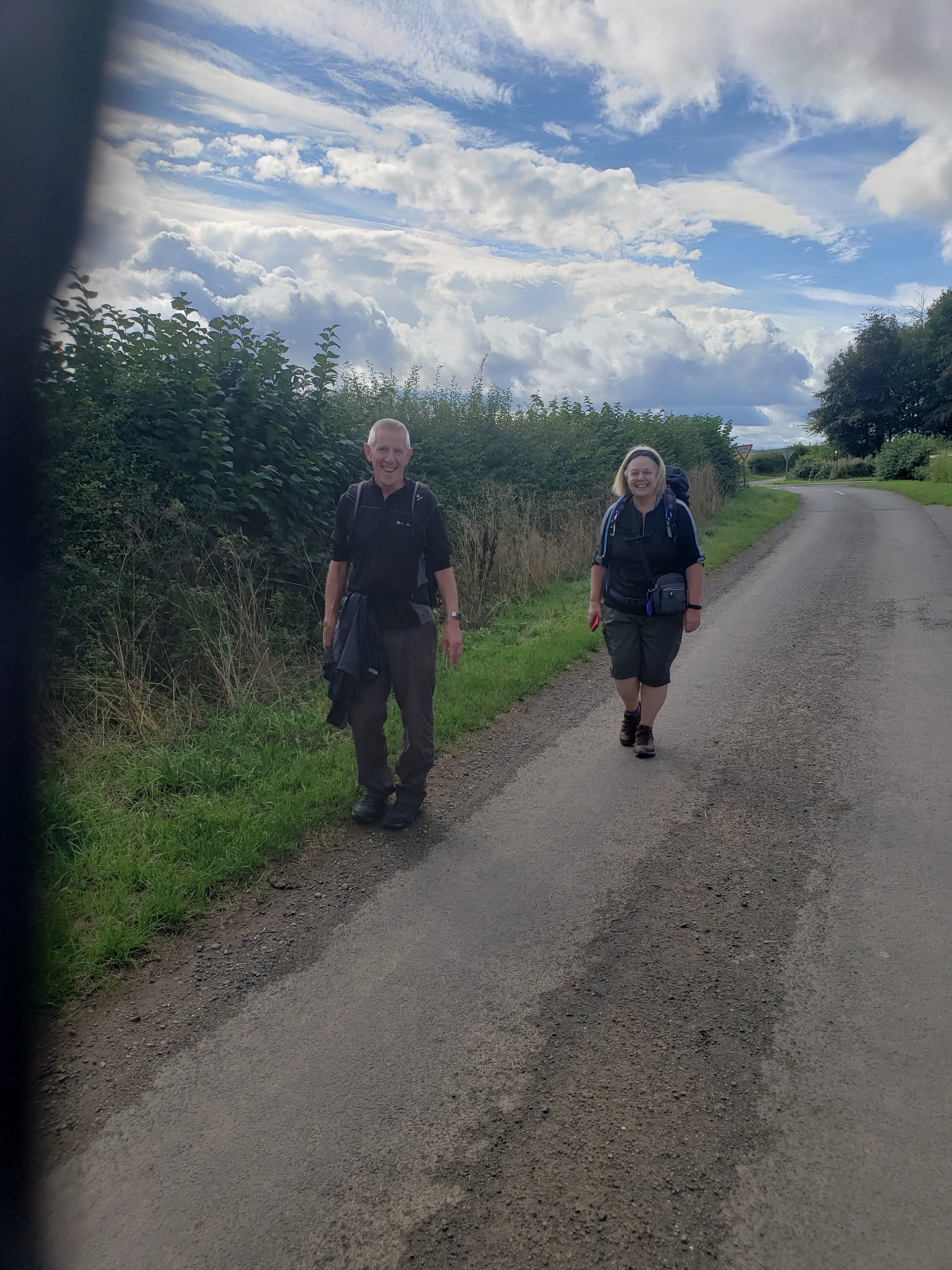
Kelso with her daughter, an amazing and delightful coincidence. Then Helen and Derek rolled into town having had a much easier-paced walk once they had rid themselves of me. I was wonderfully happy and a little bit tiddly as I tottered back to my hotel for my meal.


Dryburgh Abbey dep. 09.09, Kelso arr. 14.25 

GPS 14.13 miles in 5hrs 16mins 30secs walking with a 10 min break near Harrietfield.

I stayed in Ednam House, a superb hotel in contrast to last night. I ate a top-class meal of belly pork with a dessert of Eccles cake and yarg cheese. A glass of Portuguese red wind complemented it perfectly.


Tuesday 13th September 2022          Kelso – Denholm

Go to Jail, Do Not Pass Go


This was to be my long day so I was first down for breakfast and out into the morning sunshine before 8.30am. The ruined abbey was difficult to see or get near to. So I marched onto the bridge above the confluence of the Tweed and the Teviot and paused to take in the distant view of Floors Castle. A long drag along a busy A-road wound round to the River Teviot where a stile led to a riverside path that I followed for at least three miles, all the way to Roxburgh, the ancient county town. The view ahead was dominated by the beautiful old railway viaduct. The route continued for a short way along the riverbank before ascending up a grass track and steep field to join the old railway line.


Another three-mile stretch took me at a good pace along the curving old railway track round to the hamlet at Nesbit. Emerging onto a road next to a narrow metal bridge, I crossed the Teviot and turned into the flood meadows on the east bank, following for much of the way a raised flood bank. Where the Jed Water enters the Teviot, the trail turns up the side stream and across a main road. For a short while and a big climb, Deer Street and St Cuthberts Way is joined. After a mile or so, I turned off onto a wooded path which gentle descended into the outskirts of Jedburgh. An urban pathway followed the stream as it weaved below the town eventually coming out onto a road below the abbey ruins. These sit like a parish church on a hilltop above town centre. The Abbey View Café caught my eye and brought my long morning to a conclusion. A cappuccino and apple cake were vital to further progress.


It took some getting going again after my lunch break. The trail exits Jedburgh via a steep street passing the police station and heading for the Castle Gaol. I fleetingly passed through the cell block but had no time for the museum. The route beyond the castle descended to a stream and then reared up to gain the highpoint beneath the summit of Black Law. Here I paused for a bite to eat. This was a magnificent section of hill walking culminating in a dramatic decent through bracken and woodland to the small village of Bedrule. The last section began easily enough with a steady climb to a ridge, but I lost all signage and directions in the top field and took the wrong line down to Spital Tower. Here I picked up the official route and found the wet and overgrown path down to Denholm. It was a lovely moment to emerge opposite the huge village green and to see my hotel in one corner.


Kelso dep. 08.30, Denholm arr.17.00

GPS 21.50 miles in 7hrs 47mins 38secs walking time plus 30mins in the Abbey View Café in Jedburgh and a 10min brake on Black Law.

I stayed in the Auld Cross Keys, a friendly pub with nice accommodation. After a couple of pints of Kirkstall Pale Ale (4.0%), I settled down to a large plate of fish and chips with a dessert of treacle tart & ice cream.


Wednesday 14th September 2022                Denholm – Selkirk               

Through the Flood Defences


Another sunny morning, if a bit chilly in the shade. I crossed the village green and set off from the far corner down the road to the bridge across the Teviot. The riverside path on the far bank was closed due to a landslip and I had to follow the diversion along the lanes round to Knowetownhead. Here I picked up to a lovely stretch of riverside path with the river on one side and open pasture on the other. This brought me to the old bridge at Hornshole where the path continued through woodland into the outskirts of Hawick. The way was then barred because of the flood defence workings but some very understanding contractors showed me the way through the barriers and onto the road passing the rugby grounds. This brought me out on the A7 at the foot of the town, not close to any cafes. But as I started my ascent up the other side, there was a small post office cum shop which had a coffee machine and a stock of carrot cake. I adjourned to a bench across the street and sat for a while taking my morning sugar-fix.


Setting out again up the very steep Stirches Road, I was overtaken, yes overtaken, by a couple of walkers, Nigel and Lesley Clayton from Heptonstall. Having recovered from the shock of this disgrace, I managed to keep with them to discover that they were very fit and experiences walkers with a CV of serious trail-walking. And they were a lot younger than me. They left me near Drinkstone Hill and I continued at a more sedate pace over splendid moors and into a remote plantation of pines. Paths and tracks brought me down to the Ale Water and then onto a golf where the route was well signed. Just near Wollrig, I stopped for a short break before taking to the road and the steep climb through Hartwoodmyres Forest. Good tracks led into and through the forest to emerge above pasture land on a long straight path to Middlestead. Here I fell into step with two ladies from Carlisle who were also walking the entire BAW but at a more civilised poace. A mile of road brought me to my last major turn, a path on the left that headed off toward Selkirk. Still lots of fields and stiles to negotiate but I eventually reached the tracks of the Haining Estate which twisted passed fine buildings before coming out onto the busy roads of the town centre. One last climb and I was back in the Market Place and at Scott’s Memorial. The car had survived its four-day stay in the car park and, after a quick change of clothes, I was ready for the long drive home.


Denholm dep. 08.31, Selkirk  arr.15.18

18.40 miles in 6hrs 21mins 29secs walking time with 20 mins on a bench outside a post office in Hawick and a 10 min stop at Wollrig.


Conclusion


I had completed another of Scotland’s Great Trails, my ninth I believe. At 68 miles in length (I walked 69 miles due to my wanderings above Denholm) it should have been comfortably walkable in four days but the way the towns and hotels are distributed, it might have been wiser to take 5 days. The route divides itself into two days of easy riverside walking and two or three days of pleasant hills and moors. The towns are lovely but the abbey ruins are progressively being shut off behind construction site barriers. Health & Safety gone mad. It is one of the best signed routes I have walked although there are one or two places where I felt abandoned. I was incredibly lucky with the weather and I shall always remember it for being in the national period of mourning for the late Queen.

Wednesday 10 August 2022

England Coast Path & Thames Path Extension


Thames Barrier - Grain,   2nd – 4th Aug 2022


Introduction


Earlier this year, a new section of the England Coast Path was officially opened. My walking mate David was born and bred in southeast London so offered to accompany me and act as interpreter. We had planned for a trip in mid-July but were caught out by a heatwave, train cancellations and a declared state of national emergency. We deferred our hotel bookings for two weeks and rebooked our train journey for the first day of August. The railways were still in chaos, some of it strike-induced, so our express to London was declassified and we travelled first-class. The DLR from Bank took us rapidly to Greenwich where we checked into our hotel and then found a friendly coffee shop on the High Street. To stretch our legs we went for a walk through the foot tunnel onto the Isle of Dogs. The city farm at Mudshute was suffering from lack of rain. All grassland was parched straw and the heat would take some getting used to. Back on the south side to the river, we slipped past the Naval College and along to the Cutty Sark, an olde worlde pub on the riverfront. On our way back through Greenwich, we called in at Cafe Rouge to see whether we needed a table reservation. Then we went back to our pub for another pint and a change of clothes.


Stayed at the Mitre on Greenwich High Road. Ate at Café Rouge, black truffle & camembert burger, lemon tart, a bottle of red wine and an early night. 


Tuesday 2nd Aug 2022                      Thames Barrier – Dartford Bridge

A Barrier to Progress


Descending to breakfast, we were informed that this was not included in our booking. I had not brought with me the details of the original reservation which stated breakfast was part of the deal. The girls gave us some bacon and eggs and suggested a lack of communications with the central booking office. Grabbing a butty from M&S, we leapt onto a bus heading for Woolwich, getting off at the pathway down to the Thames Barrier. I had wanted to start here as this is where my trip began along the Thames Path some 5 years ago. This time we were heading in the opposite direction, along the Thames Path Extension to the mouth of the river. A few photos were taken to commemorate the occasion and then, under a cloudy sky, we were off through the back streets of Charlton towards Woolwich. The ferry stopped working as we approached the South Circular so we went on to the subway which was the point at which the England Coast Path crosses the Thames. Our trek along the Kent section of this path was about to begin.


We passed some unusual metal sculptures at Woolwich Arsenal, a cluster of alien-like figures in dark steel. Under clearing skies and warming temperatures we walked passed mile after mile of riverside apartments. Then industrial sites became our companion as we rounded a bend in the river and saw Erith ahead. Digital technology was used to navigate into the town to find the Tropical Café where our first break of the day was taken. Returning to the coast path, we continued for another mile or so until a bench in the riverside gardens proved an ideal lunch stop to eat our M&S sandwiches. The route took to the streets to exit Erith before a track cut back towards the river at Crayford Ness and we came out into our first bit of countryside. As we rounded the Ness, the Dartford Crossing came into view. It looked so close. Little did we know what awaited us. The River Darrent blocked our way.


We had been aware that an excursion inland would be necessary to get round this impasse. What we had not realised was just how long it was going to take us to reach the point on the other side of the barrage gates. In total it took nearly two hours to get round the two prongs of this river system, a loop that brought us to the A206 dual carriageway at two separate points. By the time we regained the riverside not 100 metres further along, we had clocked up five miles of walking. The last mile and a half along the river was straightforward and we soon reached the site of the old Littlebrook Power Station, now being rebuilt as an Amazon warehouse To reach our hotel, we had to weave through an industrial estate, along a bus-only lane and across some busy roads. Luckily, we found a subway which took us under the worst of the traffic and into the car park of the hotel. It had been a long hot day.


Thames Barrier dep. 09.52, Holiday Inn, Dartford Bridge arr. 17.50

GPS 19.45 miles in 7hrs 12mins 10secs walking time, plus a 30-minute stop in Erith (Tropical Café) for coffee and cake and a 20-minute sandwich stop in Erith Riverside Gardens  

Stayed in the Holiday Inn on University Way. The beer was IPA from Goose Island (5.9%). Ate Chicken Masala followed by apple tart and custard.


Wednesday 3rd Aug 2022             Dartford Bridge - Cliffe

Out into the Marshes


An early breakfast avoided the queues at the buffet. This enabled us to be walking well before 9am. The return journey to the coast path seemed much shorter than last night. In fact it was 1½ miles back to the Thames but a good night’s rest had filled us with renewed energy and we were soon standing under Dartford Bridge, a huge concrete structure. Then it was onwards into Greenhithe and the Asda supermarket for our daily sandwiches. A complex section around the streets took us round the town centre and out once more onto the bare and parched marshes. I paused under the immense pylons carrying the 400kV national grid over the Thames. This was a project my father had worked on over half a century ago. The route cut inland to get across Broadness and the bend in the river and then continued on an inland route through the industrial complexes of Ebbsfleet. Emerging onto the main road at the football stadium, there in front of us, like a mirage shimmering in the sunshine, was a Costa’s coffee shop and the end of our early morning endeavours.


The entire riverbank now seemed to be under reconstruction and development. Firstly we by-passed the workings at Northfleet Harbour, then passed factory after factory, including one which had its own war memorial to workers killed in the last war. A coast path walker coming towards us gave us a tip about traversing the next housing estate. ‘Just walk straight through and ignore the diversion signs’, he said. And we did. This brought us into Gravesend and the pierhead at Tilbury Ferry. The attraction of a beer garden proved too much and we marched automatically into the Three Daws. A pint of Landlords later, we emerged into the intense midday heat and moved slowly on through the urban landscape. We encountered all sorts of problems getting out of Gravesend. First, we came without warning to a barrier across the path, ‘Footpath closed due to Dangerous Tyres’. With no diversion signs to be seen, we backtracked around a small harbour and back to the river using our digital mapping system. This took us into a long treelined ginnel the outlet of which was blocked by another  unclimbable barriers, the other end of the closure. So we backtracked once more and left town along a busy road.


We eventually found our way back onto the riverbank having walked at least a mile longer than planned. The only way we could get out of the sun on this shade-less path was by crawling under an industrial pier. Here we ate our Azda sandwiches. The last stage of the day was not without its mishap. It seemed so straightforward to walk along this dry cracked seawall over the featureless salt marshes but we ended up missing the turn off along an overgrown path to Cliffe Fort. An extra half mile was added to our days total. Round the vast old fort, now an active sand quarry, the route cut inland to a point where a good track headed east across freshwater pools left as bird habitats from previous extraction activities. Two tired and over-heated individuals struggled up the last hill and along the straight narrow lane into Cliffe Village. The Six Bells pub seemed an oasis.


Holiday Inn dep. 08.43,  Cliffe arr. 17.00

GPS 19.23 miles in 7hrs 11mins 34secs walking plus 30-min stop in Costas in Ebbsfleet, 15 mins in the Three Daws in Gravesend and 15-min lunch stop under a pier.

We stayed at the Six Bells in Cliffe, drank Whitstable Bay Pale Ale (4.0%) from Shepherd Neame and ate sea bass & chips. A bottle of Rioja was given a rigorous once over.


Thursday 4th Aug 2022                     Cliffe – Grain

The Hoo Peninsular


Breakfast at the Six Bells was not until 8.30am. So we had a leisurely start to the day tucking into our bacon and eggs whilst scanning the morning paper. The doors of the pub were wide open and the heat of the day was infiltrating. In fact it was cooler outside where the breeze from the west cooled us as we left the village and descended to the water pools at marsh  level. Initially we could not gain the top of the sea wall and were constrained to walk along the grassy track on the landward side. This sheltered us from the cooling effect of the breeze and we got hot very quickly. A river drainage system ran through the grazed grassland, this being connected to the sea via sluices under the sea defences. Obviously, the flatlands could be inundated with brackish water should the situation demand.

The sea wall and our walking route was not always dead straight. Inlets and bays in the estuary led to detours and U-shaped loops that were the main features in this flat and featureless peninsular. When the path regained the crest of the sea wall, we passed the time by watching large container ships approaching on the incoming tide. Towns and settlements on the north shore were clearly seen and what we thought must be Southend came into view. Ahead of us, the village of Allhallows never seemed to get any nearer. The white tents of the holiday park dominated the coastal prospect for at least two hours. It got hotter and hotter and our water rations were long consumed. So it was a great relief to emerge eventually onto the waterfront of the holiday park. We turned into the entertainment areas where we emptied a huge jar of iced water into our water-bottles and then sat in the shade of one of the holiday homes to eat our sandwiches.


The last section of the day was thankfully a lot shorter. Leaving Allhallows and its noisy holiday village behind us, our view was now dominated by oil storage tanks, part of the legacy of the power stations which once provided much of the electricity for London and the south east. Passing a monument to the raising of the sea defences, the route finally turned away from the embankment that we had been following for the best part of six hours. The village of Grain was the end of this section of the Coast Path and my completion of the entire length of the Thames Path from its source in the Cotswolds to its estuary into the North Sea, some 230 miles of walking over three trips. Half a mile short of the terminal point, our journey was brought to an abrupt end by a supermarket, the Hogarth Inn and a bus stop. Clutching more sandwiches, we toasted the successful completion of our expedition with John Smiths Gold (not my drink of choice). It had been very hot walking under a blazing sun. Now it was time to go home. The bus was only a few minutes late.


Cliffe dep. 09.24, Grain arr.15.55

GPS 17.26 miles in 6hrs 4mins 32secs walking time plus a 30 mins water and butty at Allhallows.


Conclusion


The bus into Rochester hit traffic in the outskirts of Strood. I could see the prospects of catching an early train home disappearing in the rush-hour jams. A guy on the bus suggested that it would be far quicker if we abandoned our plans to go through to Rochester, get off the bus and walk to Strood Station. He came with us, showing us the underpass that took us under the line. Wonderfully, the train to St Pancras was running late and we had time to buy tickets and leap on. It was an amazing quick journey. The suburban unit joined the high-speed line at Ebbsfleet and shot under the Thames and under most of east London to get to St Pancras International. We summoned up the sinews to stride along Euston Road and into Euston Station. Here a very early evening train had been delayed and, not wanting to chance cancellations later on, we raced down the platform to claim seats for the trip north. My wife met the train and took David home first. Arriving so late and tired, I was ready to go straight to bed but was told in no uncertain terms to have a shower first, the sheets on the bed had been changed in my absence.

Thursday 30 June 2022

Peak District Boundary Walk (Part 1)


Bollington – Old Glossop,   17th – 19th June 2022

Introduction


It was the weekend of the Long Distance Walkers Association’s 50th Anniversary and the South Manchester Group had asked for suggestions as to how this might be celebrated. I  proposed that a 50-mile walk might be appropriate and that the Peak District Boundary Walk was a local route that was easily accessible. The 50 miles between Bollington and Old Glossop had good transport links with Manchester, Stockport and Macclesfield. After a slow acceptance and much reconnoitring, the scheme eventually gained momentum and received  great support from both the South Manchester and High Peak Groups.


Friday 17th June 2022                       Bollington – Buxton

Hottest Day of the Year


Bridget and David had offered to pick me up on their way through Macclesfield and we called into the railway station to collect Andrea. We drove to the Vale Car Park in Bollington and walked up to Pool End, the official start of our walk. Frank and Quentin were waiting for us and just after 9am, the six of us set off on the first day of our 50-mile expedition. The forecast was for very hot temperatures so sun-cream and sunhats were the order of the day. The first 5 miles of the route were in a generally northerly direction taking us further away from Buxton, our ultimate goal. We stopped briefly to look at the capped coal shaft about Bakestonedale and again at the lovely cottages at Birchencliff. The Coffee Tavern on Shrigley Road was a tempting refreshment stop but it was far too early for such frivolities. Instead we paused for ten minutes at a bench on the canal tow-path before crossing the metal footbridge, listening to one of Quentin’s lectures, and ascending into Lyme Park.


The first major climb of the day led us up beside Lantern Wood and over the ridge to the old Moorside Hotel, now a school. An easy descent into Whaley Bridge emerged right opposite the Bridge Bakehouse where we sat in the sun and any shade we could find. I demolished a large piece of cake in preparation for the second half of our day’s walk and David went back for more. Down in the Goyt Valley and out of the breeze, it was really hotting up. We set off again into the park and up the side of the damaged wall of the dam which had made the national news three years ago. There was some shade along the wooded river as we walked through Taxal and up the valley passed Fernilee Reservoir. But once out on Errwood Dam and around Bunsal Cob, we were at the sun’s mercy. Andrea began to overheat as we traversed above Errwood Reservoir and climbed to the old railway line. The final climb over the last ridge at Beet Wood was a struggle in what we later learned was almost 30 degrees temperature.


It was a relief to be heading downhill at last and over the golf course towards Buxton. I had to wax lyrical about the bars of Buxton to prevent Andrea from disappearing into the golf club house for a drink. Instead she stood in someone’s front garden under a lawn sprinkler. Suitably cooled, we quickly dropped into town and through the Pavilion Gardens to the Buxton Brewery Tap where some local beers were quickly dispatched. Then Bridget, David and myself returned to my car which had been there overnight. I drove them back to Bollington and then drove home to a cold shower and a welcome meal.


Bollington dep. 09.04, Buxton arr. 17.30

GPS 19.09 miles in 7hrs 28mins 36secs walking time, plus a 40-minute stop in Whaley Bridge for coffee and cake and a 15-minute stop in the Goyt Valley.

We ended our day at the Buxton Brewery Tap and cooled off with a pint of Deepdale (4.0%), a session IPA from the local brewery.


Saturday 18th June 2022               Buxton - Hayfield

Diversionary Tactics


My wife gave me a lift down to the bus station for the early bus over the Cat and Fiddle. David was also on the same bus. Thank goodness it was cooler today. Perhaps a little too cool as a brisk wind blew across the open spaces of Buxton Market Place. The customary group photographs were taken: a party some ten walkers strong set off at 9am heading for King Sterndale. Our numbers were swelled in the main by a group of women from the High Peak group of the LWDA. David G, the chairman of the South Manchester Group, regaled us with the story of his lucky escape from a rampant herd of cows in the very field we were passing through. The guidebook indicated that the original route turned into Deep Dale but this dale has long been closed due to erosion and industrial activities. So we were well prepared for the steep climb up to Caxterway Lane, the diversion route into Wye Dale. The bicycle hire kiosk was open for coffee and scones and the first refreshment halt of the day was called.


The next section began with a big climb up to Mosley Farm and over the fields to Wormhill. A road section took us passed Hargate Hall and over rough pasture to the descending path into Hay Dale. Our butty break was taken sitting on the rocks and shelfed grass half way along the dale. Then we quickly moved on along Dam Dale to Damside Farm. Here the route was signed towards Newhouses Farm and a busy road to Peak Forest. As we did not need to visit Peak Forest (no café, closed pub etc.) the chance of a short cut over the fields to Chamber Farm was too tempting. Looking behind us, we saw Frank, who had arrived an hour late at Buxton, coming up the road behind us. So now we were eleven, I had had great problems in finding the correct route around Middle Barwood Farm and up the gorsy bank above Boltedge Farm. But Gill and Bev, in the vanguard of the party, found all the stiles and overgrown paths with no trouble. After an altercation with a herd of cattle, mitigated by the Neil’s brave defiance, we dropped gentle down the fields to Blackbrook where we said goodbye to two of our group.


The afternoon section was short and sharp. After a brief refuelling stop at Bowden Head, the route climbed up to Malcoff Farm, dropped steeply down to the railway line before rearing up towards South Head. A wonderful high level track weaved between South Head and Mount Famine before beginning the long descent into Hayfield. Just above Peep-a-Day, we lost further members of the group but five staunch folk saw out the full route via Bowden Bridge and through the campsite into Hayfield Village. The Three Musketeers from High Peak continued down the road to their bed & breakfast. David and I jumped into David’s wife’s car for the drive home. A long and satisfying day, done to time and budget.


Buxton dep. 09.02,  Hayfield arr. 18.05

GPS 21.14 miles in 8hrs 18mins 10secs walking plus several short stops in Wye Dale, Hay Dale and Bowden Head.


Sunday 19th June 2022                     Hayfield – Old Glossop

From Pike To Edge


It was my turn to drive. I picked up Bridget and David from Wilmslow and drove to Hayfield via the new road, the A555. My plan was to park up at the bus station car park and get a lift back at the end of the day with Steve and his son. But Steve’s son had withdrawn his offer so I drove in convoy with Steve to Old Glossop, dropped my car near the pub and returned with him to Hayfield. The car park was full with the competitors and supporters of the Tour of Tameside race. But we finally got away along the Sett Valley Trail some ten minutes late, picking up the High Peak Team from near their Birch Vale b&b. The climb up Lantern Pike seemed endless, initially up a rising track through some woodland and then up a step path beside a wall onto the summit ridge. The view from the trig point was restricted by grey gloom across the landscape.


The convoluted route down to Rowarth passed much more quickly and we were soon admiring the manicured surrounds of the Little Mill. On my recce I had followed the map but today I took the signed track to the right which was described in the text of the guidebook. I believe that this is not the only point where map and text disagree. I can only assume that the updates in the transcript are not reflected in the strip maps. Leaving the village on our second climb of the day we paused for a few minutes to eat our sandwiches and then completed our ascent onto Cown Edge. The flat grassy ridge was too wide to provide much in the way of good views but it was easy walking. The northern end of the ridge offered the best views down to Charlesworth and Glossop. I have a long history with the next descent, having failed to find the correct route on three previous visits. But now I had it spot on, aided of course by my new Ordnance Survey App on my phone. We soon were standing on a traffic island on the main road into Glossop.


The official route of course does not take the road but circumnavigated a new housing estate and by-passed Glossop Town Centre on a high-level path to the east. This eventually deposited us at a road crossing and the entrance into Manor Park. It was busy with Sunday family activities so we quickly passed by the bowling greens and out via the Queens Arms  into Church Road South. At the top of here stood the Bulls Head, our final destination and the end of our 50-mile treck. I was treated by Bev to a pint of White Rat (4.0%) from Ossett Brewing and we sat outside and toasted the LDWA, ourselves and our successful venture. I returned Steve to his car in Hayfield and then drove home with Bridget and David. A most enjoyable weekend for all concerned.


Hayfield dep. 10.10, Old Glossop arr.14.15

GPS 9.21 miles in 3hrs 45mins 03secs walking time plus a 15mins butty break above Rowarth.


Conclusion


We felt that we had done justice to the 50th Anniversary of the LDWA. The South Manchester Group had turned out in force, nobly supported by our colleagues in High Peak. I have promised to lead the first section again next year for those who, because of work commitments, could not make this year’s Friday start. For my own part, I have made a start with a trail that I really should get to know better. So I plan to return to Old Glossop in the not too distant future and continue on to Marsden and Ringinglow. Perhaps next year I will have got all the way round, either by myself or with LDWA members who fancy the challenge.


Friday 20 May 2022

Southern Upland Way (Part 3) & Berwickshire Coast Path

Galashiels – Berwick-upon-Tweed,   9th – 13th May 2022


Introduction


At last, the big moment: the opportunity to complete my last national trail. I had hope to finish the nineteen LDWA-designated trails by last year but everything was put back because of the pandemic and its restrictions on travel and accommodation. Last year Mike & I finished our second section of the Southern Upland Way (SUW) on the banks of the River Tweed opposite Abbotsford House near Galashiels. To complete the trail, we needed to return to Tweedbank and walk to the North Sea coast, a three-day trip. So we had the opportunity, in our week-long expedition, to wander down the 30-mile Berwickshire Coast path, one of Scotland’s Great Trails that links in with the SUW at its trailhead in Cockburnspath.


All we had to do was get back to Galashiels, in principle a straightforward affair of taking a train to Carlisle and jumping on a bus. But it did not work out to be that simple. Our various train connections worked well but we just missed the bus in Carlisle and had to wait for two hours for the next. I had not twigged that, since the pandemic, the hourly bus service had been reduced. Then a set of road works delayed us by another half hour. Sheep on the road and Hawick diversions added to the nightmare so we final dismounted at Kingsknowle roundabout at 3pm, some 2½ hours behind schedule, still with 13 miles to walk to our overnight accommodation.


Monday 9th May 2022                       Galashiels – Lauder

Crossing the Tweed


From the bus stop, we walked back along the A7 and down to the river passed a couple who were grooming a huge black dog in their garden. We quickly reached the car park where we had abandoned our trip last year and at last were on our way. Down the road and over a footbridge alongside the railway, the route was well waymarked passed Tweedbank railway station and along the river to Gattonside suspension footbridge . After crossing the Tweed, the route ran westward along the north bank until we reached a road. A took us uphill on what appeared to be an old drovers’ route heading northwards for more than six miles. In places it was stony, sometimes tarmacked and some sections crossed grassy fields but its line was straight and true.


A light shower of rain came through. It was getting late and I was increasingly concerned that we would not get to the pub before they finished cooking. I rang our b&b and asked if they could contact the pub and tell them we might be late. It was nearly 7.30pn, the time the kitchen was due to close, when we pulled over a grassy ridge and saw the village of Lauder below. Running down the finally grassy slopes, we decided to forego a check-in at the b&b and go straight to the pub. Apologising for our late arrival, we were told that they were so busy and short of kitchen staff that we would have to wait 15 minutes before ordering. So we had plenty of time to quench our thirst whilst studying the menu.


 Kingsknowle, Galashiels dep. 15.05, Lauder arr. 19.35

GPS 13.39 miles in 4hrs 28mins 06secs walking time, plus a 10-minute stop.

We went straight to the Black Bull and downed a couple of pints of Black Sheep Best Bitter (3.8%) from the Masham brewery. Chicken Balmoral was on the specials board. This came with haggis and mash with whisky sauce. We finally checked into our b&b, Lornebank Homestay, at 9.30pm. It was far too late to have a shower and I went straight to bed.


Tuesday 10th May 2022                Lauder – Ellemford

The Operatic Hills


Before setting off, we went up to the general store and bought some sandwiches and cakes for our lunch. Then we picked up from where last night’s finish and set out on a bright morning towards the Lammermoor Hills. Pertinent since the opera Lucia di Lammermoor is being streamed from the Met in two-week’s time. Crossing the cattle-filled fields, Thirlestane Castle loomed austerely over us. A friendly farmer told us a story about how one of the pubs in town was called the Dipper by the locals. Allegedly the beer used to taste like sheep dip. Up on the hills w found much forestry damage. Storm Arwen last November caused much havoc in the area. On Scoured Rig an entire strip of pine plantation had blown down across the SUW path. A deviation across a field took us round and then through the devastation and down to the farm at Braidshawrig.


As we climbed towards the day’s high point, a sharp shower came through, blown on a cold north-westerly wind. By the time we crested Twin Law the sun was out but it was far too exposed to stop to eat our butties. So we strode out downhill towards Watch Water reservoir. Eventually we found a sheltered spot for our lunch stop near Scarlaw in an undamaged woodland of deciduous trees. Our native trees seemed to have avoided the storm damage. As we circumnavigated the reservoir, the fields leading down to the water were full of bird-life, in particular families of Greylags and their goslings. Amongst all this activity stood one solitary Barnacle Goose looking lonely and lost.


A road section took us along to the hamlet of Longformacus where we stood for a few minutes watching a young shepherdess training her sheep dog. As we climbed over our final moorland section of the day, the rain and wind came in again . At least it was at our backs and blowing us towards our haven for the night. A steep grassy descent brought us to a road and the end of today’s stage. But we still had over 1½ miles of tarmac to reach our accommodation. It was a glorious moment when we finally looked down onto the house at Green Hope in its idyllic forest and valley setting.


Lauder dep. 09.03,  Ellemford arr. 17.15

GPS 21.11 miles in 7hrs 57mins 17secs walking plus 15 mins lunch break near Scarlaw.

We stayed at Green Hope, a lovely house in an idyllic settling a mile from Ellemford Bridge. Alison and Bill looked after us like royalty and catered for all our logistical needs for the next two days.


Wednesday 11th May 2022               Ellemford – Cockburnspath

And What Did We See, We Saw the Sea valley


After a leisurely breakfast with much chat, there was always so much to talk about with Alison and Bill, we set off up the valley to retrace last night’s diversion from the SUW. Today, we travelled light because Alison was coming out to collect us and bring us back for a second night in paradise. The trail started with a steep climb along the edge of a wood, over a grassy field where I nearly stepped on a hare and across a deep defile to reach a woodland track that took us all the way to Abbey St Bathans. Here we crossed a footbridge over Whiteadder Water and turned to follow its north bank until the route turned north again and started to go uphill. Gaining higher ground we passed a magnificent cairn with a weathervane on top, which commemorated a now non-existent airfield. By-passing another storm-devastated plantation, we came out at a farm specialising in quad bike activities. Then over more fields to Blackburn Mill Farm where the official route was diverted into the most appalling rutted field imaginable. In wet weather this would have been a nightmare. 


Soon we were out onto smoother tracks to Blackburn and along their newly tarmacked drive to the A1. After dicing with the fast-moving traffic, we entered a roadside area of scrub and emerged onto a bridge over the railway. Initially the track through Penmanshiel Wood runs parallel to the road and railway through a steep-sided valley but then begins to climb into the forest. Bill had urged us to consider a low-level short cut but I was adamant that we would take the zig-zags to the higher traverse. It was beginning to rain as we searched amongst the dark and dismal trees for a dry and flat place for lunch. Eventually we just sat down on a bank beside the track and ate our sandwiches. The rain had passed through as we descended to the Pease Bridge, a narrow viaduct over an impressive drop to the railway. Then it was down all the way to the sea, down step after step and through the verdant gorge of the Pease River. We broke out onto the road opposite the Pease Bay Leisure Park. Our next two miles were to be shared with the Coast Path. Ascending a steep road, the path turned onto the headland above Cove harbour and then turned inland just before the car park to pass back beneath the railway and the A! and into the village of Cockburnspath. 


There was a SUW notice board at the entrance to the village but we thought that the official end of the trail was further into the centre. So we passed the village cross, a memorial to Queen Margaret, and continued to the community shop near the village hall. It was only then that I was happy with another national trail completion, this my nineteen and last trail. After a cup of coffee from the shop, we returned to the cross and sat waiting for Alison and our lift back to Green Hope and another wonderful meal.


Ellemford dep. 09.10, Cockburnspath arr.15.30

GPS 15.81 miles in 5hrs 58mins 54secs walking time plus a 20mins butty break in Penmanshiel Wood.


Thursday 12th May 2022                  Pease Bay – Eyemouth

Berwickshire Coast Path


It seemed pointless to repeat the 2-mile section of the coast path that we had walked yesterday so, when Bill offered to take us back to the start of today’s walk, we asked him to drop us in Pease Bay. At 9.45am we were off on a new trail, the Berwickshire Coast Path. The well-signed route was initially onto the cliff tops but soon retreated inland up to a high lane and farm track. We climbed even higher to a grassy plateau and then walked on a trod parallel to the lane to Dowlaw. Just before the farm, the coast path joined the road. We could not use the farm bypass due to tree wind-blow in the adjoining plantation. We apologised to the lady farmer and passed onwards down a grass track to a delightful old bridge that is now no longer in use.


 Up the other side of the burn the coastal views opened up as we crested the next grassy field. Then it was a sheer delight to stride out over sheep-grazed cliff tops with St Abbs head dominating the view ahead. One huge drop took us almost down to sea-level, crossing a damp valley full of orchids, primroses and cow-slips. Lunch break was declared at the top of the next climb before another grassy descent took us down to St Abbs Head and its dramatic lighthouse.


The next section of clifftop paths was not near so exciting but it led to St Abbs village and the great Old School Café. After a scrumptious slice of Eyemouth tart, we walked down to the  lovely harbour, then back onto the cliff-tops via a devious path up a grass bank and along a cottage-lined street. Eyemouth was now visible a few miles ahead but the panorama was spoilt by a huge holiday park of static caravans. Weaving round the edge of this, we eventually reached the old French fort and had a view of the beach and harbour of Eyemouth. Over the end of the beach, we continued along the promenade and round the corner into the inner harbour to find our accommodation above the Ship Bar & Restaurant.


Pease Bay dep. 09.45, Eyemouth arr.17.15

GPS 13.98 miles in 6hrs 35mins 39secs walking time plus 15mins butty stop above St Abb’s Head and 30mins in the Old School Café in St. Abb’s village.


We stayed in the Ships Quarters on the harbour in Eyemouth. We ate next door, at the Ship Restaurant, steak & ale pie, chips and stramash of vegetables, with a dessert of apple tart with vanilla tablet ice cream. Two Scottish words here that are new to me. A new beer as well:  Pagan Queen (4.1%) from Firebrick Brewery, Blaydon.


Friday 13th May 2022                       Eyemouth – Berwick on Twee

Crossing the Border


No breakfast include, said the booking. So we were out into the town at 8am looking for an early café. There was a queue outside Loughs bakery and here we bought bacon and sausage baps which we devoured seated above the beach. Then we walked round the harbour looking at all the fishing boats and up over the golf course onto the cliff path. A roller coaster route ran round the edge of the verdant fields, some growing oil-seed rape that was not helpful to my hayfever. We emerged onto a road that took us steeply down to Burnmouth. The climb out was quite strenuous, first up some wooden steps and then zig-zagging up the grassy cliff-face and final up a steep meadow to join a track running parallel to the railway. We followed the railway for miles, on a so-called nature trail passed signs to peregrine nesting sites. A wire fence eventually blocked our progress and as we headed towards a kissing gate, we saw that it was the English border. What this tiny gate might be like in a few years’ time, I dread to think. A national crossing point and immigration control? 


Industrial units filled the land over the other side of the railway line. The character of the landscape was changing rapidly as we approached Berwick. Then the perennial golf courses and holiday parks pushed us back to the cliff edge. We paused briefly near Brotherstone’s Hole to eat our butties and then walked on and on, bypassing the town centre and across sandy beaches and dunes until, there in front of us was the sea wall. Here was the mouth of the River Tweed and the end of the Berwickshire Coast Path. Turning back along the wall and into the wind, we struggled up river to the bastioned town walls which led us round to the beautiful old Berwick Bridge, the end of our trip. We quickly retreated into a coffee shop to await our train home.


Eyemouth dep. 08.25, Berwick upon Tweed arr. 13.45

GPS 12.63 miles in 5hrs 03mins 10secs walking time with a 15min lunch break near Brotherstone’s Hole.


Conclusion


We started beside the Tweed and finished at its mouth, from Tweedbank to Tweedmouth in five days. We walked 80 miles and had a hell of a lot of fun. And somewhere in between, I achieved my quest of completing all nineteen of the LDWA-designated national trails. We have put ourselves in the perfect position to start the English Coast Path, itself now categorised as a national trail. The trains worked perfectly and we had the joy of standing briefly on York Station and the interest of looping round Manchester on the link between Victoria and Piccadilly Stations. Wives were awaiting us in Macclesfield and another adventure was over.