27th April – 1st May
2012
Introduction
This had
been intended to be the continuation of the annual walking trip that is taking
Mike and me from Minehead to Cape Wrath via Land’s End over an epic 15 year
period. At the very last minute, however, Mike pulled out with a virus that had
totally debilitated him. I had the choice of rearranging everything for a later
date or going it alone. I had put in so much work into planning a new route
across the Scottish lowlands that I decided not to let it go to waste.
Friday 27th April 2012 Galashiels – Innerleithen
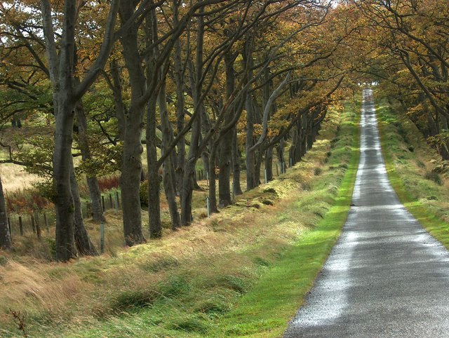
Jill took me down for the 6.22am train and the transport system worked perfectly. I even had time for a breakfast in Carlisle whilst I waited for the bus. This time I could not persuade the driver to take an English bus pass for to trip into Scotland. So I paid my money like every other Sassenach. Almost to the second of the scheduled time I was dropped in Galashiels bus station and I set off immediately, heading south out of the town to find the Southern Uplands Way. After weeks of rain in England, I was amazed at the Scottish sunshine. On the first set of hills I met Frank Loy from Sheffield brewing tea whilst keeping out of the biting wind behind a wall. He was doing the entire Southern Upland Way in one 12 day walk. Then a long grassy descent to Yair Bridge brought me to a short road section beside the Tweed. On the long climb up to the Three Brethren, I met my second walker of the day (the last of the entire trip), Dave Stokes who was on a north-south ‘end-to-end’ epic expecting to take three months or so. I agreed to try to meet up with him as he crossed Cheshire next month. There followed a fantastic high level traverse in beautiful sunshine over Minch Moor. The only pause was at a sculpture in heather called the Point of Resolution, where a hole in a wooden staff looked out over oval-shaped cuts in the heather covered plateau below.
A winding track led down to the road at Traquair. I looked for the brewery but failed to recognise it so I set off along the mile and a half of tarmac into Innerleithen calling in at the hotel as I passed to reserve my dining table. Then it was up to my b&b and a welcome cup of tea. After a shower, I returned to the hotel for a magnificent meal and then it was early to bed.
Galashiels dep. 12.18 - Innerleithen arr. 17.25, GPS: 14.89 miles in 5hrs-7.22min
Stayed at Glede Knowe Guest House, 16 Ronans Terrace, Innerleithen, EH44 6RB
Ate at the Traquair Arms Hotel, Fried Brie for starter and Duck for main course, with 2 pints of Traquair Bear (5%) a strong dark beer, the strongest they brew.
Saturday 28th April 2012 Innerleithen – Penicuik

A long tramp beside a wall was on a good path and my confidence increased as to an easy passage over these hills. Suddenly however the path disappeared into a strip of mowed heather and dropped steeply into a deep ravine, Leithen Door, which I assume is the source of Leithen Burn. On the other side, the mowed strip disappeared and the heather became deep and untrampled so I crossed the wall onto the forestry side and scrambled up a narrow trod. Once I had crested Leithen Door Hill, the path opened up again and doubled as a mountain bike track for some of its progress towards Dunslair Heights. The final few yards are along a wide track and bikers were everywhere. This was one of the few points in the week where I experienced other folk using the hills.
After
leaving the buildings and tower behind, the bikers track continued in the right
direction downhill into a wide windbreak in the forest. It was at this point
that my planned route started to cause concerns. I had noticed on the map that
a track went off right into the forest but I never noticed it nor was that worried about it. The wall
that had been my faithful guide was still beside me even though the going was
getting considerably rougher.
I got level with the top of Shieldgreen Kipps but was so determined to follow my trusty wall (now a fence) that I did not take the easier route over its summit. At the highest point I momentarily took the wrong wall and was on the point of dropping a needless 1000 ft into the wrong valley when I remembered Mike’s last instructions. So I sat still for a few moments, got out my compass and studied the map. Then I sheepishly got back to my feet and retraced my steps to the fence/wall junction. Mike would be proud of me! However my struggle was only just beginning. The correct wall led over some narrow outcrops with just a trace of a trod in the deep grass. It was a rollercoaster section which got harder and harder. And at just the point when I expected it to ease, as the forest was left behind on Cardon Law, it got considerably worse. Even beside my trusty fence I was floundering around in long tussocks and making very slow progress. I kept getting glimpses of the forest road in the trees to my right and was bitterly regretting no taking this all the way from Dunslair Heights.
Eventually I reached the open moor on Dundreich and again made a poor decision. Rather than heading for the summit to pick up any path, I compassed across the moor on a direct heading for Jeffries Corse. Not one of my better decisions on a day of some very poor ones. But all bad things come to an end and I finally hit the top fence and the traces of a trod. Then suddenly the view opened up and I was looking down into a wide valley and over to the Pentland Hills beyond. What a relief to be striding out again down the wet grassy slopes. I took the right-hand wall down to Gladhouse Cottage and Moorfoot, stopping briefly to take on some food and water. At the road I turned right and then left up a farm road through Toxside. The track beyond the farm was straightforward enough but I was tempted by a short cut indicated on the map across a new plantation. This cost me half a mile and 15 minutes of going round in circles. But I eventually found my way back on the lane to Mount Lothian where a left turn was the prelude to a three mile walk along quite busy roads. But I could now make up for the slow crossing of the Moorfoots and was not far behind my three mile per hour target as I dropped down the last steep hill into Penicuik. The last piece of navigation for the day was to find the hotel which was up a suburban road on the far side of town, ideal for tomorrow but not that welcome extra distance after an extremely tough day.
Innerleithen dep. 08.48 - Penicuik arr. 16.40: 21 miles in 7hrs 52 mins
Stayed at Craigiebield House Hotel, 50 Bog Road, Penicuik, Midlothian, EH26 9BZ I ate at the hotel, battered haddock and chips followed by apple cake and ice cream. The only drinkable beer was John Smiths Golden, but I was desperate!
Sunday 29th April 2012 Penicuik – Linlithgow
I had been looking to yesterday’s crossing of the Moorfoot Hills as being the new and exciting breakthrough in the missing links in the ‘end-to-end’ but it had disappointed. Now was the section that had I was not looking forward to and on which I had put in so much planning effort. But whereas all plans and decisions yesterday could have been improved on, today's choices worked out just the opposite. It all went swimmingly well and the route proved a classic.
I had thought hard and long about the next section. In an attempt to avoid a long road walk, I decided to cut through a farm and hamlet at Cockburn. Then left onto a road that took me up to the A70. I could have gone straight across towards Kaimes Hill but a better route seemed to be to walk south west down the A70 for 250 yards and then turn right at Boll-o-Bere and along a well-defined track which led out into a field system. Across the other side, a track was picked up again and this took me almost to Easter Newton before I saw a stile adjacent to a gate on the left leading into the parkland of Kirknewton House. Grassy paths then traversed the park and came out in front of the hall where I emerged onto the B7031. I crossed the road and tried a farm track that led Overton Farm. Here I had an opportunity to take a field path that was marked on the map but I could see no sign of this path on the ground nor any stiles in the walls so I continued to the main road and walked along the pavement passed the station and onwards to a very busy junction.
Immediately after this junction, my chosen route turned onto an old dismantled railway. This proved to be an absolute gem of a section, almost 5 miles of good quality track going northwards towards my target, through pleasant semi-industrial countryside. It finally dropped me in the centre of Uphall where my next experiment began. An article in the New Scotsman (11/04/08) described as the walk of the week a route from Uphall to Linlithgow over Binny Craig. I followed this easily with the aid of the map and soon found the farm track out of Uphall that took me to new footbridge and then over a road onto the steep-side grassy lump. A wonderful set of steps cut into a granite cliff gave me access to the final steep grassy slope. The views from the summit were stupendous, with the Forth Bridge and the whole river layout out below. Then a reverse of the grass and a traverse of a horse-filled field took me onto a footpath linking the agricultural college with Longmuir Plantation.
A long ride passed a paintball enclosure and on through the plantation and then brought me out into the fields of the Riccarton Hills, hardly any more than a few grassy bumps. Crossing the road at the end, I tried to find a path through Beescraig Wood but the storms of the previous January had brought down so many trees that I had to break out again onto the road than ran north to the visitor centre. There was latterly a path parallel to the road which kept me off tarmac. The drop to Hiltly was blocked by a huge tree that had fallen across a stile at the top of the steep drop. But this was by-passed with care and I eventually reached the lane that led into Linthigow. This lane took me to the top of Strawberry Bank and my digs for the evening.
Penicuik dep. 08.45 - Linlithgow arr. 16.45, 24 miles in 7hrs 50mins.
I stayed at Strawberry Bank House, 13 Avon Place, Linlithgow, EH49 6BL
Rachel, Charlotte and Peter arrived just after I had finished showering. It was great to see them all after three days on my own. We went down to the Four Marys where I had steak & ale pie followed by apple lattice and ice cream (real puddings were not the feature of this trip!). The beer was remarkably good, Edinburgh Gold from Stewart. Then Rachel gave the kids a shower before they left me to drive back to Ayrshire. I was so entranced with Linlithgow that I went back into town as the sun set and walked round the palace and its loch. I celebrated with a pint of Freoach Heather Ale in the Four Marys and got a much later night that I had intended.
Monday 30th April 2012 Linlithgow – Kilsyth
This was what the Scots call a ‘dreich day’. Grey and overcast with clag on the hills, rain in the air, and very very cold. There was no hurry today, it promised to be an easy trek along the towpath all the way. So I got a leisurely start and wore my Teva sandals not, it turned out to be, a good idea. I kept up my record of starting every day before 9am but only just. The early part of the canal was a delight with narrow winding sections along tree lined cuttings with birds singing and herons sitting on every bank. I was soon round to Falkirk and was about to come off and divert through the town centre just for a break in the monotony. However I local man told me to carry on to a supermarket beside the towpath. I was well passed the turnoff when I realised the supermarket was Tesco’s and the café look dreary. As part of a family who have signed up to 'say no to Tesco’ I was reluctant to stop so I carried on and on down the canal which was now far less rural. I did manage a short diversion through the town to miss the long tunnel. Then I had difficulty locating the canal on the far side but I eventually tramped down to the locks and turned sharp right through another canal tunnel. This time the exit was spectacular. I came out of the tunnel onto a long concrete viaduct which suddenly came to an end at the Falkirk Wheel. I dropped down the slope beside the wheel and was delighted to find a visitors centre and café. So I was able to drink a cappuccino and eat a slice of cake as I watched the Wheel in action with a canal boat coming down to the lower level on an amazing piece of engineering. It was by far the highlight of the day.

Refreshed I set out along the Forth and Clyde Canal which was wide open and lacking any interest. At one point I thought I saw a pub ahead but this turned out to be a mirage, or rather a restaurant. The last 3 miles were in a dead straight line, a disheartening end to the walk. I left the canal at the earliest opportunity and entered Kilsyth via a series of narrow but busy lanes. Navigation through the town centre proved a problem but I found that the b&b was sign posted with a brown sign. The last half mile up to the farm was seriously uphill the more so since I had been on a towpath all day. It turned out to be a longer day than I had expected and my feet had blistered in the sandal. But after a cup of tea, a shower and needles in the feet, I was able to stagger back into town for a meal and a drink.
Linlithgow dep. 08.58
- Falkirk Wheel (lunch) 12.55 – 13.30
- Kilsyth arr. 16.50, 22 miles in 7hrs 20 mins + 30
mins for lunch.
I stayed at Allanfauld Farm, Allanfauld Road, Kilsyth, G65 9DF. The meal was at the Coachman Hotel where I had haggis and black pudding fritters to start and fish and chips as an encore. The beer however was once again John Smith’s.
Back at the farm, Libby showed me the names and mailings from other ‘end-to-enders’who had stayed there and introduced me to the book by Carole Loader who ran the whole route and also stayed with them. I bought this book when I got home.
Tuesday 1st May 2012 Kilsyth - Dumgoyne
I was down before breakfast before 8am encouraged by the sunshine and the clear hill tops. The previous day I had abandoned the idea of crossing the Campsie Fells and had been preparing for another day of boredom on the canal towpath. But, lo and behold, the great God of walking was smiling on me. So in the morning brightness I said my goodbye to Libby and set off up the hillside towards the Kilsyth Hills. Archie was in the bottom fields and came over to help my route choice. He advised me to head straight up for Laird’s Hill and then go west to pick up the reservoir road. This crossing was pathless but quite walkable except for a boggy section just before the road. I was able to make good time along the track which eventually dropped down to Birkenburn Reservoir. I chose to by-pass this on its south side and the going suddenly got a lot slower. A tussocky section led up from water’s end and headed onto a featureless plateau of colourless grass. It was difficult to distinguish a high point to Lecket Hill but I headed left to pick up a track that came over from Cort-ma Law. A great track then descended gradually to the road.
The hillside opposite, on the Campsie Fells, looked heather-free so I ascended the road only very briefly before climbing the new barbed-wire fence and headed straight up through the new plantations. I thought it a good idea to miss out the first summit and head straight for Hart Hill using Alvain Burn as my route finder. However it was almost impassable at the top of the valley and across the plateau. So I headed for a fence that I could just see on the top of the ridge and found just the traces of a trod. But very faint. Nobody seems to walk the Campsie Fells. I staggered along the fence picking up any slight vestige of a path where I could and, after what seemed an age dropped down steeply into Fin Glen. Again I took a straight line rather than head for the tops. So I tramped over more rough ground heading for the col between Earl’s Seat and Little Earl. Once across the top fence the navigation became very complex even in the bright sunshine. This is not the place to be in mist. A long slow slog across a boggy wilderness brought me to the final edge of the Campsies near Garlock Hill. A track at last, the first for several hours then took me down and round to the impressive pinnacle of Dumgoyne. Suddenly the view opened up and I could see Loch Lomond and the mountains of the Highland behind. That one moment made all the effort in the traverse of the Campsie Fells worthwhile. Then a final steep grassy slope dropped me down directly into the Dumgoyne Distillery. My bus timetable told me a bus may just have gone but, after a ten minute wait, it came in late and I was able to jump on and get a ride to the station at Milngavie. A train was waiting to leave and I was soon on the way home, another tough section of the end-to-end route behind me.
Kilsyth dep. 08.40 - Dumgoyne arr. 14.50, GPS 14.34 miles in 5hrs 57.55 mins (+ 10 min break).
I caught the bus almost straight away to Milngavie Station and was in Glasgow so early that I had time to wash and change, have a coffee and cake and then eat a plate of fish and chips (and Deuchars IPA) before boarding my train home. The connection in Preston was a close shave but there were no more scares and I was home bang on schedule. I was glad that Jill was there to pick me up from the station. A long walk home at this late hour would have been a step too far.